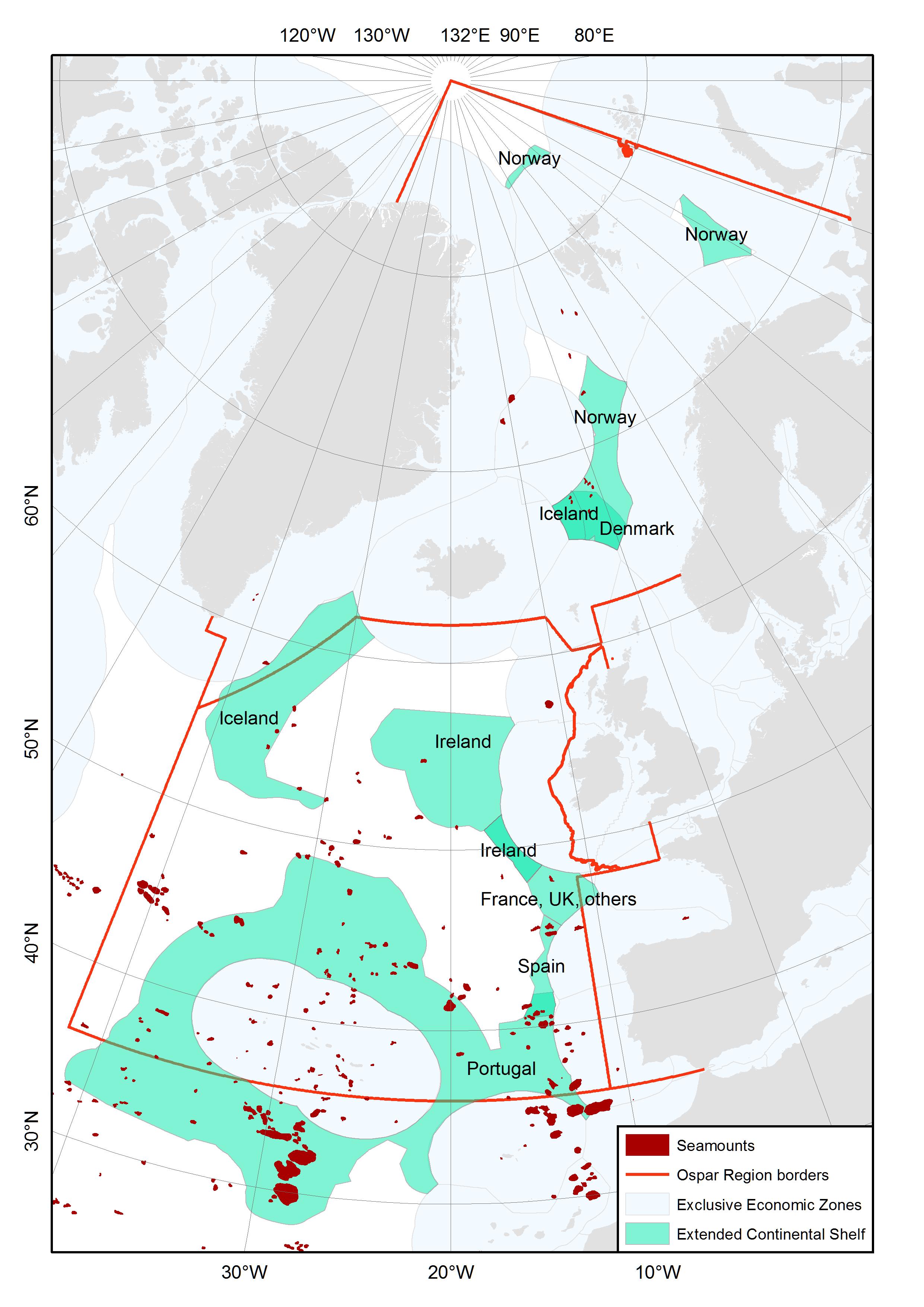
Figure
3. Occurrence of modelled seamounts (from Harris et al. 2014) in the
exclusive economic zones and extended continental shelf claim areas
(ECS) of OSPAR member counties. EEZ and ECS boundaries are the
outer limit lines and points displayed on the UNEP Shelf Programmes
data inventory map and were downloaded
from
http://www.continentalshelf.org/ecs-shapefiles2.aspx?src=http://tuvalu.grida.no/cgi-bin/ecs.pl?subm=prt_44_2009;&type=line