Gå til hovedinnhold
Havforskningsinstituttet
HI
English
<- Tilbake
Søk
Søk
Søk
View page in English
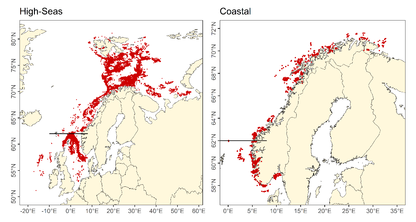
Figur
Fra rapporten:
Monitoring bycatches in Norwegian fisheries
Figure 1 Locations of samples taken by the High-Seas and Coastal Reference Fleet between 2015 and 2018. Black horizontal line is at 62 °N latitude showing the division of north and south areas.