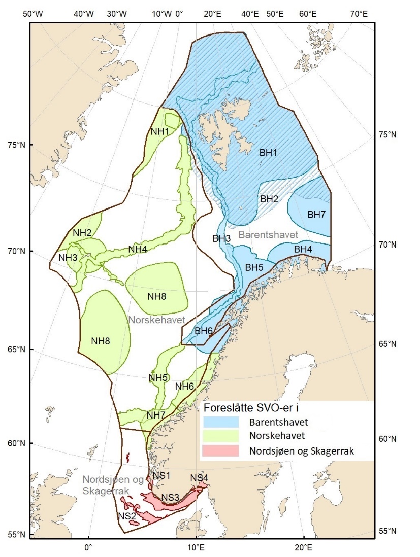
Figure 1.2. Map of particularly valuable and vulnerable areas (SVOs) presented in this report. Seven SVOs are located in the Barents Sea (BH1-BH7), eight in the Norwegian Sea (NH1-NH8) and four in the North Sea and Skagerrak (NS1-NS4). The SVO Marginal ice zone (shaded) overlaps with the SVO Sea areas around Svalbard (BH1), parts of SVO Eggakanten north (BH3), and parts of SVO The central Barents Sea (BH7). The boundaries of the management plan areas are outlined in brown.