Gå til hovedinnhold
Havforskningsinstituttet
HI
English
<- Tilbake
Søk
Søk
Søk
View page in English
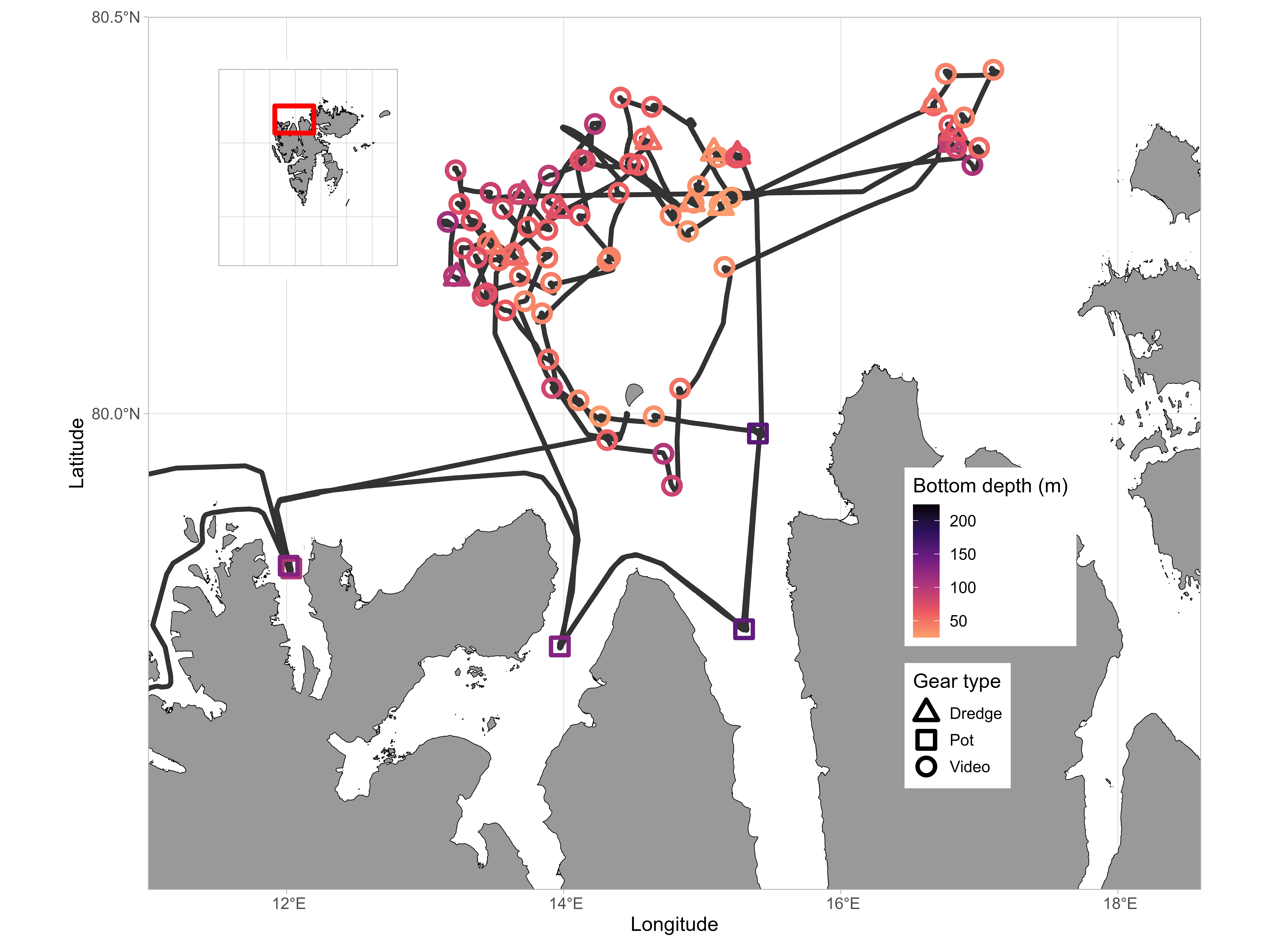
Figur
Fra rapporten:
Survey of Iceland scallop beds north of Svalbard
Figure 3: Map with stations and survey track. The color shows the registered bottom depth, and the shape on each station indicates the gear type.