Gå til hovedinnhold
Havforskningsinstituttet
HI
English
<- Tilbake
Søk
Søk
Søk
View page in English
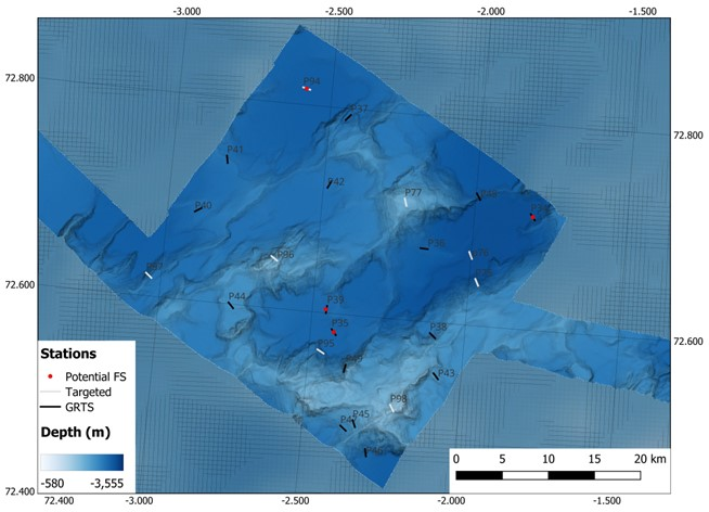
Figur
Fra rapporten:
MAREANO's first cruise to the Arctic Mid-Ocean Ridge
Figure 4. Map of NH3-B08 with the locations of the targeted stations (grey line), GRTS stations (black line), and potential full stations (red circle).