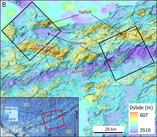
Figure 18. A) Map that shows the extent of the map B. JM: Jan Mayen, GH: Greenland Sea (Grønlandshavet), NH: Norwegian Sea (Norskehavet). B) Overview map showing this year's survey areas (black squares). Examples of a mountain ridge and seamount (over 1000 m high), basin, axial valley and axial volcanic ridges (AVR) are shown on the map.