Topic: Seismic surveys
Published: 20.08.2018 Updated: 28.06.2019
Seismic surveys use powerful, low-frequency sound waves to map and analyse the ground below the sea floor in order to locate oil and gas reserves. Their frequency range overlaps with the frequency range that fish can hear, so they can be disturbing to fish.
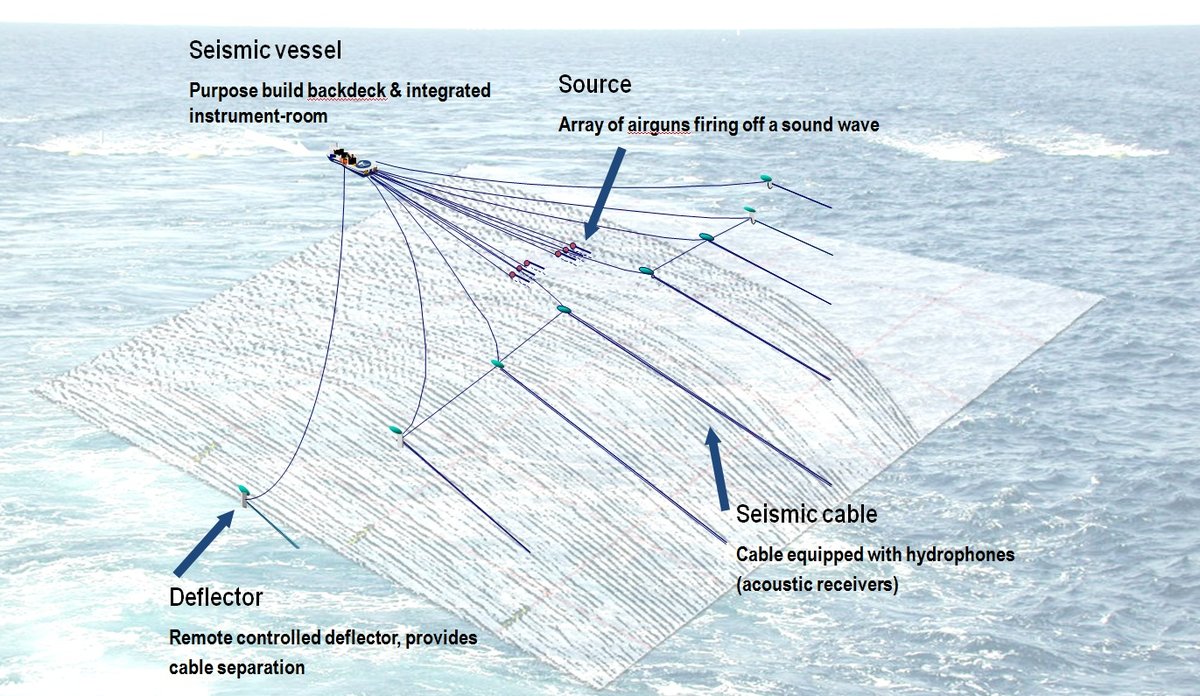
Seismic data are vital to finding new oil and gas reserves, and they also make it possible to extract more oil and gas from producing fields. Seismic surveys involve firing multiple airguns simultaneously, which creates powerful sound waves that can penetrate deep into the ground. By analysing the echo from these waves, geologists learn about the composition of the rocks below the sea floor and the possible location of oil and gas reserves.
The sound waves used overlap with the frequency range that fish can hear. Sound is important to fish for communication, finding food, finding a mate and reproducing and discovering enemies. Since fish are dependent on sound throughout their lives, it is possible that the loud noise from seismic surveys may disrupt their normal activities, for example by making them swim away, preventing important communication and drowning out mating calls or the sound of approaching enemies.
Consequences for spawning
It has been shown that certain species of fish travel significant distances away from areas where seismic surveys are taking place. This isn’t necessarily a big problem if the new habitat is of the same quality as the one that the fish left behind.
However, in the spawning season the situation is slightly different, as the whole population often gathers in a very small area. The place is not random: spawning there at that particular time enables the eggs to drift with the ocean currents in such a way that they will hatch at a place and time that is favourable in terms of the availability of food and chances of survival. If the spawning population moves far away from its traditional spawning grounds, it may have a negative impact on spawning and recruitment to the population.
Advises against seismic surveys in certain places
The Institute of Marine Research therefore advises against seismic surveys in places where important fish stocks are actively spawning if we have a good understanding of where and when the spawning occurs, as well as during spawning migrations towards these spawning grounds. It also recommends against seismic surveys in a buffer zone around the spawning ground itself, since fish can react to a full-strength source up to at least 18 nautical miles (22 km) away. We advise against full-strength surveys less than 20 nautical miles from a spawning ground, and against so-called site surveys with a less powerful source less than 5 nautical miles from spawning grounds.
Advisory body
The Institute of Marine Research acts as an advisory body to the Norwegian Petroleum Directorate in relation to all seismic surveys in Norwegian waters. Each year we advise on a relatively large number of notices and change notices relating to seismic surveys performed by various commercial entities. In addition, a smaller number of scientific surveys are carried out each year. The Institute of Marine Research is asked for advice on the impact of seismic surveys on biological conditions, while the Directorate of Fisheries and Coastal Affairs advises on conflicts with fishing activities.