Models
Do you check the weather forecast on yr.no before you walk out of the door? If so, you like many others, have used a model. Weather forecasts are examples of results from a numerical model, and such models have been used for a long time.
Models for the ocean, populations and ecosystems function in a similar way as weather models. Using a set of mathematical equations models describe how different species function together, how the ecosystem is affected by fisheries, or how the ocean currents vary.
How models are used at the IMR
At the Institute of Marine Research models are extensively used in our research and scientific advises. The usage of models is manifold, varying from a simple description of the ocean currents and the temperature of the water, to models describing dispersion of pathogens from aquaculture farms or models describing the interaction between the physical environment, plankton and fish.
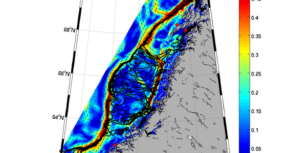
An example of a model is the dispersion model for salmon lice in the water masses. Embedded is knowledge of the growth and behaviour of the louse, the water current, temperature and salinity, and finally information of how many lice the farmers have on their fish. The Meteorological institute is an important collaborator with the IMR delivering daily simulations of current, salinity and temperature from the nationwide coastal current model NorKyst800.
The dispersion model for salmon lice provides important knowledge when the IMR delivers information to the authorities regulating the aquaculture industry. The infection pressure from salmon lice on the wild salmonids determines if the aquaculture farms in the given production regions along the coast can increase their production or not.
With the salmon lice dispersion model, we can monitor the infection pressure from salmon lice along the whole coast, providing a necessary supplement to the observation of lice infection collected from the field. The model results act almost like a weather forecast:
An animation illustrating how the IMR collects and uses data at fixed observational locations in our fjords in combination with numerical model results.
Do we need models?
Models play an increasingly important role in our understanding of the ecosystem. They can be used alone or more preferably in combination with observations.
Observations provide information of the nature for a limited time and in a limited space. Spatial and temporal variability not captured by the observations will not be described, and here the models come into play. Model results will describe the nature with higher spatial and temporal extent, filling in information not covered by observations. The combination of model results and some observations is most cost effective and gives together a far better description of the natural situation. Most models operate without the need for information from observations, thus their results are independent.
Which models are used by the IMR?
At large we can divide our models in five categories:
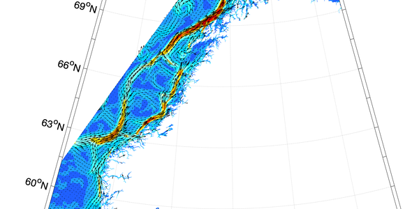
Current models calculate the physical environment in the ocean just like a weather forecast model for the atmosphere. The results of a current model are eg. water current, temperature, salinity and water level. Current models found the basis for most of the other modelling work we are doing at the IMR.
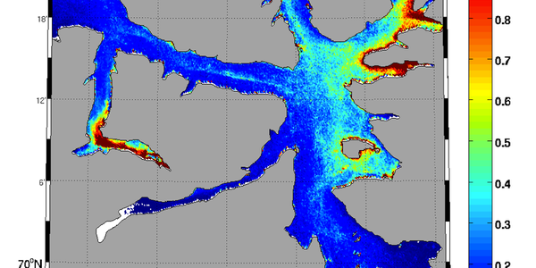
Dispersion models use the results from a current model to calculate how various water borne matter or organisms are transported away from a source. The ocean is transporting for instance pollution, oil, fish larvae, salmon lice or micro plastic. A dispersion model calculates how fast these are spreading, how the dilution is and where they at any time are located and finally ends up.
Ecosystem models are used to describe smaller or larger parts of the marine ecosystem and how these interact. An ecosystem model can include sea mammals, fish, plankton and nutrients. Often information from current models is included.
Climate models estimates how the climate will develop in the future. Climate models use both current models and atmosphere models. Additionally, models for phenomenas like evaporation over land, glacier impacts or the carbon chemistry cycle are included.
Stock assessment models calculate how the size of fish stocks change in time. Data from fisheries, cruises and field work connected to spawning stock size and recruitment are used together with other models to predict the fish stock size many years ahead.
Can we trust the models?
Most modern models are reasonably good today, and development and validation improve the results continuously. Models predicting the physical environment are today quite precise and in a similar way as for weather prediction models, the current models usually describe the conditions in a satisfying way.
The model results are tested or validated in an ongoing process to establish the uncertainty. Most commonly the results are compared against observations. Observations are not always fully representative for the conditions at hand, and the match between the observations and model results does not need to be complete for the model results to have sufficient quality.
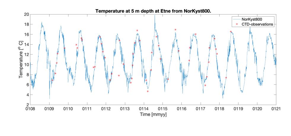
An example of model results validation is taken from a comparison of modelled and observed water temperature at Etne fjord in Vestland. Daily results at 5 m depth between 2008 and 2018 are calculated by the NorKyst800 current model. Observations are made by a ctd-sonde at a number of cruises. The match between the two is good and with only a few deviations. This clearly shows that the model results can complement the observations with information in between each measurement.