Go to main content

Topic: The ocean, coast and fjords

Norway has a long coast, deep fjords and extensive territorial waters, and they are all teeming with life.

There are many different ecosystems in our seas and coastal areas. An ecosystem is all of the animals and other organisms naturally confined to a limited area – and the interactions between them and with their physical environment.

Some species provide food for other species, while others compete with each other. The food chain represents “who eats whom”.

The basis for life: Photosynthesis

In the same way as on land, marine life is based on the photosynthesis performed by plants, algae and plankton. These organisms use the energy in light to transform water, carbon dioxide and inorganic nutrients into energy and oxygen. In other words, the amount of light affects how much underwater life there is.

In the ocean, photosynthesis is mainly performed by phytoplankton. All other organisms are dependent on them for their survival, growth and reproduction.

Phytoplankton are grazed on by zooplankton, such as copepods and krill, which are in turn eaten by a range of animals including fish. Higher up the food chain we find the bigger predators such as cod, seals, seabirds and whales. Polar bears, orcas and humans look proudly down from the very top of the food chain.

Water conditions affect marine life

Marine life is constantly changing. There are a number of factors that play into this. The amount of light and the physical and chemical properties of the water have a big impact on marine ecosystems.

The physical properties include the water temperature, salinity and local currents. These factors affect the ecosystem “from the bottom up”: at the very bottom of the food chain, the physical conditions determine how much phytoplankton can grow.

For fish and sea mammals, the physical factors have both direct and indirect impacts. A temperature change, for instance, may directly alter the metabolism of a fish or reduce the amount of phytoplankton and consequently the amount of food available. Both of these things may affect the growth of the fish.

The water’s chemical properties include its nutrient levels and pH value. The inorganic nutrients in the water are the fertilizers that phytoplankton need in order to grow. Many of the chemical components in the ocean are natural, but some of them are the result of pollution.

The role of climate in ecosystems

The climate also affects ecosystems. Climate is often defined as the average weather over a period of 30 years: precipitation levels, air temperature and wind conditions. In the ocean, we measure the average “weather” by looking at the water temperature, ocean currents, sea level and salinity.

Natural fluctuations mean that the climate varies a lot from year to year. Equally, the climate can stabilise for extended warm and cold periods lasting several years, or even decades. On top of these natural fluctuations comes the climate change caused by humans. This is due to rising greenhouse gas emissions into the atmosphere. Both natural fluctuations and changes caused by humans affect ecosystems.


Økosystem trål

Et økosystem kan defineres som “et dynamisk kompleks av planter, dyr og mikroorganismer som i samspill med det ikke-levende miljø utgjør en funksjonell enhet”.

Photo: Erlend Astad Lorentzen / IMR

Ecosystem is often described in the form of energy transfer between levels in the food chain. But behind the energy transfer there is a game of life and death between predators and prey. This game, in which each individual try to make the best possible for himself in terms of spreading their genes, results in the so-called interaction in nature. This is a fascinating interaction both to explore and manage.

An ecosystem can be defined as "a dynamic complex of plants, animals and microorganisms that, in interaction with the non-living environment, constitute a functional entity". Ecosystems are not closed systems, and this applies to ecosystems in the ocean where currents greatly contribute to the exchange of organisms between different oceans and ecosystems. Nevertheless, the marine ecosystems are characterized by the fact that the dynamics within the system are more important than the import and export of organisms. The framework conditions for the ecosystem are laid by the physical environment, which includes the bottom depth and type as well as the characteristics of the ocean in the form of temperature, salt and current. Geographical location is also essential for the degree of seasonality in, for example, light.


Tromøya

Tromøya.

Photo: Espen Bierud, HI

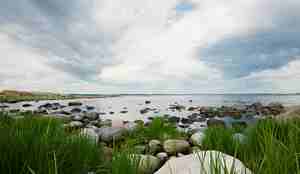
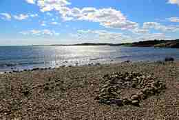
Norway has the world’s second-longest coastline, only beaten by Canada. The total length of the Norwegian mainland coastline, which snakes in and out of fjords, is around 24,000 km, or approximately half of the way around the Equator. If we include all of the islands as well, the total coastline is almost 60,000 km long.

Since our coastline stretches approximately 23 degrees of latitude from Lindesnes to Svalbard, conditions along the coast also vary greatly between the south and north. The life found deep in the fjords is also unlike the life out at sea.

The differences encompass both the species that thrive in each place, and physical conditions such as currents, temperatures and salinity.

A large proportion of the Norwegian population lives near the coast. These areas are therefore heavily exposed to human influences, both from businesses and private individuals.

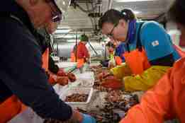
The Institute of Marine Research (IMR) carries out extensive research along the coast and in the fjords. We survey currents, temperatures and salinity. We also survey the populations of fish and other species: their size, their distribution and where they spawn. The IMR produces fish stock estimates for various species, and advises the authorities on appropriate fishing quotas, mainly through the International Council for the Exploration of the Sea (ICES). In addition, the IMR is engaged in major research projects involving monitoring and surveying how aquaculture affects ecosystems.
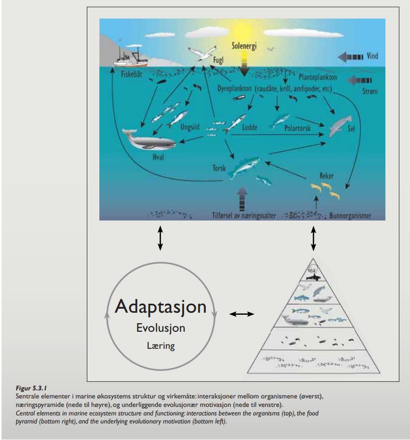
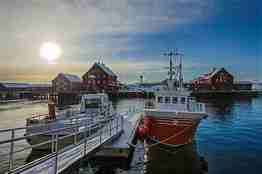
The Norwegian coast

The most important transport artery along the Norwegian coast is the Norwegian Coastal Current. From Skagerrak in the south, it runs north all the way up the coast before dividing: one branch continues north towards Svalbard and the other one enters the Barents Sea.

The water in the Norwegian Coastal Current is less salty than the surrounding waters. This is because the current is fed by brackish water from the Baltic Sea and fresh water from Norwegian rivers. This water is then mixed with water from the North Sea and the Atlantic Ocean. The Norwegian Coastal Current travels up the coast as a wedge-shaped current. The salinity of the water gradually increases on its way north, as more Atlantic water is mixed in.

Unlike in open water, large algae, such as brown algae, play an important role in coastal ecosystems. Many fish and other animals live in the kelp forests, and other species go there to find food.

This great diversity of species is one of the key foundations for Norway’s coastal fisheries, which have been exploited for over a thousand years. These fisheries remain important, including for recreational fishing: many Norwegians continue to harvest what the coast has to offer, such as lobster and coastal cod.
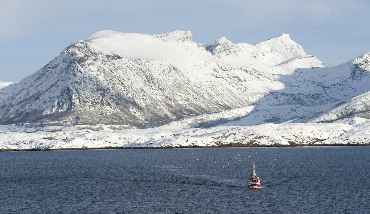
The fjords

The Norwegian fjords are very diverse – no two fjords are identical!

A barrier of islands and skerries protects a high proportion of our coastal zone and fjords from the waves and wind of the open seas. Deep fjords, carved out by glaciers over 10,000 years ago, cut into the Norwegian geography. There is often a threshold at the mouth of the fjord. This reduces the circulation of water between the deep fjord basin and the sea outside it, which is often shallower.

Some big fjords in the counties of Troms and Finnmark, such as Porsangerfjorden, lack this sea threshold. These fjords are therefore classed as bays.

Large quantities of fresh water flow into our fjords from the surrounding rivers. This water mixes with the salt water in the fjords, resulting in moderately salty “brackish” water. This water is normally found in the top 5-10 metres of the fjord.

Norway’s longest fjord is Sognefjorden. It is roughly 200 km long, and up to around 1,300 metres deep. Apart from Sognefjorden, the deepest Norwegian fjords are roughly 700 metres deep. However, the majority of Norwegian fjords are 300 to 500 metres deep.

Animals that live in the deep fjords are more isolated than ones that live out at sea. Even when fjords are close together, the distance that a fish has to swim in order to travel from one fjord to the next is often long. The fact that the fish are isolated from even their closest neighbours means that they can be viewed as separate populations.


Isbjørnmor med unge på Svalbard

A polar bear mother with her cub in Svalbard. 

Photo: Julio Alberto Erices HI

The Arctic includes the land and water around the North Pole and inside the Arctic Circle. Arctic Norway includes mainland Norway north of the Arctic Circle and the Svalbard archipelago.

The Arctic Ocean, which is the ocean in the Arctic, is the smallest and shallowest of the world’s five oceans. By area, around half of it is above the continental shelf, while the rest consists of deep sea basins, often around 3,000 metres deep. The Arctic Ocean is split into several basins by underwater ridges.

In the winter, most of the Arctic Ocean is covered by ice. In summer some of the ice melts, so ice cover is lower. Sea ice extent has fallen significantly in recent years, with the biggest declines being seen in summer. The ice has also become noticeably thinner. The proportion of old, multi-year ice, in other words ice that has survived at least one summer, is at a record low. One of the reasons for this reduction is the inflow of warm Atlantic water.

Water circulation in the Arctic Ocean largely follows the topography. From Svalbard, the Norwegian Current heads east along Siberia following the edge of the continental shelf. The current starts on the surface, but in due course it sinks below a layer of cold, fresh Arctic water. The heat brought by the Norwegian Current can be traced almost everywhere in the Arctic Ocean.

The water in the central Arctic Ocean is highly layered, and it contains few nutrients. Consequently, there are few animals or plants in this part of the ocean. Most life is found above the continental shelves and along the ice edge. That is where you find ice algae, zooplankton, ringed seals and polar bears.


Økosystemtokt i Barentshavet 2018

Ecosystem survey in the Barents Sea. Anders Fuglevik, Erlend Langhelle, Irene Huse, Stine Karlsson and Holly Ann Perryman is sorting the catch from a bottom trawl.

Photo: Erlend A. Lorentzen / IMR

The Barents Sea occupies the area north of the Arctic Circle between Norway and Russia, bounded by Svalbard to the west and Novaya Zemlya to the east. It is an enormous sea, covering approximately 1.4 million square metres, or almost four times the area of Norway.

At its deepest, the Barents Sea is 500 metres deep, but the average depth is 230 metres. In other words, it is relatively shallow and therefore highly productive. The fish harvested here include cod, haddock, Greenland halibut, American plaice and beaked redfish. Capelin, shrimp, minke whale and harp seals are also caught here.

The temperature and ice cover varies greatly over the course of the year. This is primarily because this is where cold, Arctic waters meet the warmer, saltier waters brought by the Norwegian Current. The mixing ratio and the temperature of the water coming up from the south vary by season.

The Norwegian Current also results in rich and diverse fauna and flora, from small phytoplankton to whales and seabirds. The current carries fish eggs and larvae all the way from Lofoten and Vesterålen to the Barents Sea, where they grow into adults.

The multitude of life in the Barents Sea is dependent on the eggs and larvae delivered by the ocean currents.

Fishery resources in the Barents Sea are managed through a close collaboration between Norway and Russia. This involves the Institute of Marine Research working with the Russian Polar Research Institute of Marine Fisheries and Oceanography (PINRO).


Storegg jr

"Storegg jr." docking at Ellingsøy.

Photo: Gunnar Sætra, HI

The sea and coastal area around Lofoten and Vesterålen is unique. The islands protrude far into the sea, breaking up the ocean currents. This is how the nutrient-rich water from the deep sea is pushed up to the surface. Strong winds mix the water well together. The midnight sun makes the production of phytoplankton occur around the clock. 

These factors mean that Lofoten and Vesterålen are an area rich in diverse marine life: it grows and grows at every stage of the food chain. Here is a great diversity of species.

The water from the deep sea is nutrient-rich, but if the ocean currents go deep, little light is released, and thus the biological production becomes small. But when this water is pushed up off Lofoten and Vesterålen, with sun around the clock, a huge biological production starts: phytoplankton bloom up and give the zooplankton a lot to eat. The zooplankton are again important food for the fish – which gives those at the top of the food chain dinner; seals, whales and us humans.

At the intersection of the Norwegian Sea in the south and the Barents Sea in the north, conditions are well placed for the fish to carry the species forward. Lofoten and Vesterålen are the area where our most important fish stocks migrate to spawn, like the cod (Northeast Arctic cod / skrei). The skrei is the basis for the traditional Lofoten fishery.

After spawning, fish eggs and larvae drift with the currents up to the Barents Sea, where they grow up.

What happens in the sea area around Lofoten and Vesterålen has major implications for ecosystems in the Norwegian Sea and the Barents Sea.


Makrelltokt Norskehavet

Mackerel- and ecosystem survey in the Norwegian Sea (2017).

Photo: Erlend Astad Lorentzen / Havforskningsinstituttet

The part of the ocean bounded by Norway, Iceland, Greenland and Svalbard is referred to as the Nordic Seas and consists of the Norwegian Sea, Greenland Sea and Iceland Sea. Some of the boundaries between these seas run along underwater ridges.

The Norwegian Sea alone covers an area of over 1.1 million square metres. Its average depth is 1,600 metres, including two deep basins that are up to 4,000 metres deep. The great variation in the depth of the Norwegian Sea gives rise to varied benthic fauna, including large coral reefs.

There are three main water masses in both the Norwegian Sea and Barents Sea: Atlantic waters, Arctic waters and coastal waters. Every single second, around 8 million tonnes of warm, salty water flows into the Norwegian Sea from the North Atlantic. That is eight times the flow of all of the rivers in the whole world.

The mix of water masses with different temperatures and salinities in the Norwegian Sea greatly affects the distribution of plankton and fish. There isn’t as much diversity of species, but on the other hand the species that do exist are present in great numbers.

Zooplankton such as Calanus finmarchicus and crustaceans like krill are found in great quantities, providing dinner for the fish stocks we harvest: Norwegian spring-spawning herring, blue whiting and mackerel. The Calanus finmarchicus, which is a keystone species of the ecosystem, overwinters deep in the Norwegian Sea.

The fish, meanwhile, don’t live permanently in the Norwegian Sea: they only come here on summer holiday. The mackerel have their main residence further south and west. The blue whiting mainly spawn off the west coast of Great Britain. Herring graze in the Norwegian Sea in summer, but they spawn along the Norwegian coast and mainly grow into adults in the Barents Sea.


Økosystemtokt Nordsjøen Skagerak

"Johan Hjort" on an ecosystem survey in the North Sea and Skagerrak.

Photo: Jørgen Ree Wig / Havforskningsinstituttet

The North Sea is the shallowest of our seas: two thirds of it is less than one hundred metres deep.

The ecosystem here is also different from the Barents Sea and Norwegian Sea. The North Sea is much more heavily influenced by us: it is one of the world’s most heavily trafficked seas with big ports, large-scale fisheries, oil and gas extraction, sand and gravel dredging, and the dumping of earth. Around 184 million people live in the drainage basins that feed the North Sea. The ecosystem is affected by emissions from buildings, agriculture and industry.

The North Sea can be split into four main areas:

  • The north, where the depth ranges between 100 and 200 metres, is where the most important habitats for Norwegian fisheries are found. This is where adult cod, saithe, herring, haddock and Norway pout are harvested.
  • In the Norwegian Trench, which is the deepest part of the North Sea at up to 700 metres deep, we find deep-sea species such as the herring smelt, roundnose grenadier and velvet belly lanternshark.
  • Fish are generally less abundant in the central part of the North Sea than further north.
  • Skagerrak in the east, which is 50-100 metres deep, is home to nursery habitats for herring and cod. This area is also important to sandeel, as well as being the main habitat for flatfish.

Antarktis Sørishavet Kjartan Mæstad

RV G.O. Sars in the Southern Ocean

Photo: Kjartan Mæstad / IMR

The Southern Ocean surrounds the continent of Antarctica. It is a closed ecosystem, clearly separated from the surrounding oceans by the polar front. The front forms where the icy Antarctic waters meet warmer waters from the north, “closing off” the ecosystem.

The Southern Ocean can be split into three different zones: an outer, ice-free zone; a middle zone; and an inner zone with permanent ice cover around Antarctica. There is most activity in the middle zone, which is where the krill live.

Krill is a keystone species in the Southern Ocean. It is the most important food source for fish, octopuses, penguins, seals and whales. In the Southern Ocean, the rungs in the food chain are unusually far apart. This means that small krill eat microscopic phytoplankton, and are themselves eaten by enormous whales.

Norway is the country with the biggest commercial krill fishery in the Antarctic. That’s why our country has a responsibility to ensure that the catch is sustainable and doesn’t harm the ecosystem. The IMR is helping by performing research and carrying out monitoring activities, in order to provide the information needed to properly manage the krill stocks. We present our results, including analyses and reports, through various international forums.