Rapporten gir en oversikt over tokt i 2021 i regi av Havforskningsinstituttet, Universitetet i Bergen og Tromsø, og Norsk Polarinstitutt, med egne og mange av de innleide fartøyer. Den gir en kort beskrivelse av toktet og viser kurs- og stasjonskart – over CTD og trålstasjoner. Tabeller viser når de faste snittene er tatt og antall observasjoner per måned for de faste stasjonene. Toktene er innrapportert ICES (Det internasjonale råd for havforskning) i skjemaet:”Cruise Summary Report”: https://www.seadatanet.org/Metadata/CSR-Cruises . Data (og kart) fra toktene er tilgjengelig fra Norsk marint datasenter, Havforskningsinstituttet (https://www.nmdc.no). Kartene er generert av Silje Smith-Johnsen ved hjelp av ggOceanMaps av MikkoVihtakari (HI). Det er ikkeinkludert tabeller eller kart for toktene med våre båter «Fangst» og «Hans Brattstrøm».
Report on cruises and data stations 2021
Report series:
Rapport fra havforskningen 2022-32
ISSN: 1893-4536
Published: 21.10.2022
Project No.: 4200
On request by: Helge Sagen
Research group(s):
Bentiske ressurser og prosesser
,
Bunnfisk
,
Bunnsamfunn
,
Bærekraftig utvikling
,
Norsk marint datasenter (NMD)
,
Oseanografi og klima
,
Pelagisk fisk
,
Plankton
,
Populasjonsgenetikk
,
Økosystemakustikk
,
Økosystemprosesser
Subject:
Hav, kyst og fjord ,
Klima i havet
Program:
Kystøkosystemer,
Norskehavet,
Barentshavet og Polhavet,
Nordsjøen,
Marine prosesser og menneskelig påvirkning,
Trygg og sunn sjømat ,
Miljøeffekter av akvakultur,
Fremtidens havbruk
Approved by:
Research Director(s):
Geir Huse
Program leader(s):
Bjørn Erik Axelsen, Henning Wehde, Jan Atle Knutsen og Maria Fossheim
Norsk sammendrag
Summary
The report gives an overview of cruises in 2021, by the Institute of Marine Research, University of Bergen and Tromsø and Norwegian Polar Institute, on board our research vessels and many of the hired commercial vessels. Each cruise has a short description and a track chart showing CTD and trawl stations. A table displaying the coverage of the oceanographic sections in addition to a table showing the number of observations per month for the fixed stations are included at the end of the report. Meta data about the cruises are reported to the International Council for the Exploration of the Sea (ICES) using the form “Cruise Summary Report”: https://www.seadatanet.org/Metadata/CSR-Cruises . Research data (and chart) are available from the Norwegian Marine Data Centre at Institute of Marine Research (https://www.nmdc.no). Charts are generated by Silje Smith-Johnsen using ggOceanMaps by Mikko Vihtakari (IMR). There are no overview or maps for the cruises with our vessels "Fangst" and "Hans Brattstrøm".
1 - Charts overview 2021 – CTD stations and trawl stations.


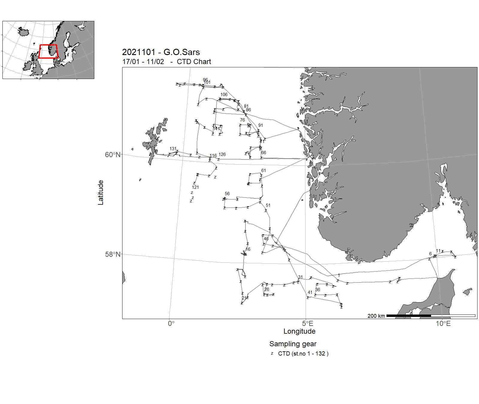
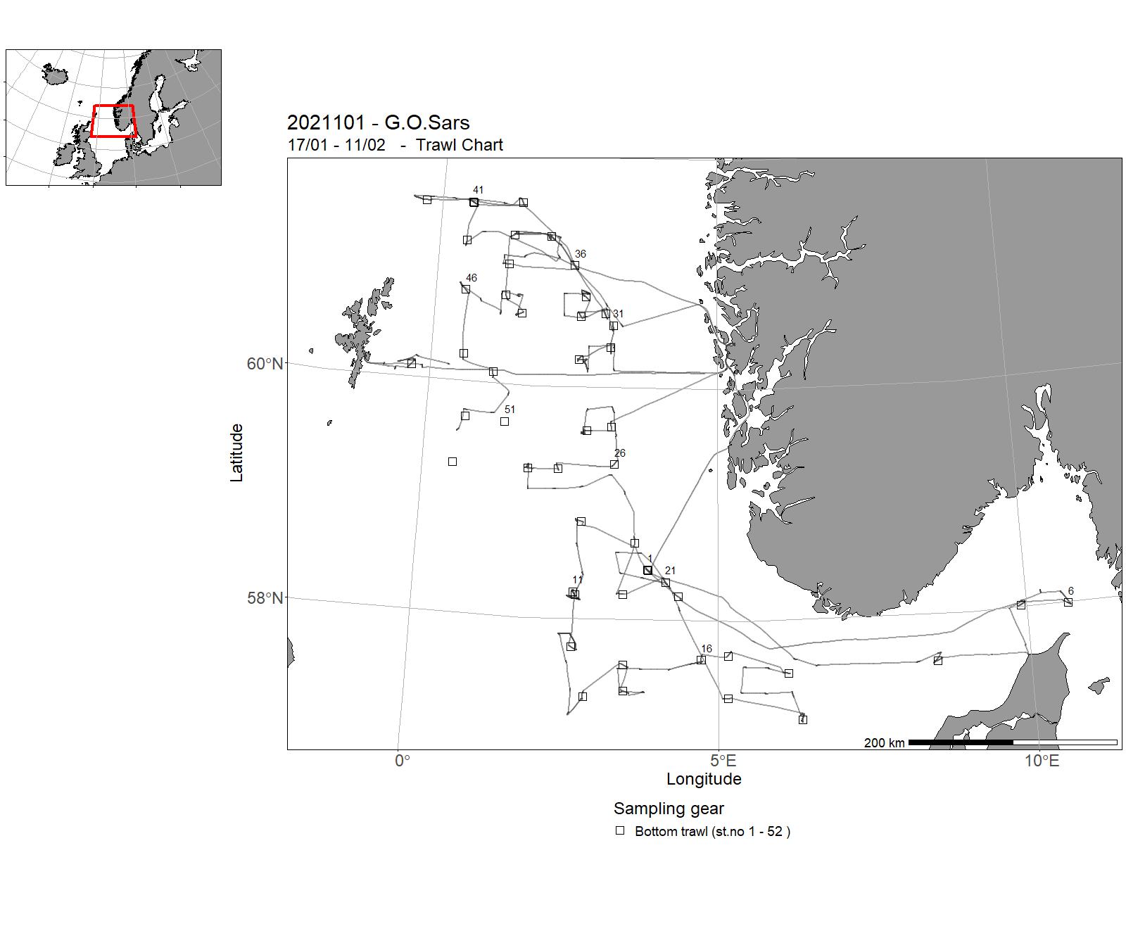
2 - "G. O. Sars" – Cruises 2021
| Cruise No | Period | Purpose | Area | CTD st.no | Trawl st.no |
| 2021101 | 17/01 - 11/02 | The main objectives of the IBTS Q1 bottom trawl survey coordinated by ICES/IBTSWG are: 1)to determine the distribution and relative abundance of pre-recruits of the main commercial species with a view of deriving recruitment indices. 2) to monitor changes in the stocks of commercial fish species independently of commercial fisheries data. 3) to monitor the distribution and relative abundance of all fish species and selected invertebrates. 4) to collect data for the determination of biological parameters for selected species. 5) to collect hydrographical and environmental information. 6) to determine the abundance and distribution of herring and other fish larvae as well as fish eggs. | North Sea | 1 - 132 | 1 - 52 |
| 2021102 | 13/02 - 16/02 | Cancelled | - | - | - |
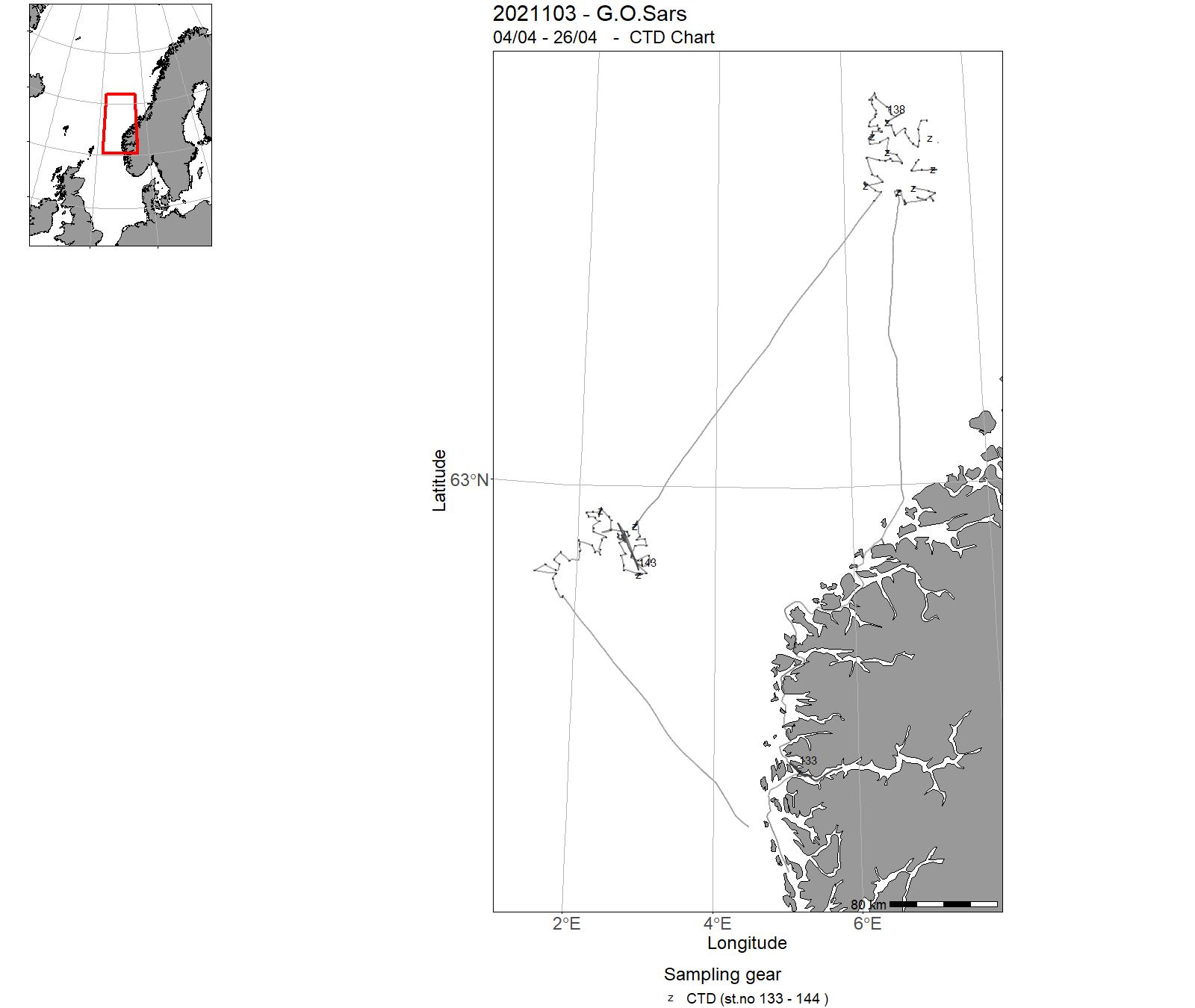
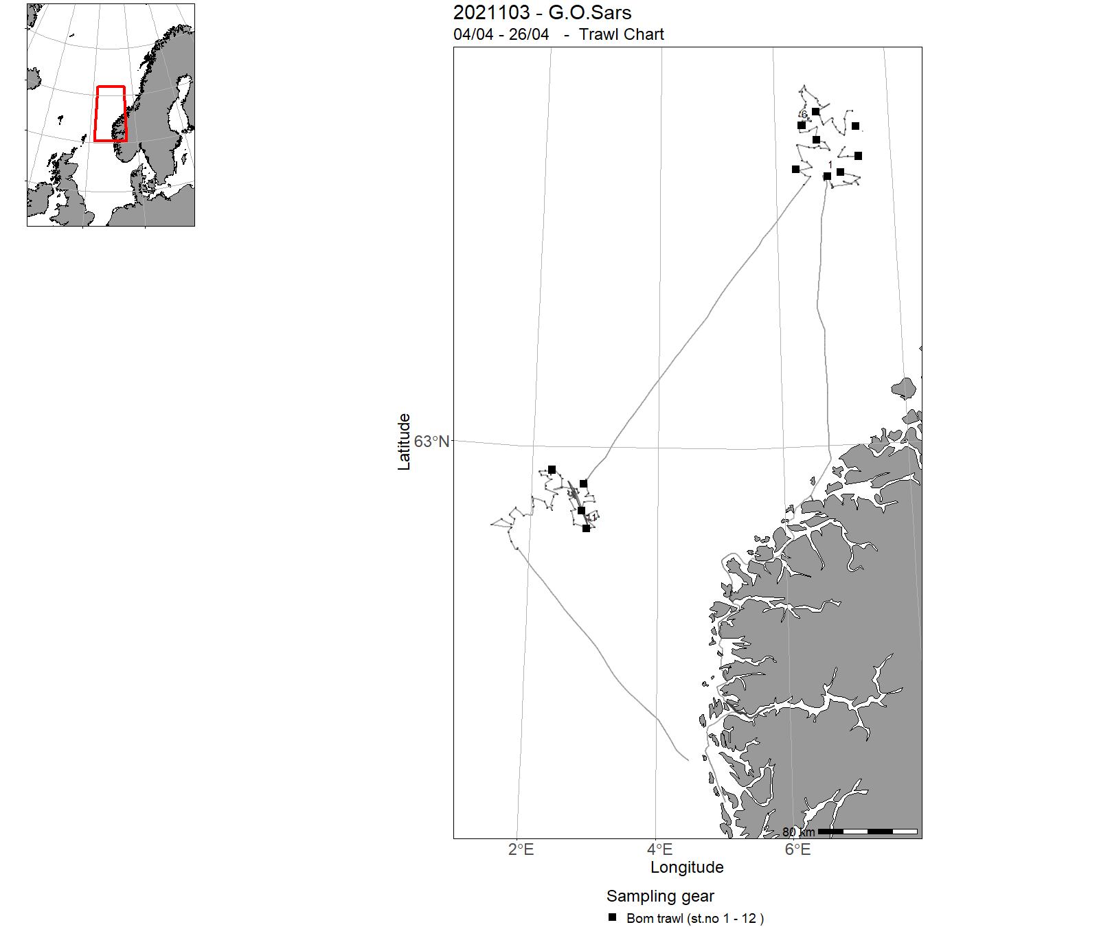
| 2021103 | 04/04 - 26/04 | 2021-MP-002: Innsamling av vann og bunnprøver for undersøkelse av biologisk mangfold og arters utbredelse, miljøkjemi og bunnsedimenter, i Mareano-programmet. Kunnskap om havbunnen inngår i forvaltningsplaner for havområdene, SVOer spesielt og ev til overvåking. | Norwegian Sea | 133 - 144 | 1 - 12 |
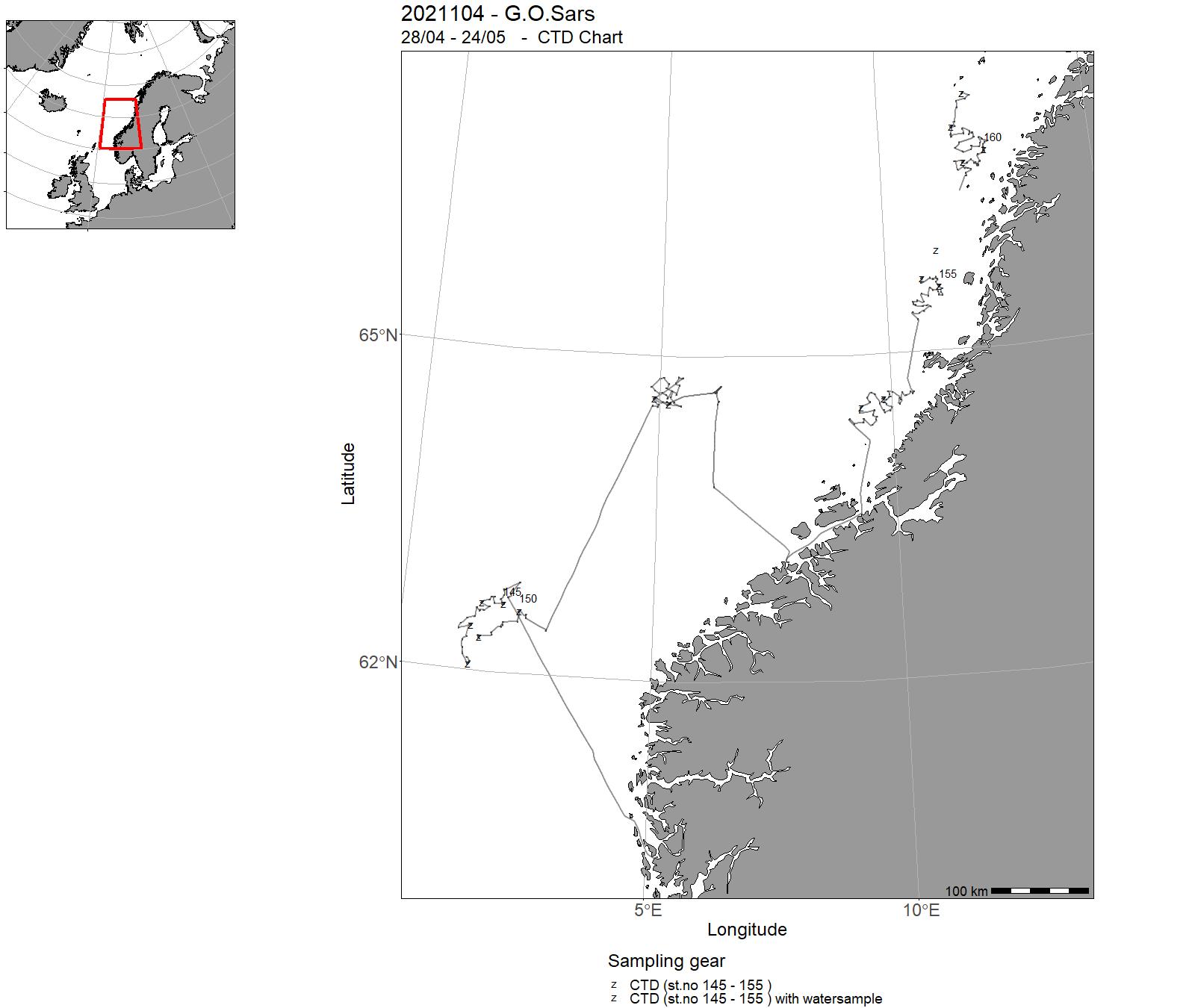
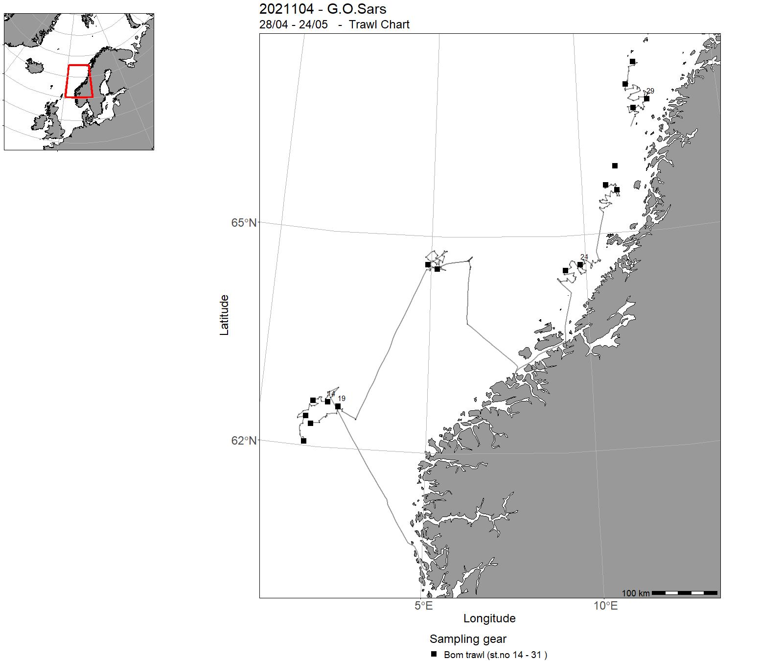
| 2021104 | 28/04 - 24/05 | 2021-MP-019: Innsamling av vann og bunnprøver for undersøkelse av biologisk mangfold og arters utbredelse, miljøkjemi og bunnsedimenter, i Mareano-programmet. Kunnskap om havbunnen inngår i forvaltningsplaner for havområdene, SVOer spesielt og ev til overvåking. | Norwegian Sea | 145 - 162 | 14 - 31 |
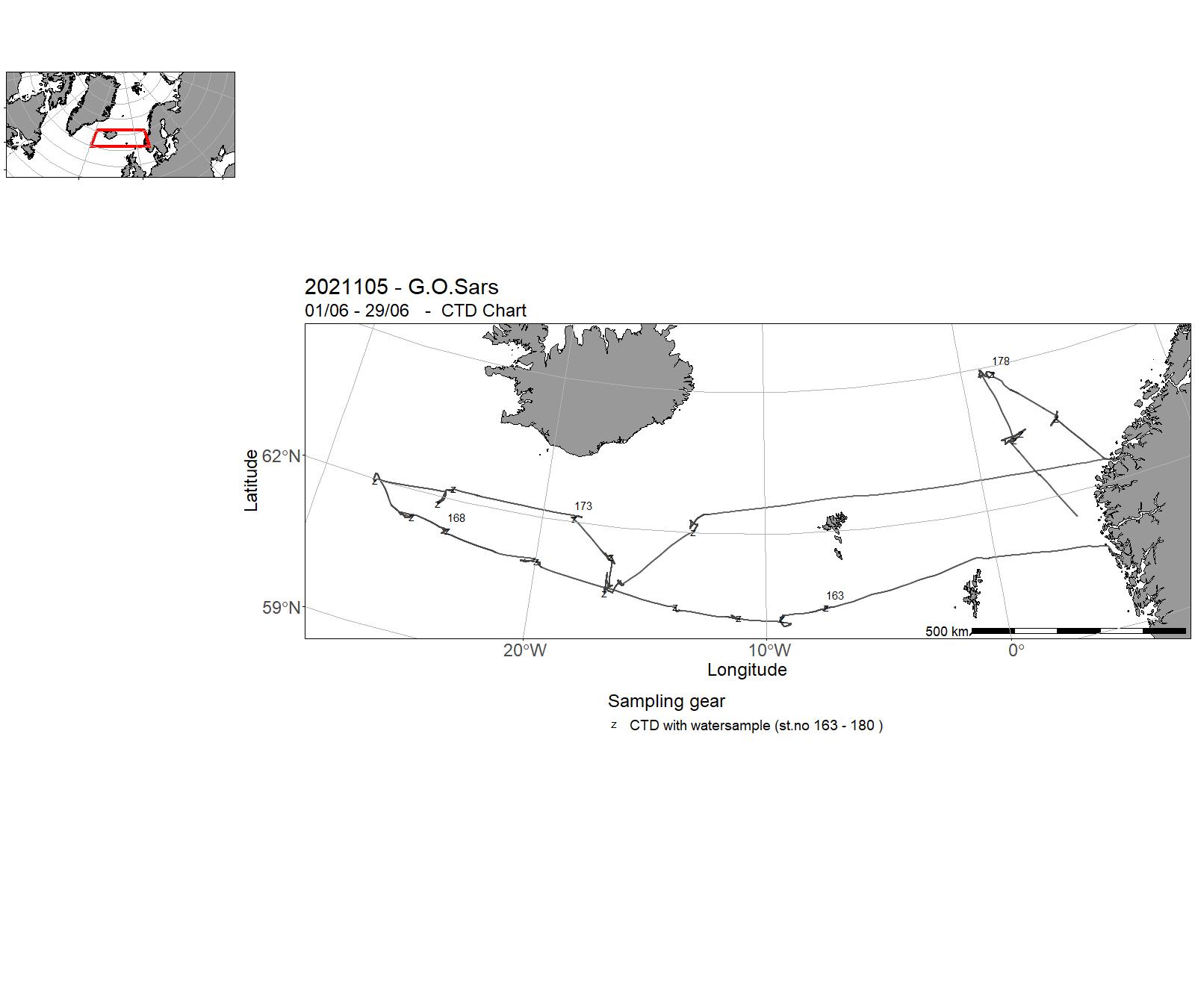
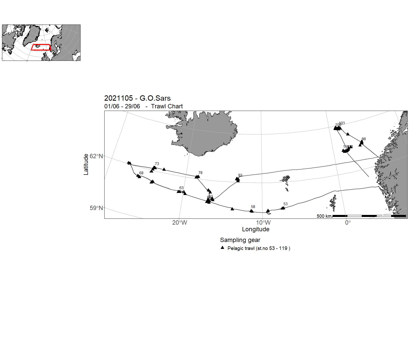
| 2021105 | 01/06 - 29/06 | Study mesopelagic ecosystem. Project name: MEESO Coordinating body: Institute of Marine Research, Norway | Norwegian Sea | 163 - 180 | 53 - 119 |
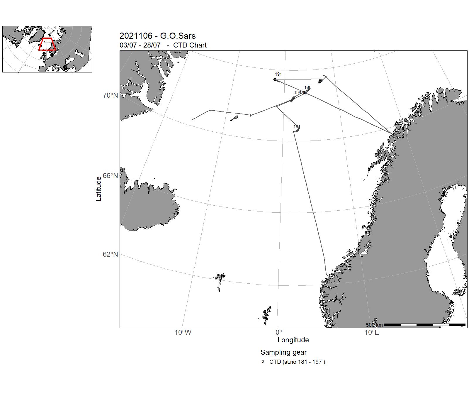
| 2021106 | 03/07 - 28/07 | Leg 1 started by going back to Sulafjorden to take sediment cores. Then, to the Norwegian and Greenland Seas to investigate manganese crust. Longer stops at the Fåvne vent field and Loki’s castle vent field, where the ROV, gravity cores, CTDs and multibeam echo-sounders were used to explore, take samples and video footage, measure parameters, and map the different zones. Leg 2 revisited several hydrothermal fields along the ridge : Fåvne, Ægir, Jan Mayen and the Seven sisters. The ROV and multibeam echo-sounders were used to explore, take samplesand video footage, and map the different zones. | Greenland Sea | 181 - 197 | - |
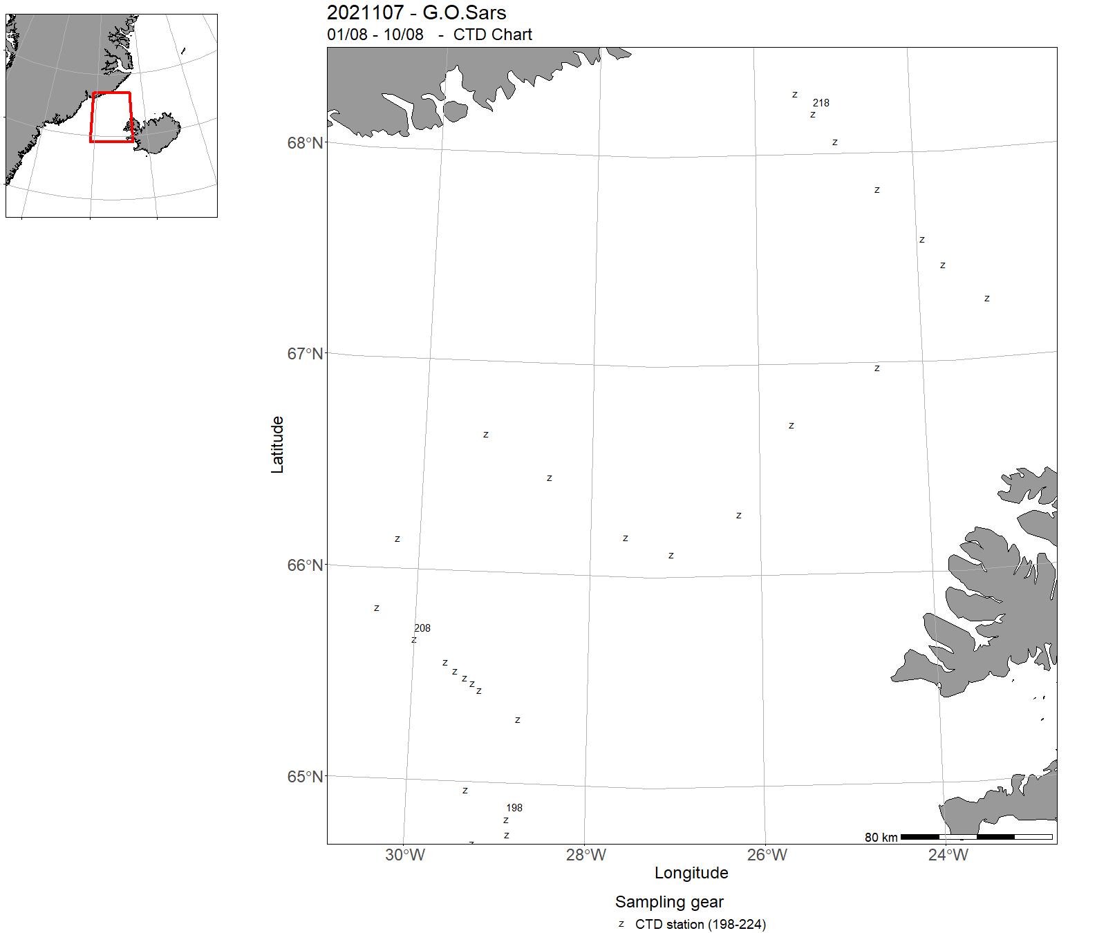
| 2021107 | 01/08 - 10/08 | 2021-RED-001: HI er partner i EU-prosjektet Eurofleets Plus hvor Transnational Access (TA) er den største komponenten. Vi er forpliktet til å levere 10 dager tokttid med G.O. Sars. Bruk av ROV Ægir inngår i toktet. | Norwegian Sea | - | - |
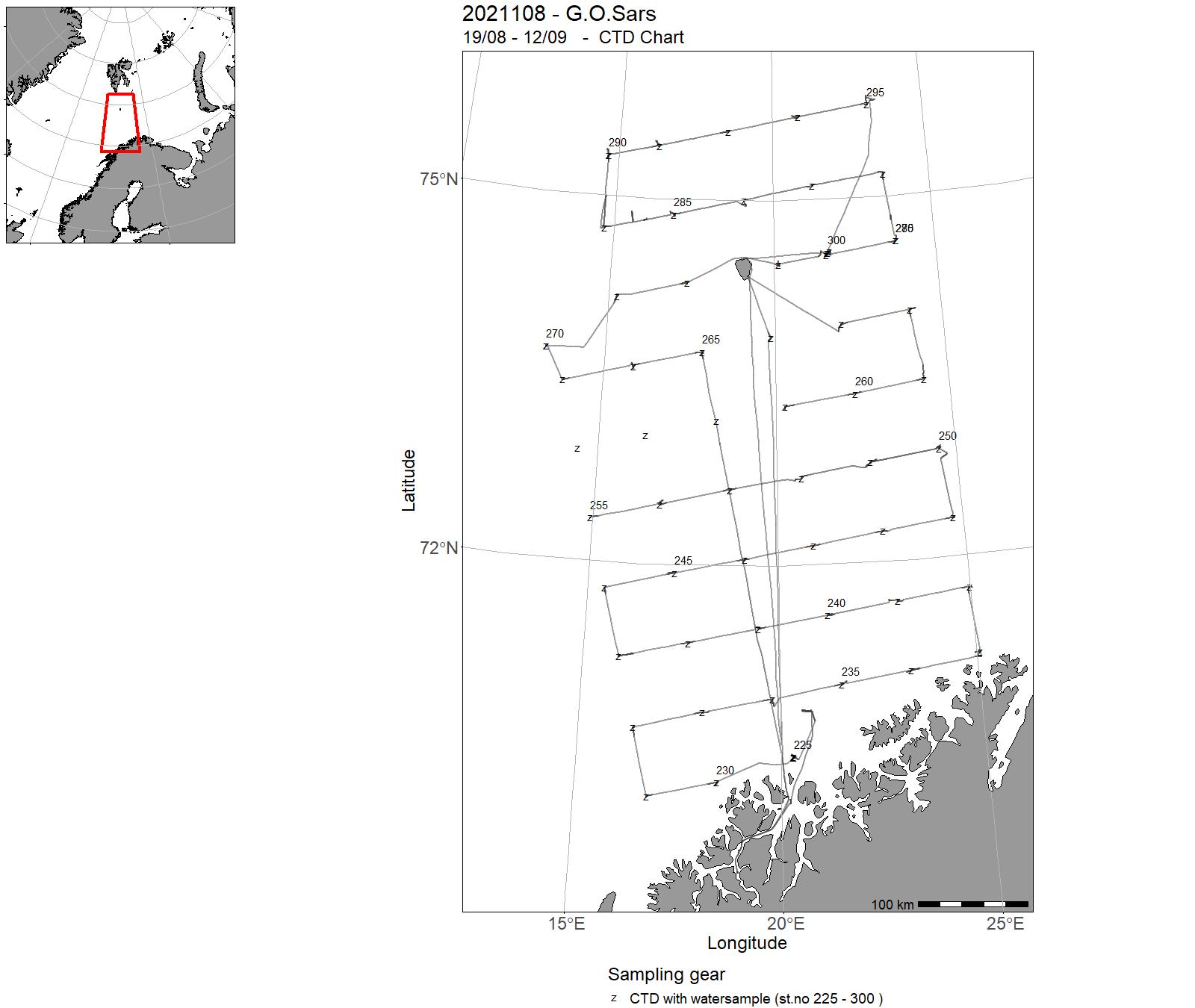
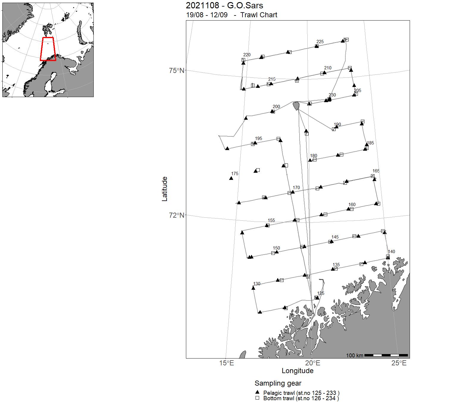
| 2021108 | 19/08 - 12/09 | The cruise forms part of a multipurpose, multiship ecosystem survey of the Barents Sea, a joint enterprise of IMR in Bergen, Norway and Northern Branch of VNIRO (PINRO) in Murmansk, Russia. The aim is to conduct a full coverage of the Barents Sea and adjacent areas north of Svalbard, where all compartments of the ecosystem is studied : physical and chemical oceanography, phytoplankton, zooplankton, pelagic fish, demersal fish, marine litter, sea birds and sea mammals. | Barents Sea | 225 - 300 | 125 - 234 |
| 2021109 | 19/09 - 05/10 | Cancelled | - | - | - |
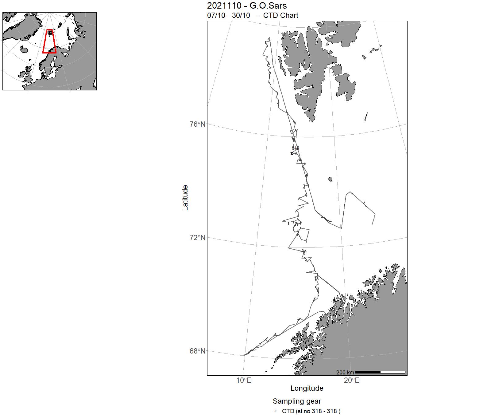
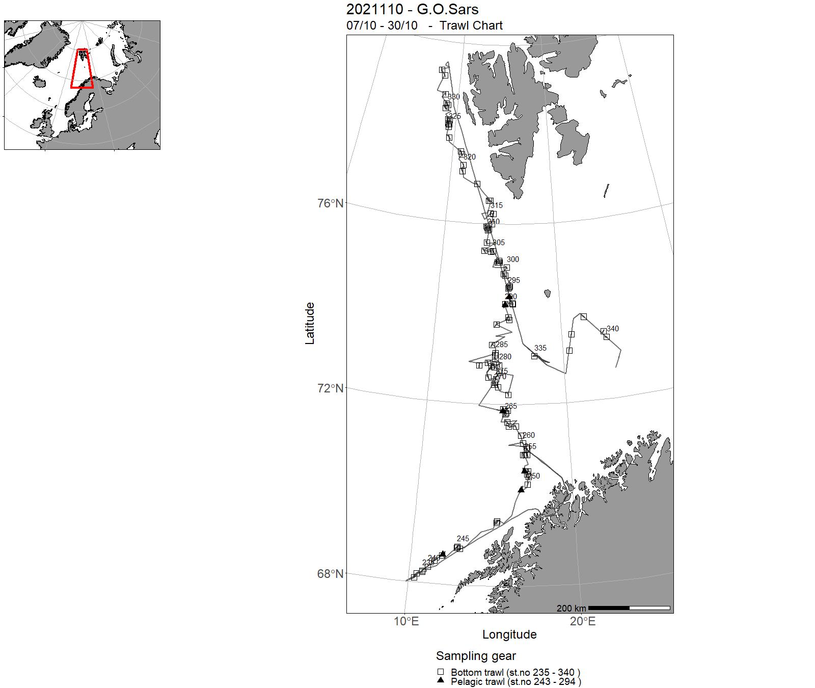
| 2021110 | 07/10 - 30/10 | “Norwegian Sea continental slope NOR deep-sea fish cruise in autumn”. Bottom trawl survey for deep sea resources on depths 400-1500 along the continental slope of the eastern Norwegian Sea between N 68 and N 80, included Bear Island trench. Bottom trawl stations primarily for biomass estimation of Greenland halibut (Reinhardtius hippoglossoides), along with registrations on beaked redfish (Sebastes mentella) and other deep-sea fish species. | Norwegian Sea | 318 - 318 | 235 - 340 |
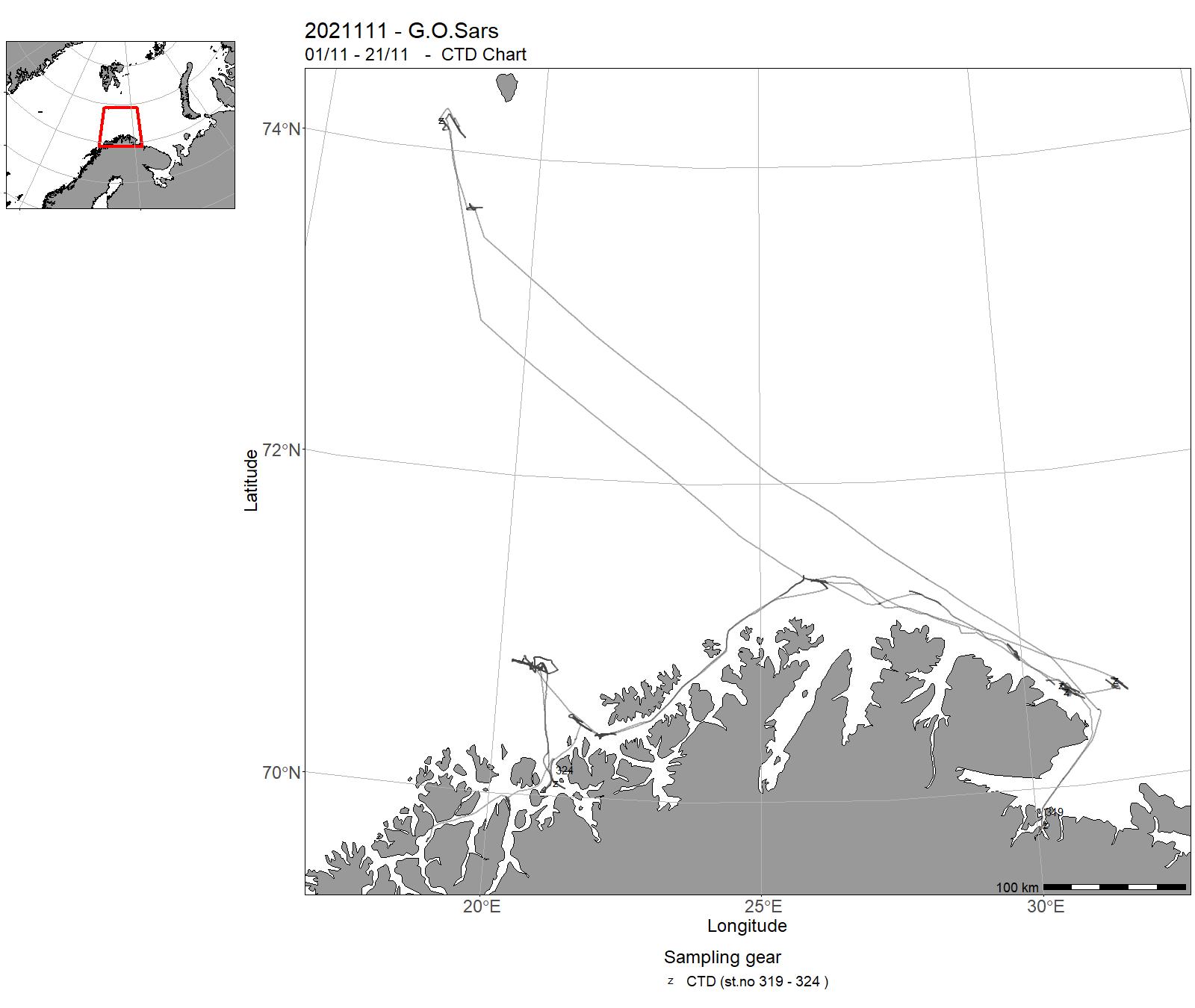
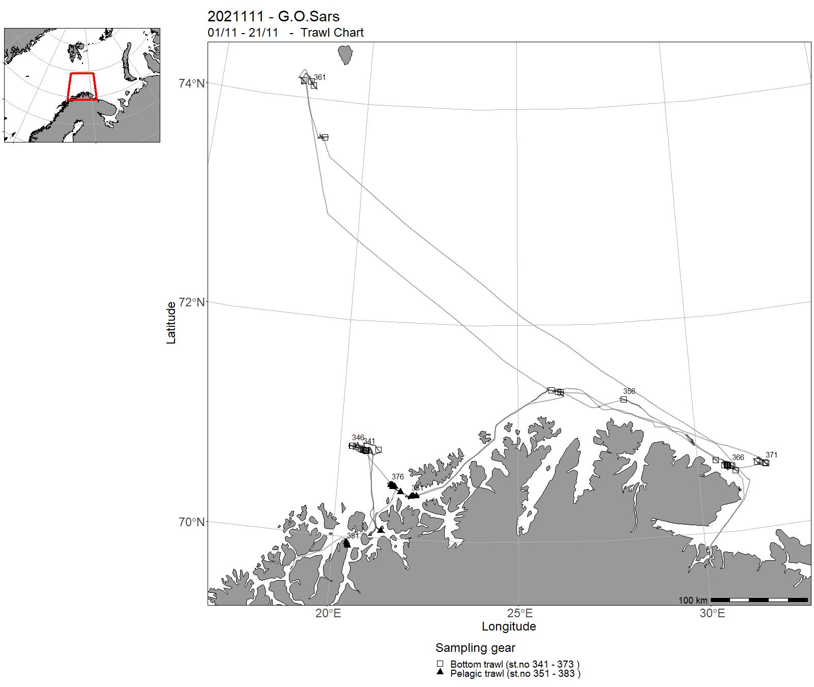
| 2021111 | 01/11 - 21/11 | The objective of the survey was to test IMRs sampling trawls and to obtain optical and broad banded acoustical measurements of demersal fish. The survey is a joint survey between the CRIMAC SFI and the Trawl methodology project at IMR. Subobjectives: - Further develop video trawling close to seabed for scientific and commercial fishery - Train operators for the FOCUS underwater vehicle for monitoring trawl performance. - Develop and test sensors and methods for trawl positioning and winch steering - Test performance of IMRs standard Harstad sampling trawl performance - Collect broad-banded acoustic data from demersal fish; from both hull-mounted and probing platforms. - Data collection to estimate crosstalk between frequencies using standard settings and validate acoustic FM to CW conversions - Data collection to provide optimal settings for near-seafloor acoustic measurements and broadband data from near sea floor for classification - Data for comparing the combined Simrad EC150 Echosounder and ADCP against the standard onboard ADCP were conducted. | Barents Sea | 319 - 324 | 341 - 383 |
| 2021112 | 24/11 - 28/11 | 1. Retrievial of ocean observatory platforms 2. Search of the lost marine cable | Norwegian Sea | - | - |
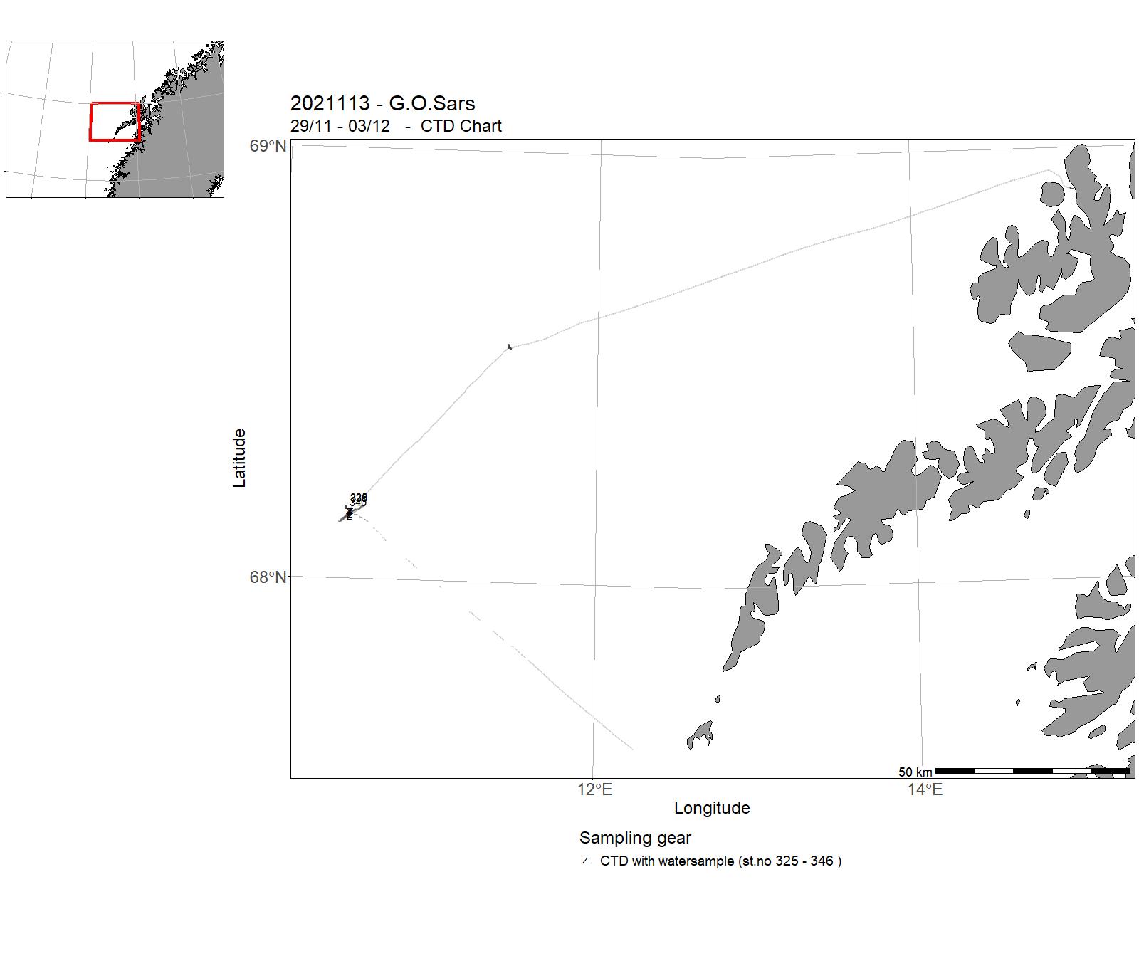
| 2021113 | 29/11 - 03/12 | The cruise to the Lofoten margin is organized and funded through the NFR Norwegian-Polish GRIEG project “ArcticSGD” at NGU in collaboration with Nord University, Stockholm University, and the Institute of Oceanology of Polish Academy of Sciences. It is the first cruise with RV “G.O. Sars” co-ordinated within the “ArcticSGD” project. The G.O. Sars cruise is directed to the canyons identified along the SW Lofoten margin, where groundwater seepage has been documented in 800 m water depth. From previous cruises in 2017 and 2020, we have identified typical features of cold seep sites in two depressions southwest of the most distinct canyon and will investigate them closer during this cruise. | Norwegian Sea | 325 - 346 | - |
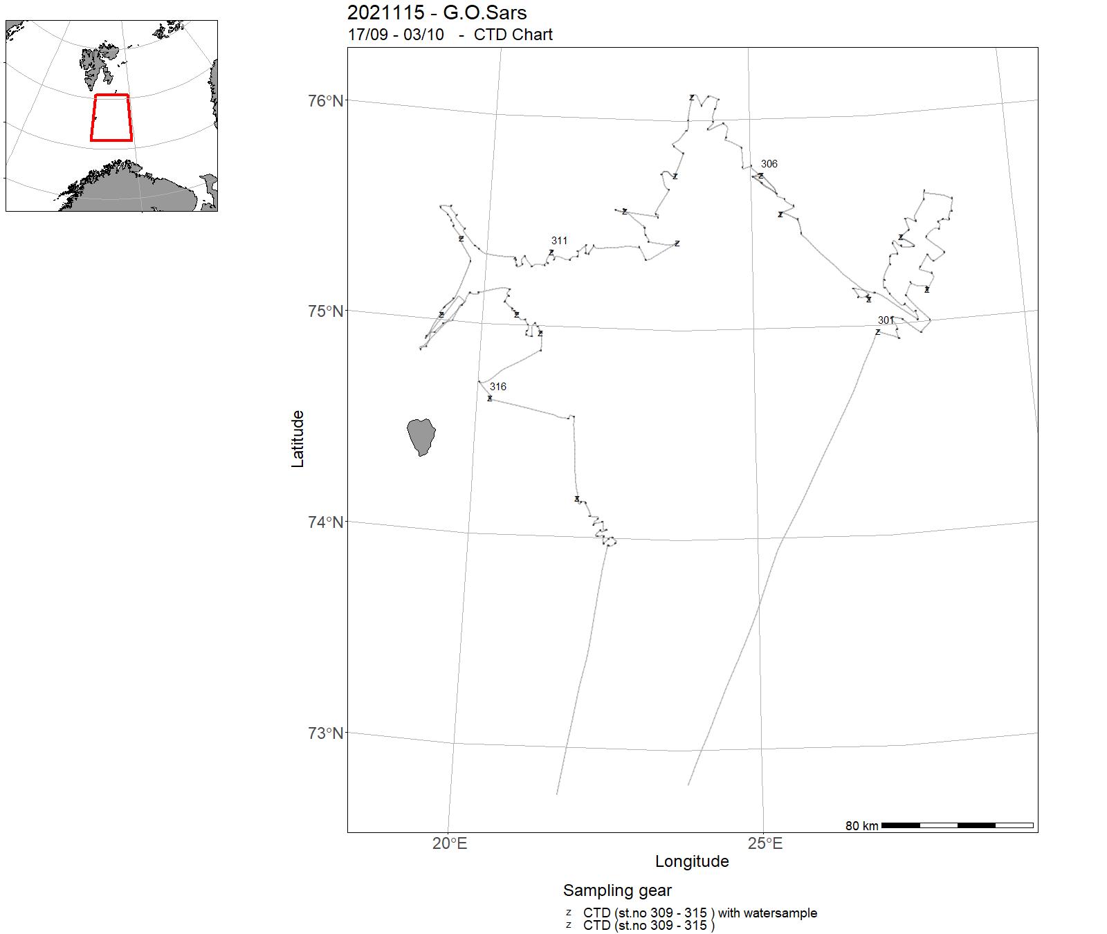
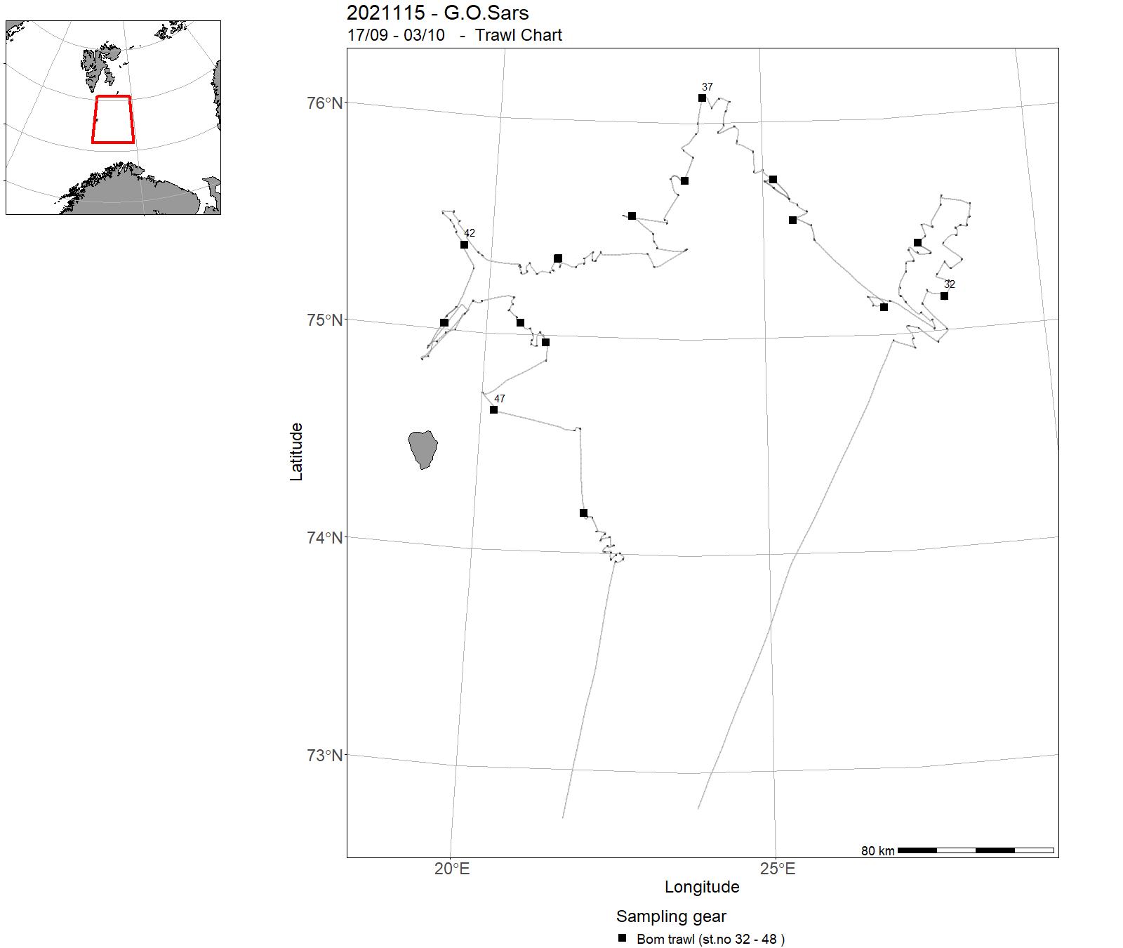
| 2021115 | 17/09 - 03/10 | Sea bottom mapping with video-filming and sampling of benthic fauna and sediments at selected stations in the Barents Sea (south-east in the North European Zone, NEZ). The main aim was mapping of benthic fauna, bio-diversity, biotopes, geological terrain-parameters and chemical pollution. The mapping was performed using visual seabed observation and sampling of sediments and organisms using video-rig, grab, boxcorer, multicorer, beam trawl and hyperbenthic sled. | Barents Sea | 301 - 317 | 32 - 48 |
| 2021114 | 09/12-22/12 | Cancelled | - | - | - |
3 - “ G.O. Sars” – Charts for cruises 2021
4 - "Johan Hjort" - Cruises 2021
| Cruise No | Period | Purpose | Area | CTD st.no | Trawl st.no |
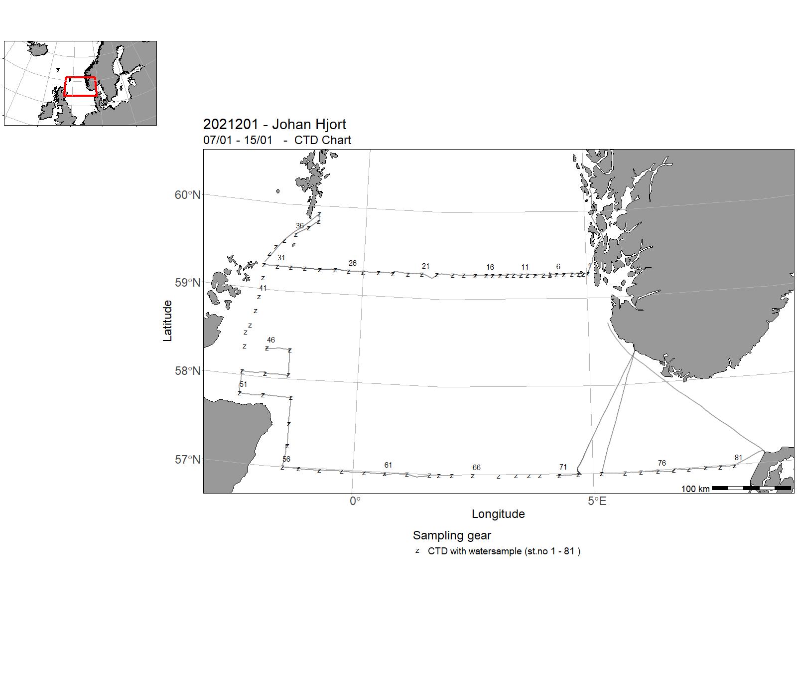
| 2021201 | 07/01 - 15/01 | To collect data and samples on pre-selected stations. To sample standard transects for physical oceanographic parameters (CTD casts, nutrients and chlorphyll) and zooplankton in the North Sea. Cruise programme : 1. Utsira-V transect 2. Fair Isle-Pentland transect 3. Scotland East Coast transect 4. Hanstholm-Aberdeen transect | North Sea | 1 - 81 | - |
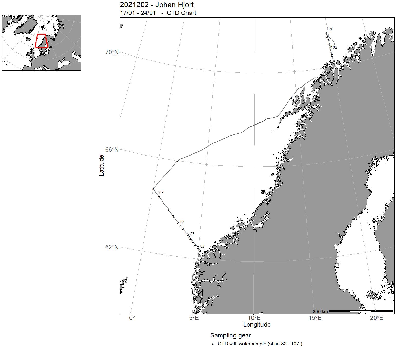
| 2021202 | 17/01 - 24/01 | The objective of the cruise was to collect data and samples on pre-selected stations as part of the IMR Monitoring of the environment and plankton on the Svinøy and Fugløya-Bjørnøya sections and at station M in January. Sampling was undertaken on the following standard transects: Svinøy and Fugløya-Bjørnøya sections and at station M. Implementation of transect over LoVe. The cruise programme included sampling for physical-chemical oceanographic parameters (CTD casts, nutrients and chlorphyll), zooplankton with plankton net and the Multinet Mammoth. | Norwegian Sea | 82 - 107 | - |
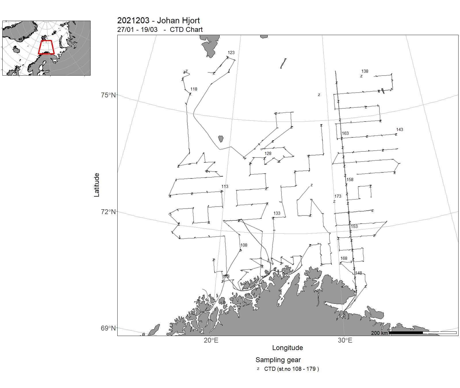
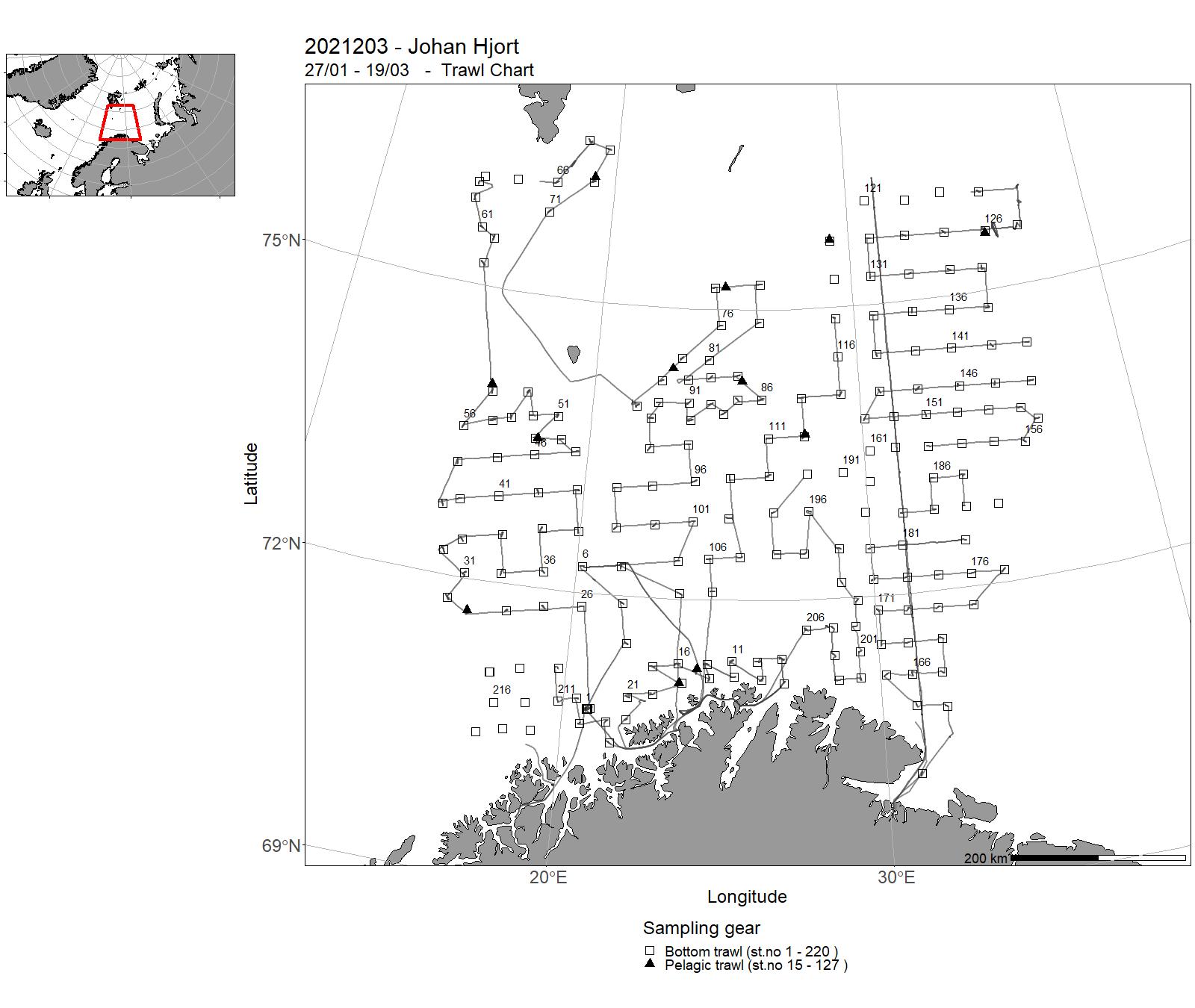
| 2021203 | 27/01 - 19/03 | Annual combined acoustic and bottom trawl survey in the Barents Sea in winter to: 1) map the distribution and estimate acoustic and bottom trawl abundances indices, length, weight and maturity at age of cod and haddock. 2) map the acoustic distribution and do biological sampling of capelin, herring, polar cod and blue whiting. 3) map the general hydrographic regime by using a CTD-sonde to monitor the temperature and at about every second-third fixed bottom trawl stations (for about every 40 NM). 4) stomach sampling of cod and haddock. 5) collection of biological data for snow crab. 6) collection of samples for analyses of contaminants. | Barents Sea | 108 - 179 | 1 - 220 |
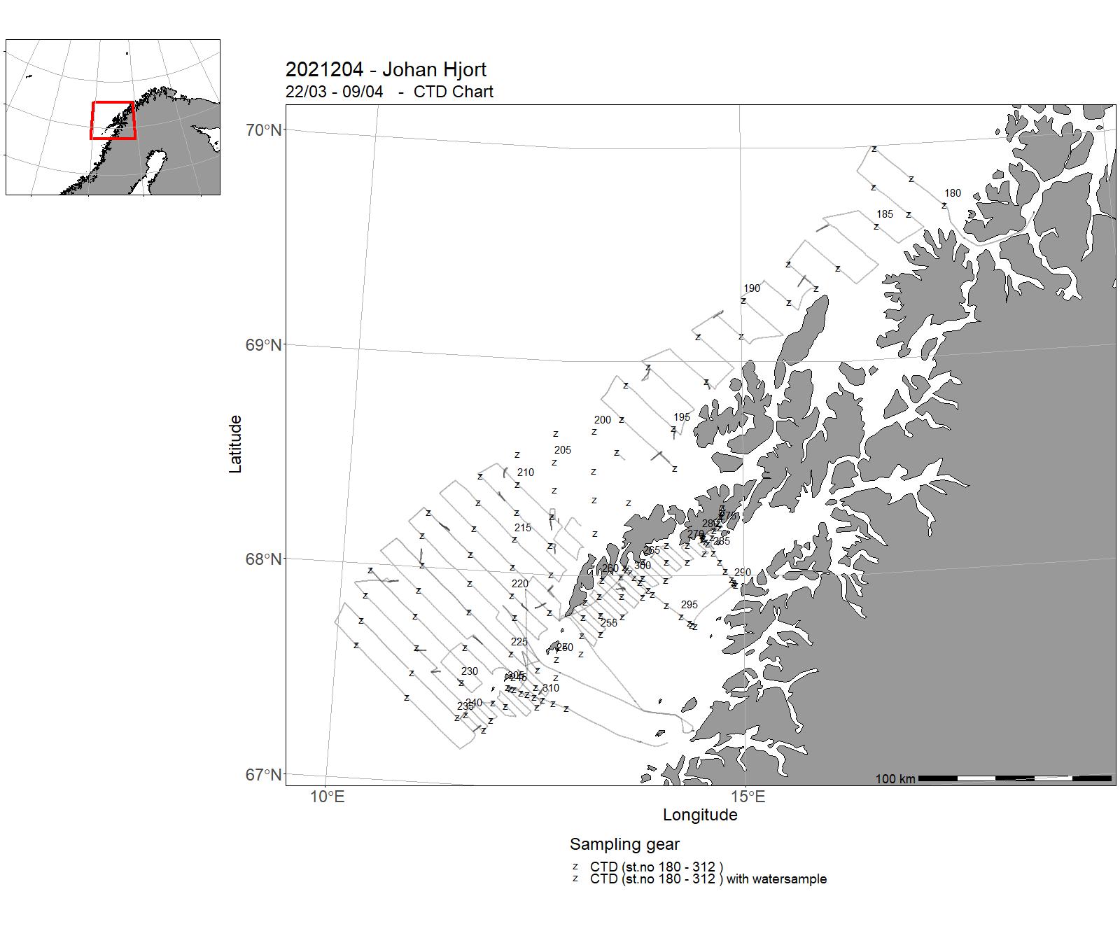
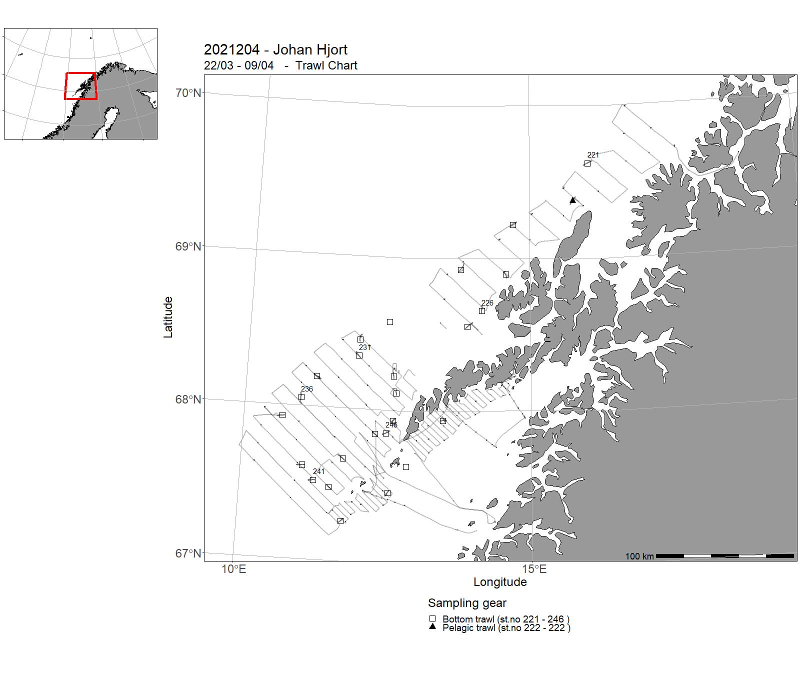
| 2021204 | 22/03 - 09/04 | Anually recurrant acoustic survey to monitor abundance of spawning North-East Arctic cod in the spawning area around Lofoten by systematic parallell transects and with systematic sampling of fish-egg concentrations by vertical nets in the upper 100 m of the water column. Lofoten is the main spawning location for the stock, and the survey index indicate spawning biomass and abundance of the mature stock. | Norwegian Sea | 180 - 312 | 221 - 246 |
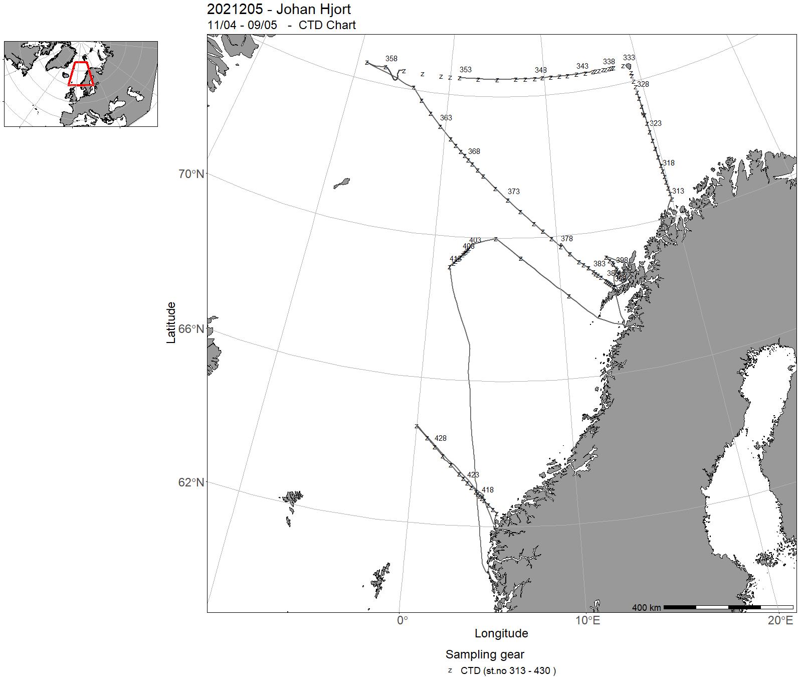
| 2021205 | 11/04 - 09/05 | The cruise objectives were to occupy the monitoring sections Fugløya-Bjørnøya in the Barents Sea, extended Bjørnøya vest and extended Gimsøy section in the northern Norwegian Sea and the Svinøy section in the southern Norwegian Sea and deploy Argo floats. On the sections, CTD observations measueremenst were made from surface to bottom. Water samples were drawn for nutrients analysis and chlorophyll was sampled for the top 100 m. Carbon system analysis and water samples for oxygen analysis were drawn in selceted stations. WP2 plankton nets for the top 200 m (100 m in the Barents Sea) was conducted along the sections. Qualitative plankton samples were sampled on selected stations. ADCP, Thermosalinograph and echo sounder data were collected underwa, and Argo floats wer deployed in selected locations. | Barents Sea | 313 - 430 | - |
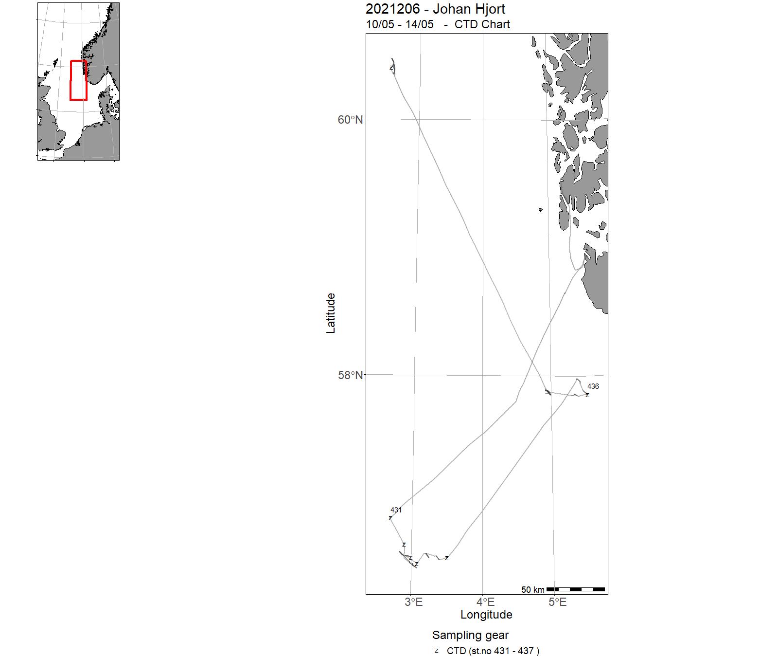
| 2021206 | 10/05 - 14/05 | The major objective is to document to what extent discharges from the oil and gas installations cause contamination of fish negatively affecting the quality. For both the petroleum industry and the Norwegian fishing industry it is important that safety and quality of Norwegian seafood is documented, as well as environmental health of the marine environment. Water column monitoring with fish from the Norwegian Continental Shelf are conducted every third year and shall document whether fish from Norwegian Seas are affected by pollution from oil and gas industry activities. | North Sea | 431 - 437 | 247 - 260 |
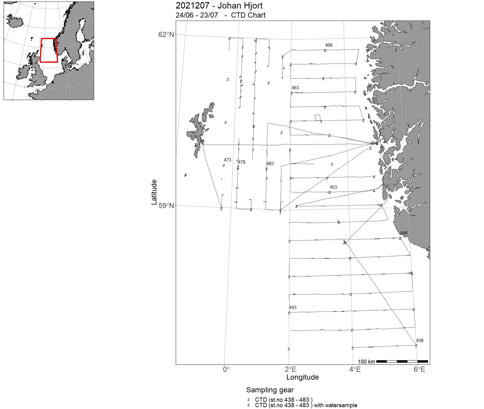
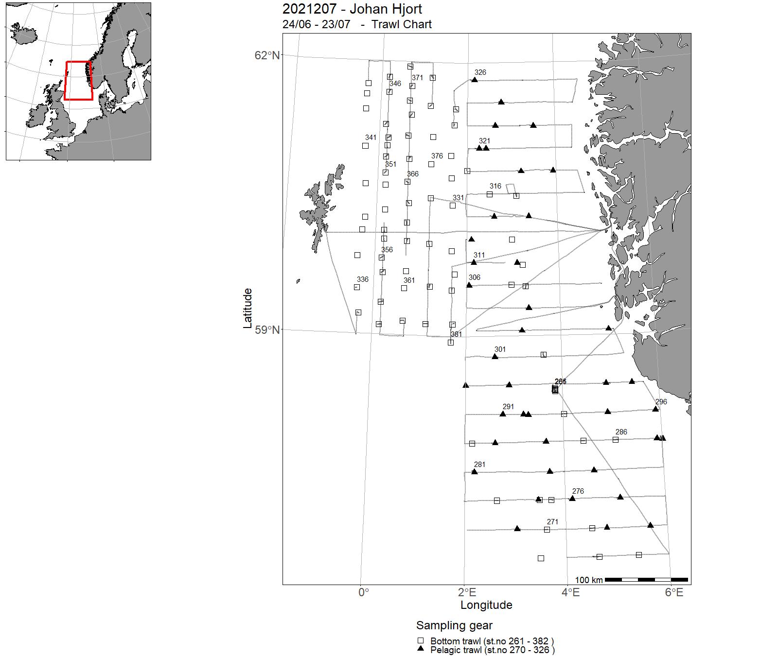
| 2021207 | 24/06 - 23/07 | Acoustic survey focusing on herring (HERAS, leg 1) and saithe in the northern North Sea. The herring survey, coordinated by ICES and WGIPS, is part of an international sampling effort (involving also Denmark, Netherlands, Germany and Scotland) and the index is used in the assessment of North Sea herring. NORACU: times series focusing on saithe (both legs) to be used in assessment of the NS saithe after 5 years of consistent sampling (ICES regulation). Project name: Population estimates of demersal fish stocks in North Sea Coordinating body: Institute of Marine Research | North Sea | 438 - 483 | 261 - 382 |
| 2021208 | 27/07 - 08/08 | Monitoring of the environment and plankton on the Svinøy, station M, Gimsøy, Fugløya-Bjørnøya and Bjørnøya-V sections. Measuring physical, chemical and biological parameters important to follow changes in climate and environment at weather station M in the Norwegian Sea. Gliders and rigs. | Norwegian Sea | 484 - 559 | - |
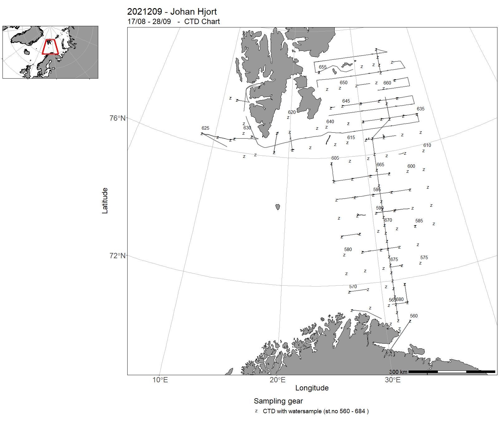
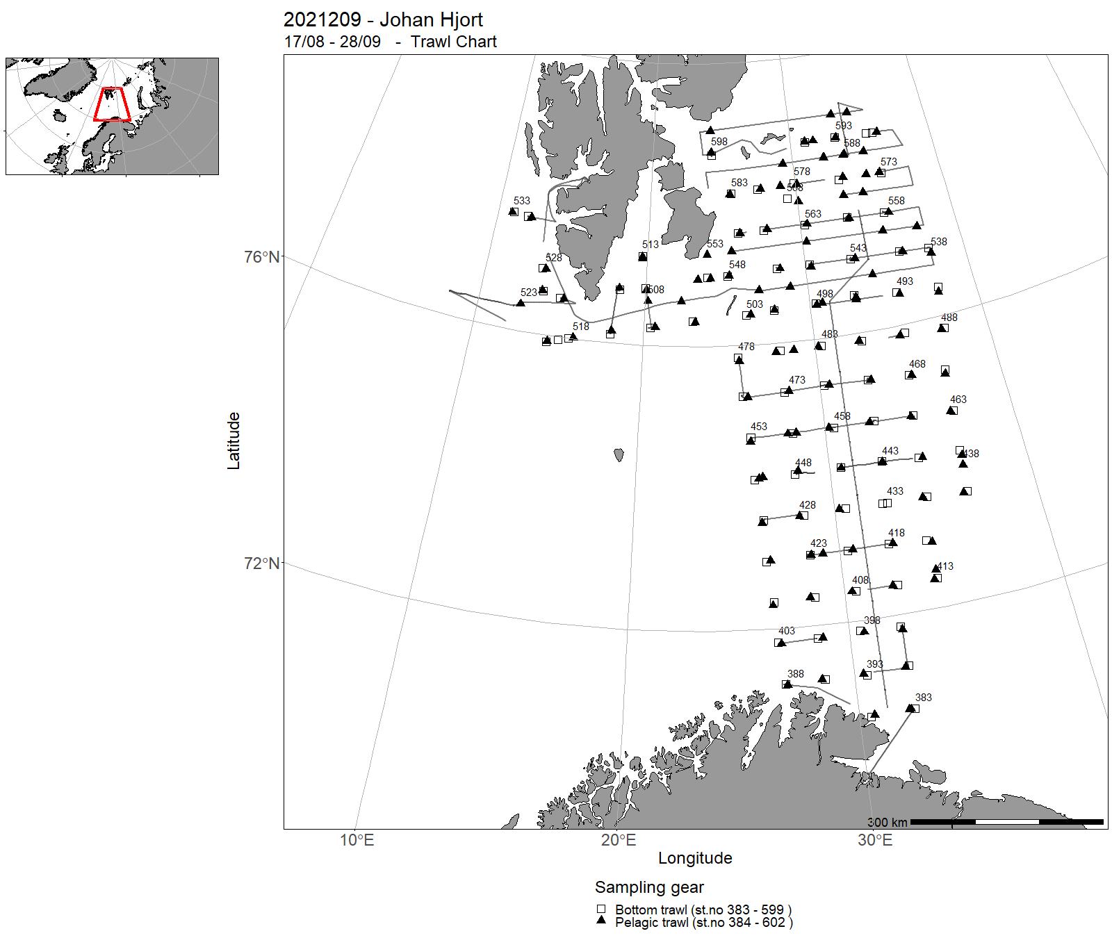
| 2021209 | 17/08 - 28/09 | The cruise forms part of a multi-ship, multi-purpose ecosystem survey of the Barents Sea, carried out jointly by Norway and Russia. The objective of the cruise was to collect data related to stations and along cruise tracks, on water chemistry and physics, phytoplankton, zooplankton, fish (acoustics and trawl), benthic organisms, sea mammals, and birds. | Barents Sea | 560 - 684 | 383 - 602 |
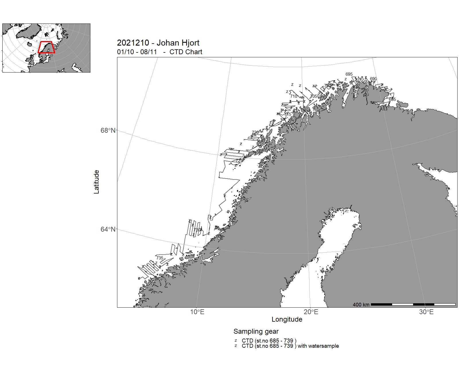
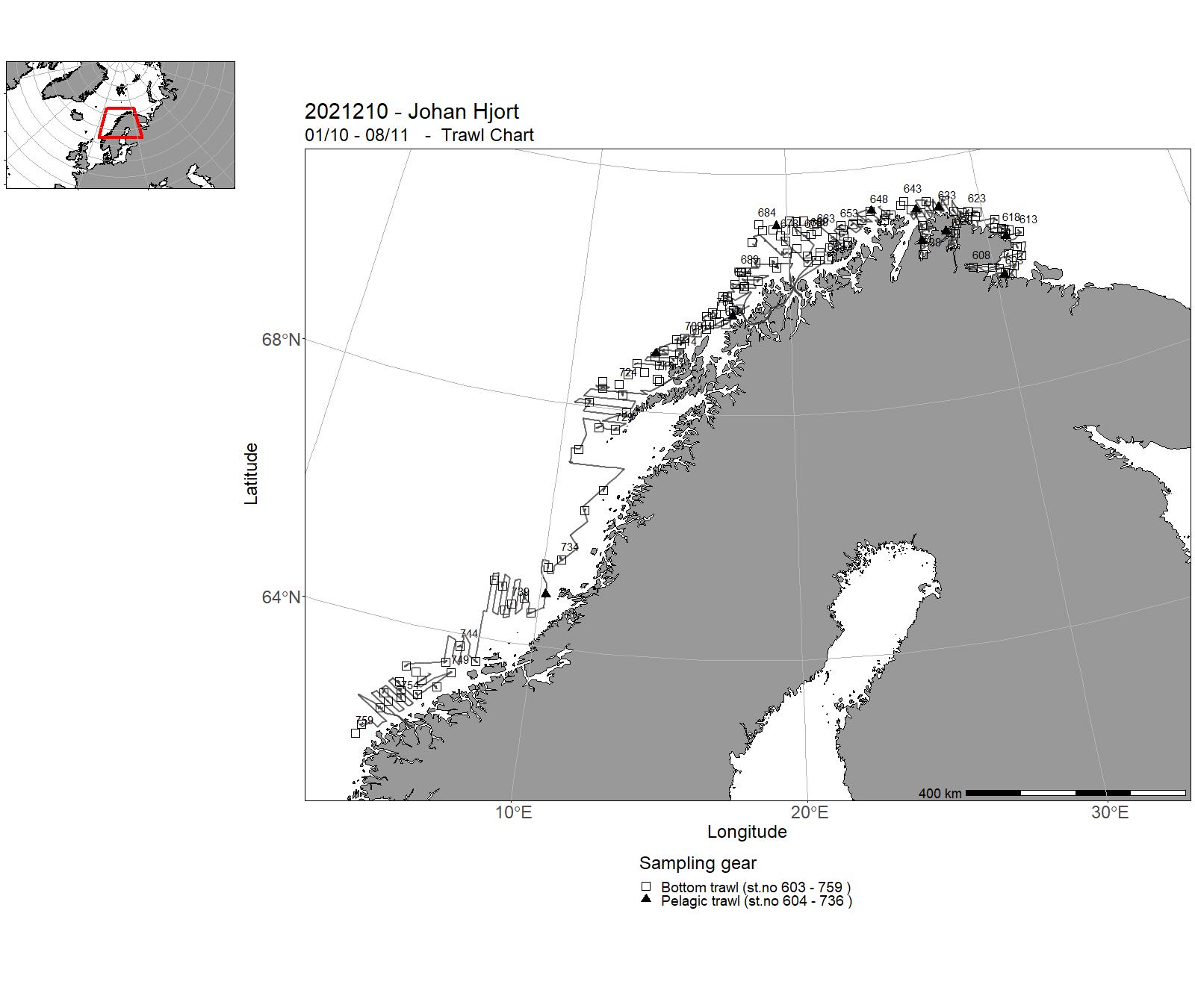
| 2021210 | 01/10 - 08/11 | Annual combined acoustic and bottom trawl survey along the Norwegian coast north of 62˚N • map the distribution and calculate acoustic abundances indices, length, weight and maturity at age for coastal cod and saithe • improve data basis for the assessment of golden redfish, by allocating additional bottom trawls • map the general hydrographical regime by using a CTD-sonde to monitor the temperature and salinity at one at bottom trawl stations and/or at fixed intervals (about 30 NM) • acoustic coverage of pelagic fish in Laksefjord, Tanafjord,and Varangerfjord • collection of frozen samples of selected shark and skate species, deep sea shrimps, and hake • collection of tissues samples for genetic study of hake and halibut • collection of frozen hake for analysis of contaminants | Barents Sea | 685 - 739 | 603 - 759 |
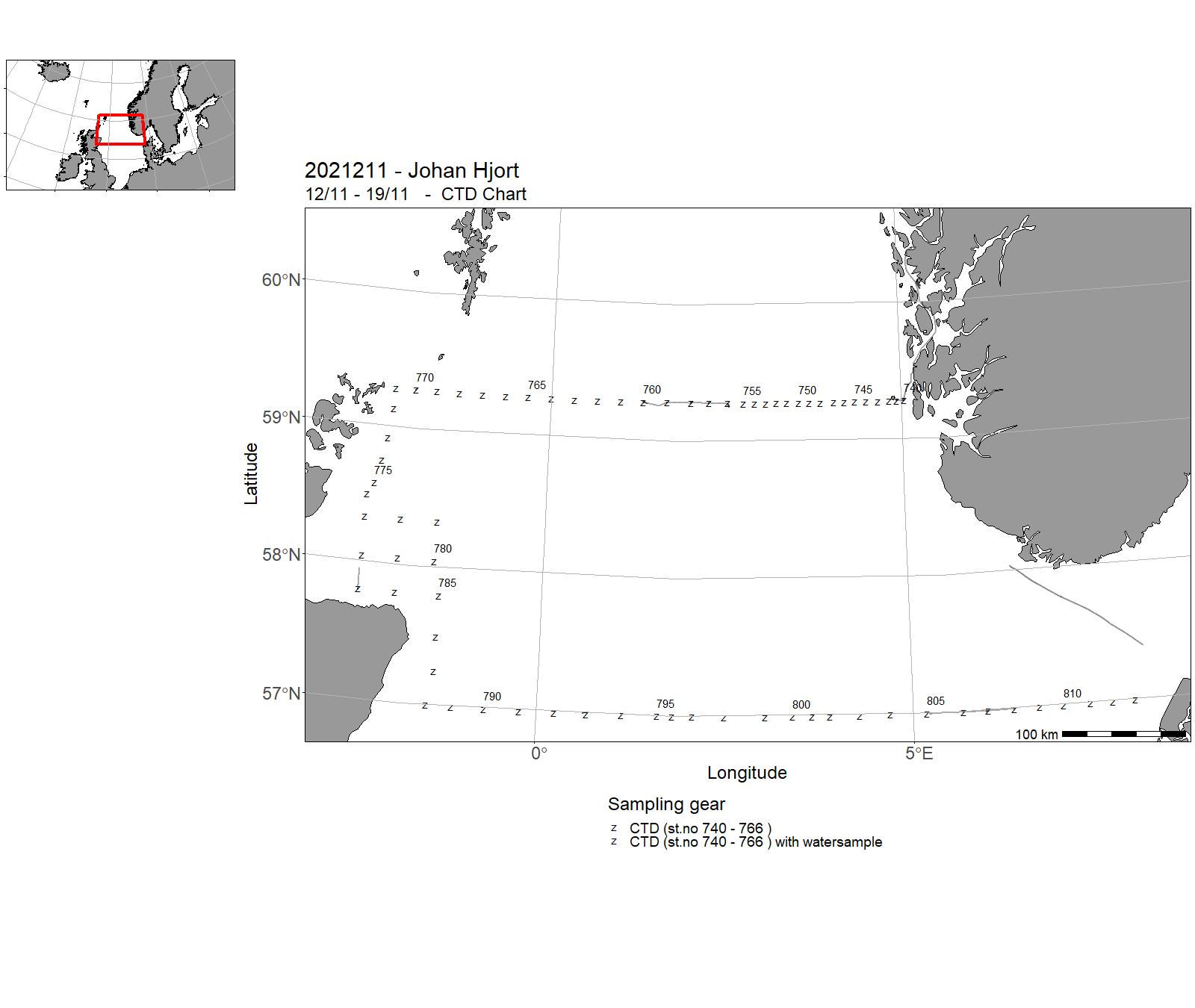
| 2021211 | 12/11 - 19/11 | The objective of the cruise was to collect data and samples on pre-selected stations as part of the IMR monitoring of physical and biological parametres in the North Sea. Sampling was undertaken on the following standard transects: Utsira-Start Point, Fair Isle-Pentland, east coast of Scotland and Aberdeen-Hanstholm (North Sea). The cruise programme included sampling for physical-chemical oceanographic parameters (CTD casts, nutrients and chlorphyll), zooplankton with plankton net and the Multinet Mammoth. A larger plankton net with an associated smaller and finer mesh net was used to sample the fish larvae and fish eggs. From the Fair Isle-Pentland transect only the 6 last stations were sampled. | North Sea | 740 - 813 | - |
5 - “Johan Hjort” – Charts for cruises 2021

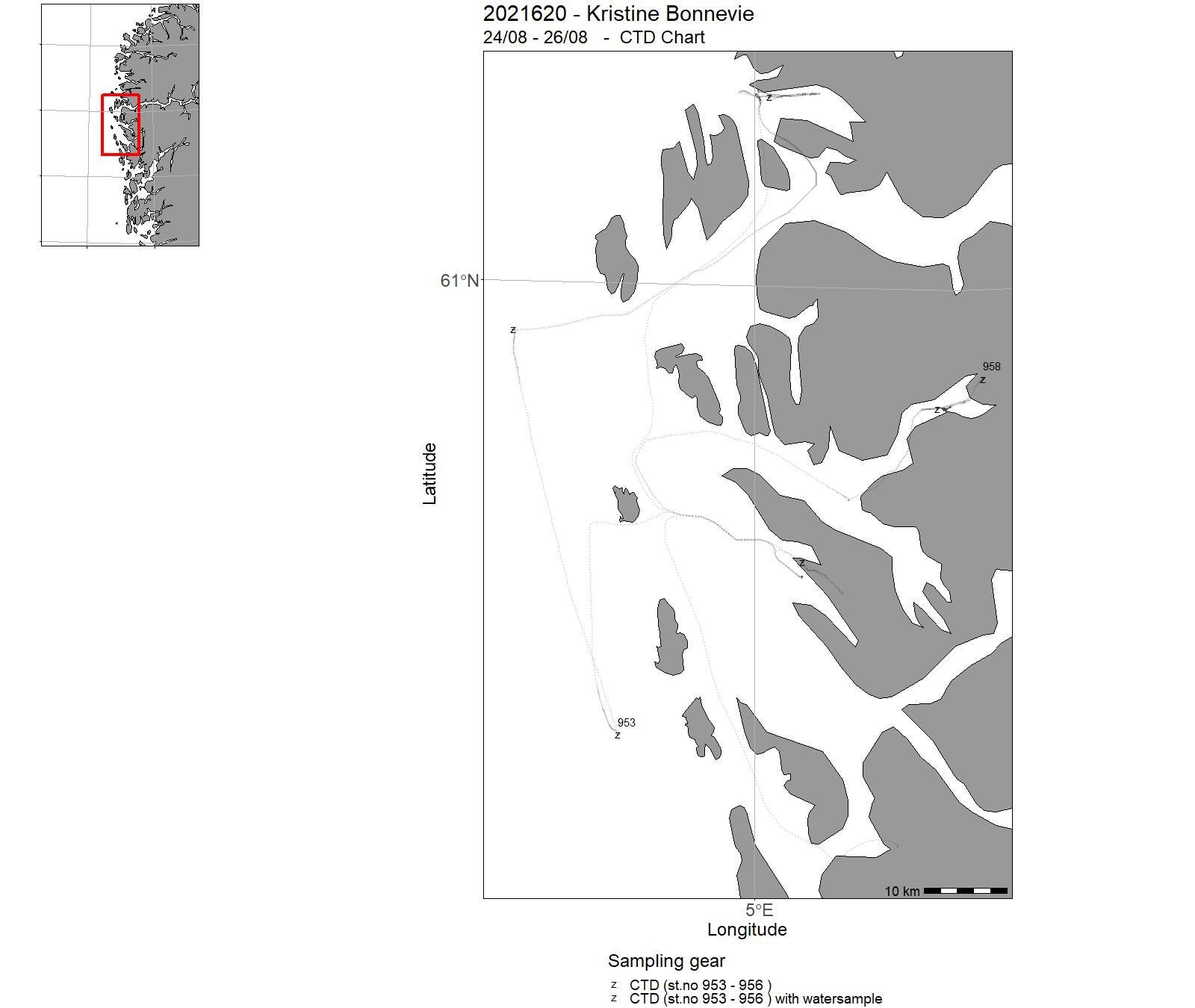
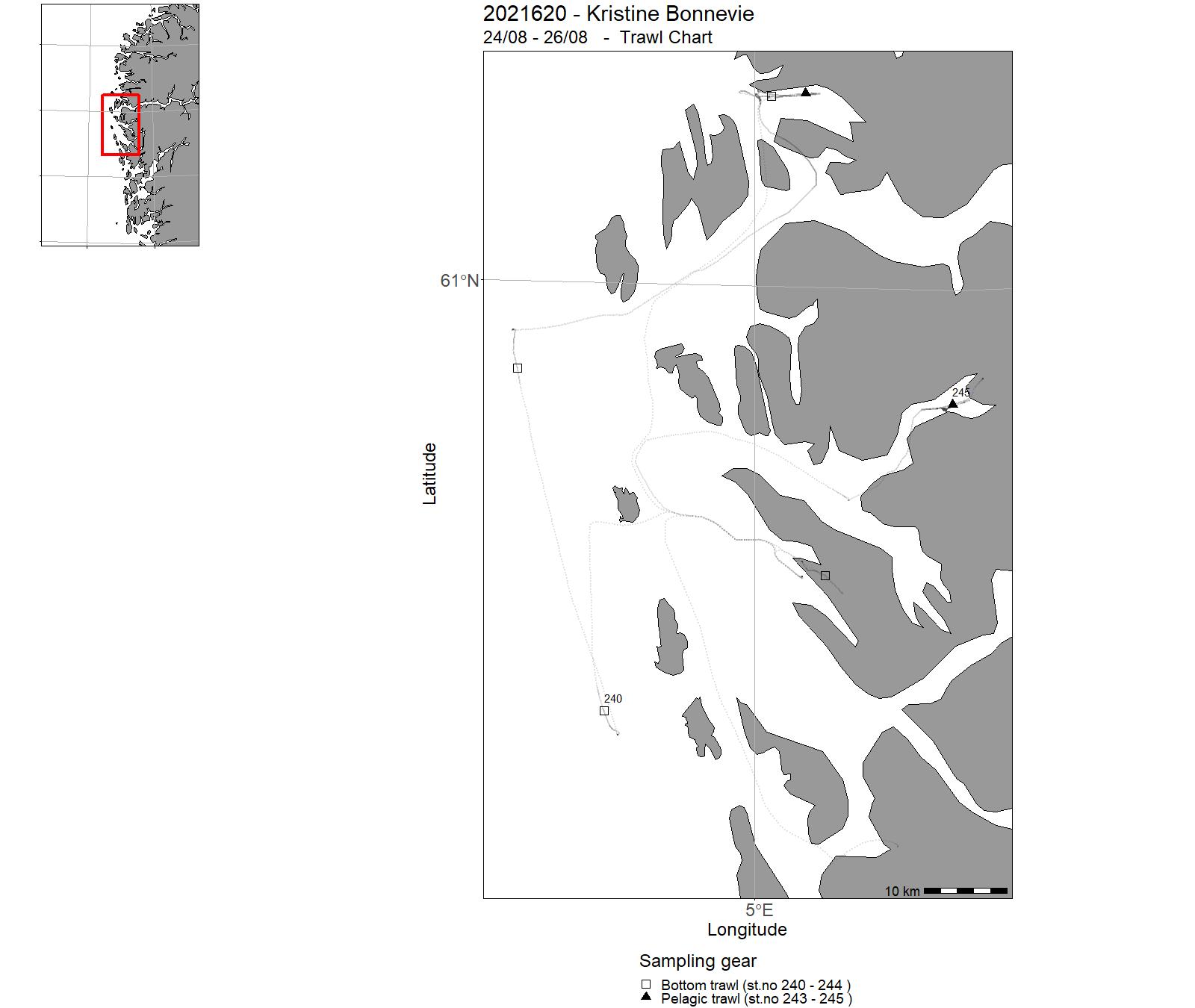
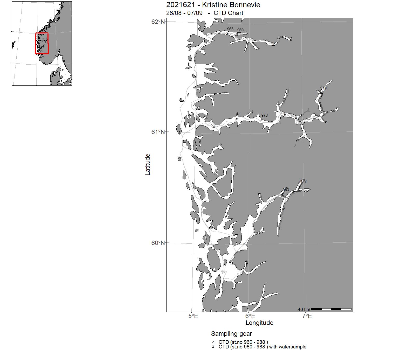
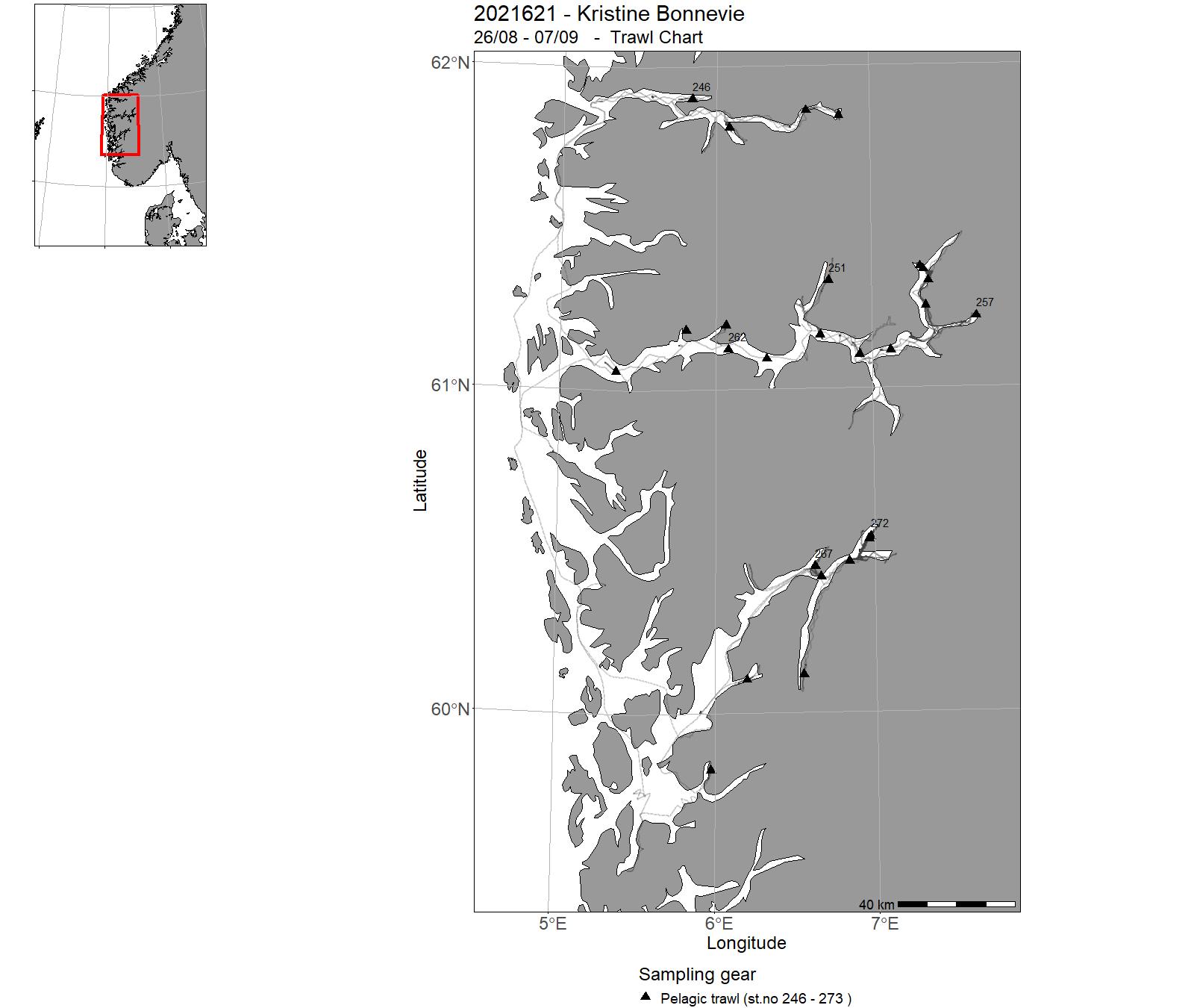
6 - "Kristine Bonnevie" – Cruises 2021
| Cruise No | Period | Purpose | Area | CTD st.no | Trawl st.no |
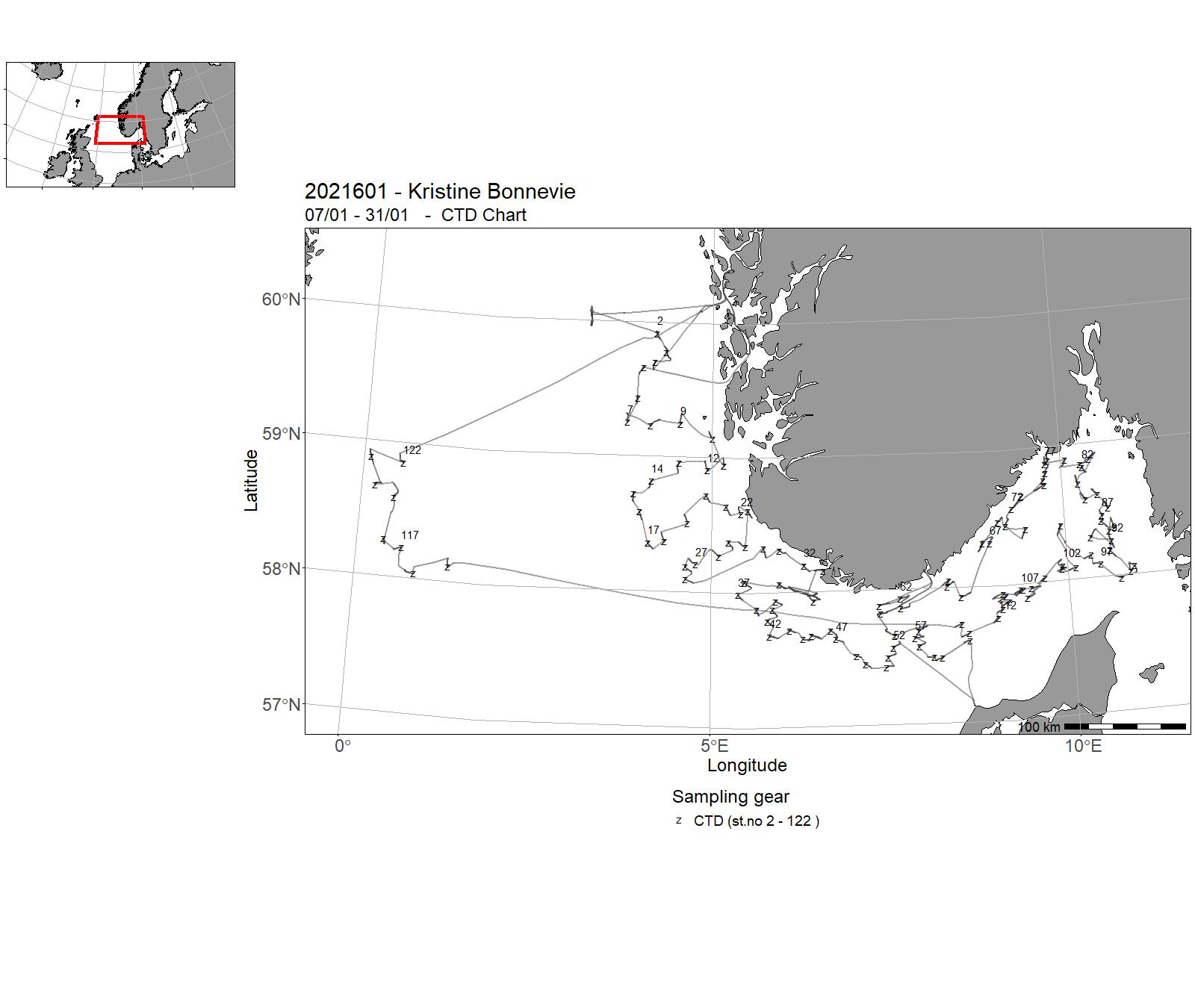
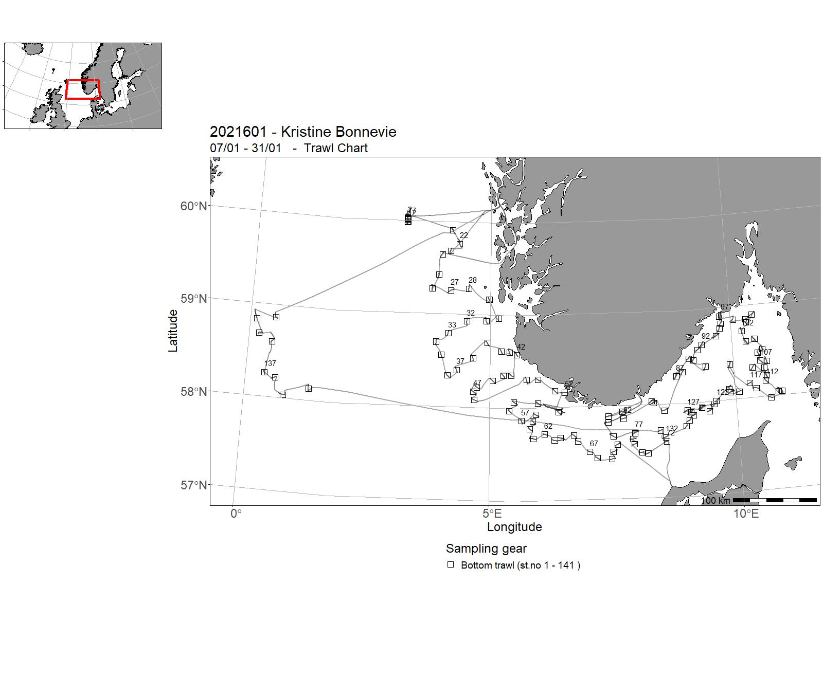
| 2021601 | 07/01 - 31/01 | Annual shrimp survey conducted by the IMR : 1. Fixed trawl stations (bottom trawl) for northern shrimp (Pandalus borealis) and fish. Data on shrimp biomass, abundance, and recruitment: total weight, length, sex, maturity 2. CTD (temperature, salinity) on all trawl stations 3. Length and total weight of all fish species. | Skagerrak | 2 - 122 | 1 - 141 |
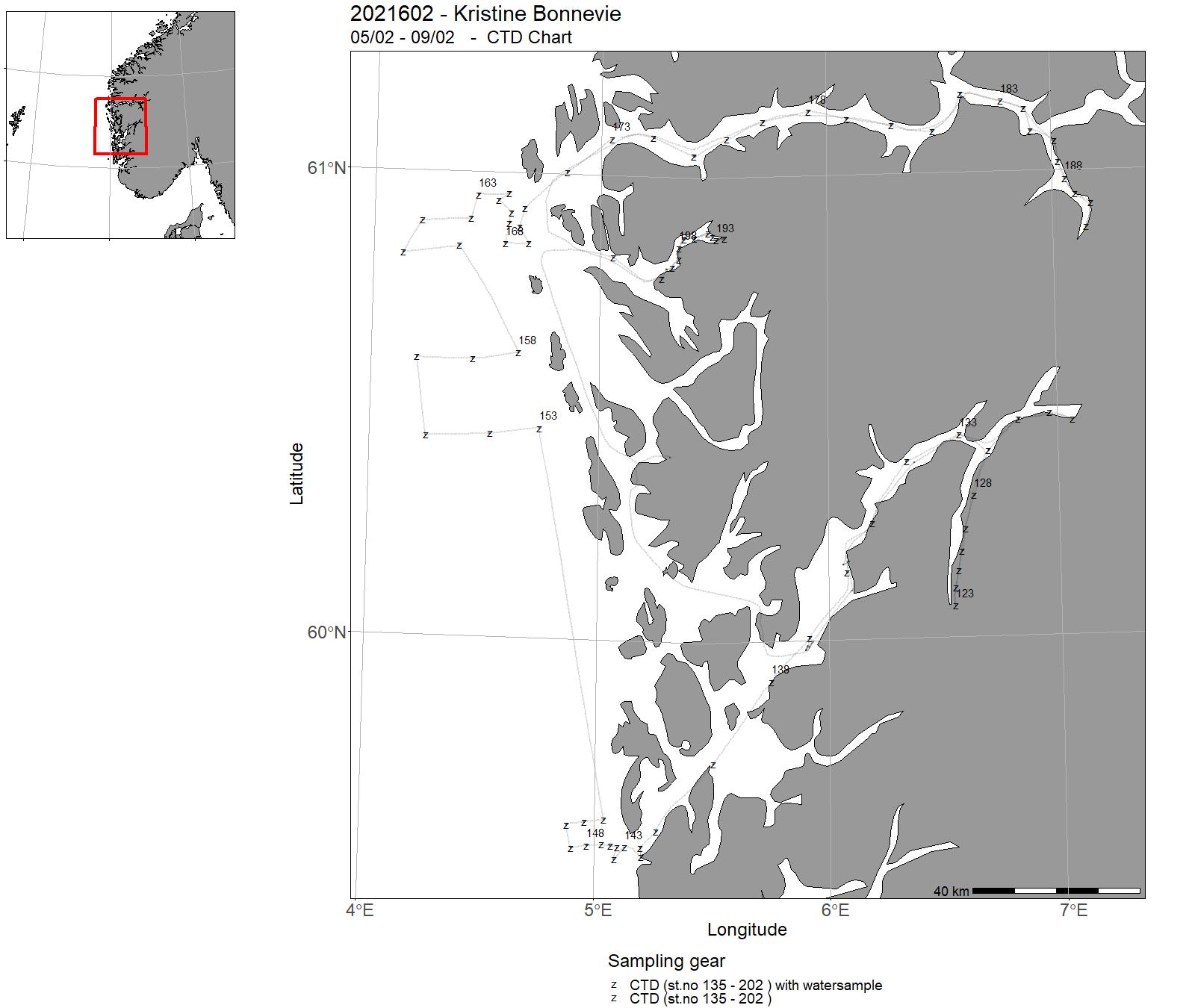
| 2021602 | 05/02 - 09/02 | Hydrography along regular transects in Hardangerfjord, Masfjord and Sognefjord. Hydrography at the coast outside Bergen. Exchange of batteries and new deployments of current meter moorings in Hardangerfjord. | Norwegian Sea | 123 - 202 | - |
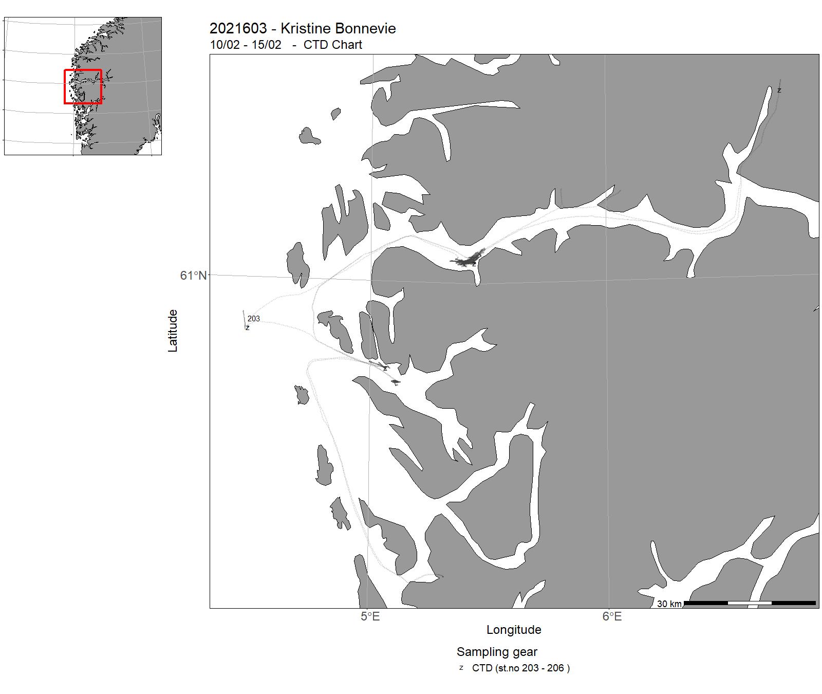
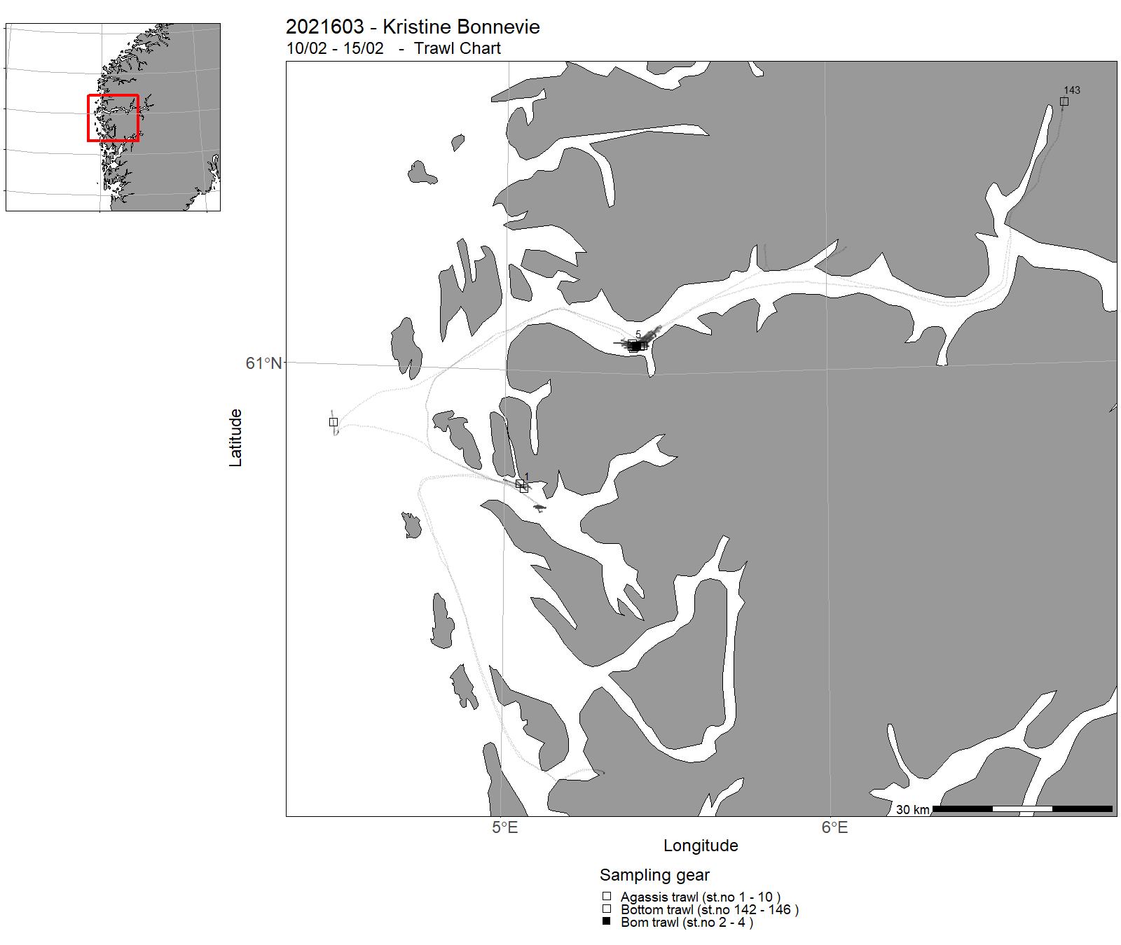
| 2021603 | 10/02 - 15/02 | Many animals can produce weak light, so-called bioluminescence, and this is potentially very important in the deep sea where there is a complete lack of sunlight. The importance is supported by studies finding up to 80% of deep-sea species being bioluminescent and many deep-sea animals also have eyes to detect the emitted light. This project will through behavioral and physiological experiments test our hypothesis on a novel function of bioluminescence based on our recent unique observation that a species of deep sea starfish has bioluminescent eggs, which putatively light up to be eaten and thereby dispersed. Another goal is for the first time to document natural bioluminescence from deep sea benthic living animals in their habitat in combination with observations of the correlated behaviors. The project will add new important knowledge about the functional significance of bioluminescence along with unique insight into life in the deep sea. Project name: LIGHT UP TO BE EATEN | Norwegian Sea | 203 - 206 | 1 - 146 |
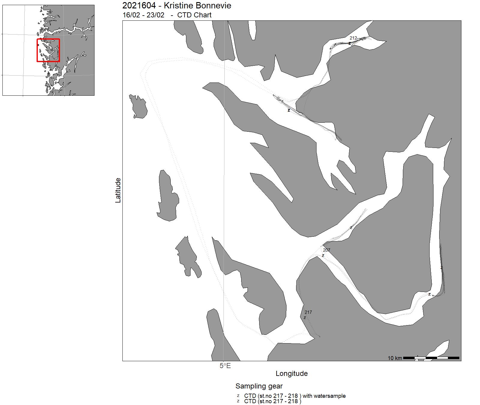
| 2021604 | 16/02 - 23/02 | The survey collected samples in West Norwegian fjords (Osterfjord, Sørfjord, Fensfjord, Masfjord). The equipment used was : - CTD - Harstad Pelagic trawl 320 with and without MultiSampler (3 cod-ends) - Spectroradiometer - Acoustics - TRIOS Ligthmeter - LOL Ligthmeter Project name: HypOnFjordFish Coordinating body: Department of Biological Sciences, University of Bergen | Norwegian Sea | 207 - 219 | 147 - 163 |
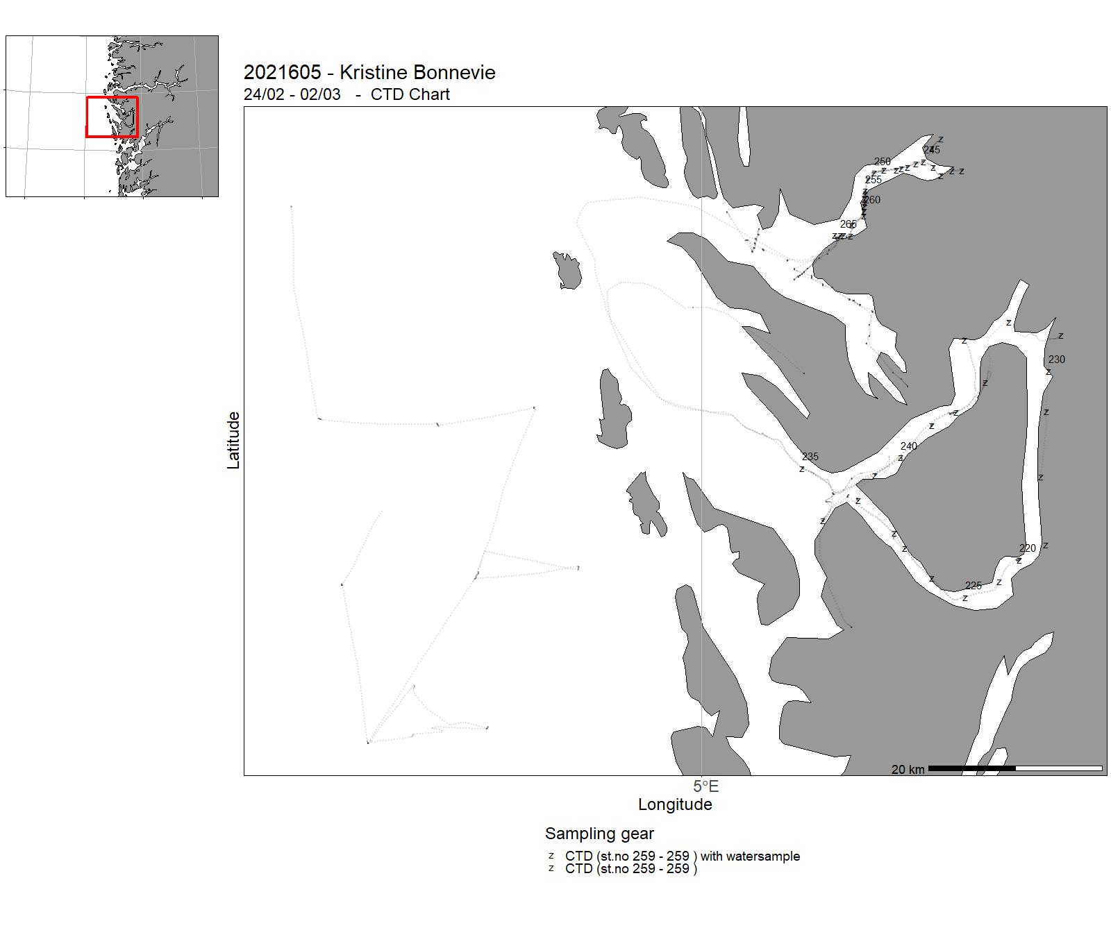
| 2021605 | 24/02 - 02/03 | The cruise on board the Research Vessel Kristine Bonnevie was undertaken as a part of the GEOF232, Practical Meteorology and Oceanography course and the GEOF337 Fjord oceanography course offered at the Geophysical Institute (GFI), University of Bergen. The site of study was Sørfjorden, Osterfjorden, Lurefjorden, Masfjorden, Fensfjorden, and the coastal area west of Bergen. The data set collected aimed to address processes related to fjord circulation and the observed deoxygenation of the inner basins in the fjords. The students are familiarized with typical and state-of-the-art measurement systems, including ship-based measurements (CTD and Ship-ADCP), weatherstations, and measurements of oxygen concentrations, isotiopes, nutrients and CO2 in collected water samples. We redeployed two moorings in Masfjord, at the sill and in the inner, deep basin. We also deployed surface drifters in Osterfjord, Masfjord, and on the open coast. The students participated in planning of the cruise and the sampling, and contributed substantially to the cruise report. | Norwegian Sea | 220 - 266 | - |
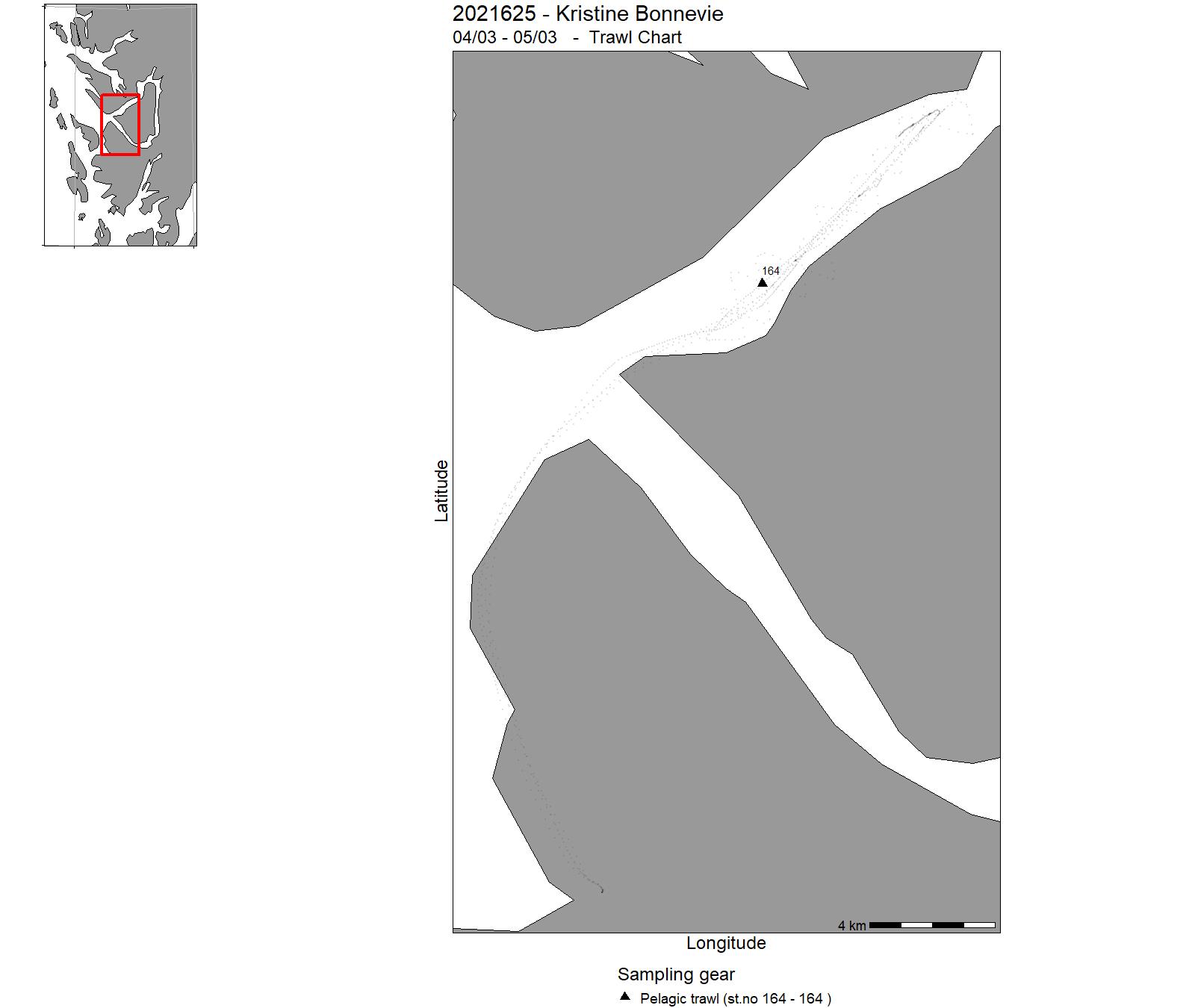
| 2021625 | 04/03 - 05/03 | Training of students at University of Bergen, Course BIO356, in fishery acoustic and trawl methods. Echo sounder sampling . Trawling with DeepVision camera system. | Norwegian Sea | - | 164 |
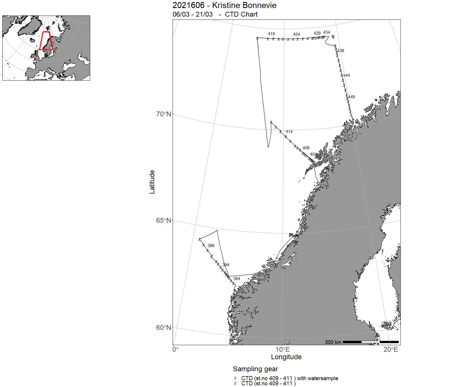
| 2021606 | 06/03 - 21/03 | Monitoring the environment and plankton condition on Svinøy, station M, Gimsøy, Fugløya-Bjørnøya and Bjørnøya-V sections in March 2021. Measuring physical, chemical and biological parameters, important to follow changes in climate and environment at weather station M in the Norwegian Sea. Monitoring Ocean acidification (carbon) on Svinøy, Gimsøy, Fugløya-Bjørnøya sections and on station M. Deployment and recovering of gliders. | Norwegian Sea | 384 - 453 | - |
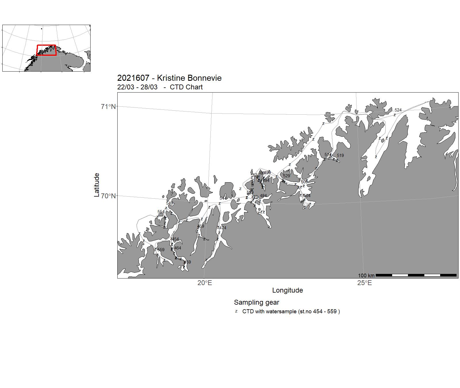
| 2021607 | 22/03 - 28/03 | CTD-survey of fjords and coast in Troms and western Finnmark (Malangen-Porsanger). Water sampling for analysis of eDNA, nutrients, dissolved oxygen, and the carbonate system. Deploy current meter moorings in Kaldfjorden Project name: Fjord oceanography and coastal climate (FOKK), FishDiv & SalCod Coordinating body: Institute of Marine Research, Lars Asplin | Norwegian Sea | 454 - 559 | - |
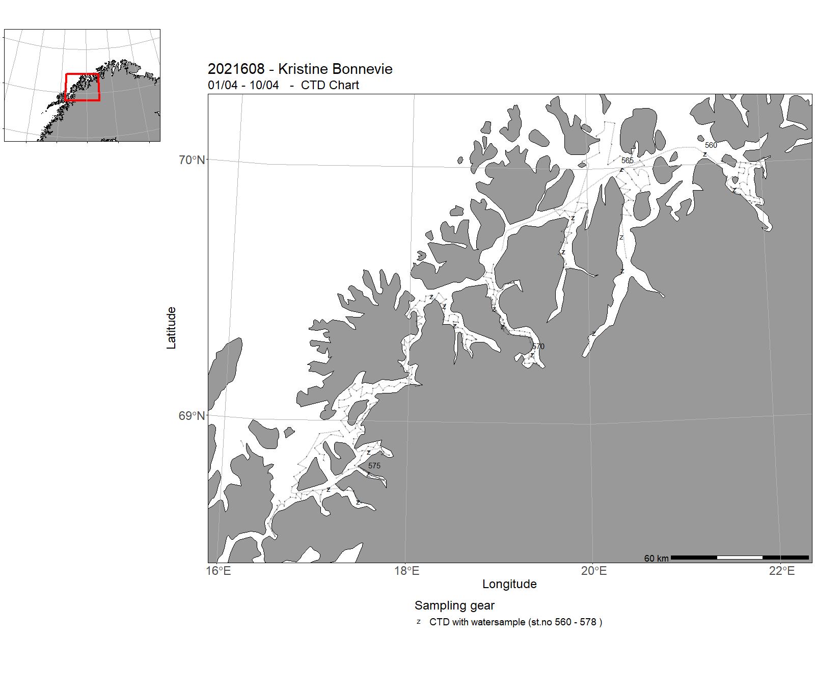
| 2021608 | 01/04 - 10/04 | This research cruise is aimed at gathering fish eggs in and around the fjords in Troms as part of a bigger, long-term program on the mapping of spawning and nursery areas for commercially important fish species in Norway. As a « value-added » to the cruise, we also collected plankton on 21 previously established stations in the study area, as well as CTD (conductivity, temperature and depth) data for a majority of the stations we used for egg sampling. Project name: Program om gytefelt og oppvekst område kartlegging Coordinating body: Fisheries Dynamics Research Group/Institute of Marine Research (IMR) Cruise coordinator: Sigurd Heiberg Espeland (Fisheries Dynamics Research Group, IMR) | Norwegian Sea | 560 - 578 | - |
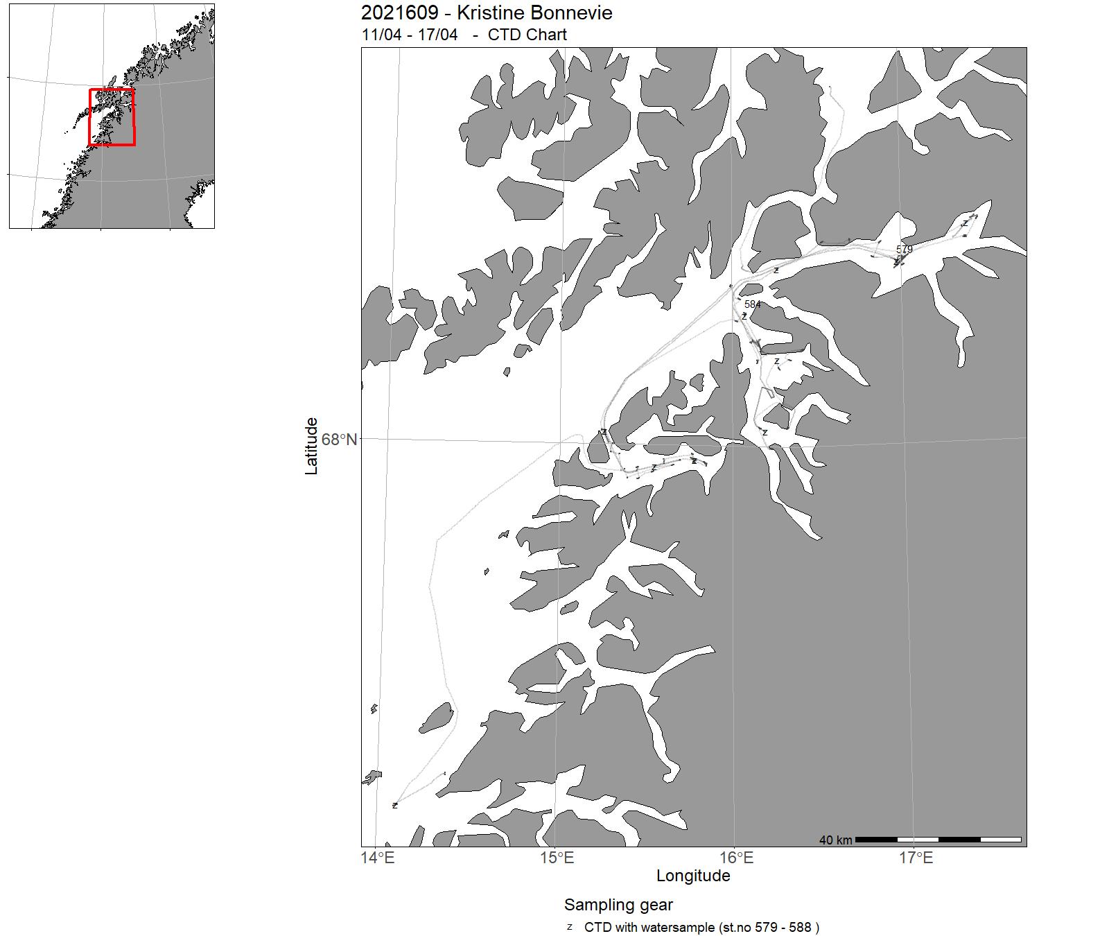
| 2021609 | 11/04 - 17/04 | The objective of this cruise was to generate new knowledge on the distribution and characteristics of vulnerable marine ecosystems buildt by coral and sponges in Northern Norweigan fjords. Project name: Mapping of vulnerable marine ecosystems in Norway Coordinating body: Institute of Marine Research | Norwegian Sea | 579 - 588 | - |
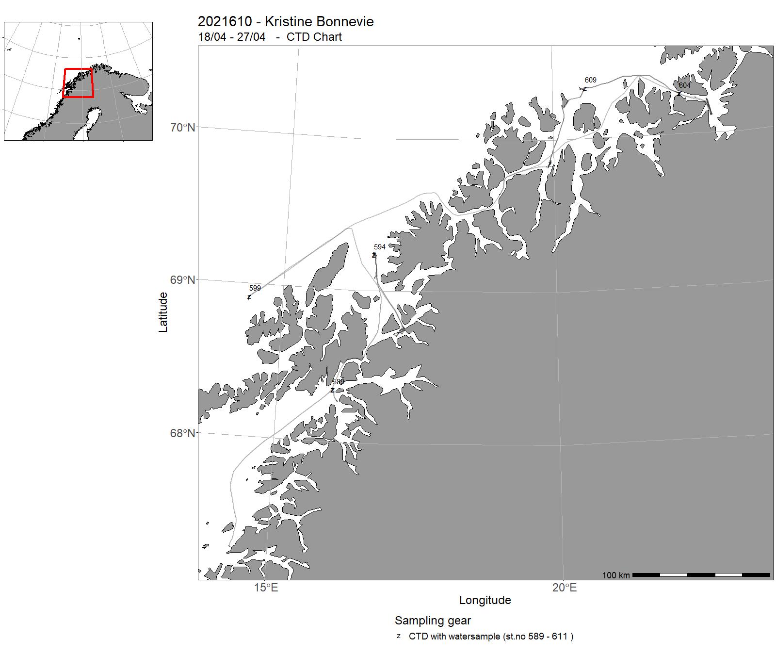
| 2021610 | 18/04 - 27/04 | The objective of the cruise was to survey reefs and collect corals from a few selected deep-sea coral reefs to assess the biological and physiological health status of reefs in the Northern part of the Norwegian coast and shelf. In addition, water samples were collected to assess water quality parameters and food availability for organisms living in the reefs. Carbon chemistry parameters were measured to assess temporal variability in ocean chemistry and to create a basline data base for the OA monitoring in Norway. Fugløya, Stjernsund, Steinavær and Rotværrevet were sampled. Project name: Monitoring of sponges and corals Coordinating body: Institute of Marine Research | Norwegian Sea | 589 - 611 | - |
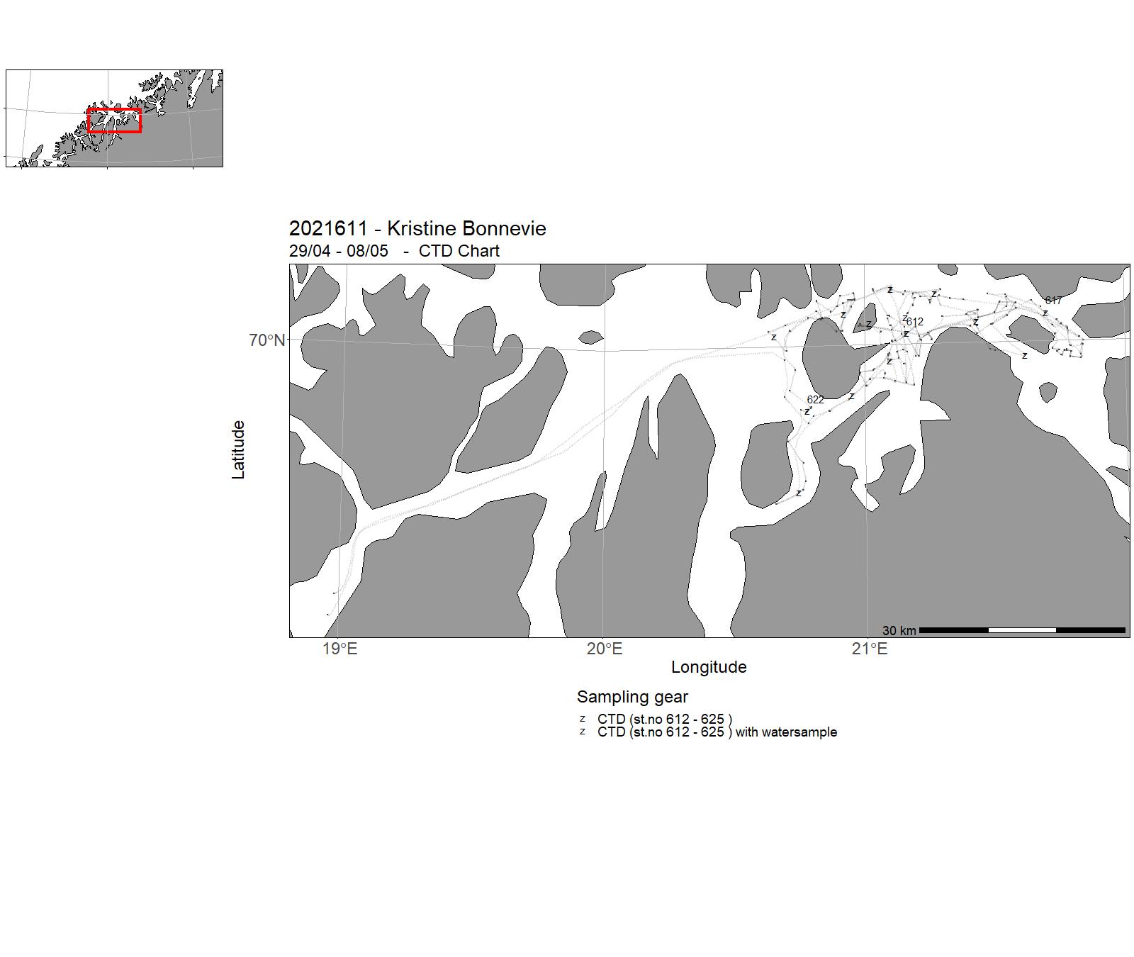
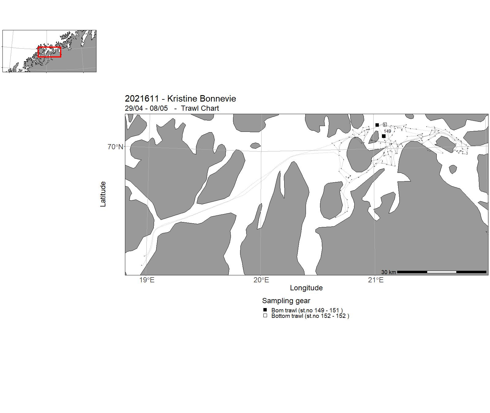
| 2021611 | 29/04 - 08/05 | A cruise to collect biological data for ecological seafloor maps in the Skjervøy and Kvænangen, Troms, one of three areas that are part of the national pilot coastal mapping program Marine Grunnkart I Kystsonen. The primary aims of the project are to develop coastal mapping methods and to generate maps for sustainable coastal planning. The cruise data collection will be used in combination with seafloor bathymetry and substrate data collected by Kartverket and NGU in 2021 in the same area. Task: ROV and towed seafloor camera transects over 50 m to record seafloor biological diversity and nature types in accordance to the Natur i Norge classification system. CTDs throughout the area to validate oceanography models. Beams trawls to collect biological specimens for identification. Project name: Marine økologiske grunnkart i kystsonen Coordinating body: Kartverket | Norwegian Sea | 612 - 625 | 149 - 152 |
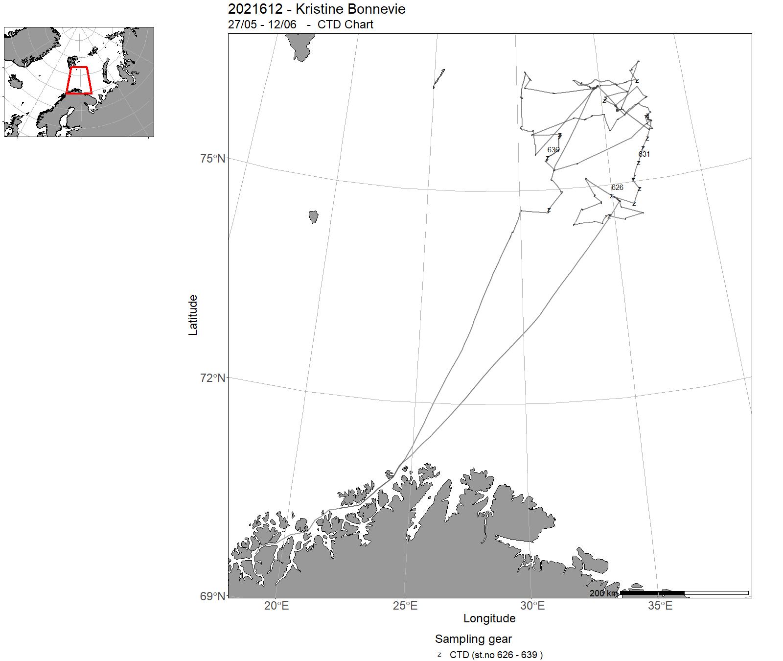
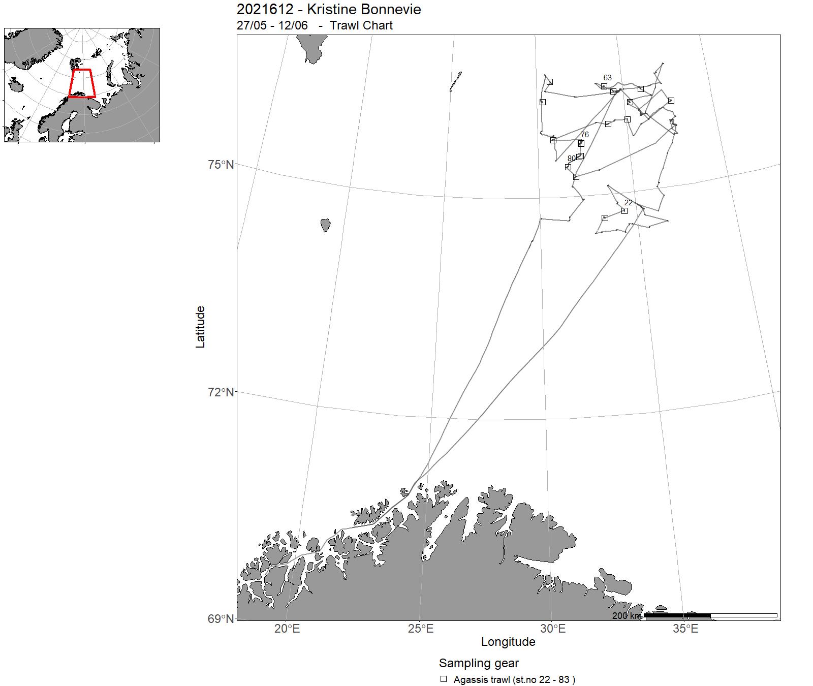
| 2021612 | 27/05 - 12/06 | The aim of the cruise was to study the spreading and collect density data on the snow crab in the Svalbard Fishery Protection Zone by using a research vessel. Our main study area was in the present area for commercial fishing. Also testing of different traps were performed during the cruise. Project name: 14422 Snøkrabbe and 15560 Fangstteknologi snøkrabbe | Barents Sea | 626 - 639 | 22 - 83 |
| 2021613 | 13/06 - 22/06 | Study the spreading area for red king crab in Vest Finnmark, Norway. This is the area for a free fishing for red king crab and the further spreading is monitored. Project name: 15594 Bestandsrådgivning kongkrabbe | Norwegian Sea | - | - |
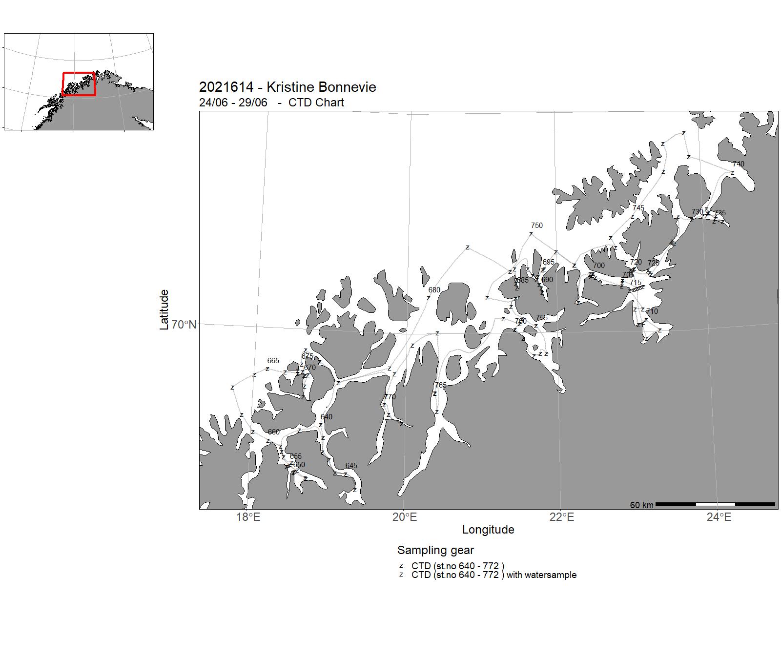
| 2021614 | 24/06 - 29/06 | CTD-SURVEY OF FJORDS AND COAST IN TROMS AND WESTERN FINNMARK (MALANGEN TO REVSBOTN). WATER SAMPLING FOR ANALYSIS OF eDNA, NUTRIENTS, AND THE CARBONATE SYSTEM. Project name: FJORD OCEANOGRAPHY AND COASTAL CLIMATE (FOKK) and FISHDIV Coordinating body: IMR (CONTACT: LARS ASPLIN, OCEAN AND CLIMATE RESEARCH GROUP) | Norwegian Sea | 640 - 772 | - |
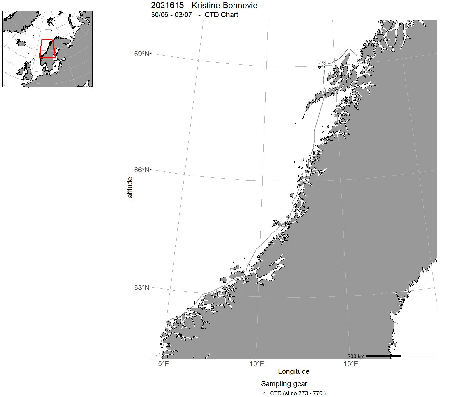
| 2021615 | 30/06 - 03/07 | The cruise objectives were to deployr CTD and current meter moorings off the Vesterålen Islands. The moorings are part of a process study of breaking internal waves generating turbulence. | Norwegian Sea | 773 - 776 | - |
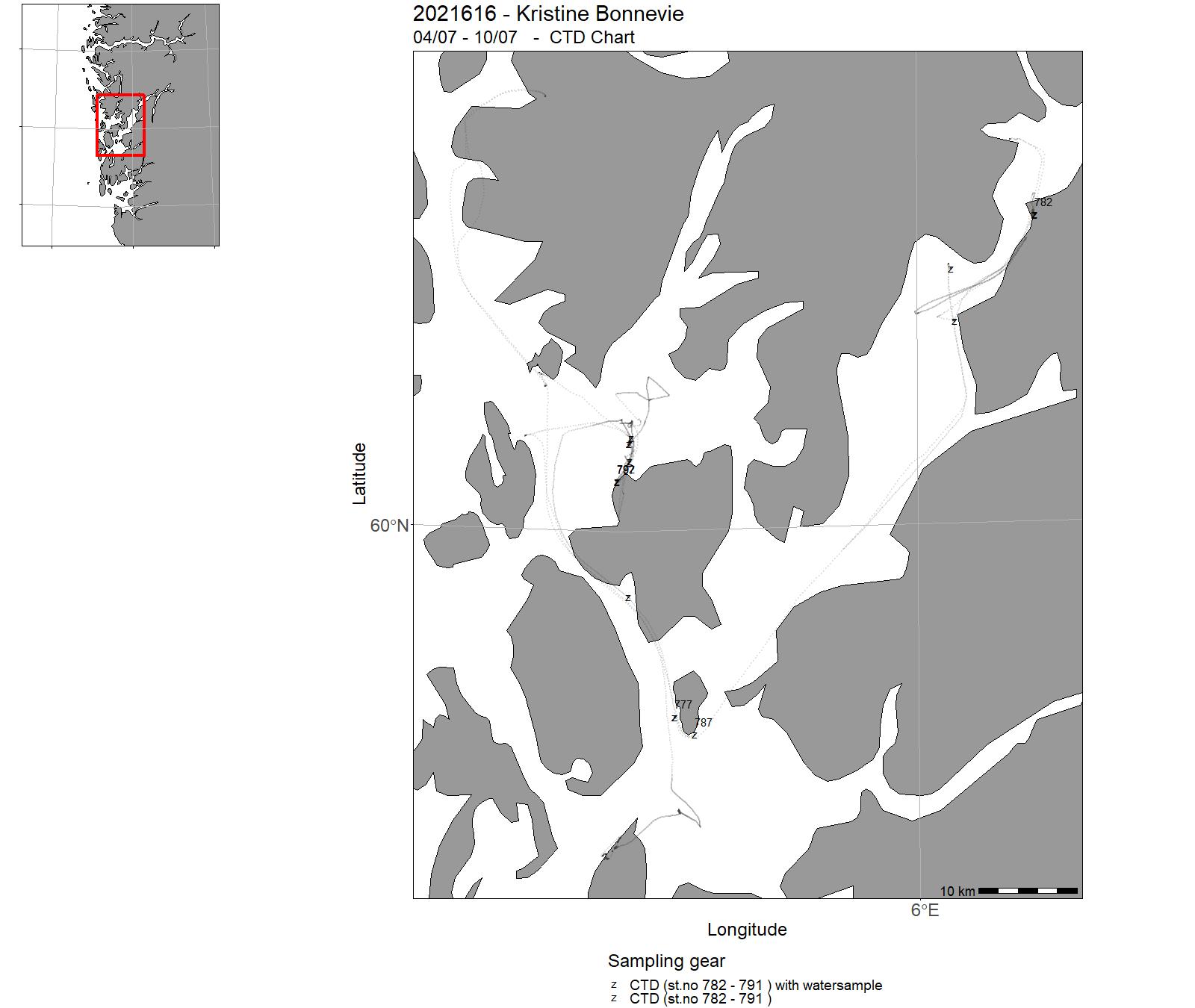
| 2021616 | 04/07 - 10/07 | The objective of this cruise was to assess the impact of effluents from fish farms on the cold-water coral Lophelia pertusa and the demosponge Geodai barretti. This was achieved by documenting the distribution and health of natural coral communities around fish farms and recovering transplanted coral and sponge fragments (from cruise 2018612) from a gradient away from a fish farm where the organisms had been exposed to fish farm effluents for 3 years. Mortality, growth, cellular stress, and energy stores were compared. In addition, water sample were collected off two wall reefs in Langenuen, Hordaland and video transects were run around 4 sites with bamboo corals in the deep Hardagnerfjord to assess the effects on fish farming on bamboo coral forests. Exploratory dives were made to assess the distribution of bamboo corals in Norwegian fjords. Project name: Monitoring of sponges and corals Coordinating body: Institute of Marine Research | Norwegian Sea | 777 - 797 | - |
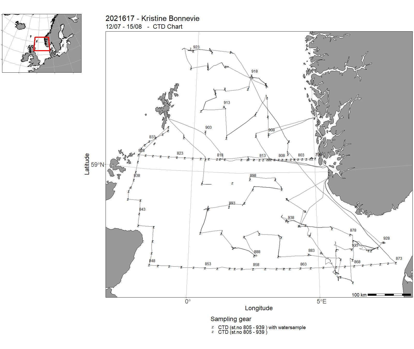
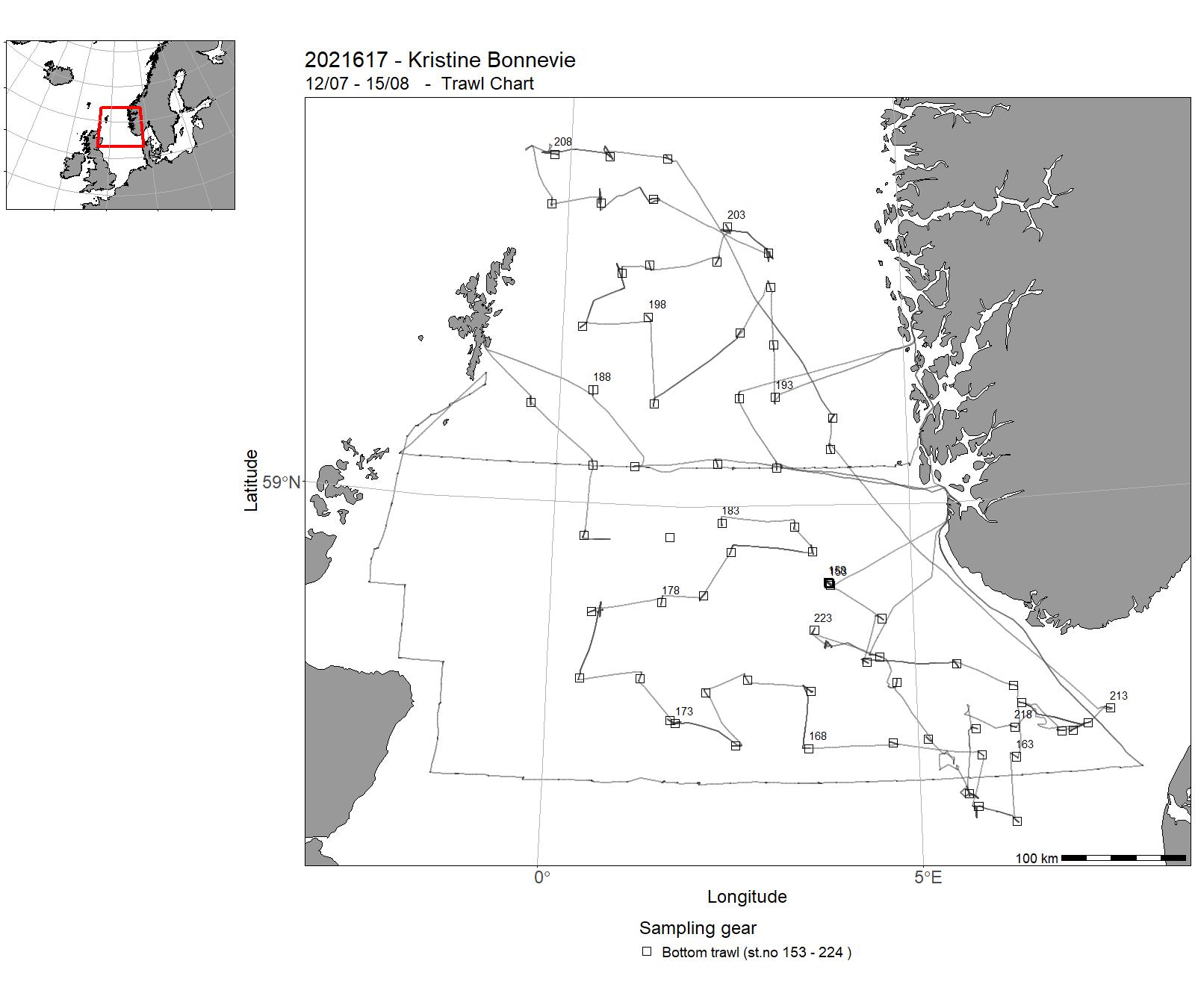
| 2021617 | 12/07 - 15/08 | The aim of the first part of the cruise (12th to 21st of July 2021) was to sample 4 standard transects for physical oceanographic parameters (CTD casts, nutrients and chlorphyll), phyto- and zooplankton, and fish larvae for the IMR projects "Monitoring of climate and plankton in the North Sea Skagerrak", and"Early life history dynamics of North Sea Fishe". Data and samples were collected on pre-selected stations along the 4 standard transects «Utsira-StartPoint» between Norway and the Orkney Islands, «Hanstholm-Aberdeen» between Denmark and UK and «Shetland - Pentland» and «Scotland East Coast» between the southern tip of the Shetland Islands till the east coast of Scotland. During the second part of the cruise (21st of July to 15th August) the IBTS, International Bottom Trawl Survey, took place, coordinated by the ICES International Bottom Trawl Survey Working Group (IBTSWG).The main objective of the IBTS quarter 3 survey was to monitor changes in herring, cod, haddock, whiting, saithe, Norway pout, mackerel, sprat independently of commercial fisheries data, and to collect data for the determination of biological parameters relevant to stock assessments. Parallel to trawling, hydrographic data (salinity, temperature) were collected. Project name: ICES Coordinated 3rd Quarter International Bottom Trawl Survey (IBTS) in the North Sea Coordinating body: ICES | North Sea | 798 - 939 | 153 - 224 |
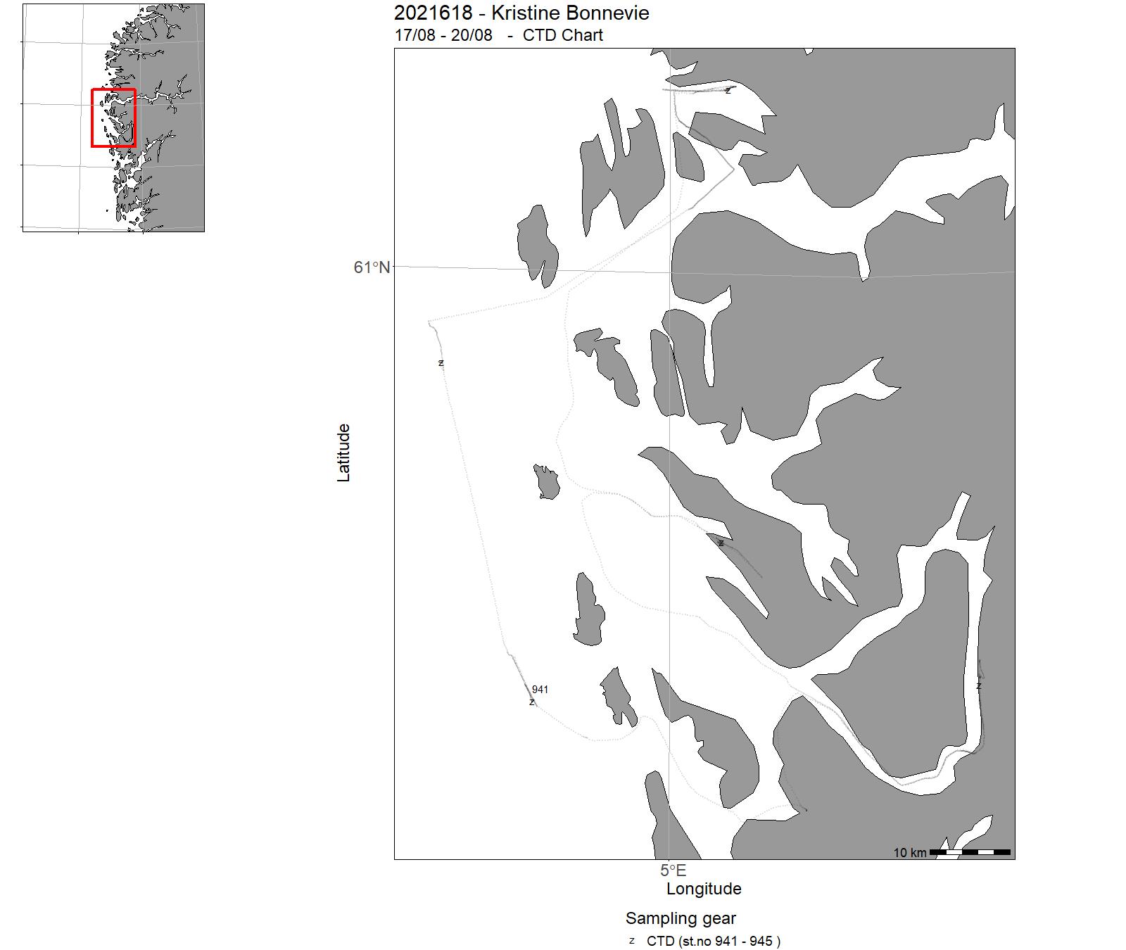
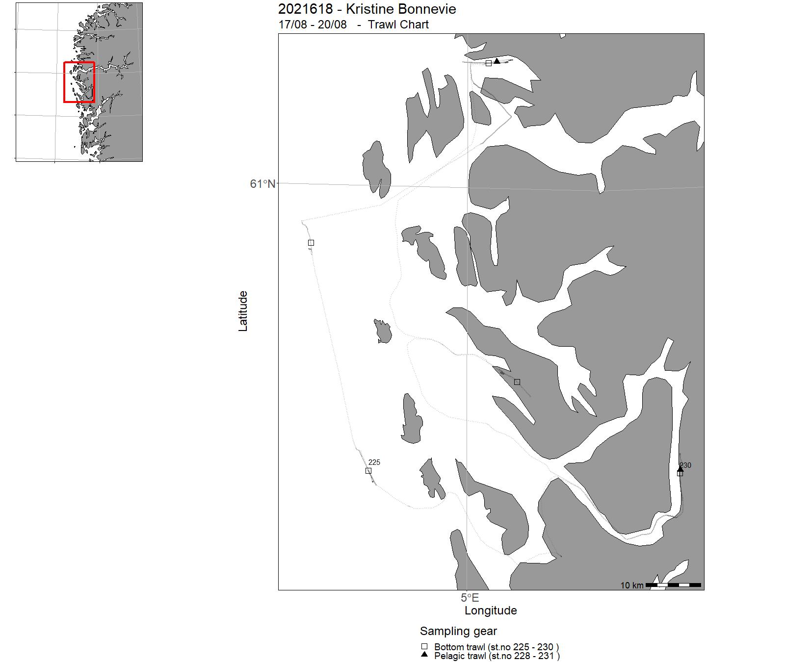
| 2021618 | 17/08 - 20/08 | Training course for BIO102 students (biology bachelor). | Norwegian Sea | 941 - 945 | 225 - 231 |
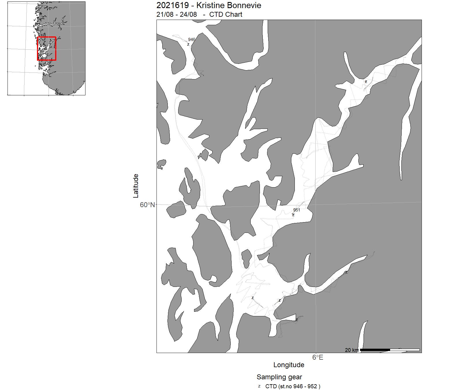
| 2021619 | 21/08 - 24/08 | Acoustic trawl survey for surveying sprat and herring, zooplankton and hydrography in western Norwegian fjords. Provide abundance indices for sprat for giving fishery advice. The survey covered the outer part Hardangerfjord. | Norwegian Sea | 946 - 952 | 232 - 239 |
| 2021620 | 24/08 - 26/08 | Training course for BIO102 students (biology bachelor). | Norwegian Sea | 953 - 959 | 240 - 245 |
| 2021621 | 26/08 - 07/09 | Acoustic trawl survey for surveying sprat and herring, zooplankton and hydrography in western Norwegian fjords. Provide abundance indices for sprat for giving fishery advice. Comparisons of acoustic observations with a research vessel and a kayak drone. The survey covered Nordfjord, Sognefjorden and the inner part of Hardangerfjord. | Norwegian Sea | 960 - 989 | 246 - 273 |
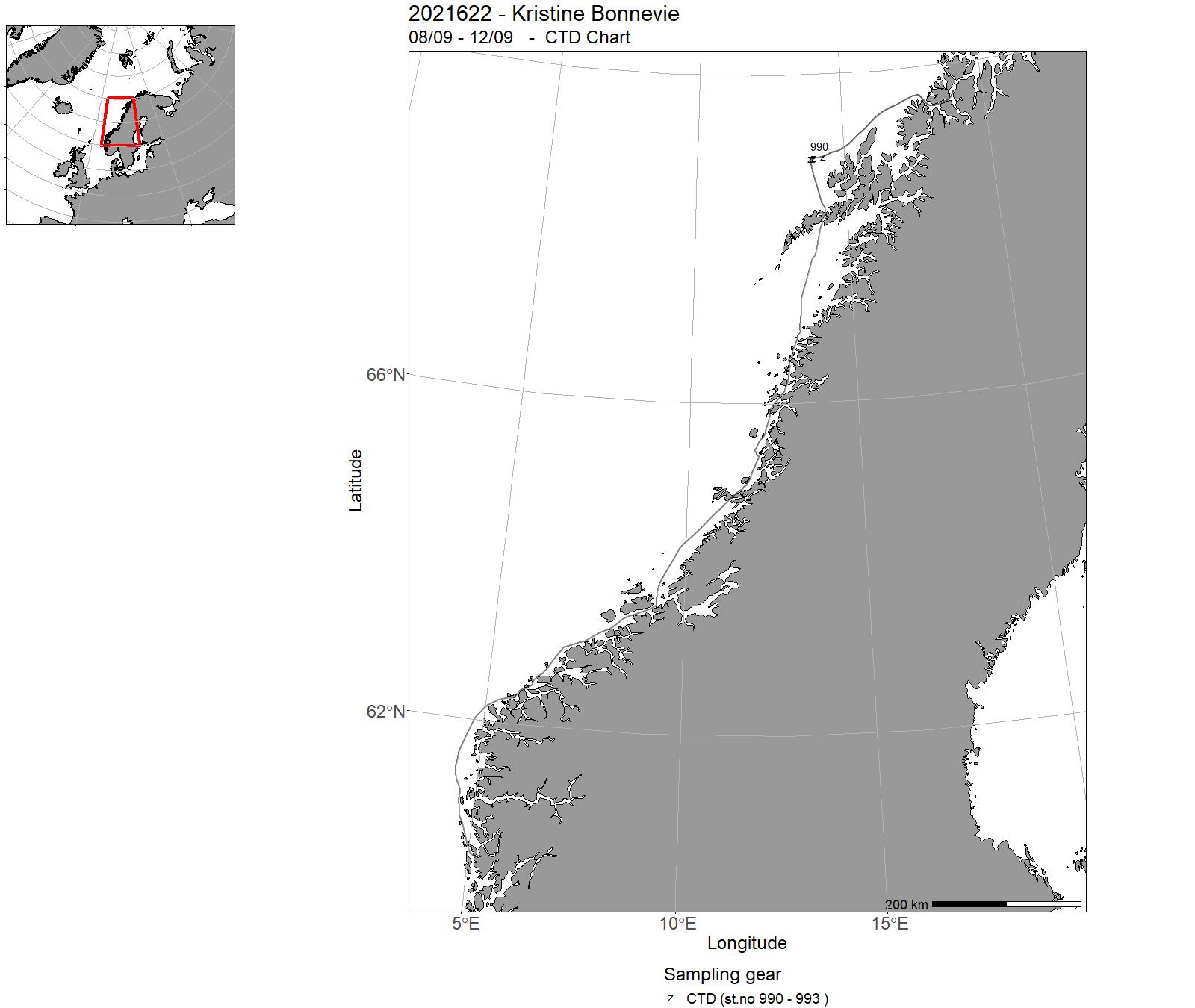
| 2021622 | 08/09 - 12/09 | The cruise objectives were to recover CTD and current meter moorings deployed off the Vesterålen Islands early July 2021 (cruise 2021615). The moorings are part of a process study of breaking internal waves generating turbulence. | Norwegian Sea | 990 - 993 | - |
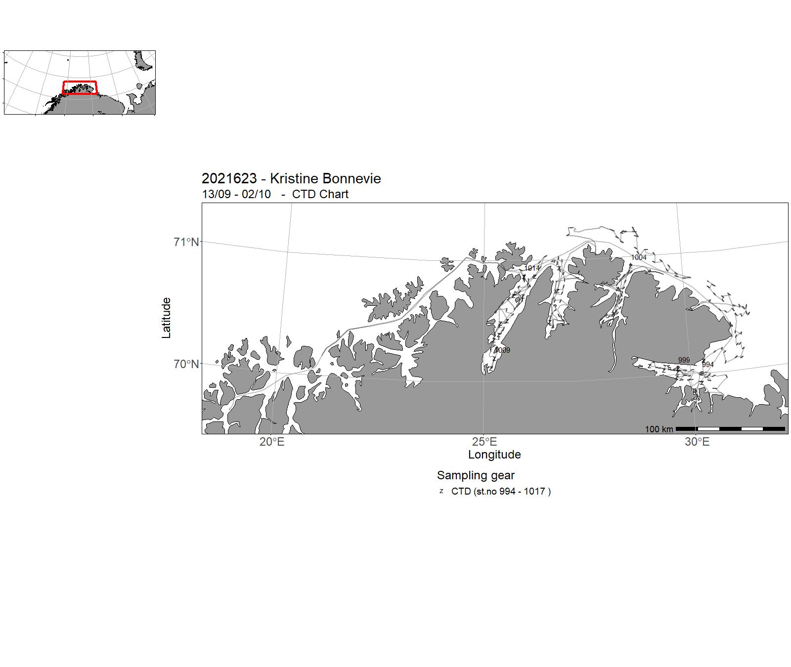
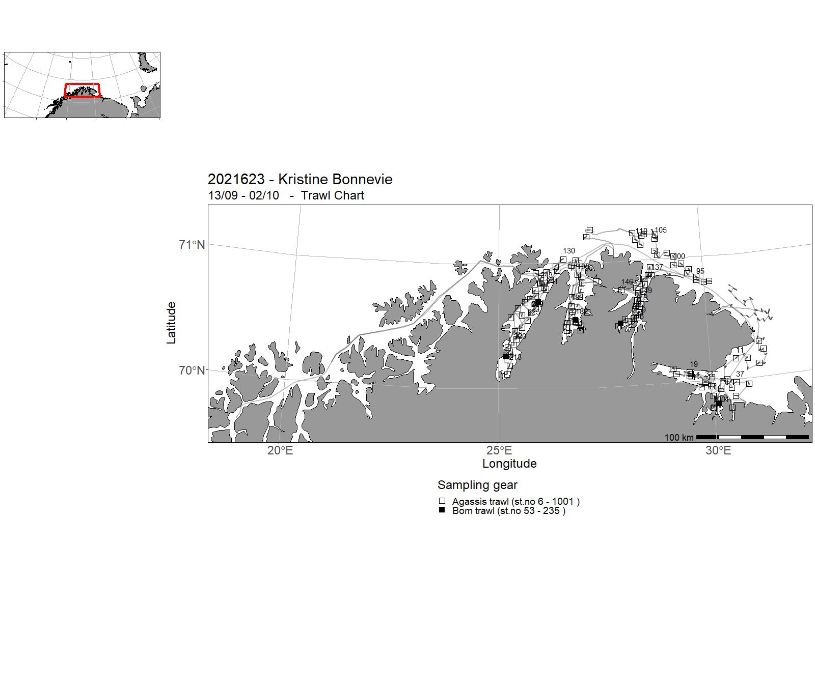
| 2021623 | 13/09 - 02/10 | Stock assessment study for red king crab in quota regulated area in East Finnmark, Norway. Project name: 15594 - Kongekrabbe | Norwegian Sea | 994 - 1017 | 6 - 1001 |
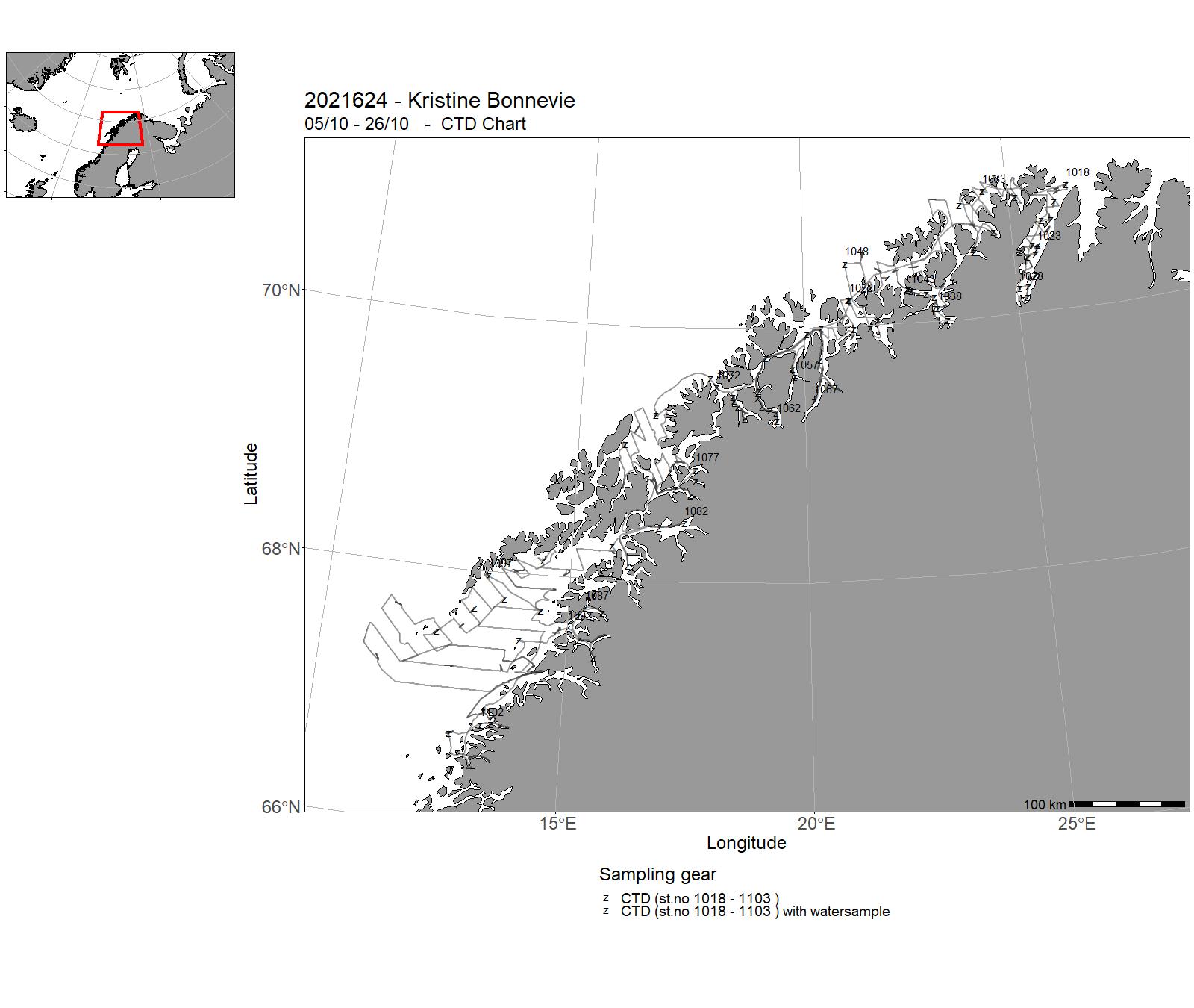
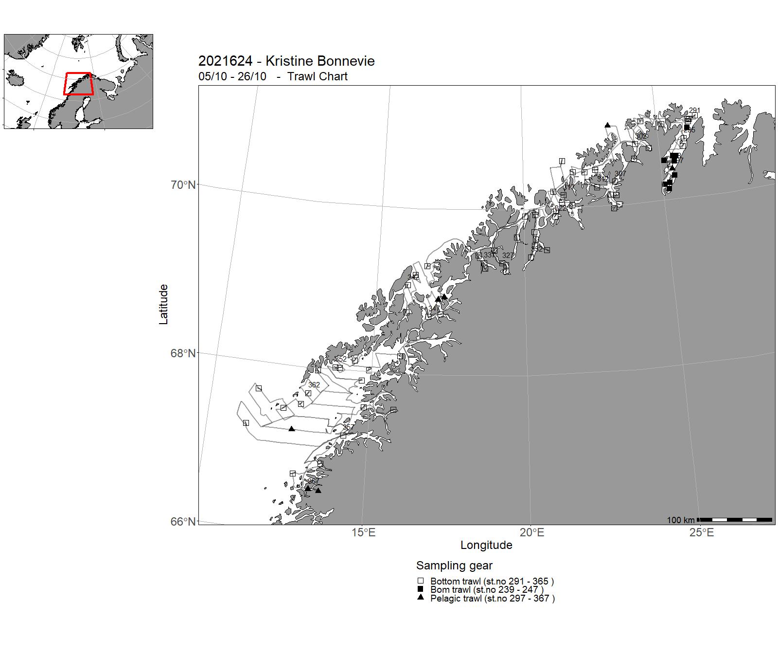
| 2021624 | 05/10 - 26/10 | Annual combined acoustic and bottom trawl survey along the Norwegian coast north of 62˚N • map the distribution and estimate acoustic abundances indices, length, weight and maturity at age of cod, saithe and haddock • improve data basis, by allocating additional bottom trawls, for the assessment of golden redfish • map the general hydrographical regime by using a CTD-sonde to monitor the temperature and salinity at bottom trawl stations and/or at fixed intervals (about 30 NM) • in selected fjord systems – Lyngen, Malangen, Ulsfjord, and Nordland - collect additional biological – and catch data for monitoring purposes and the establishment of a time series of deep water shrimps • collect zooplankton samples in selected fjords, as well as water for chemical analysis • collect sediment samples in Lakse-, Vefsn-, Namse-, and Trondheimsfjord • acoustic coverage of sprat in Trondheimsfjord and Romsdalsfjords • acoustic coverage of 0 and1-group heering in Finmark fjords • collect eDNA samples on selected CTD stations • collect frozen fish for analysis of contaminants | Norwegian Sea | 1018 - 1103 | 239 - 367 |
7 - "Kristine Bonnevie" – Charts for 2021


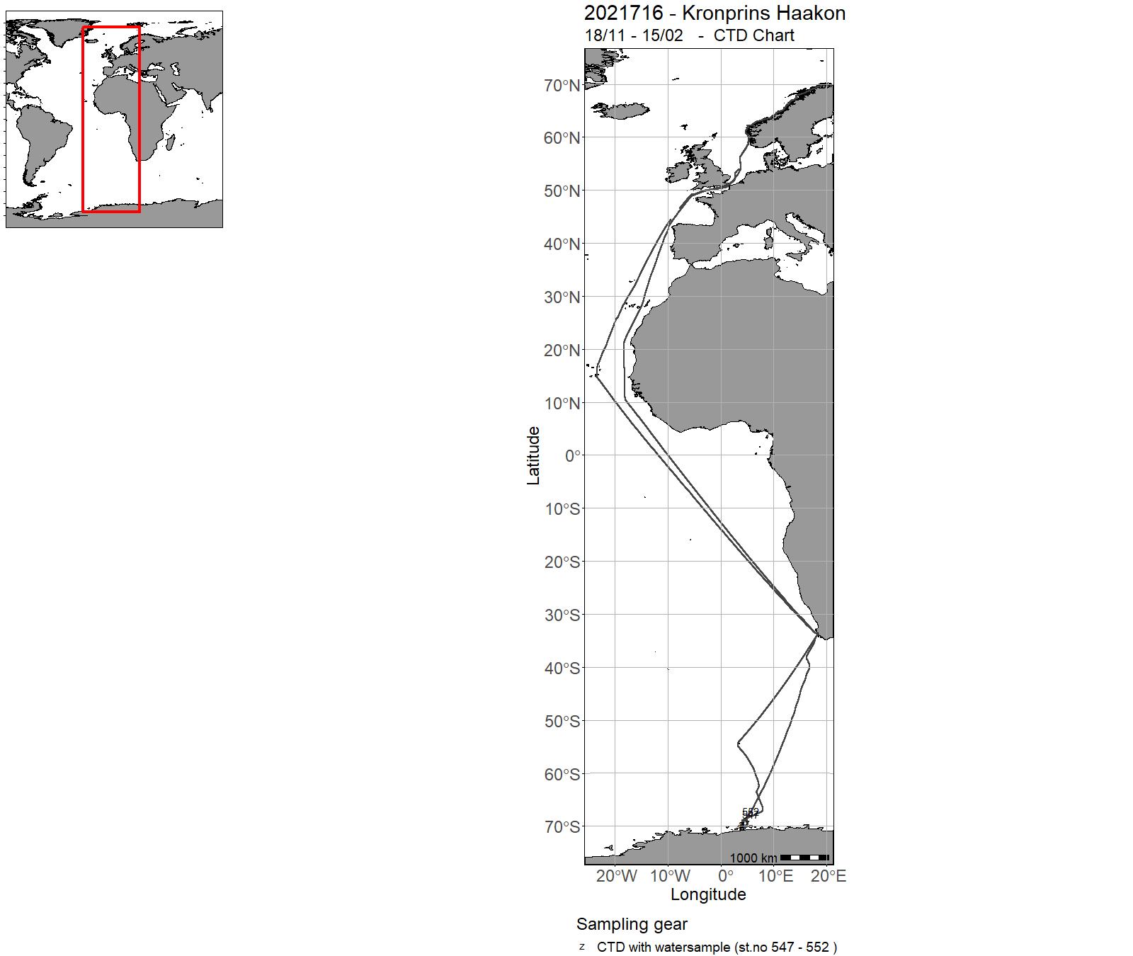
8 - "Kronprins Haakon" – Cruises 2021
| Cruise No | Period | Purpose | Area | CTD st.no | Trawl st.no |
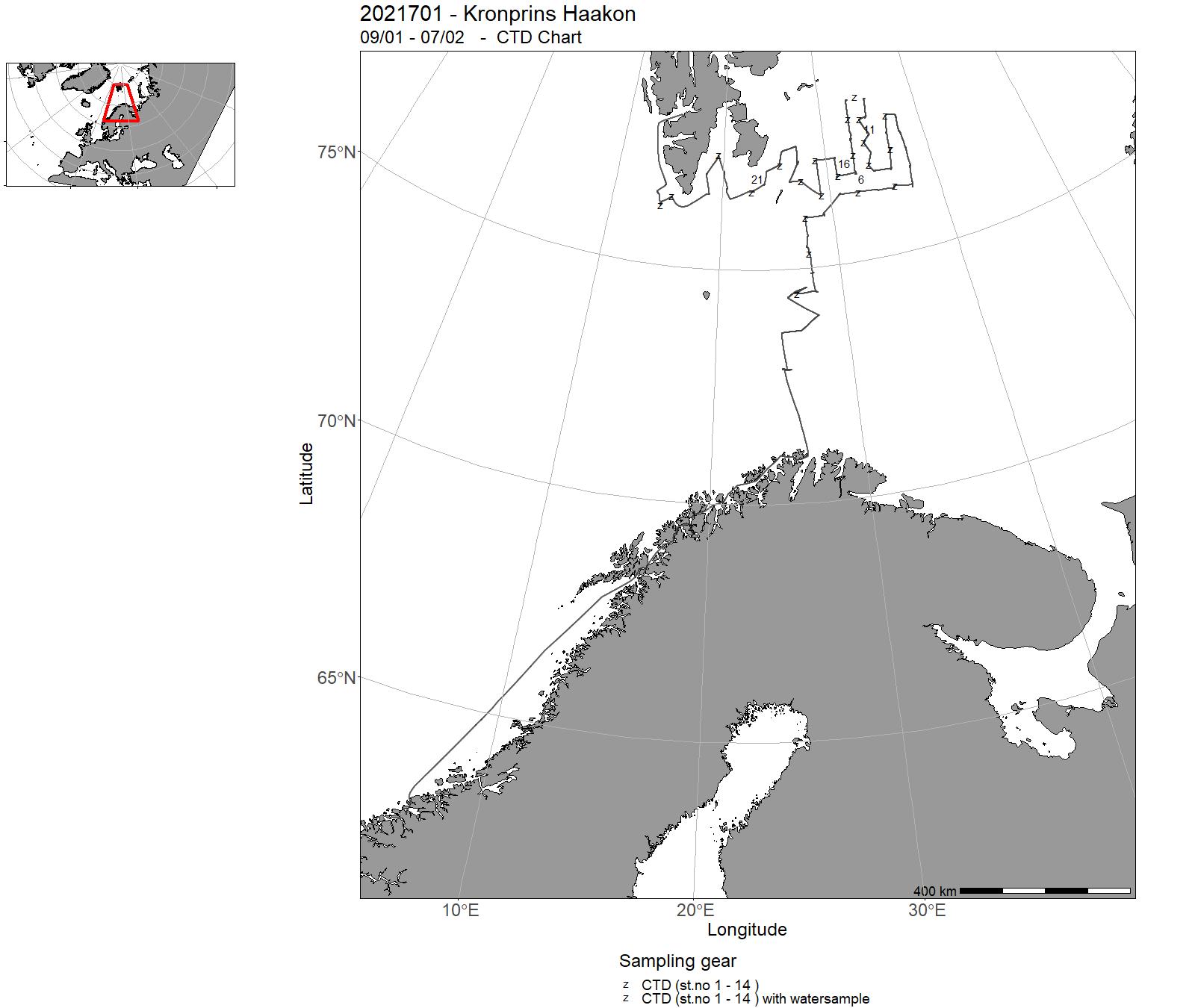
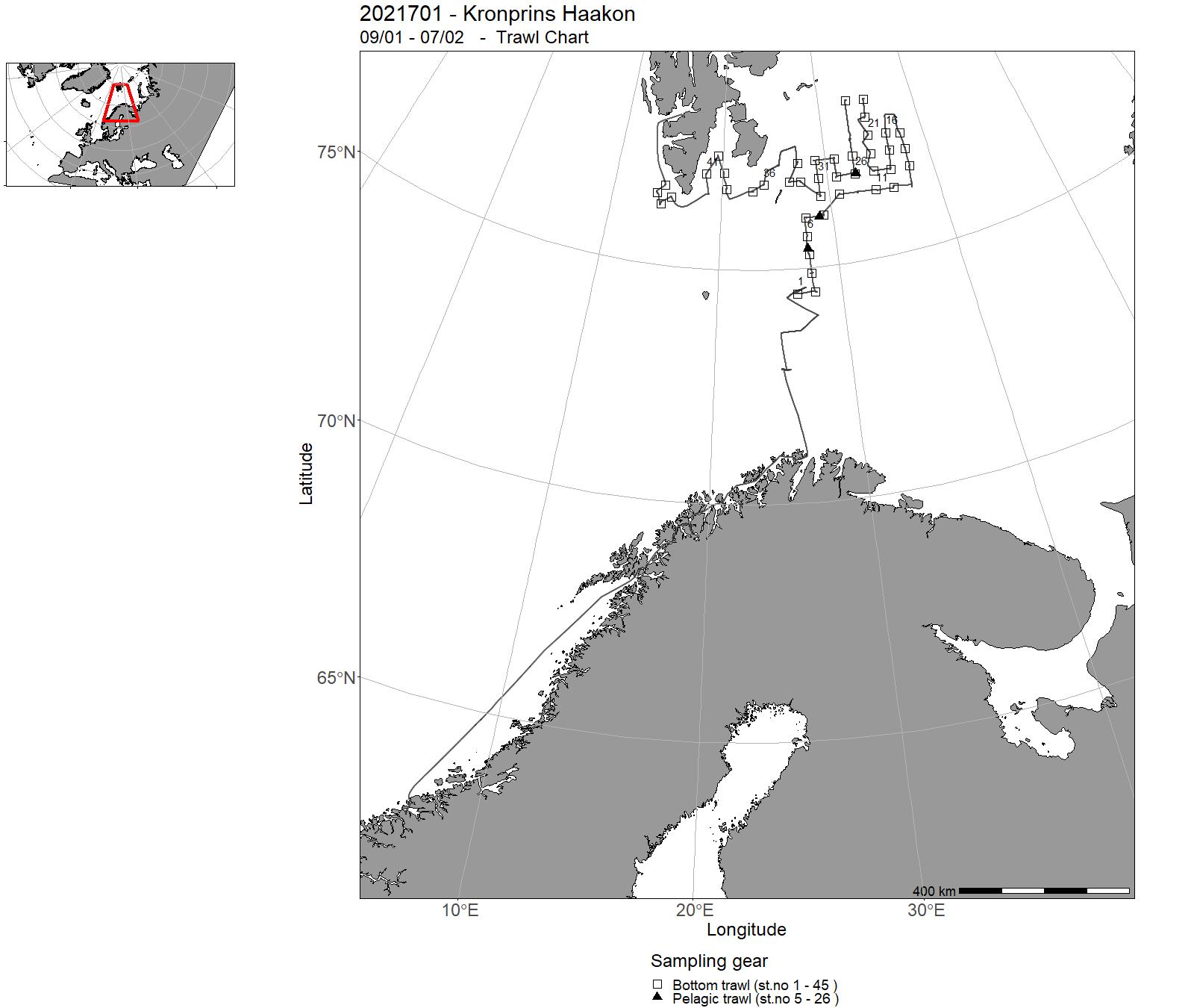
| 2021701 | 09/01 - 07/02 | Mengdemåling av bunnfisk, med hovedfokus på torsk og hyse. Data brukes i bestandsberegning (AFWG). Innsamling av sjømatprøver. Prøvetaking av snøkrabbe. Project name: Vintertoktet / 15569 | Barents Sea | 1 - 24 | 1 - 45 |
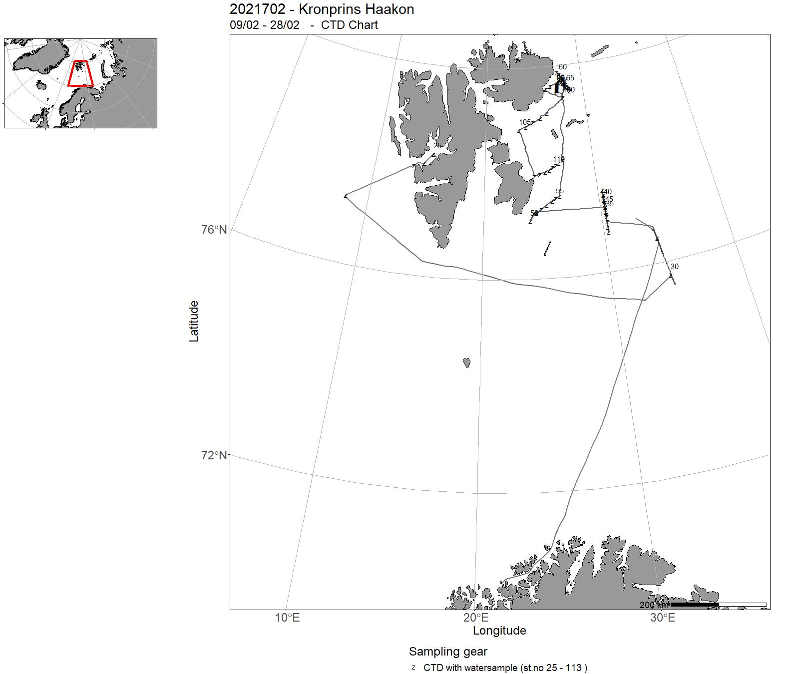
| 2021702 | 09/02 - 28/02 | The Winter Process Cruise (WPC) aboard RV Kronprins Haakon (KH2021702) is primarily a physical oceanography cruise with objectives to conduct wintertime hydrographic- and current profiling surveys, and ocean mixing and water transformation process studies within the northwestern Barents Sea region and in the gateways to the northwestern Barents Sea, both with shipborne instrumentation and from a drifting sea ice floe. Meteorological measurements were also made. Activities included: recovery and deployment of oceanographic moorings and gliders, an AUV, a remotely piloted unmanned aircraft and weather balloons: collecting underway measurements from ship-mounted ocean current profilers, wind profilers, radiometer and wave sensors: and collecting ocean stratification, currents, and microstructure profiles along selected transects across the Atlantic water pathways in the northwestern Barents Sea. | Barents Sea | 25 - 113 | - |
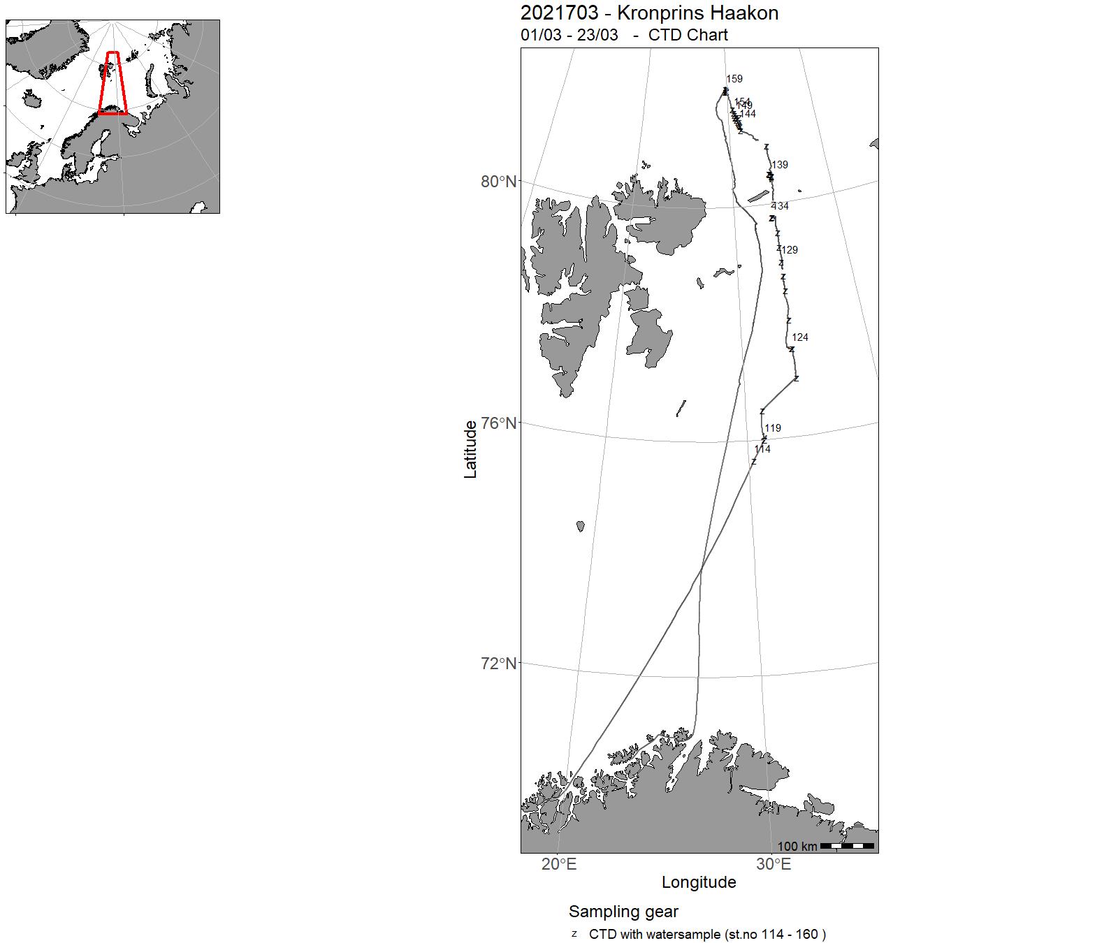
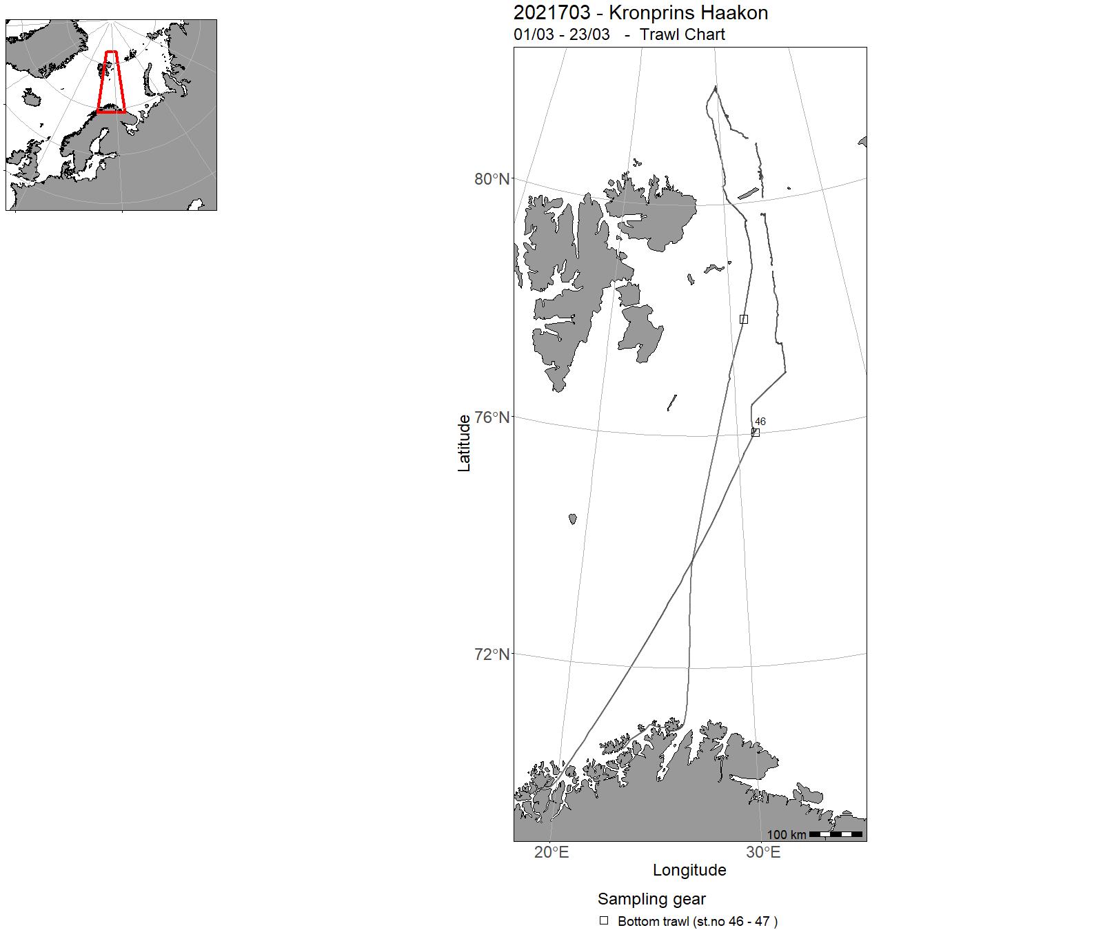
| 2021703 | 01/03 - 23/03 | The Nansen Legacy cruise Q1 (Q1: 1st quarter of the year) addressed objectives of the Nansen Legacy work packages ‘Physical drivers’ (Research Focus 1), ‘Human impact’ (Research Focus 2) and ‘The living Barents Sea’ (Research Focus 3). In total, seven process stations (P1, P2, P3, P4, P5, P6 and P7) were conducted, with some more additional (NLEG) stations in-between. The station P1 was the only open water station, all other stations were in ice covered waters at the shelf, on the slope and in the deep basin. | Barents Sea | 114 - 160 | 46 - 47 |
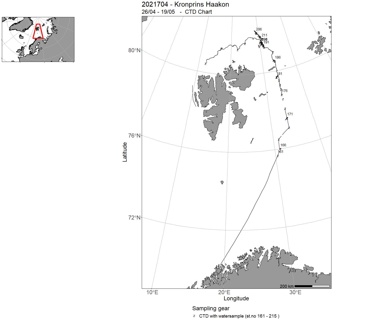
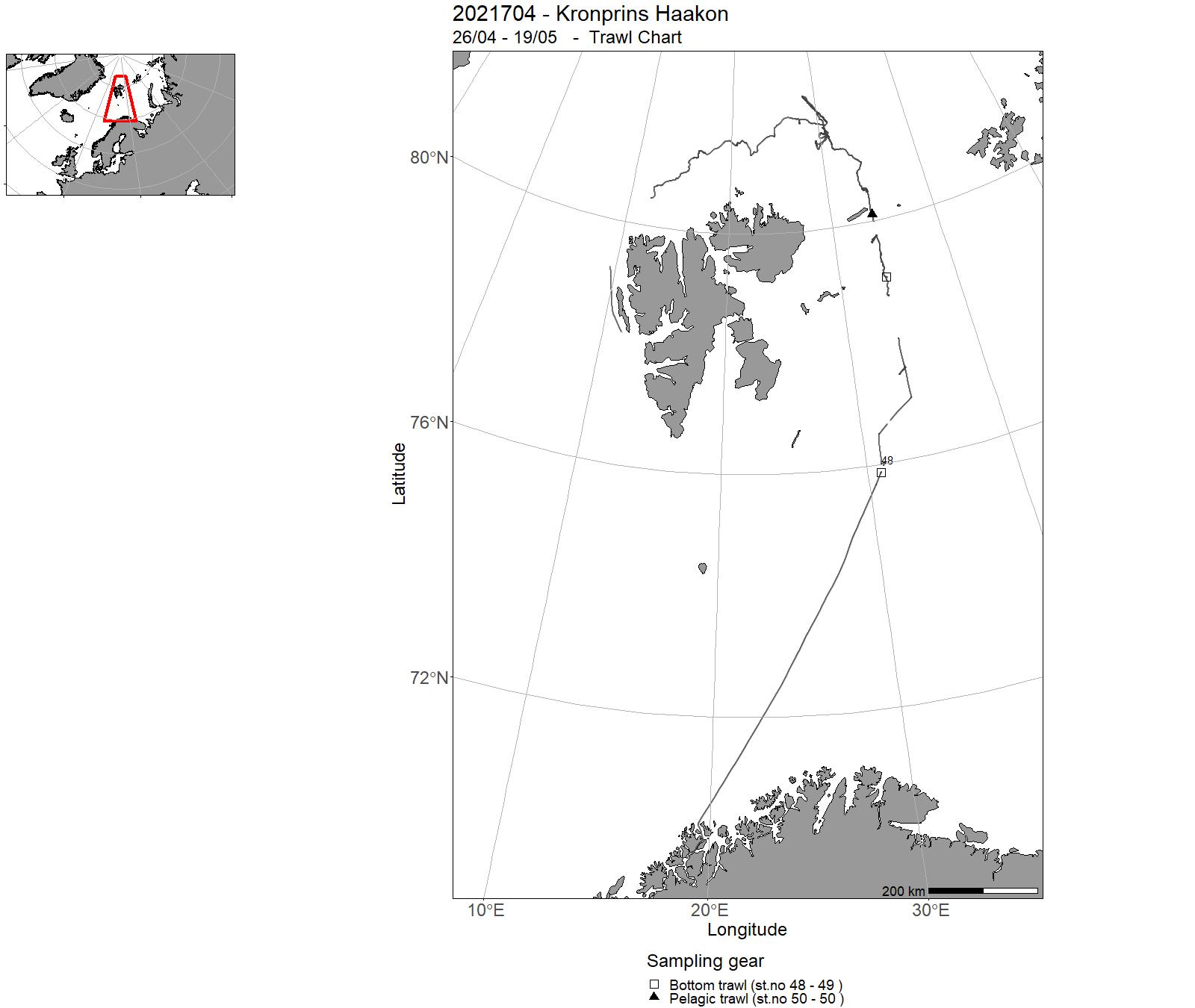
| 2021704 | 26/04 - 19/05 | The Nansen Legacy cruise Q1 (Q1: 1st quarter of the year) addressed objectives of the Nansen Legacy work packages ‘Physical drivers’ (Research Focus 1), ‘Human impact’ (Research Focus 2) and ‘The living Barents Sea’ (Research Focus 3). In total, seven process stations (P1, P2, P3, P4, P5, P6 and P7) were conducted, with some more additional (NLEG) stations in-between. The station P1 was the only open water station, all other stations were in ice covered waters at the shelf, on the slope and in the deep basin. | Arctic Ocean | 161 - 215 | 48 - 50 |
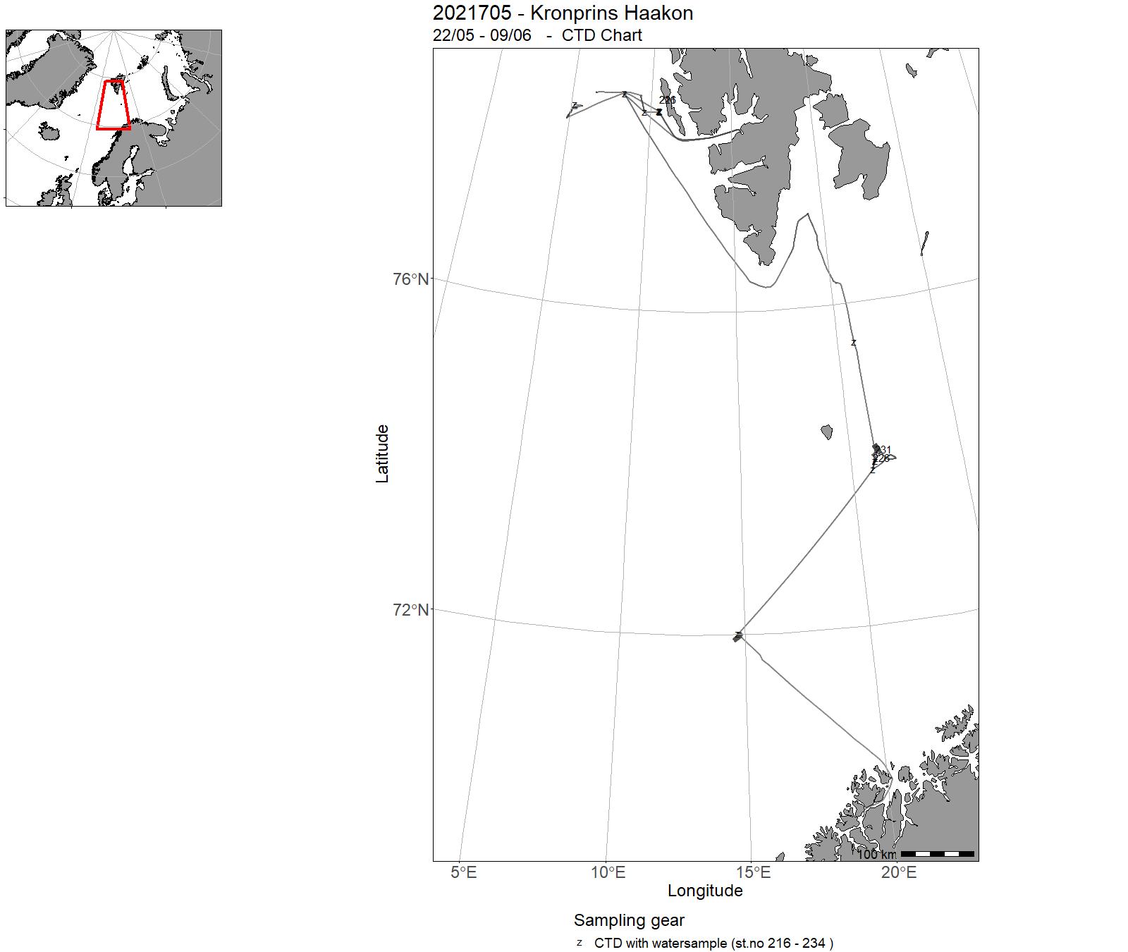
| 2021705 | 22/05 - 09/06 | The research expedition cruise CAGE21-1 (UiT internal name) is a major component of the project AKMA (Advancing Knowledge of Methane in the Arctic, NFR INTPART programme) and it is organized under the helm of the Norwegian Centre of Excellence for Arctic Gas Hydrate, Environment and Climate, CAGE at UiT The Arctic University of Norway in Tromsø. CAGE investigates Arctic gas hydrate and methane seepage systems to better understand the effects they may have on our oceans, ecosystems and global climate. The projects aim is to advance collective knowledge about methane activity in the seabed, on the seafloor and in the ocean in Arctic regions. | Barents Sea | 216 - 234 | - |
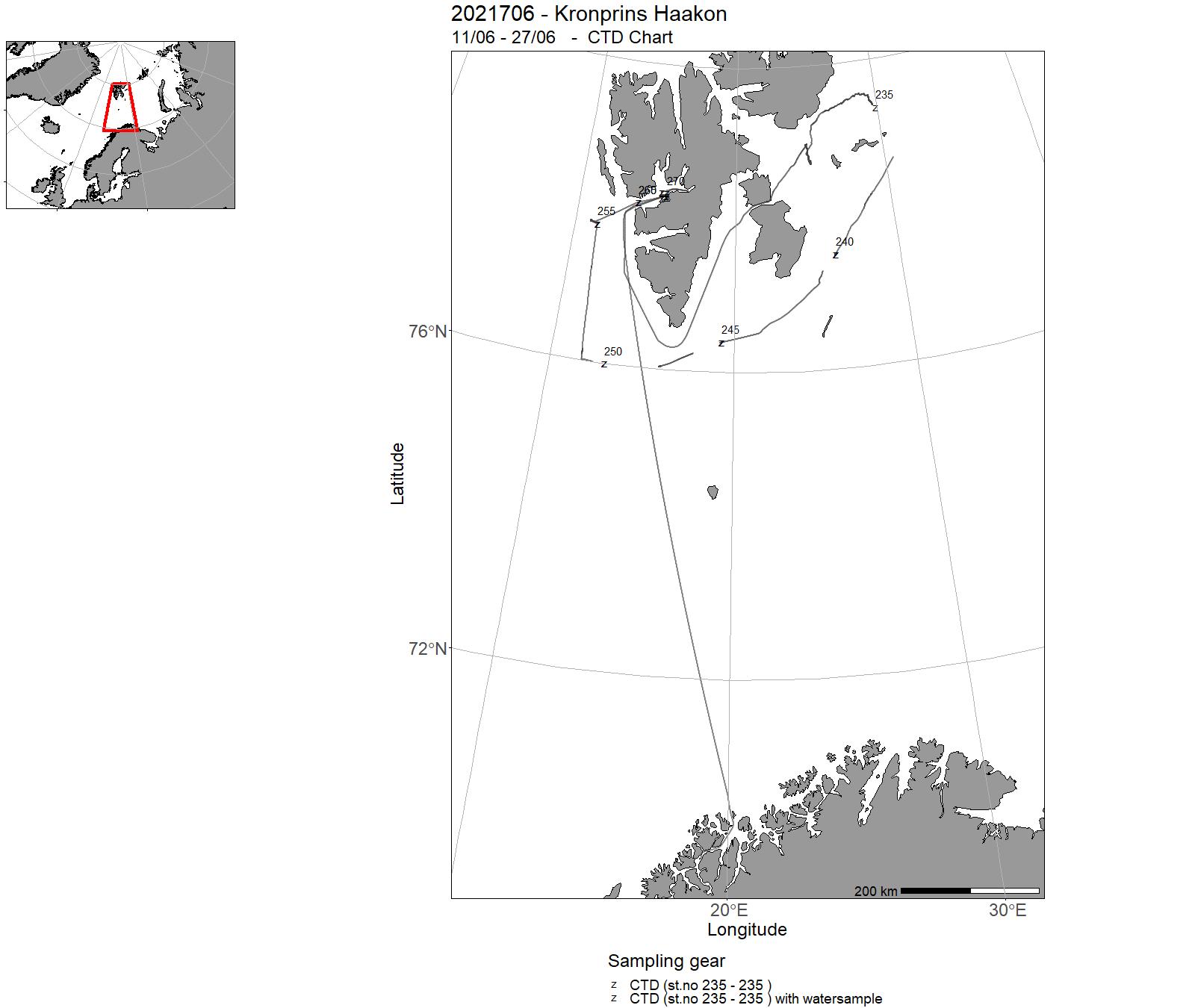
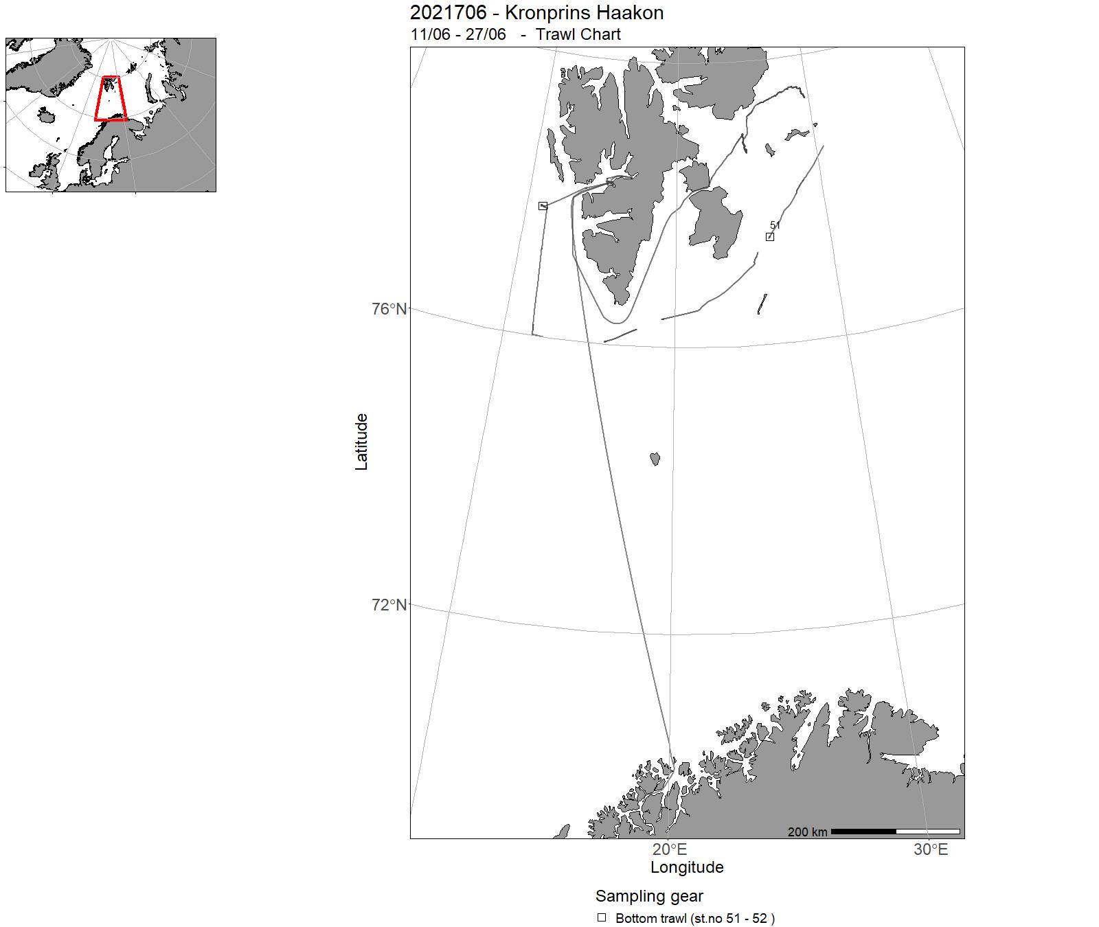
| 2021706 | 11/06 - 27/06 | The Arctic is affected by plastic pollution. The general knowledge about plastic pollution and microplastics throughout the Arctic is limited and fragmented. Therefore, it is very important to obtain good quantitative data and robust methods in order to establish monitoring and management of plastic poll uti on in the Arctic. During this cruise we have ai med to I) test methods when sampling different media for microplastic analysis, and 2) obtain samples from different media: air, sea ice, sea water, biota and sediments. | Arctic Ocean | 235 - 270 | 51 - 52 |
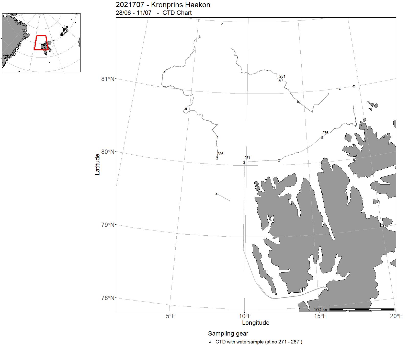
| 2021707 | 28/06 - 11/07 | During this cruise, we collected 1. surface sediments (multicores) for establishing an Arctic sedimentary DNA database 2. sediment records (gravity cores) for investigating the Arctic sea-ice history 3. water samples (CTD), plankton tows (0-50 m) and sea ice for assessing phytoplankton biodiversity 4. CTD profiles and water samples (CTD) for assessing the isotopic signature of the prevailing water masses. Project name: AGENS I (www.agensi.eu) - "A Genetic View into Past Sea lee Variability in the Arctic" | Longyearbyen | 271 - 287 | - |
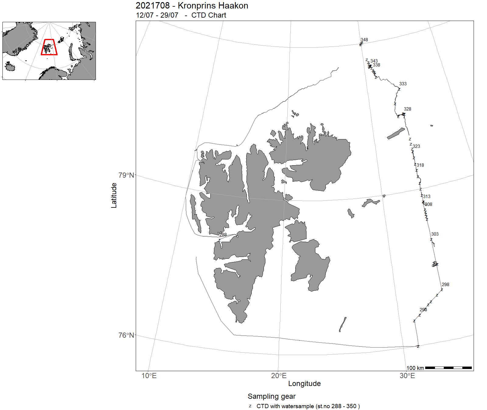
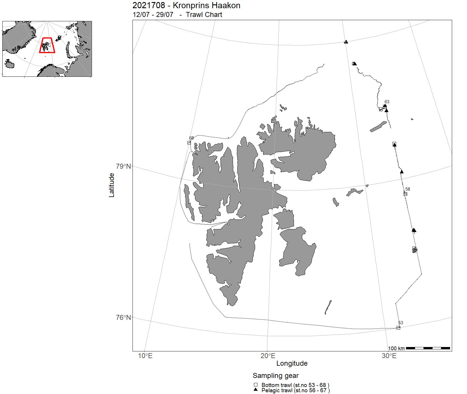
| 2021708 | 12/07 - 29/07 | The Nansen Legacy (NLEG) joint cruise (JC2-1) followed up the seasonal investigations of the northern Barents Sea and adjacent Arctic Basin, as well as investigations of interannual variability in the late summer period. The transect represents an environmental gradient through the northern Barents Sea, and included 7 process stations (P1-P7) lasting 10-39 hrs. Additional CTD stations (NLEG) were taken between the process stations to increase the hydrographic resolution along the transect. | Barents Sea | 288 - 350 | 53 - 68 |
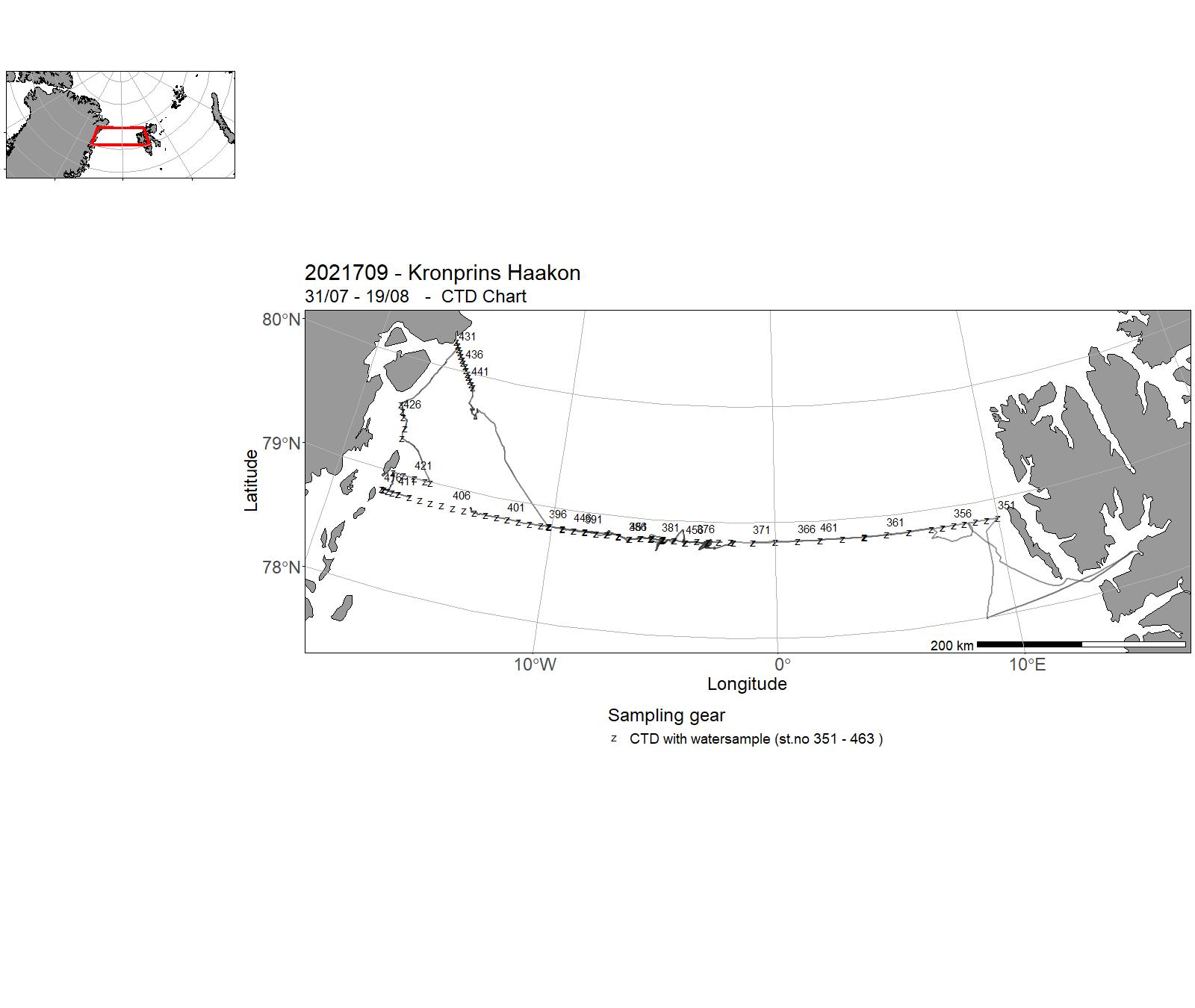
| 2021709 | 31/07 - 19/08 | The objective of the annual cruise of the Norwegian Polar Institute to Fram Strait is to service the Arctic Outflow Observatory in the western Fram Strait. This observing system monitors the properties of the Arctic freshwater, sea ice, and returning Atlantic water, as well as the state of ocean acidification, CDOM and nutrients in the East Greenland Current. The main priority was to recover and redeploy seven NPI moorings across the East Greenland Current at 78°50' N, and to carry out the CTD/LADCP section including extensive water sampling for various tracers across the whole Fram Strait along the 78°50'N line. Project name: Fram Strait Arctic Outflow Observatory (NPI), ARICE (EU), NorEMSO (NFR) Coordinating body: Norwegian Polar Institute | Arctic Ocean | 351 - 463 | - |
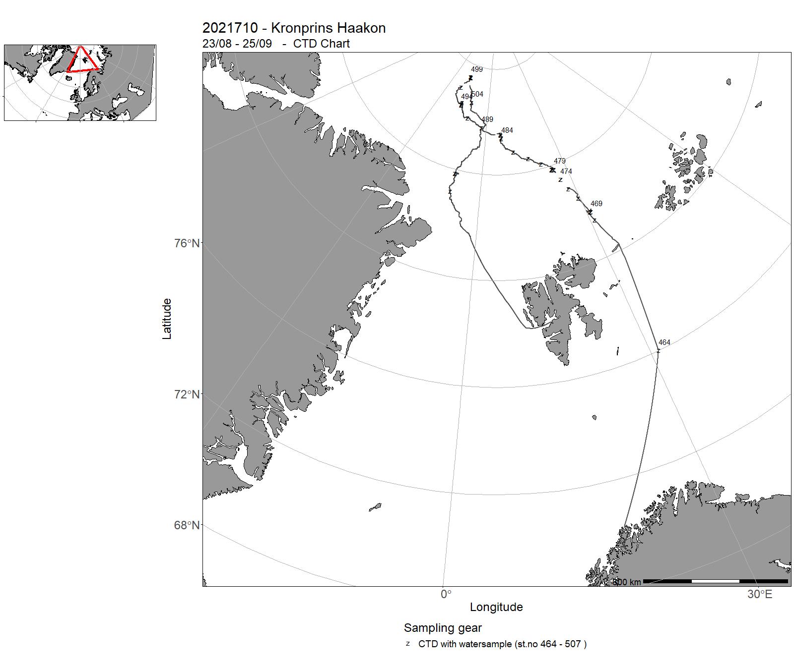
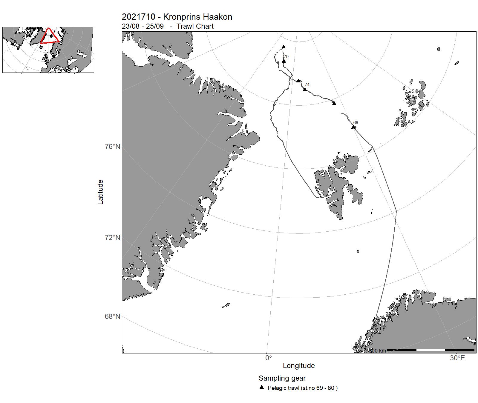
| 2021710 | 23/08 - 25/09 | The Arctic Basin (JC2-2) cruise addressed objectives of the Nansen Legacy project on the physical environment, on human impact through ecotoxicology, ocean acidification and impact of fisheries, and on community,distribution, ecology and interactions of the organisms in the Arctic Basin. The main scientific goal of JC2-2 was to extend the project’s research activities from the northern Barents Sea shelf into the central Arctic Ocean. Specifically, JC2-2 addressed objectives of the research foci by jointly collecting interdisciplinary samples and data at five process (P7-P11) along a transect from 81.46 to 87.51°N in the Nansen and Amundsen basins and in-between at NLEG stations. | Arctic Ocean | 464 - 507 | 69 - 80 |
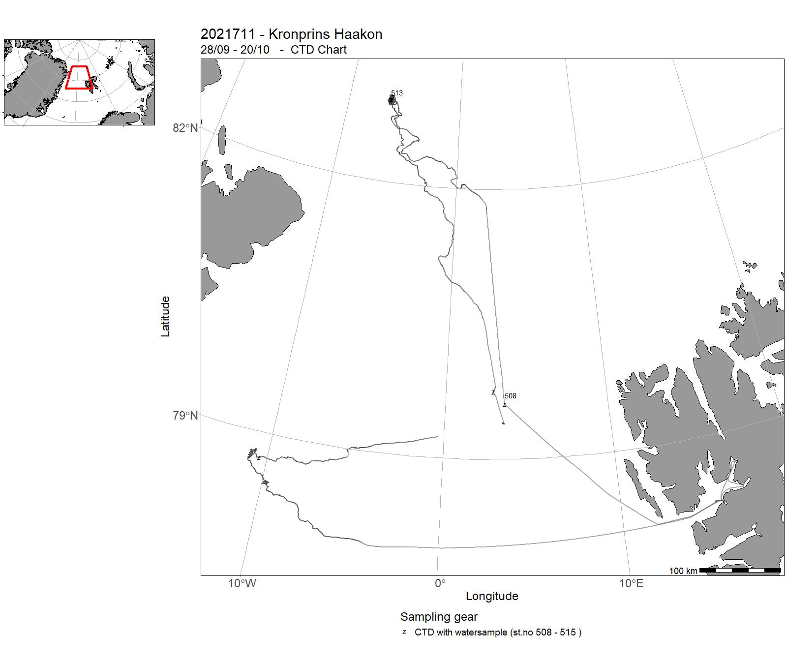
| 2021711 | 28/09 - 20/10 | Cruise 2021711 is a major component of the FRINATEK HACON project, which aims at investigating the role of the Gakkel Ridge and Arctic Ocean in biological connectivity amongst ocean basins and global biogeography of chemosynthetic ecosystems. The HACON study area is centered in the Aurora seamount and Aurora vent field. | Arctic Ocean | 508 - 515 | - |
| 2021712 | 21/10 - 30/10 | The aim of the cruise was to measure in-situ sediment properties (e.g., horizontal pressure, shear strength, pore fluid pressure, temperature) at methane seeping sites offshore west Svalbard. We rented, through a tender, instrumentation from Marine Sampling Holland (MSH) and the Marchetti Lab for conducting such measurements. Project name: SEAMSTRESS – Tectonic stress effect on Arctic methane seepage Coordinating body: UiT – The Arctic University of Norway | Arctic Ocean | - | - |
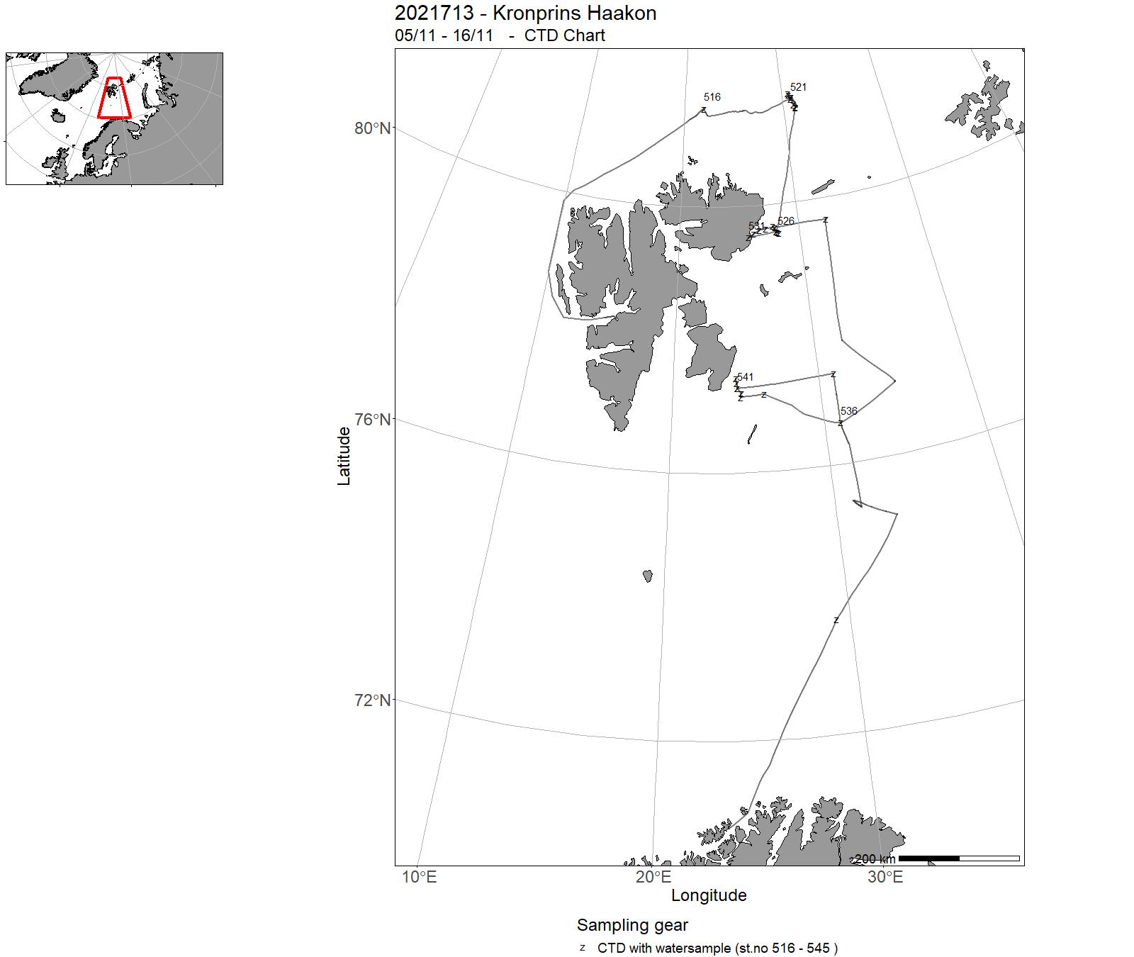
| 2021713 | 05/11 - 16/11 | This was a joint cruise between the projects Nansen Legacy, A-TWAIN and SIOS InfraNor. The main objectives were to recover and redeploy a number of moorings a) in the northern Barents Sea for the Nansen Legacy project and b) over the continental slope north of Svalbard for A-TWAIN/SIOS InfraNor, including project partner moorings. | Barents Sea | 516 - 545 | - |
| 2021716 | 18/11 - 15/02 | Supply Cruise Troll | Atlantic Ocean | 547 - 552- | - |
| 2021714 | 29/11 - 03/12 | Cancelled | - | - | - |
| 2021715 | 04/12 - 15/12 | Cancelled | - | - | - |
9 - “ Kronprins Haakon” – Charts for cruises 2021
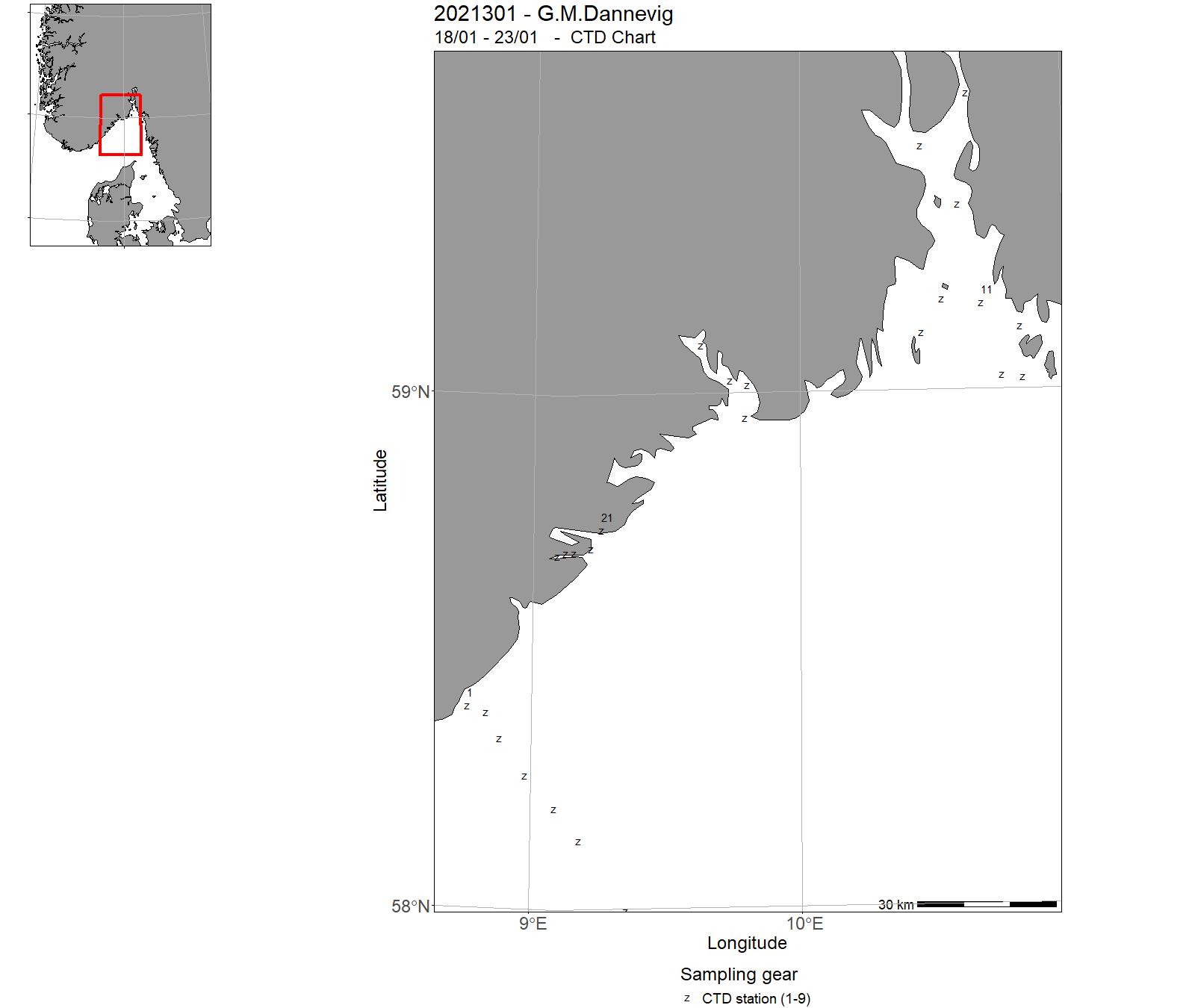
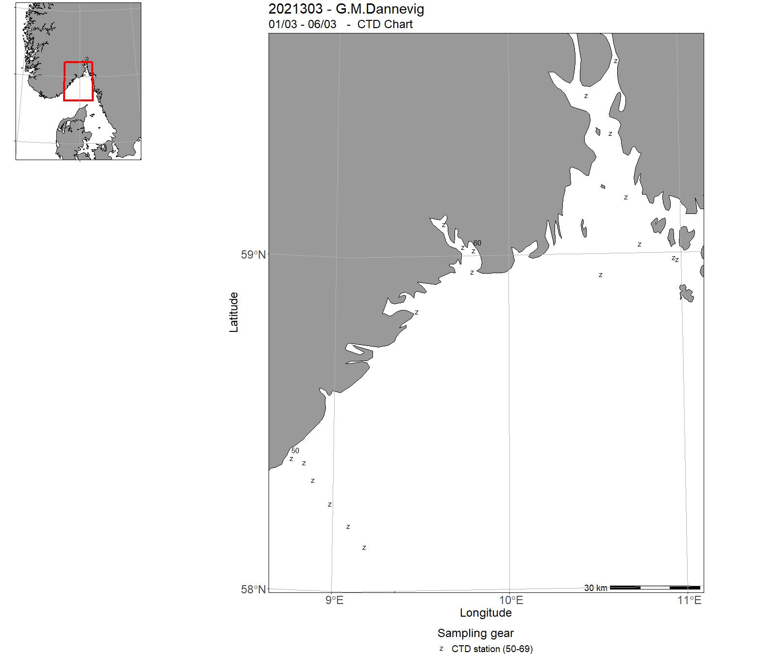
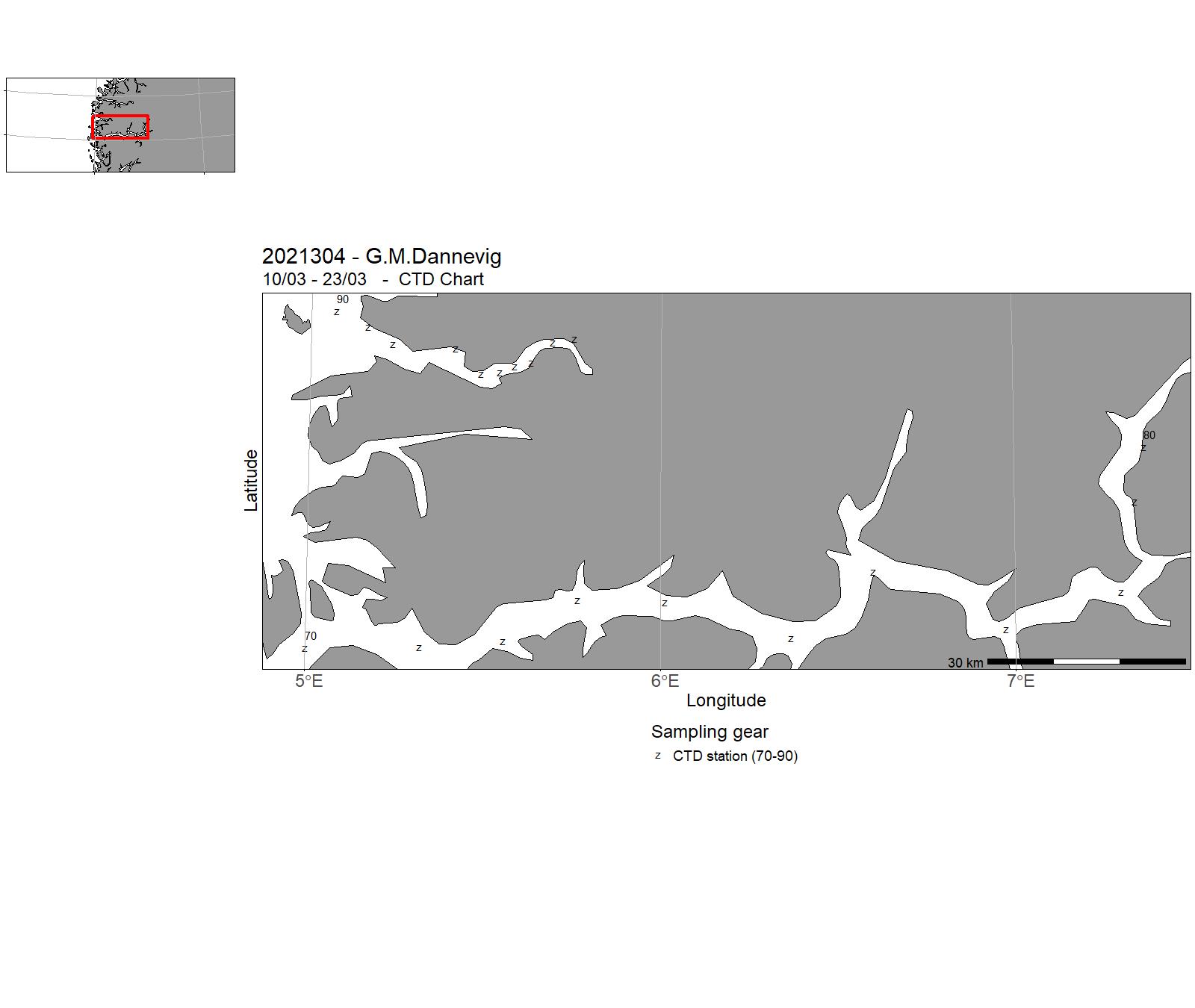
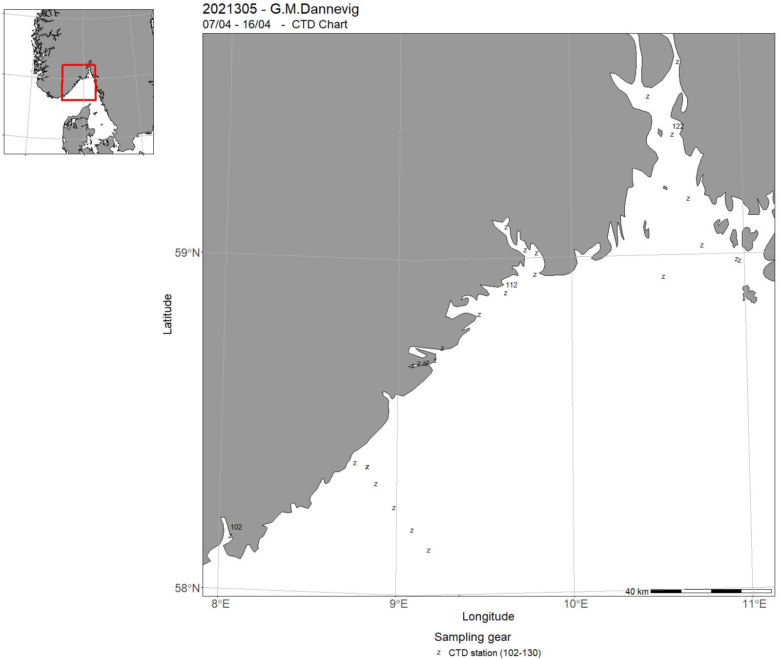
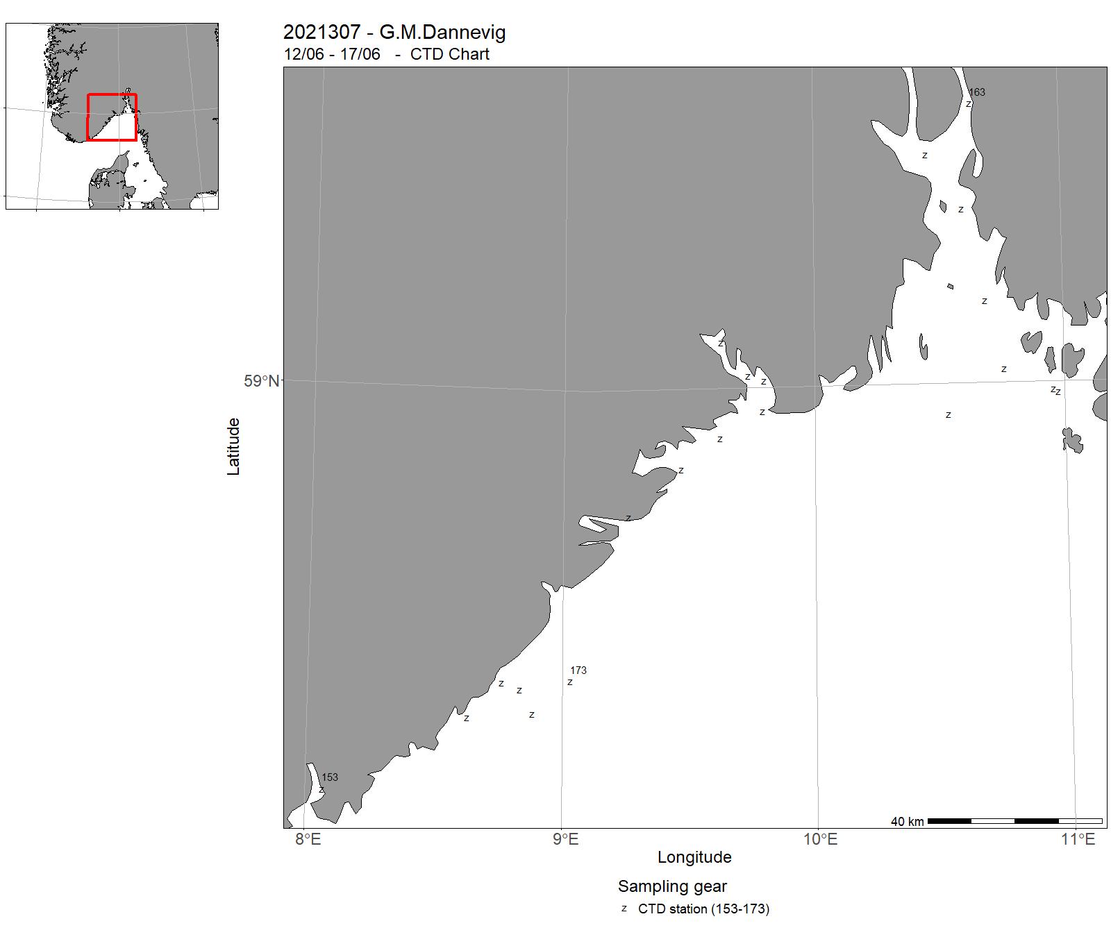
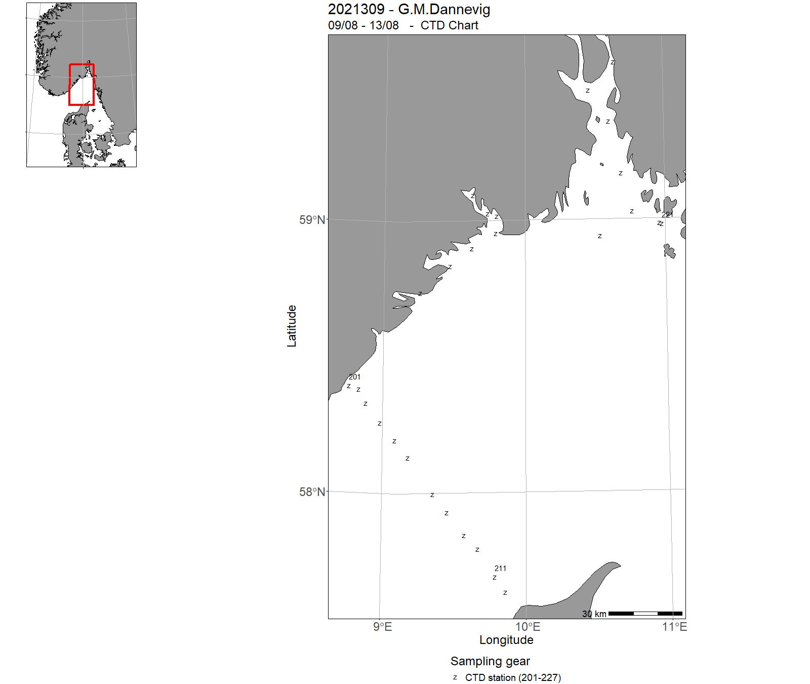
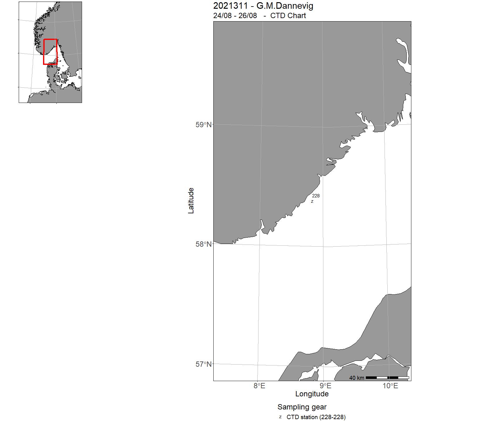
10 - "G. M. Dannevig" – Cruises 2021
| Cruise No | Period | Purpose | Area | CTD st.no | Trawl st.no |
| 2021301 | 18/01 - 23/01 | 2021-KST-013: Miljøtilstandvurdering/rådgivning for Skagerrak: Havforsurning, oseanografi, HAB, mikroplast, miljø, klima lavere trofiske nivå langs Skagerrakkysten og fast snitt Torungen-Hirtshals. Videreføring av 4 tidsserier (Torungen, Oslofjord, Grenland, Arendal) | Norwegian Sea | 1-9 | - |
| 2021302 | 29/01 - 03/02 | 2021-KST-014: Miljøtilstandvurdering/rådgivning for Skagerrak: Havforsurning, oseanografi, HAB, mikroplast, miljø, klima lavere trofiske nivå langs Skagerrakkysten og fast snitt Torungen-Hirtshals. Videreføring av 4 tidsserier (Torungen, Oslofjord, Grenland, Arendal) | Norwegian Sea | 26-49 | - |
| 2021303 | 01/03 - 06/03 | 2021-KST-015: Miljøtilstandvurdering/rådgivning for Skagerrak: Havforsurning, oseanografi, HAB, mikroplast, miljø, klima lavere trofiske nivå langs Skagerrakkysten og fast snitt Torungen-Hirtshals. Videreføring av 4 tidsserier (Torungen, Oslofjord, Grenland, Arendal) | Norwegian Sea | 50 - 69 | - |
| 2021304 | 10/03 - 23/03 | 2021-KST-007: Toktet vil kartleggge gytefelt for kystnære bestander gjennom innsamling av egg. Toktet betjener prosjektet: "Program for kartlegging av gyte- og oppvekstområder for kystnære kommersielle bestander".2021-KST-025: Prøvetaking av hydrografi, kjemi, phytoplankton og zooplankton i kyst. Toktet bidrar til prosjekt "Langtidsovervåkning og forskning på kystmiljø og plankton (15593)". | Norwegian Sea | 70 - 90 | - |
| 2021305 | 07/04 - 16/04 | 2021-KST-016: Miljøtilstandvurdering/rådgivning for Skagerrak: Havforsurning,oseanografi,HAB,mikroplast,miljø,klima lavere trofiske nivå langs Skagerrakkysten og fast snitt Torungen-Hirtshals. Videreføring av 4 tidsserier (Torungen, Oslofjord, Grenland, Arendal)2021-KST-042: Hensikten med toktet er å undersøke påvirkning fra kyststrømmen på plankton innsamlet ved vår nylig etablerte tidsserie i Farsunds skjærgård. Dette toktet kan koordineres med og organiseres i samarbeid med HI sin Miljøovervåking av Skagerrak. | Norwegian Sea | 102 -130 | - |
| 2021306 | 04/05 - 09/05 | 2021-KST-017: Miljøtilstandvurdering/rådgivning for Skagerrak: Havforsurning, oseanografi, HAB, mikroplast, miljø, klima lavere trofiske nivå langs Skagerrakkysten og fast snitt Torungen-Hirtshals. Videreføring av 4 tidsserier (Torungen, Oslofjord, Grenland, Arendal) | Norwegian Sea | 131-152 | - |
| 2021307 | 12/06 - 17/06 | 2021-KST-018: Miljøtilstandvurdering/rådgivning for Skagerrak: Havforsurning, oseanografi, HAB, mikroplast, miljø, klima lavere trofiske nivå langs Skagerrakkysten og fast snitt Torungen-Hirtshals. Videreføring av 4 tidsserier (Torungen, Oslofjord, Grenland, Arendal) | Norwegian Sea | 153-173 | - |
| 2021308 | 30/06 - 05/07 | 2021-KST-019: Miljøtilstandvurdering/rådgivning for Skagerrak: Havforsurning, oseanografi, HAB, mikroplast, miljø, klima lavere trofiske nivå langs Skagerrakkysten og fast snitt Torungen-Hirtshals. Videreføring av 4 tidsserier (Torungen, Oslofjord, Grenland, Arendal) | Norwegian Sea | 174-200 | - |
| 2021309 | 09/08 - 13/08 | 2021-KST-020: Miljøtilstandvurdering/rådgivning for Skagerrak: Havforsurning, oseanografi, HAB, mikroplast, miljø, klima lavere trofiske nivå langs Skagerrakkysten og fast snitt Torungen-Hirtshals. Videreføring av4 tidsserier (Torungen, Oslofjord, Grenland, Arendal) | Norwegian Sea | 201-227 | - |
| 2021310 | 14/08 - 22/08 | 2021-KST-048: Overvåkingsfiske hummerreservater Bolærne og Kvernskjær, ytre Oslofjord | Skagerrak | - | - |
| 2021311 | 24/08 - 26/08 | 2021-KST-047: Havforskningsinstituttet og UiA samarbeider om et undervisningstokt. Formålet med toktet er å gi studenter (master grad)gjenskap med ulike innsamlingsmetoder for bentsike undersøkelser og planktoniske organismer (zoo-plant-plankton, maneter) | Norwegian Sea | 228 | - |
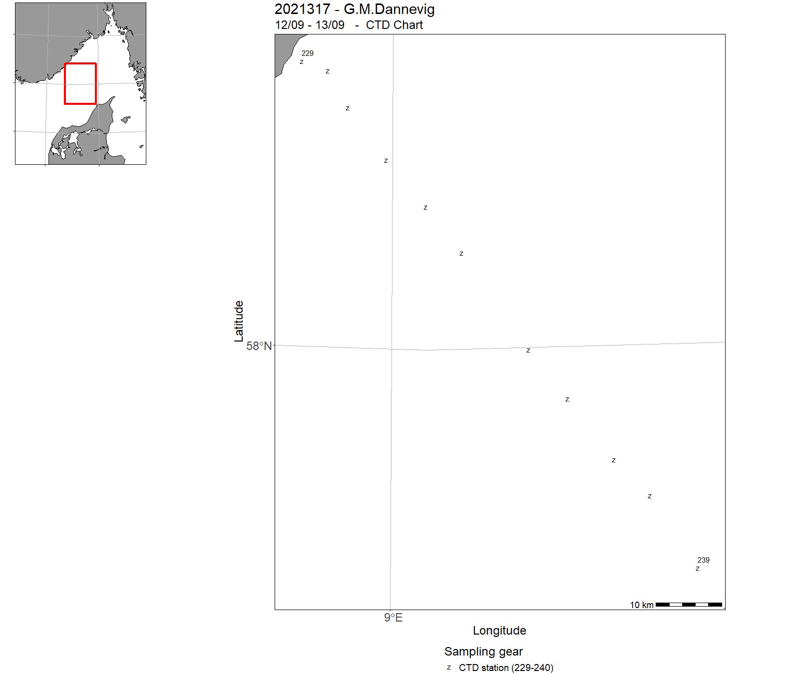
| 2021317 | 12/09 - 13/09 | 2021-KST-021: Miljøtilstandvurdering/rådgivning for Skagerrak: Havforsurning, oseanografi, HAB, mikroplast, miljø, klima lavere trofiske nivå langs Skagerrakkysten og fast snitt Torungen-Hirtshals. Videreføring av 4 tidsserier (Torungen, Oslofjord, Grenland, Arendal) | Norwegian Sea | 229-240 | - |
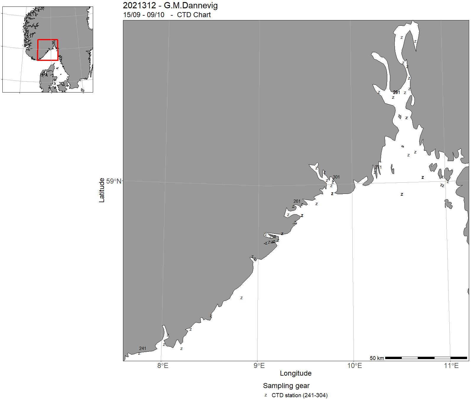
| 2021312 | 15/09 - 09/10 | 2021-KST-021: Miljøtilstandvurdering/rådgivning for Skagerrak: Havforsurning, oseanografi, HAB, mikroplast, miljø, klima lavere trofiske nivå langs Skagerrakkysten og fast snitt Torungen-Hirtshals. Videreføring av 4 tidsserier (Torungen, Oslofjord, Grenland, Arendal) 2021-KST-022: Miljøtilstandvurdering/rådgivning for Skagerrak: Havforsurning, oseanografi, HAB, mikroplast, miljø, klima lavere trofiske nivå langs Skagerrakkysten og fast snitt Torungen-Hirtshals. Videreføring av 4 tidsserier (Torungen, Oslofjord, Grenland, Arendal))2021-KST-029: Strandnotundersøkelser for å måle rekrutteringen av torskefisk og annen fisk i strand/kystsonen. Videre formål er å kartlegge utbredelsen av fisk i strand/kystsonen. Data/arbeid fra toktet benyttes i flere eksterntfinansierte prosjekt. | Norwegian Sea | 241-304 | - |
| 2021313 | 09/10 - 10/10 | 2021-NSJ-012: Miljøtilstandvurdering/rådgivning for Skagerrak: Havforsurning,oseanografi,HAB,mikroplast,miljø,klima lavere trofiske nivå på det fast snitt Torungen-Hirtshals. Videreføring av tidsserie | Norwegian Sea | 305-316 | - |
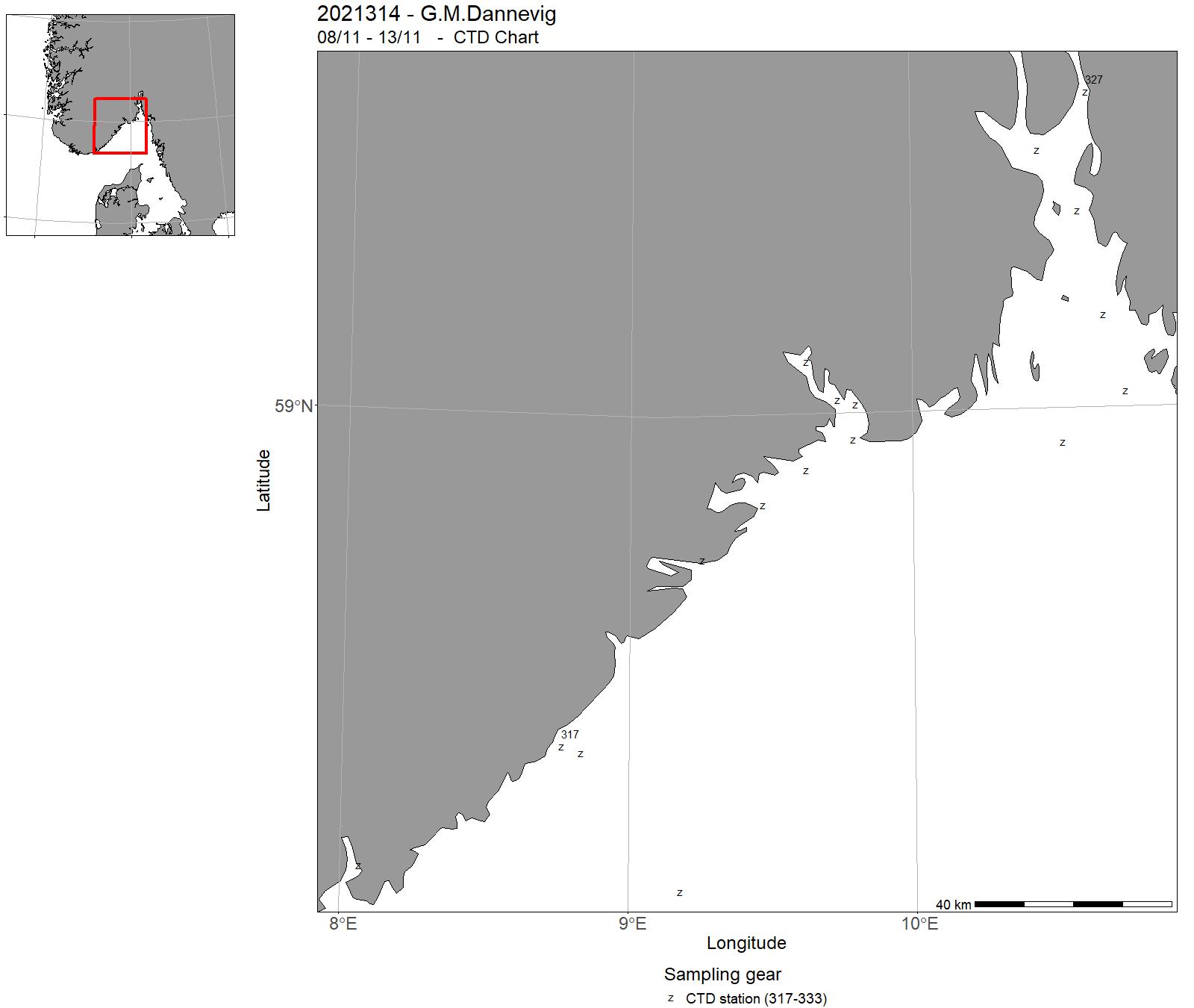
| 2021314 | 08/11 - 13/11 | 2021-NSJ-013: Miljøtilstandvurdering/rådgivning for Skagerrak: Havforsurning,oseanografi,HAB,mikroplast,miljø,klima lavere trofiske nivå på det fast snitt Torungen-Hirtshals. Videreføring av tidsserie2021-KST-023: Miljøtilstandvurdering/rådgivning for Skagerrak: Havforsurning,oseanografi,HAB,mikroplast,miljø,klima lavere trofiske nivå langs Skagerrakkysten og fast snitt Torungen-Hirtshals. Videreføring av 4 tidsserier (Torungen, Oslofjord, Grenland, Arendal) | Norwegian Sea | 317-333 | - |
| 2021315 | 14/11 - 01/12 | 2021-KST-034: Overvåker bestander av kysttorsk og andre kystarter. Driver og forskning på data, da tokt inngår i eksterne prosjekt | Norwegian Sea | 334 | - |
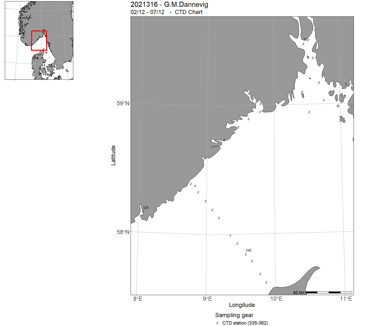
| 2021316 | 02/12 - 07/12 | 2021-KST-024: Miljøtilstandvurdering/rådgivning for Skagerrak:Havforsurning,oseanografi,HAB,mikroplast,miljø,klima lavere trofiske nivå langs Skagerrakkysten og fast snitt Torungen-Hirtshals. Videreføring av 4 tidsserier (Torungen, Oslofjord, Grenland, Arendal) | Norwegian Sea | 335-362 | - |
11 - "G. M. Dannevig" – Charts for cruises 2021


12 - Hired vessels – Cruises 2021
| Cruise No | Period | Purpose | Area | CTD st.no | Trawl st.no |
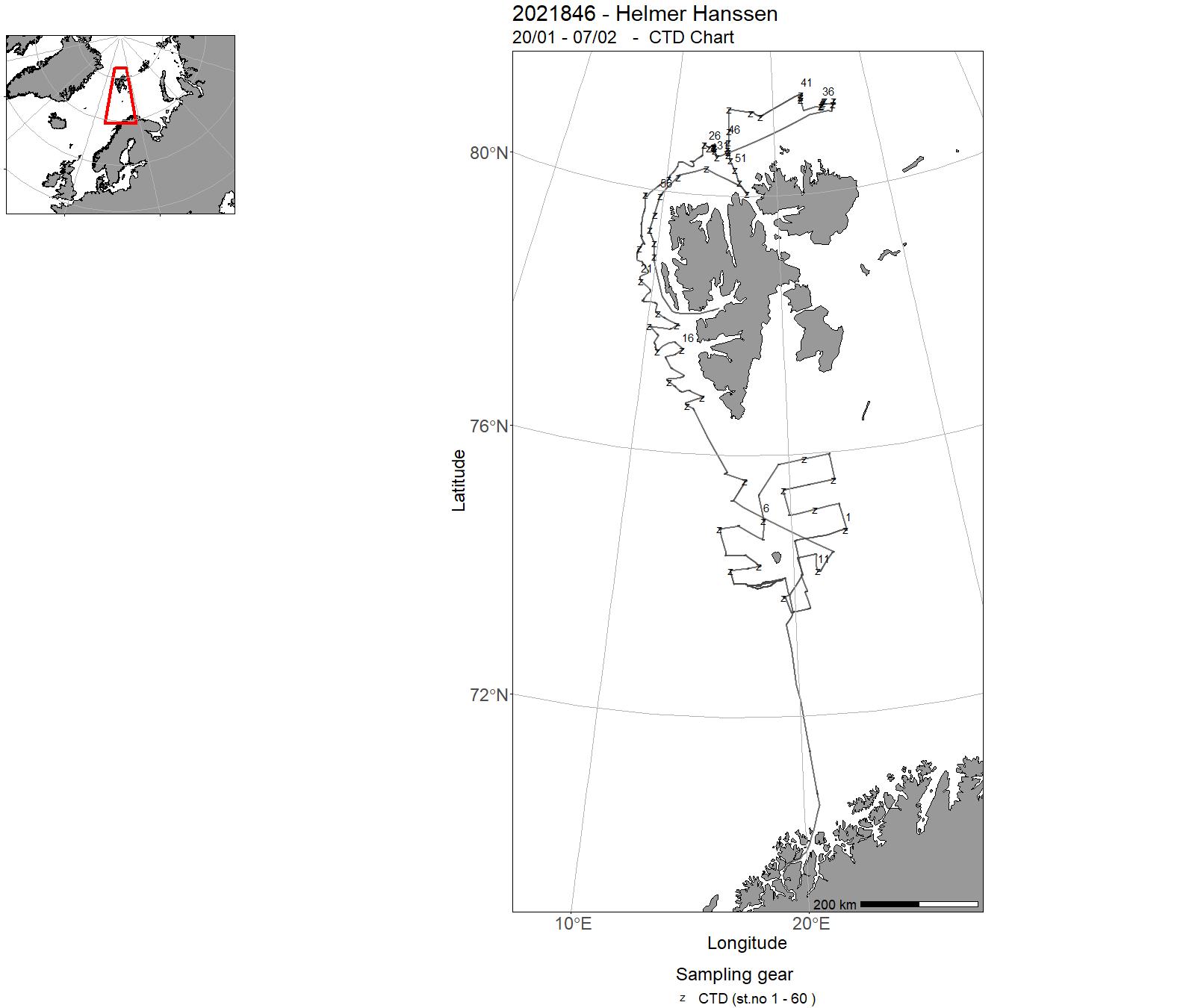
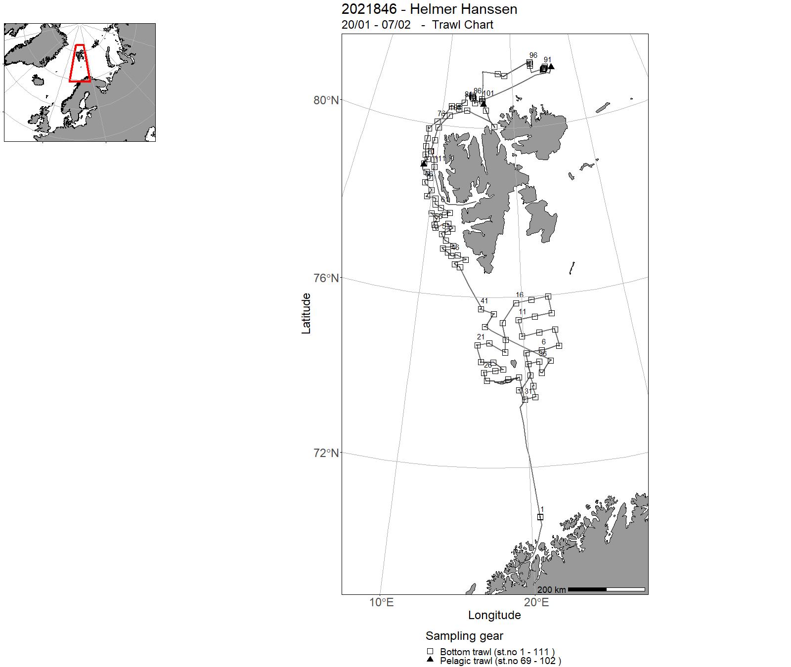
| 2021846 | 20/01 - 07/02 | Abundance and distribution of cod and haddock. Project name: Arctic Winter survey (Vintertoktet) Coordinating body: Institute of Marine Research | Barents Sea | 1 - 60 | 1 - 111 |
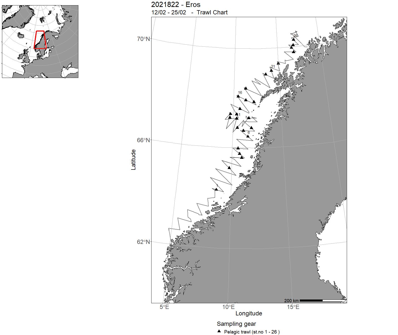
| 2021822 | 12/02 - 25/02 | Provide acoustic estimates of abundance and distribution of Norwegian spring spawning heting during the spawning migration along the Norwegian coast. Cruise coordinator: Are Salthaug, Institute of Marine Research, Norway. | Norwegian Sea | 1 - 12 | 1 - 26 |
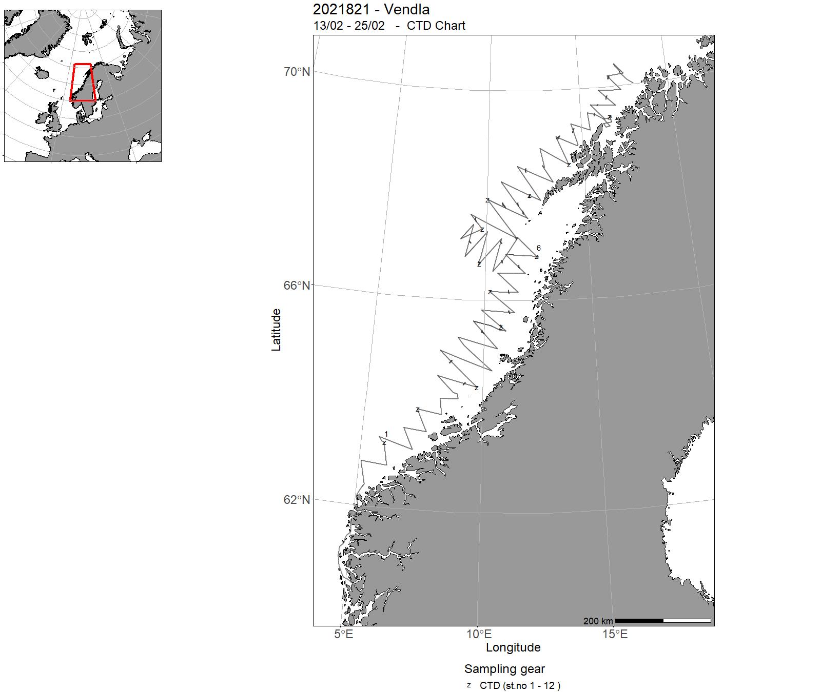
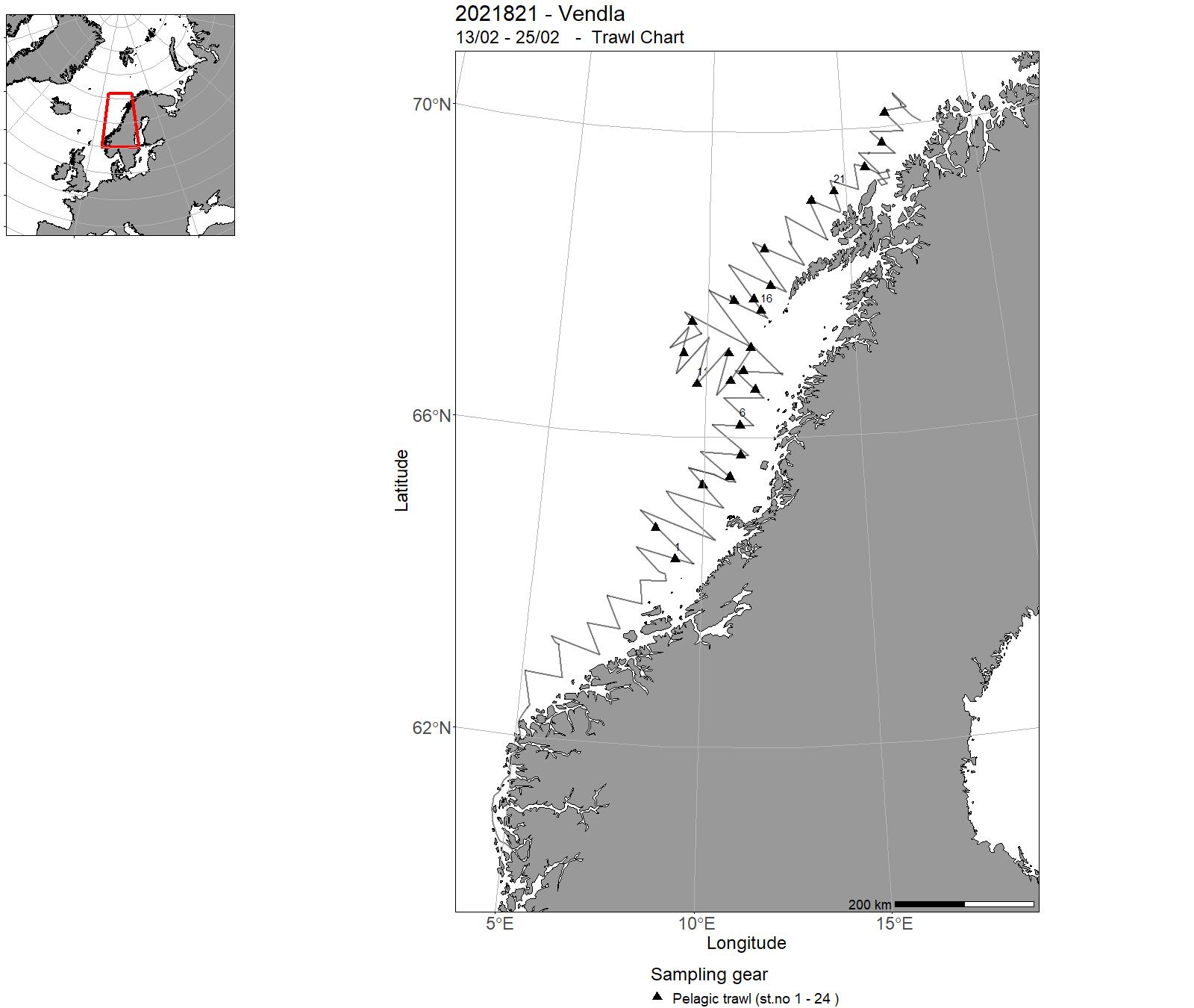
| 2021821 | 13/02 - 25/02 | Collection of acoustic data from fisheries sonar for study og herring schools . Collection of acoustic data from echo sounder for biomass estimation of herring . Collection of biological samples for estimation of species and size composistion in the acoustic observations . Collection of hydrographic data (CTD) | Norwegian Sea | 1 - 12 | 1 - 24 |
| 2021826 | 13/02 - 19/02 | The objective of the SpawnSeis project is to study effects of seismic exposures on the behaviour of wild, free ranging, spawning cod using acoustic telemetry in Austevoll, Norway. The objective of the cruise is to deploy airguns from the vessel and expose the experimental area and to monitor the resulting noise patterns in the area where the cod is tagged. CTD stations were also taken in the area to characterise the propagation properties of the water column. The behavioural data will be downloaded from the listening buoys for the fish tags later and is not part of this survey. Project name: SpawnSeis Coordinating body: Institute of Marine Research, Norway | North Sea | - | - |
| 2021849 | 14/02 - 20/02 | A demersal seine was applied with pelagic trawl doors for live capture of cod. Catch limitation devices were tested and filmed with underwater cameras. Fishing was conducted at various depths and fishing densities and viability of the fish evaluated. Project name: Pelagic trawling for live capture of cod. Coordinating body: Institute of Marine Research Bergen, Norway | Norwegian Sea | - | - |
| 0153_2021_UFJN_VILN | 23/02 - 19/03 | - | - | - | - |
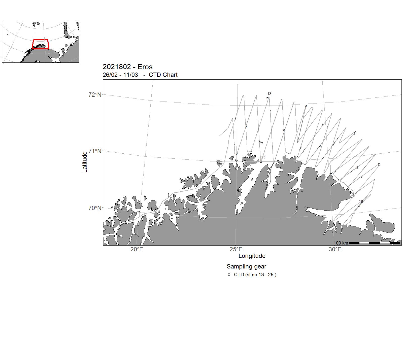
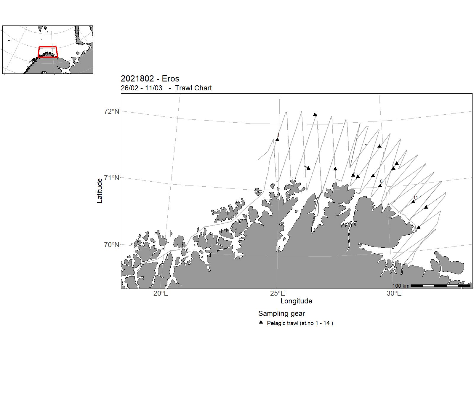
| 2021802 | 26/02 - 11/03 | Acoustic trawl survey on Capelin spawning stock. Methodological survey using a stratified survey design aiming to measure the abundance of Capelin during the spawning season. Project name: Managing strategies for the Barents Sea Coordinating body: Havforskningsinstituttet | Norwegian Sea | 13 - 25 | 1 - 14 |
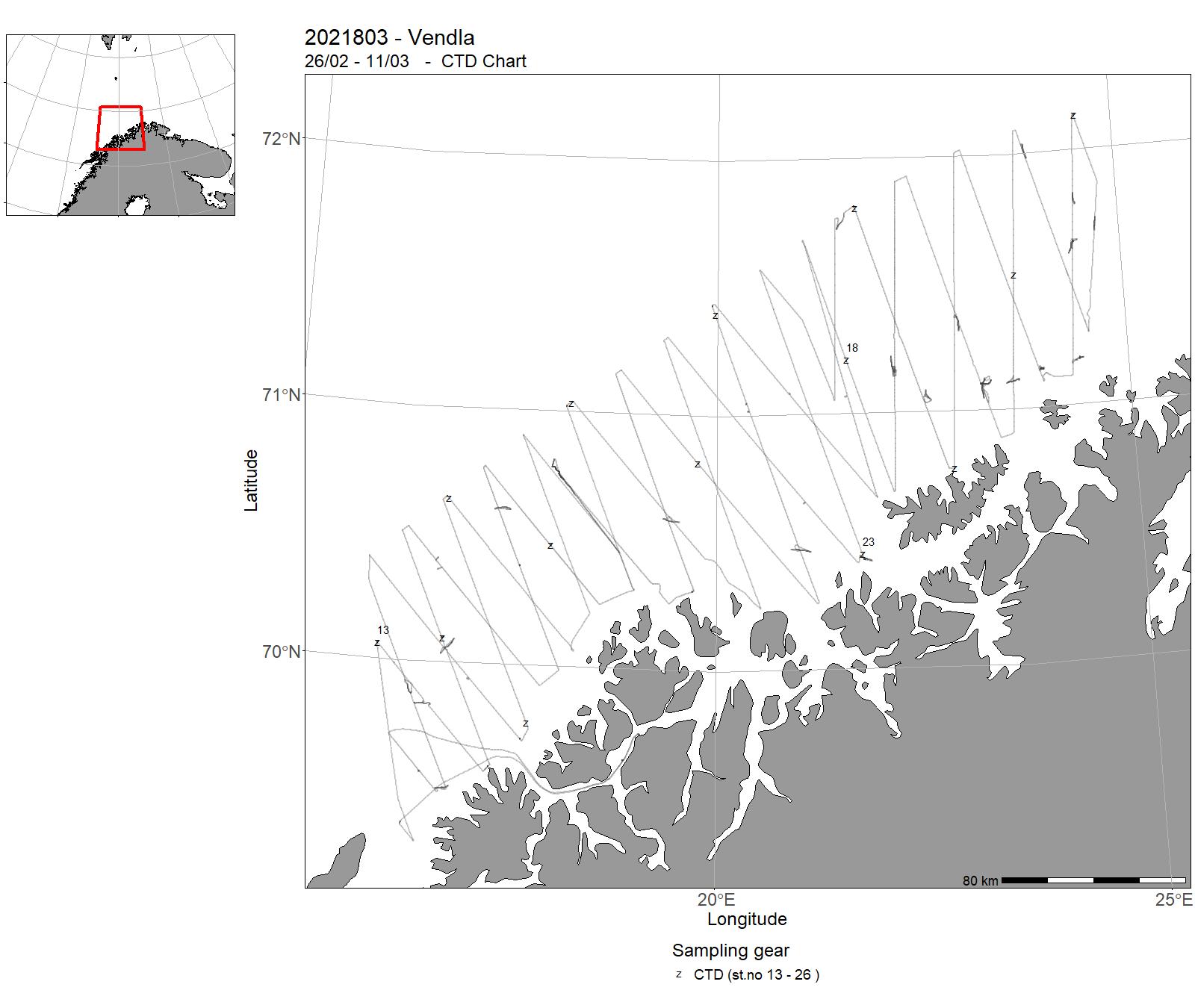
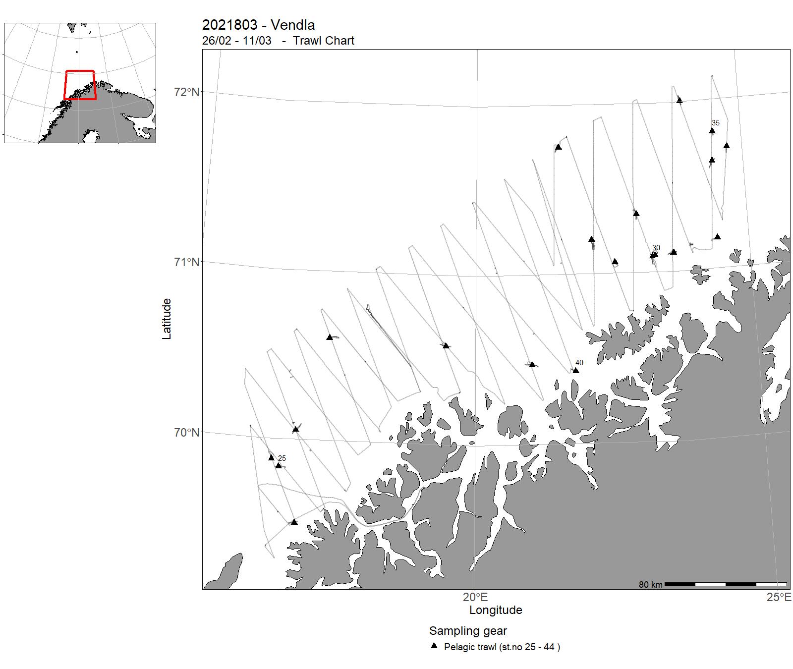
| 2021803 | 26/02 - 11/03 | Acoustic trawl monitoring survey for biomass estimation of the capelin spawning stock. Project name: Forvaltningsstrategiar for Barentshavet (15568) Coordinating body: Institute of Marine Research, Norway | Barents Sea | 13 - 26 | 25 - 44 |
| 2021825 | 08/03 - 21/03 | The aim of this research cruise was to further develop the catch control methods and technologies initially investigated in cruise No. 2019862 by addressing the following objectives: 1. Investigate the effectiveness of three designs of catch control rigs to retain target catch during fishing operations and then release excess catch once the catch limited is reached. 2. Investigate the effectiveness of the catch limit release mechanism on the trawl codend (Prototype by Foss Tech). 3. Monitor the geometry of the trawl and codend, particularly during haulback. 4. Develop methods for the rapid release of the pump from the trawl codend, as a countermeasure to sinking codends. 5. Develop methods to assess the vitality and injuries of fish being release from the catch control rigs. | Celtic Sea | - | - |
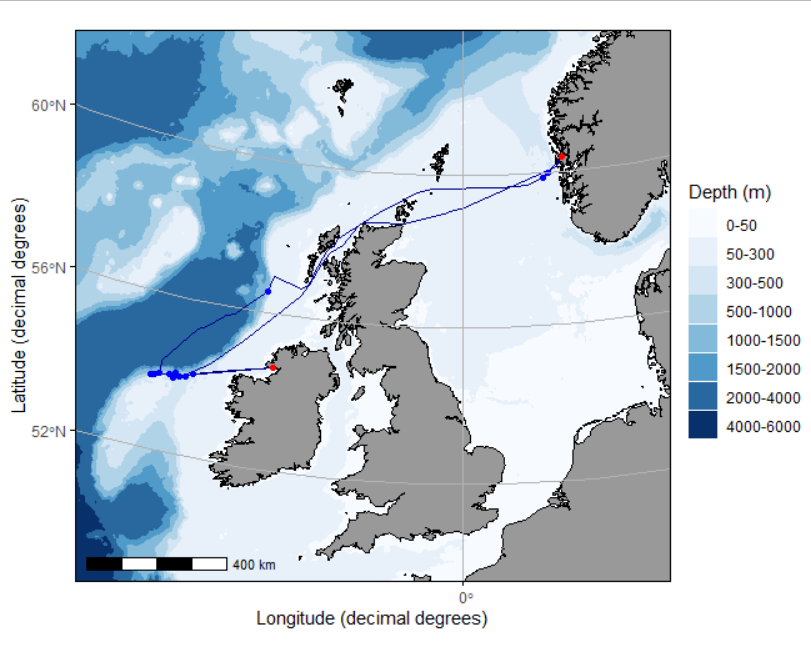
| 2021818 | 21/03 - 08/04 | International blue whiting spawning stock survey. Acoustic survey to monitor the spawning stock of blue whiting on the spawning grounds west of the British Isles. Project name: International Blue Whiting Spawning Stock Survey Coordinating body: WGIPS, ICES | Atlanterhavet/Vest for de Britiske øyer | - | - |
| 2021812 | 11/04 - 14/05 | It is established a long-term data set of reproductive data for the Harp Seal population in the East Ice/Barents Sea. The main purpose of the cruise was to obtain data to continue this work and to collect samples to get updated data for the populations condition. The methodological approach was to collect jaws, ovaries and body measurements of female harp seals. The sampled seals were animals that were part of the commercial catch of the sealing vessel MS Salarøy. | Norwegian Sea | - | - |
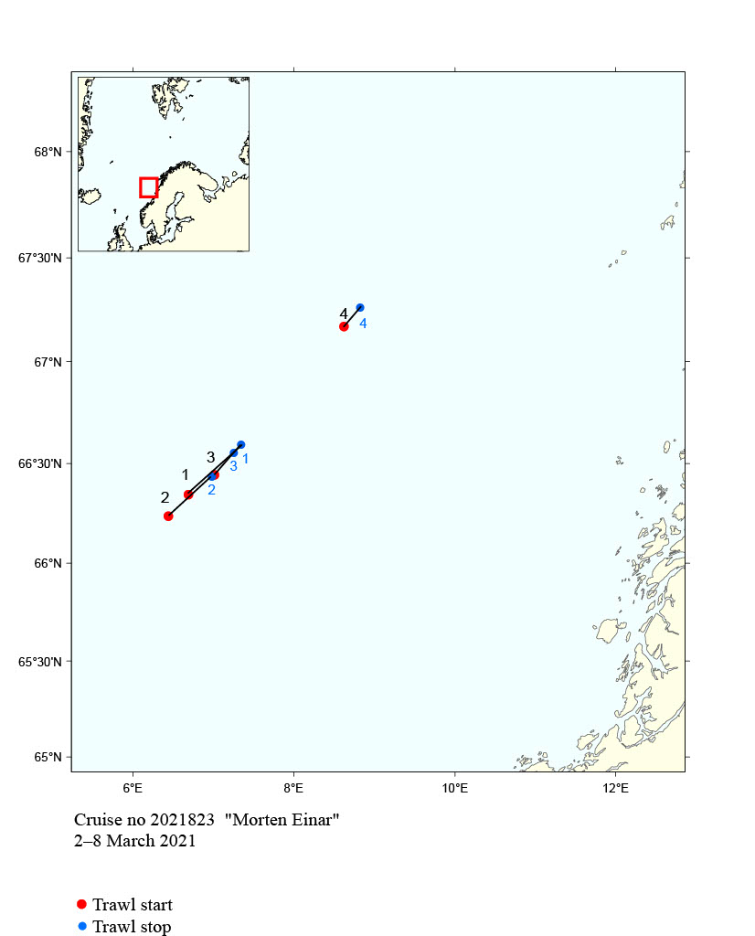
| 2021823 | 04/04 - 09/04 | The objective of the cruise was to test technical solutions to release sharks and other large fish from pelagic trawls in the Great Argentine (Argentina silus) fisheries. The devices tested were 7 and 14 m four panel sections with a 600 mm square mesh panel obliquely mounted in the sections, with large escape opening in the bottom, just in front of the square mesh section. The cruise was conducted without any serious interruptions. Under water filming was conducted using GoPro cameras in aluminium housings with dive lights. | Norwegian Sea | - | - |
| 2021830 | 06/04 - 14/05 | 2021-BAR-019: Prøvetaking av kommersielle fangstar av bunnfisk (særleg torsk, sei, hyse, blåkveite, uer) landa på strekninga Helgeland-Varanger. Prøvetaking 180 døgn per år fordelt på alle kvartal, men med hovudvekt på 1 og 2 kvartal. | Norwegian Sea | - | - |
| 2021847 | 21/04 - 16/05 | . Measuring the abundance, distribution and age composition of lesser sandeel . Dredge sampling for burrowed sandeels . Bottom trawls . Pelagic trawls . Echo sounder sampling . Zooplankton sampling . Mapping of hydrographical conditions | North Sea | - | - |
| 2021844 | 24/04 - 07/05 | 2021-MP-017: Å samle inn data med fiskefartøy med full EK80 utrustning på full spectrum av tobis, sild og øyepål, med fartøyet selv, samt med medbrakt overflate drone, KM Sounder og eller KayakDrone Bruke Drone for å måle unnvikelse, og forbedre dekningsgrad. | North Sea | - | - |
| 2021820 | 04/05 - 04/06 | Tagging with RFID technology and biological sampling of mackerel in the spawning areas west of Shetland and the Hebrides, Scotland and west of Ireland. Project name: Tagging and biological sampling of mackerel as part of studies on the European mackerel stocks. Coordinating body: Institute of Marine Research, Bergen, Norway. | Atlantic Ocean | - | - |
| 2021831 | 24/05 - 08/06 | 2021-BAR-020: Prøvetaking av kommersielle fangstar av bunnfisk (særleg torsk, sei, hyse, blåkveite, uer) landa på strekninga Helgeland-Varanger. Prøvetaking 180 døgn per år fordelt på alle kvartal, men med hovudvekt på 1 og 2 kvartal. | Norwegian Sea | - | - |
| 2021851 | 30/05 - 12/06 | Beregne hvor stor andel av totalseleksjonen av reker som skjer på hhv fiskedypet og i overflaten. | Skagerrak | - | - |
| 2021809 | 31/5-5/6 | Survey of potentially human pathogenic (i. e. anisakids nematodes) and other important parasites (i.e. Ichthyophonus) in North Sea herring intended for human consumption. In addition, a small sample of bycatch (i.e. haddock and saithe) was studied. | Norwegian Sea | - | - |
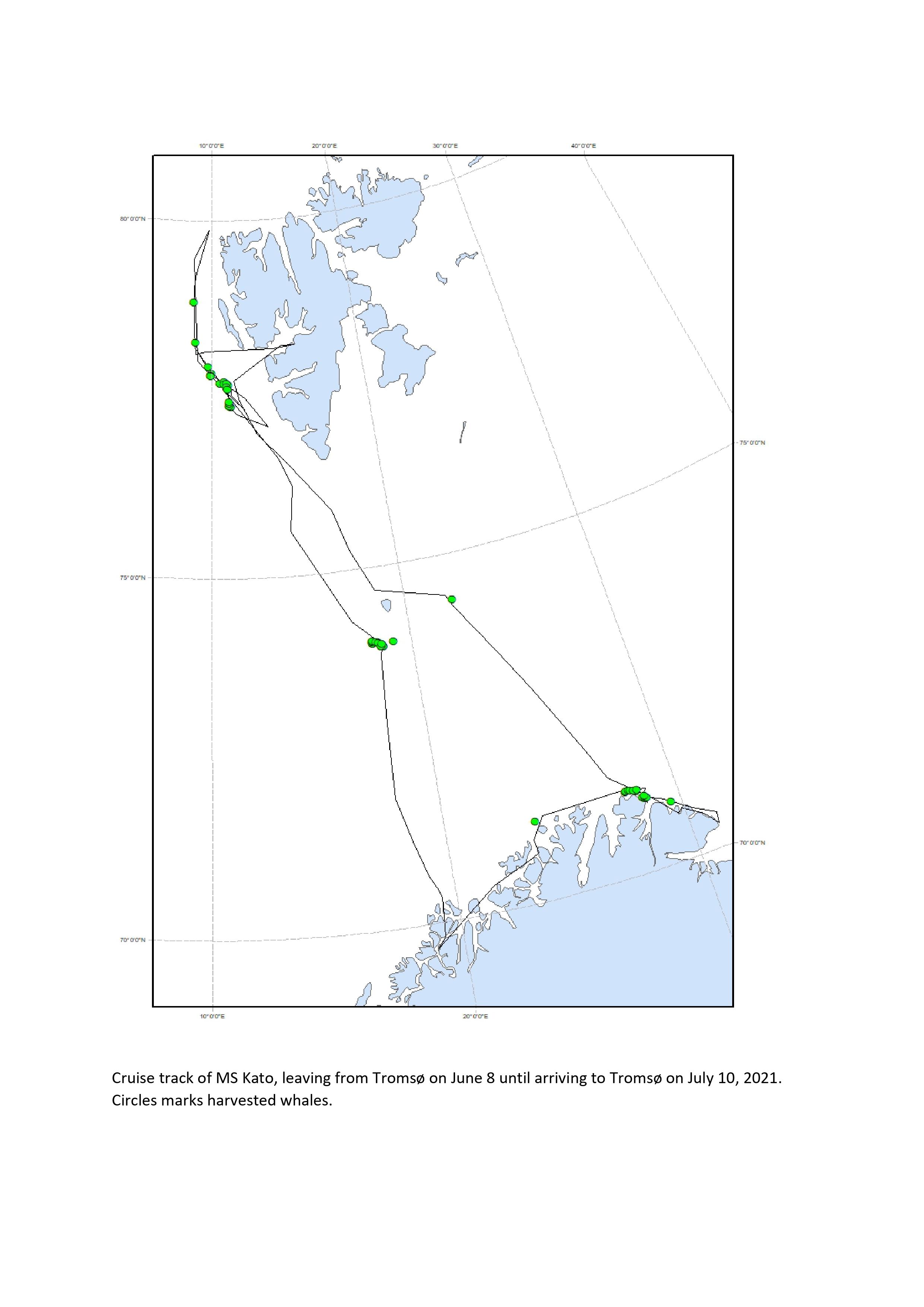
| 2021813 | 05/06 - 29/06 | The main purpose of the cruise was to obtain data for ecological monitoring of the minke whale stock. Samples were collected for the project Arven etter Nansen, with special focus on diet and dietary changes over time. Diets (stomach content): fatty acids (blubber, muscle, liver): stable isotopes (blubber, muscle, liver, eye, baleens): pollutants (blubber, muscle, liver), fertility (ovaries): age determination (eye and baleens): nutrients and micronutrients (faeces and urine). There was a complete sampling from all whales. All material was frozen to be analysed later. | Norwegian Sea | - | - |
| 2021824 | 7/6 - 1/8 | The objective of the cruise is to collect sightings information for estimating abundance of whales, especially minke whales, as part of a long-term survey program to cover the Northeast Atlantic over the years 2020-2025. The survey vessel has followed predetermined tracklines on which observations of whales have been recorded by dedicated observers. Data collected for each observation include: Species, position, position relative to vessel, weather data and other covariates. In total, around 2600 nautical miles were surveyed in the waters around Jan Mayen. Combined for the two platforms, 85 minke whale observations were recorded. Other species recorded were fin whale (31 observations), blue whale (6 observations), sei whale (3 observations), humpback whale (26 observations), harbor porpoise (2 observations), killer whales (18 observations), white-beaked dolphin (6 observations), pilot whale (2 observations), Northern bottlenose whale (67 observations) and sperm whale (25 observations). | Norwegian Sea | - | - |
| 2021853 | 23/06 - 24/06 | Klargjøre og teste deep vision (DV) stereo-kamerasystem til makrell-økosystemtoktet. Sikre at håndtering inkludert av og påmontering i trålen og utsetting og ombortaking fungerer bra. Sikre at DV ikke påvirker trålgeometri og andre trålegenskaper. I tillegg er målet å gi praktisk opplæring i bruk av DV på HI tokt. | Norwegian Sea | - | - |
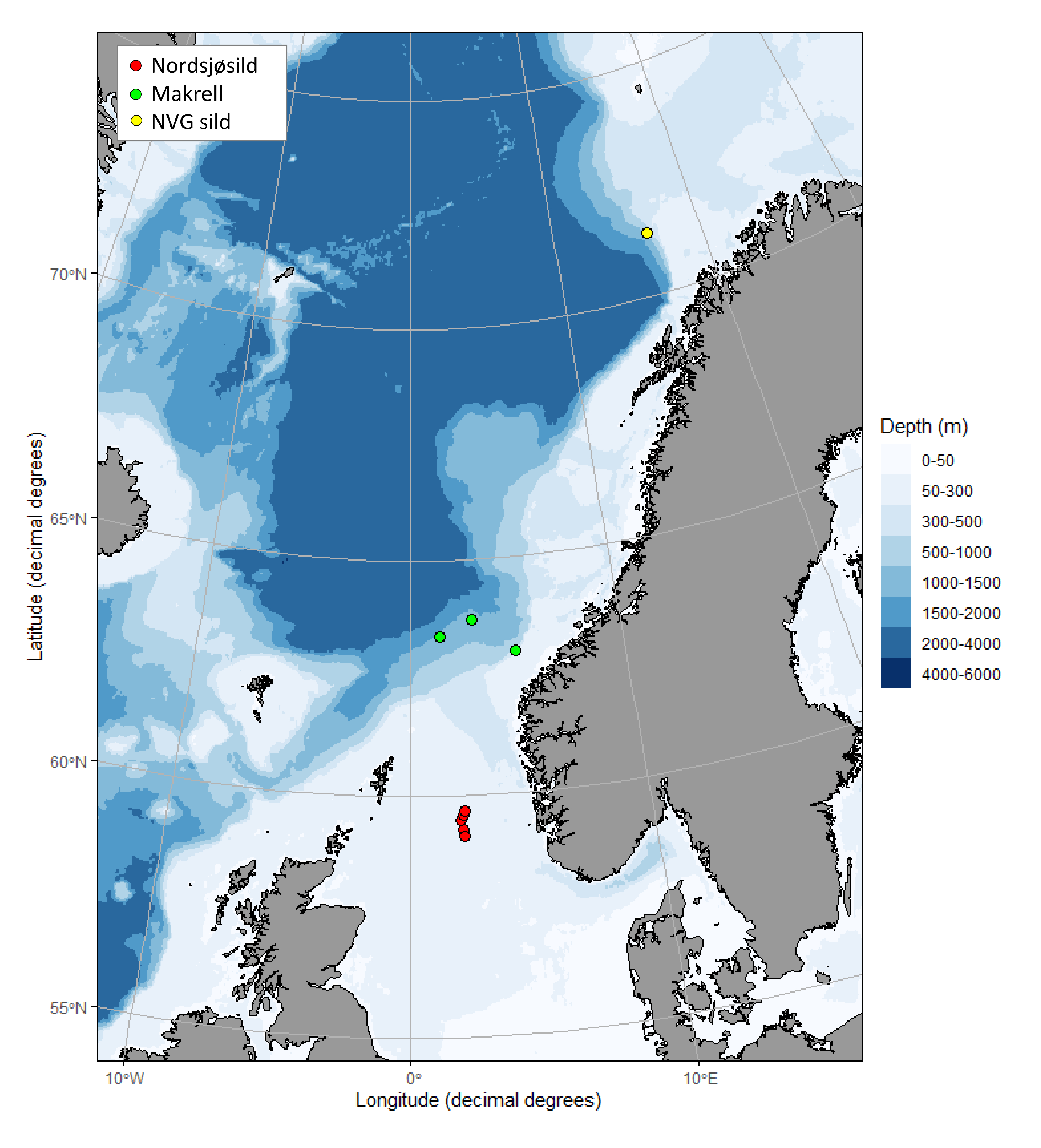
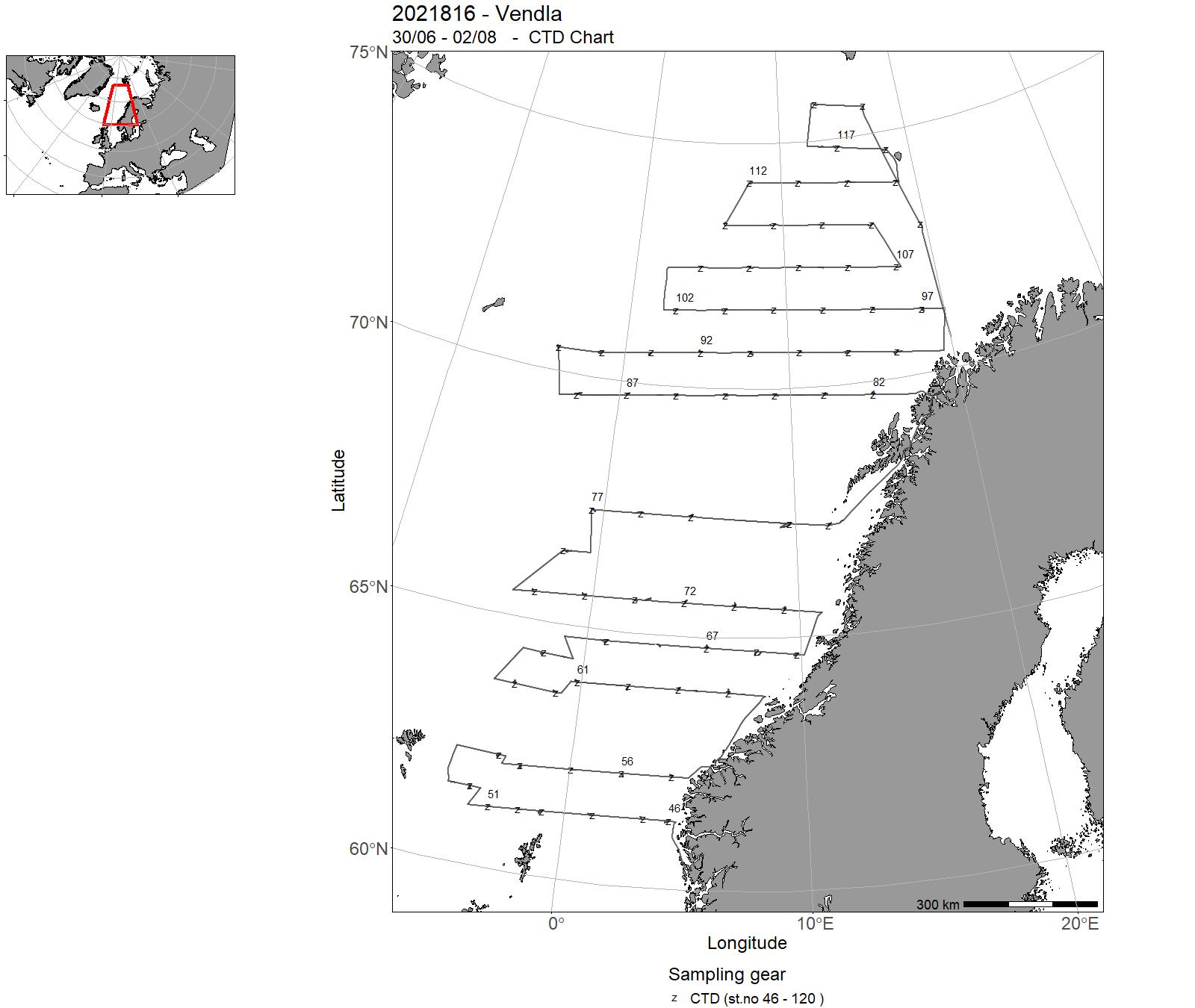
| 2021816 | 30/06 - 02/08 | Primary objectives:Large-scale mapping and abundance estimation of Northeast Atlantic (NEA) mackerel, Norwegian Spring-Spawning (NSS) herring and Atlantic blue whiting. Swept area trawling for mackerel and acoustic recordings and trawling for NSS herring and blue whiting. Secondary objectives: Mapping distribution of Atlantic salmon, lumpfish and other pelagic species. Sampling of zooplankton and water temperature/salinity profiles. Tagging of 100 lumpfish. Opportunistic marine mammals observations along the transects and survey lines. | Norwegian Sea | 46 - 120 | 54 - 149 |
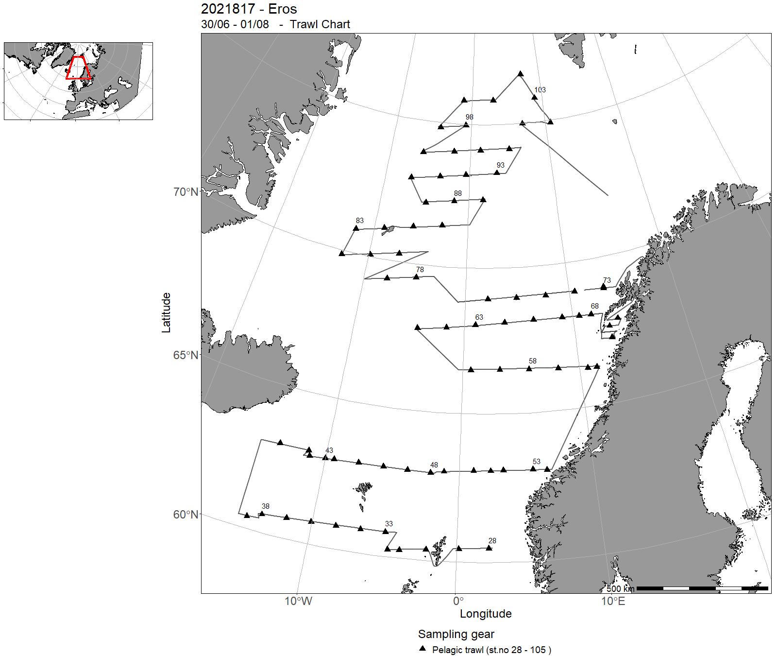
| 2021817 | 30/06 - 01/08 | Primary objectives: Large-scale mapping and abundance estimation of Northeast Atlantic (NEA) mackerel, Norwegian Spring-Spawning (NSS) herring and Atlantic blue whiting. Swept area trawling for mackerel and acoustic recordings and trawling for NSS herring and blue whiting. Secondary objectives: Mapping distribution of Atlantic salmon, lumpfish and other pelagic species. Sampling of zooplankton and water temperature/salinity profiles. Tagging of 100 lumpfish. Genetic sampling of herring populations. Opportunistic marine mammals observations along the transects and survey lines. | Norwegian Sea | 15 - 87 | 28 - 105 |
| 0154_2021_UFJN_VILN | 12/08 - 25/09 | - | - | - | - |
| 2021810 | 31/08 - 04/09 | Survey of potentially human pathogenic anisakid nematodes and other important parasites (i.e. Ichthyophonus, Kudoa and didymozoid trematodes) of Atlantic mackerel intended for human consumption. | Norwegian Sea | - | - |
| 2021852 | 31/08 - 13/09 | Collect echo sounder broadband data from mackerel during comercial operations. Project name: Center for Research Based Innovation in Marine Acoustic Abundance Estimation and Backscatter Classification. Coordinating body: Institute of Marine Research, Norway | North Sea | - | - |
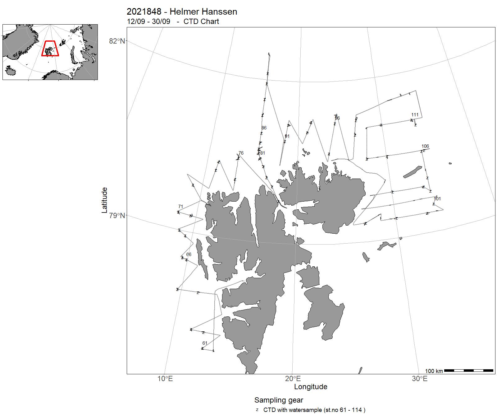
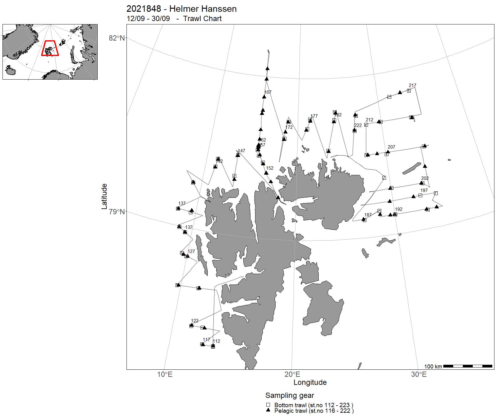
| 2021848 | 12/09 - 30/09 | This cruise is part of a multi-purpose ecosystem survey in the Barents Sea, done by several research vessels and carried out jointly by Norway and Russia. The objectives were to collect data at several trophic levels: phyto- and zooplankton, benthos, pelagic invertebrates, fish, and marine mammals. In addition, hydrography, water chemistry and physics, and acoustics were monitored. Two sections (Hinlopen and the northernmost part of Vardø-Nord) were covered. Project name: BESS - Barents Sea Ecosystem Survey Coordinating body: IMR (Norway) and PINRO (Murmansk, Russia) | Svalbardsonen | 61 - 114 | 112 - 223 |
| 2021856 | 28/09 - 01/10 | Tidsserie med trollgarn på grunnt vatn, Ryfylke - Florø, del Austevoll | - | - | - |
| 2021815 | 3/10 - 13/10 | Methodological survey to evaluate best acoustic methods for detection, identification and quantification of bluefin tuna in Norwegian waters. Project name: Acoustic and visual monitoring of BFT in Norwegian waters Coordinating body: Institute of Marine Research, Norway | Norwegian Sea | - | - |
| 2021857 | 04/10 - 07/10 | Prøvefiske på grunt vatn med trollgarn. Oktober 2021 | - | - | - |
| 2021855 | 18/10 - 22/10 | Innsamling av biologiske data på sjøkrepsbestanden i Frohavet, et viktig sjøkrepsområde (lengde, modning, kjønnsfordeling). Merkeforsøk for undersøkelser av vandring og estimering av vekst og overlevelse. Det arbeides med å få etablert et marint verneområde for sjøkreps i Frohavet, og data samles inn både fra et potensielt verneområde (før-data) og et kontrollområde. | North Sea | - | - |
| 2021841 | 18/10 - 31/10 | Gill-net survey in shallow waters along the coast. Main objective is to monitor the abundance of cod and other species in the coastal region. | North Sea | - | - |
| 2021811 | 31/10 - 04/11 | 2021-FRES-004: Kartlegging av forekomst og ditto endringer av humanpatogene og kvalitetsreduserende parasitter hos NVG-sild, med hovedvekt på kveis med de to aktuelle Anisakis-artene A. simplex og A. pegreffii, i tillegg til "sildesoppen" Ichthyophonus sp. | Norwegian Sea | - | - |
| 2021854 | 15/11 - 30/11 | 1) Undersøke nåværende utbredelse til dypvannsreke og kysttorsk på rekefelt i vestlandsfjordene, 2) oppnå estimater (med usikkerhet) av biomasse og mengde av dypvannsreke og bunnfisk, 3) kartlegge bunndyr som blir berørt av reketrål og 4) samle inn oseanografiske data (temperatur, saltholdighet og O2-innhold i bunnvannet). | Norwegian Sea | - | - |
| 2021819 | 18/11 - 09/12 | 2021-NOR-011: Merking og utsetting av Nvg-sild med RFID-teknologi i overvintringsområdene | Norwegian Sea | - | - |
13 - Hired vessels – Charts for hired vessels 2021


14 - "Dr. Fridtjof Nansen" – Cruises 2021
| Cruise No | Period | Purpose | Area | CTD st.no | Trawl st.no |
| 2021451 | 22/1 - 24/1 | Calibrate acoustics. Project name: Mesopelagic project Coordinating body: IMR | North Sea | - | - |
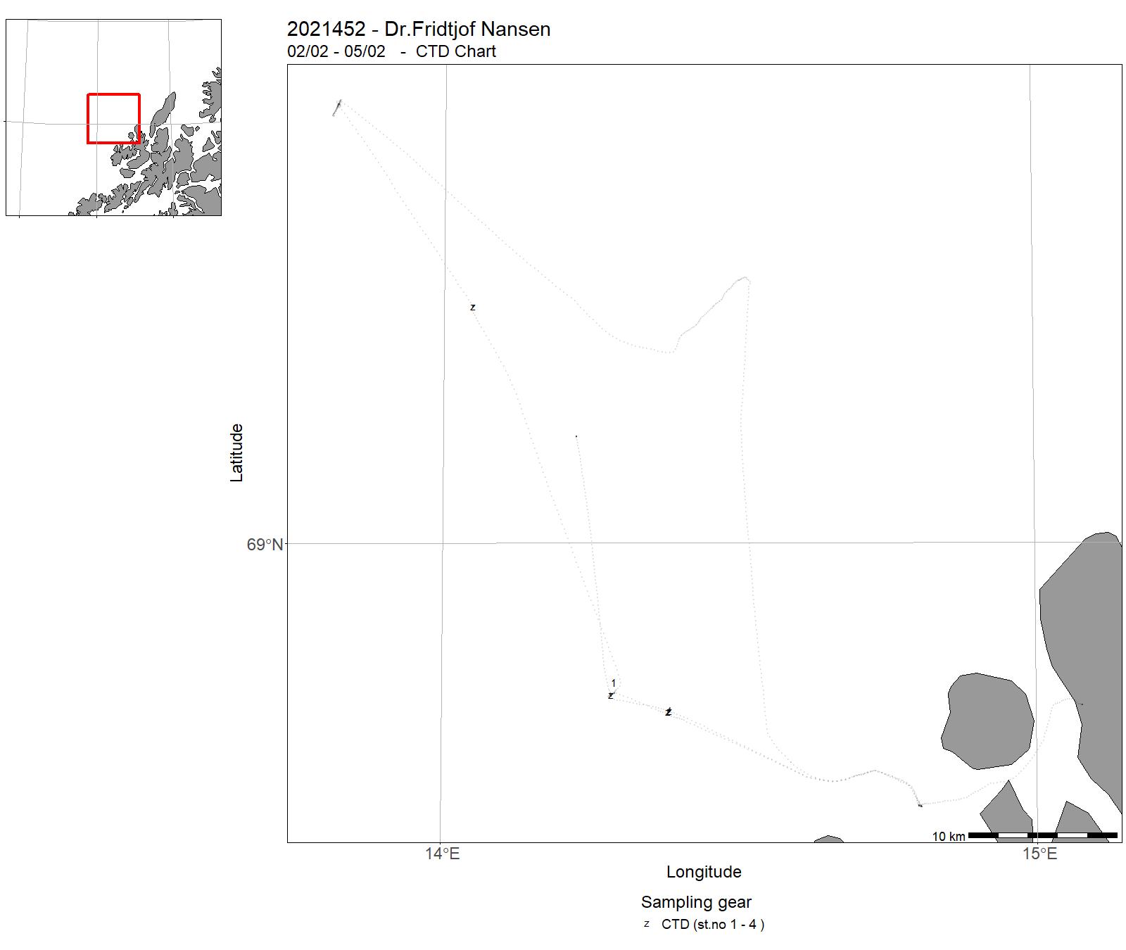
| 2021452 | 02/02 - 05/02 | 1. Installation of ocean observatory platforms 2. Retrievial of ocean observatory platforms | Norwegian Sea | 1 - 4 | - |
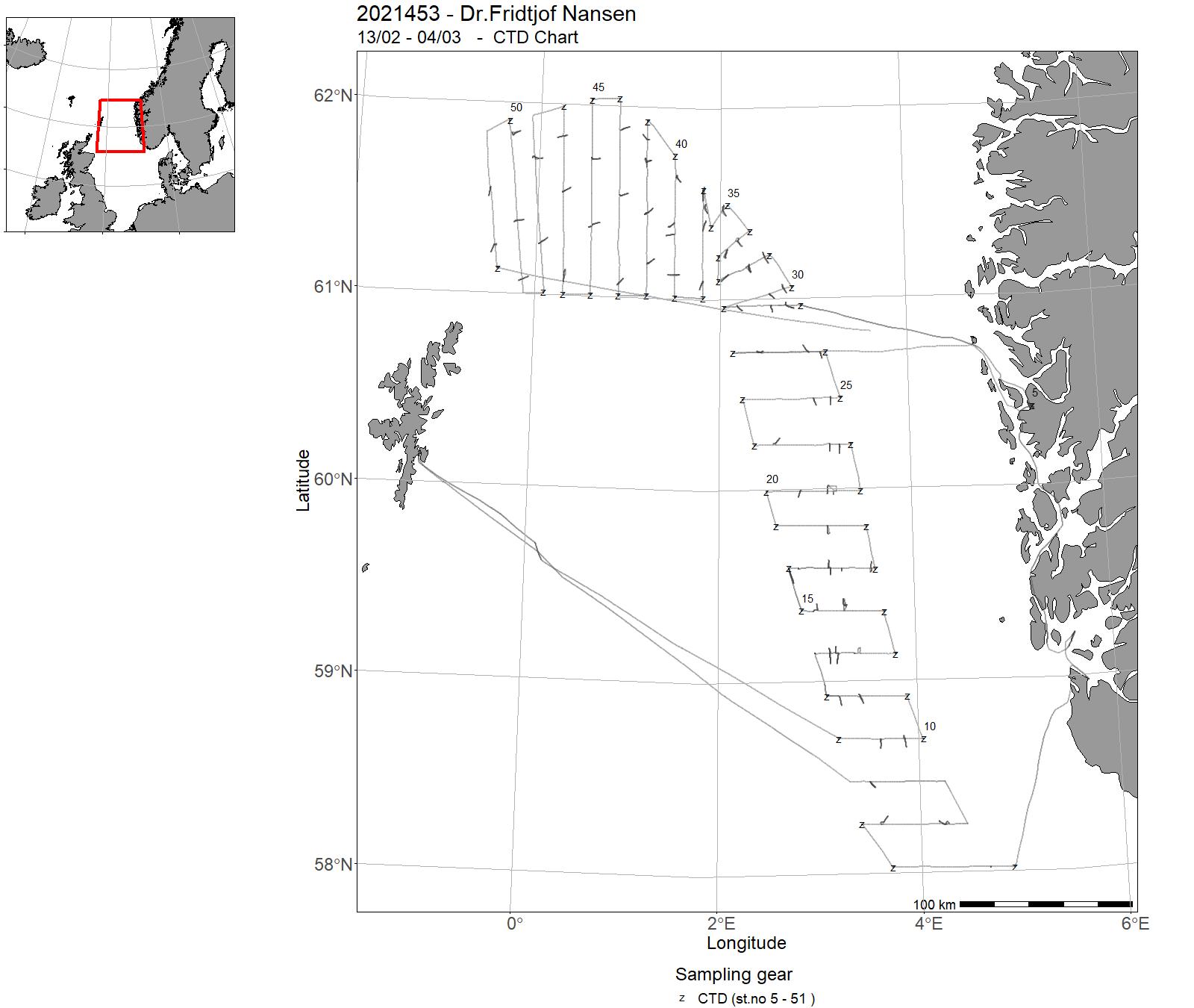
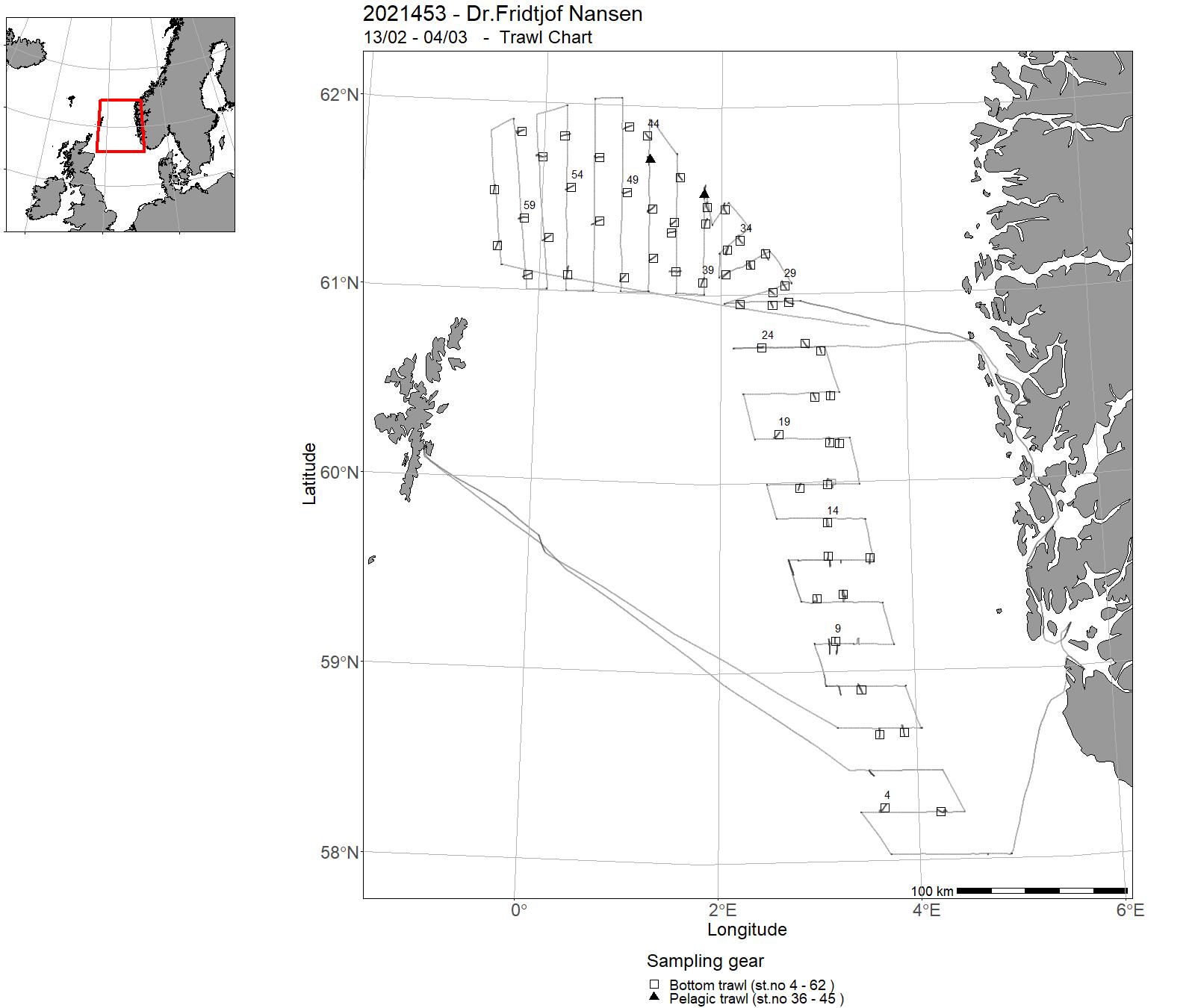
| 2021453 | 13/02 - 04/03 | Acoustic survey of saithe during the spawning period, at time of year when saithe spawning stock (SSB) are highly aggregated. Survey to be used in assessment after 5 years (ICES regulation). Project name: Population estimates of demersal fish stocks in North Sea Coordinating body: Institute of Marine Research | North Sea | 5 - 51 | 4 - 62 |
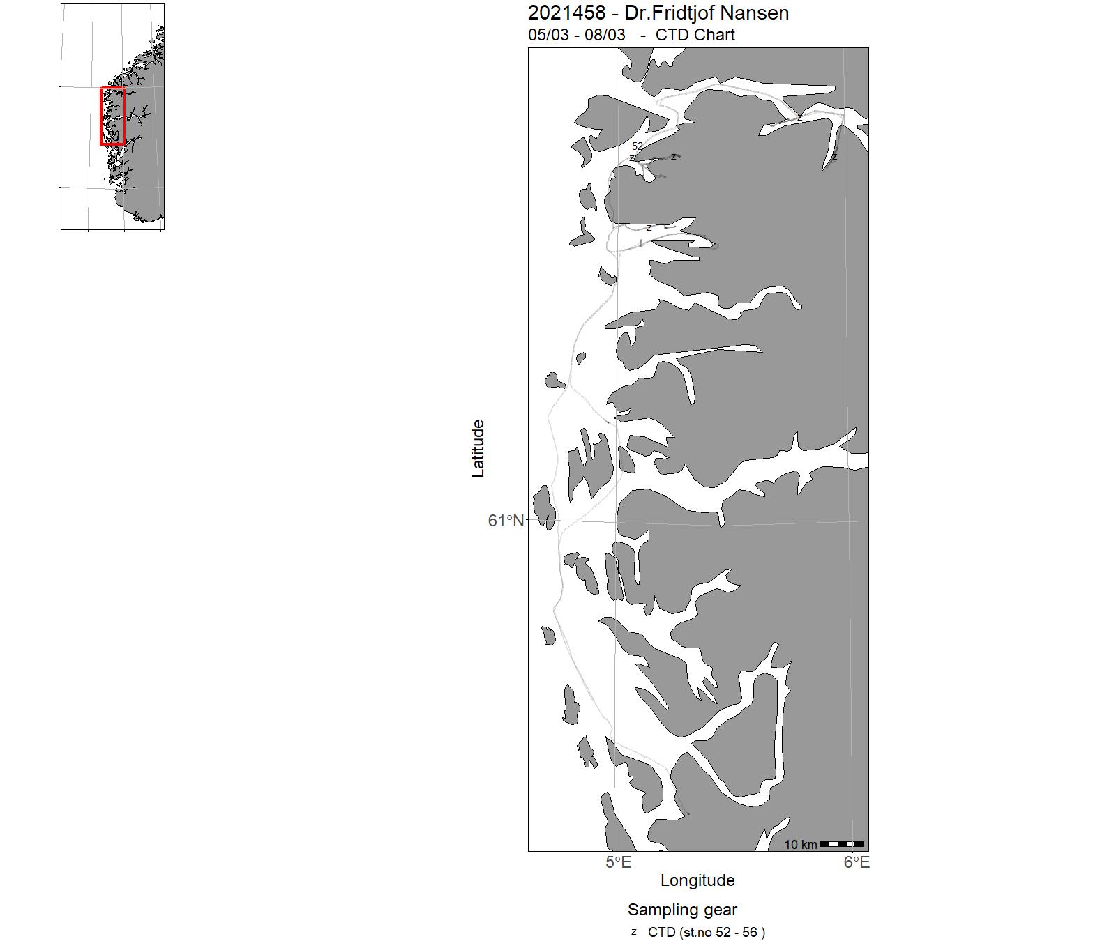
| 2021458 | 05/03 - 08/03 | The marine geological survey is a UiBs training course for students within marine geology and marine geophysics: The GEOV231 marine geological field course aims to demonstrate how acquisition and processing of seismic data and sea bottom sample data takes place and give students practical experience in marine-geological/geophysical methods and laboratory investigations. It also aims to create an understanding of how field studies can be utilized to understand geological processes in marine environment. | Norwegian Sea | 52 - 56 | - |
| 2021457 | 08/03 - 10/03 | The main objectives of the cruise are training of instrument technicians in operating the Video Assisted Multi Sampler VAMS, both at stations using the grabs and at transect flying the ROV. | Norwegian Sea | - | - |
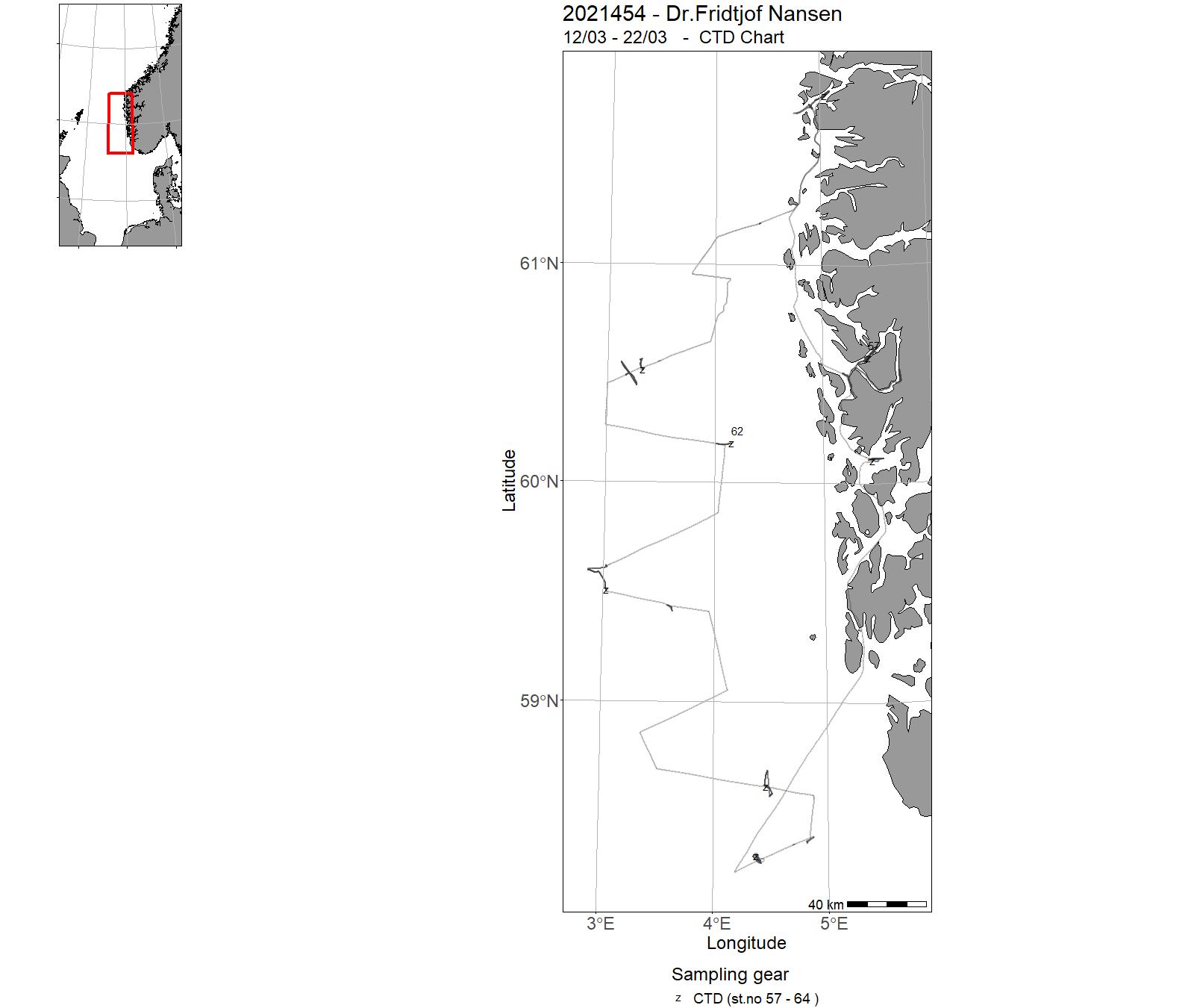
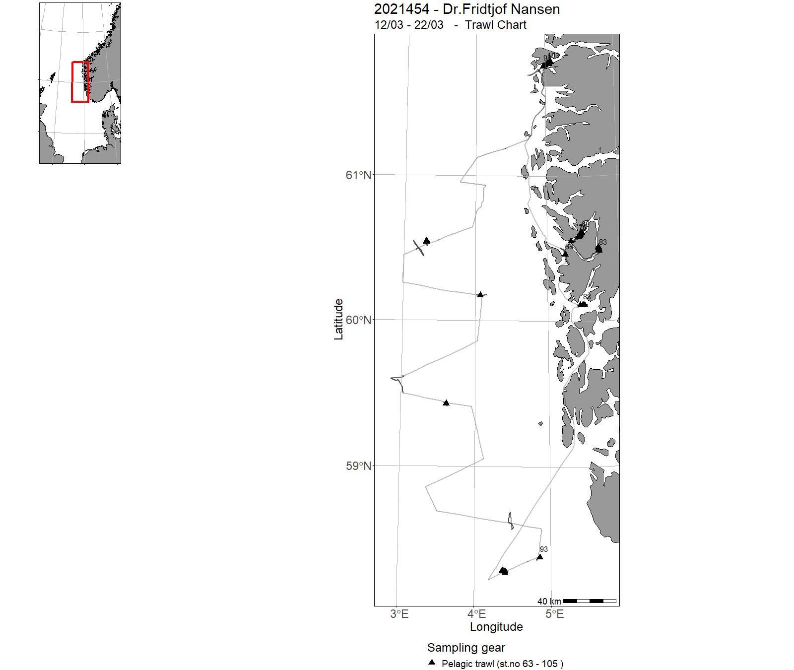
| 2021454 | 12/03 - 22/03 | Compare mesopelagic trawls Study avoidans from trawls Conduct acoustic trawl survey of Maurolicus in the North Sea Project name: Mesopegaic project Coordinating body: IMR | - | 57 - 64 | 63 - 105 |
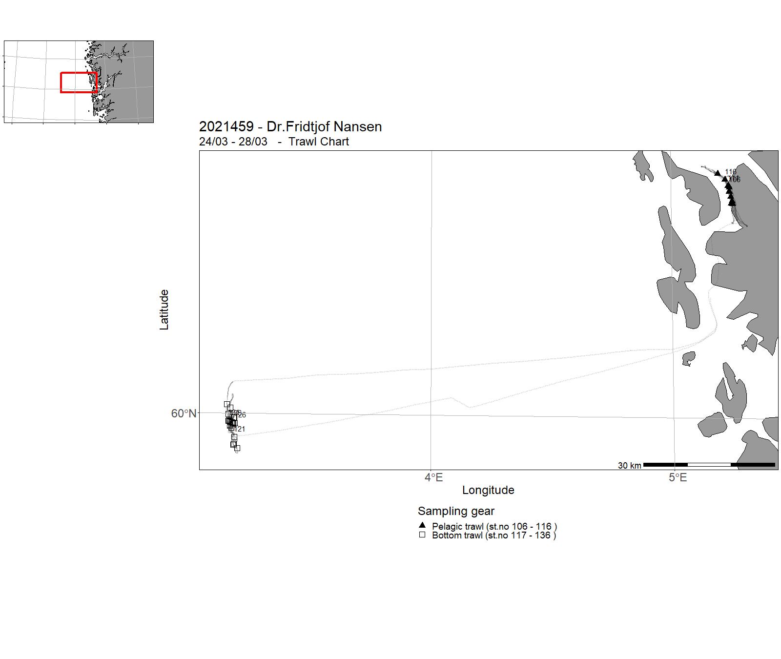
| 2021459 | 24/03 - 28/03 | 1) Teste ut Multpelt 832 pelagisktrål som brukt på makrell-økosystemtokt i Norskehavet om sommeren med Deep Vision kamera system for å sikre at Deep Vision ikke påvirker trålens geometri. Også teste ut sorteringsmekanisme for Deep Vision. 2) Teste Gisund super bunntrål med endret rigging av fløyt i overtelne. Etablere mål for Gisund super trålens geometri (åpningshøyde, dørspredning) under sjøtesting for å ferdigstille trålmanual | - | - | 106 - 136 |
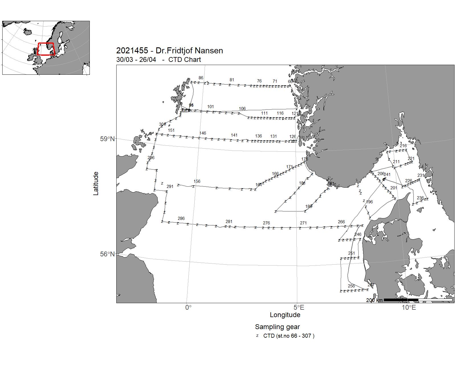
| 2021455 | 30/03 - 26/04 | The North Sea Ecosystem spring cruise has been run since 2010 by the Institute of Marine Research (IMR) as a multi-purpose survey. The cruise covers hydrography, chemistry, phytoplankton and zooplankton as well as fish eggs and fish larvae . The cruise also includes monitoring of radioactive contamination. The survey area of the North Sea Ecosystem cruise 2020 includes northern North Sea and the Skagerrak (57-60.8oN, 2.2oW- 8.6oE). Sampling were made at pre-selected stations on the IMR standard hydrographic transects. The cruise provides horizontal and vertical distributions of physical oceanographic parameters, chemistry, phytoplankton and zooplankton in the northern North Sea, Skagerrak and Kattegat. The cruise also provides depth integrated distribution of fish eggs and larvae that can be related to the zooplankton and physical oceanographic data from the standard sections. | North Sea | 66 - 307 | - |
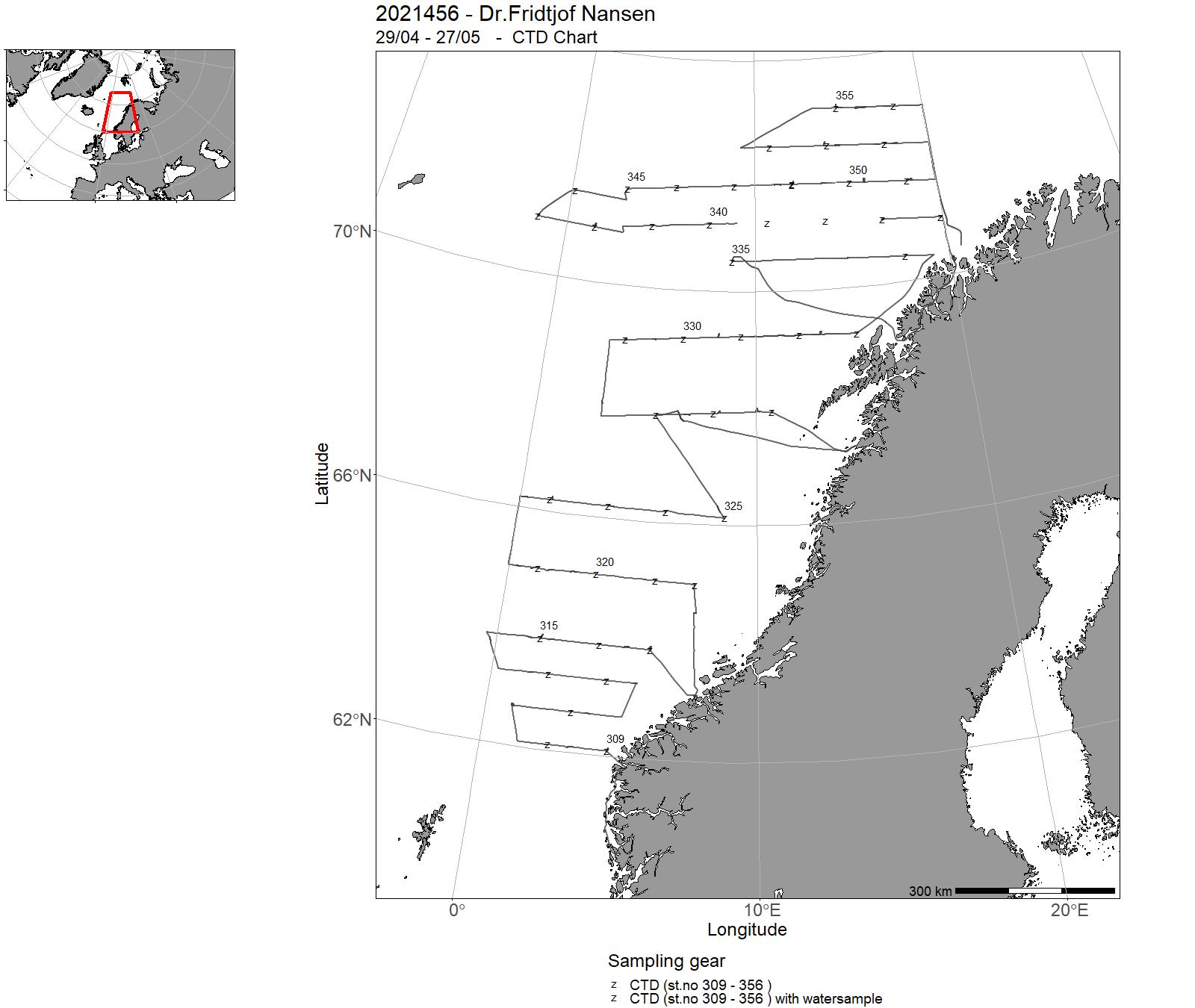
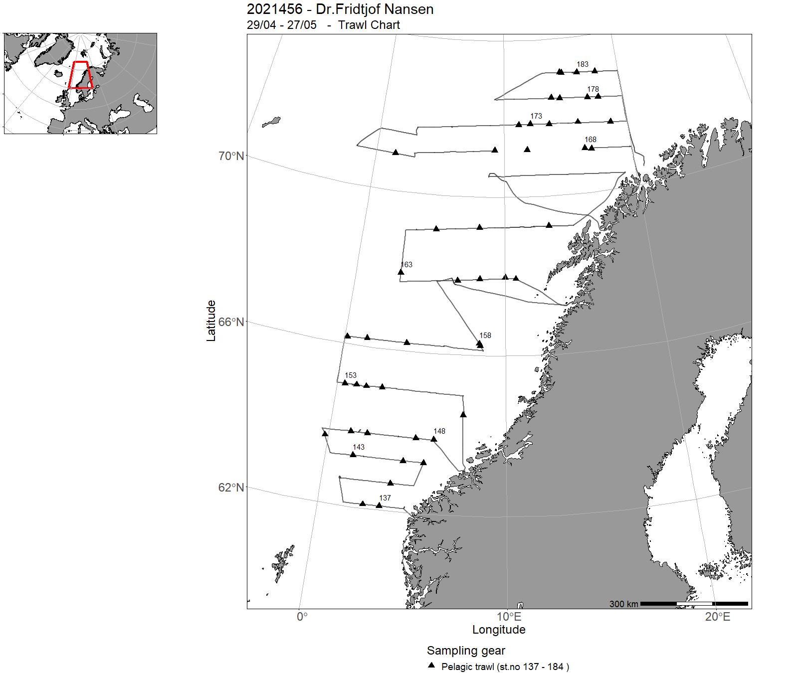
| 2021456 | 29/04 - 27/05 | Provide acoustic estimates of abundance and distribution of pelagic species in the Norwegian Sea. Collect data on hydrography and plankton in the Nowegian Sea. | Norwegian Sea | 309 - 356 | 137 - 184 |
| 2021402 | 16/07 - 29/07 | Cancelled | - | - | - |
| 2021403 | 01/08 - 17/08 | Cancelled | - | - | - |
| 2021404 | 21/08 - 20/09 | Cancelled | - | - | - |
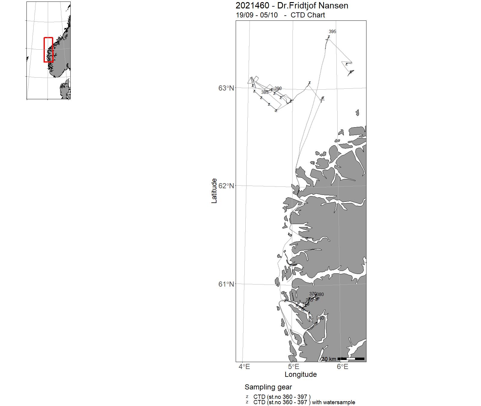
| 2021460 | 19/09 - 05/10 | Training course in Ocean Science (BIO325): The survey collected samples in West Norwegian fjords (Byfjord, Masfjord, Fensfjord, Åfjorde and Førdefjorden), and on the Møre plateau North of Ålesund, down to 1000m. The equipment used was: Demersal campelen 1800 trawl. Åkra Pelagic trawl 320 with MultiSampler (3 cod-ends) Åkra Pelagic trawl with one codend Deep-Vision Multinet Spectroradiometer Acoustics CTD Grab Longlines Traps | North Sea | 360 - 397 | 188 - 237 |
| 2021405 | 23/09 - 19/10 | Cancelled | - | - | - |
| 2021401 | 22/10 - 16/11 | Leg 1 Bottom habitat studies NW Africa, incl calibration of echosounders | Atlantic Ocean | - | - |
| 2021406 | 24/10 - 16/11 | Cancelled | - | - | - |
| 2021407 | 19/11 - 13/12 | The overall objectives of the surveys were as follows: Obtain an assessment of the demersal and pelagic resources of the continental shelf and upper slope. In addition, to determine distribution and abundance of demersal and pelagic species and communities, and collecting biological samples as specified below. Sampling was also carried out to determine oceanographic conditions (physical, chemical and biological), as well as sampling for microplastics, recording the occurrence of marine debris and mapping of nutrients and contaminants in commercial fish, regarding food safety. | Atlantic Ocean | - | - |
15 - "Dr. Fridtjof Nansen" Charts for 2021

16 - "Statsraad Lehmkuhl" - Cruises 2021
| Cruise No | Period | Purpose | Area | CTD st.no | Trawl st.no | Fig. no |
|---|---|---|---|---|---|---|
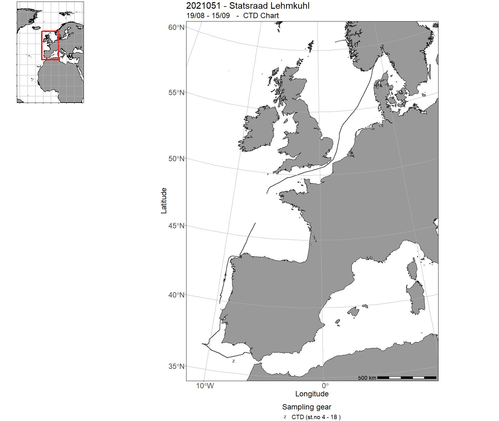
| 2021051 | 19/08 - 15/09 | One Ocean Expedition - Leg 1 | Atlantic Ocean | 4 - 18 | - | |
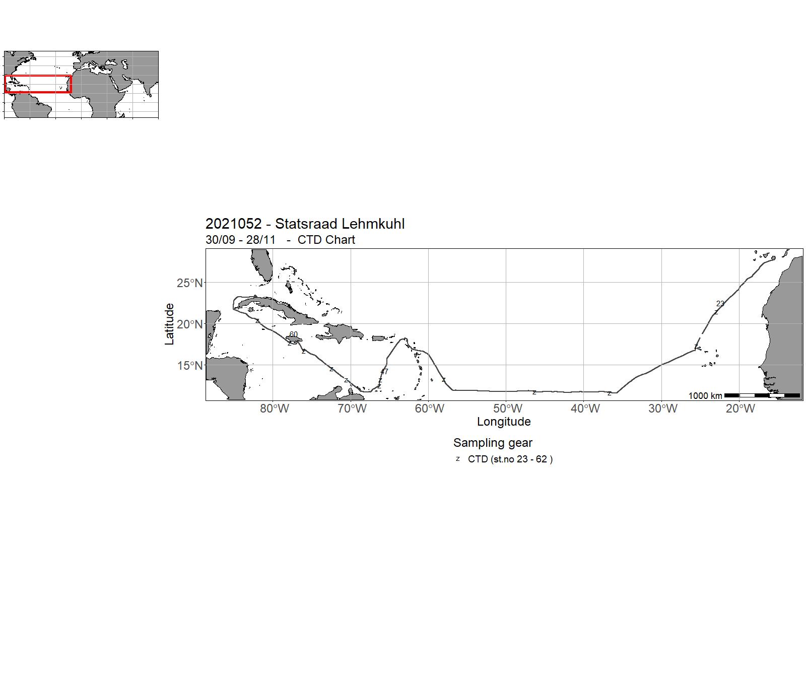
| 2021052 | 30/09 - 28/11 | One Ocean Expedition - Leg 2 | Atlantic Ocean | 23 - 62 | - | |
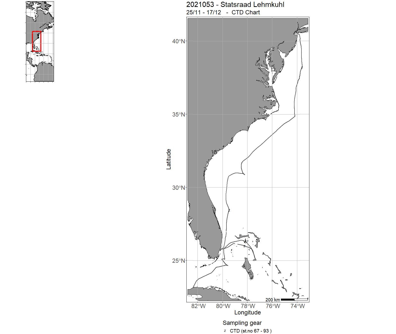
| 2021053 | 25/11 - 17/12 | One Ocean Expedition - Leg 3 | Caribbean | 67 - 93 | - |
17 - "Statsraad Lehmkuhl" Charts for 2021
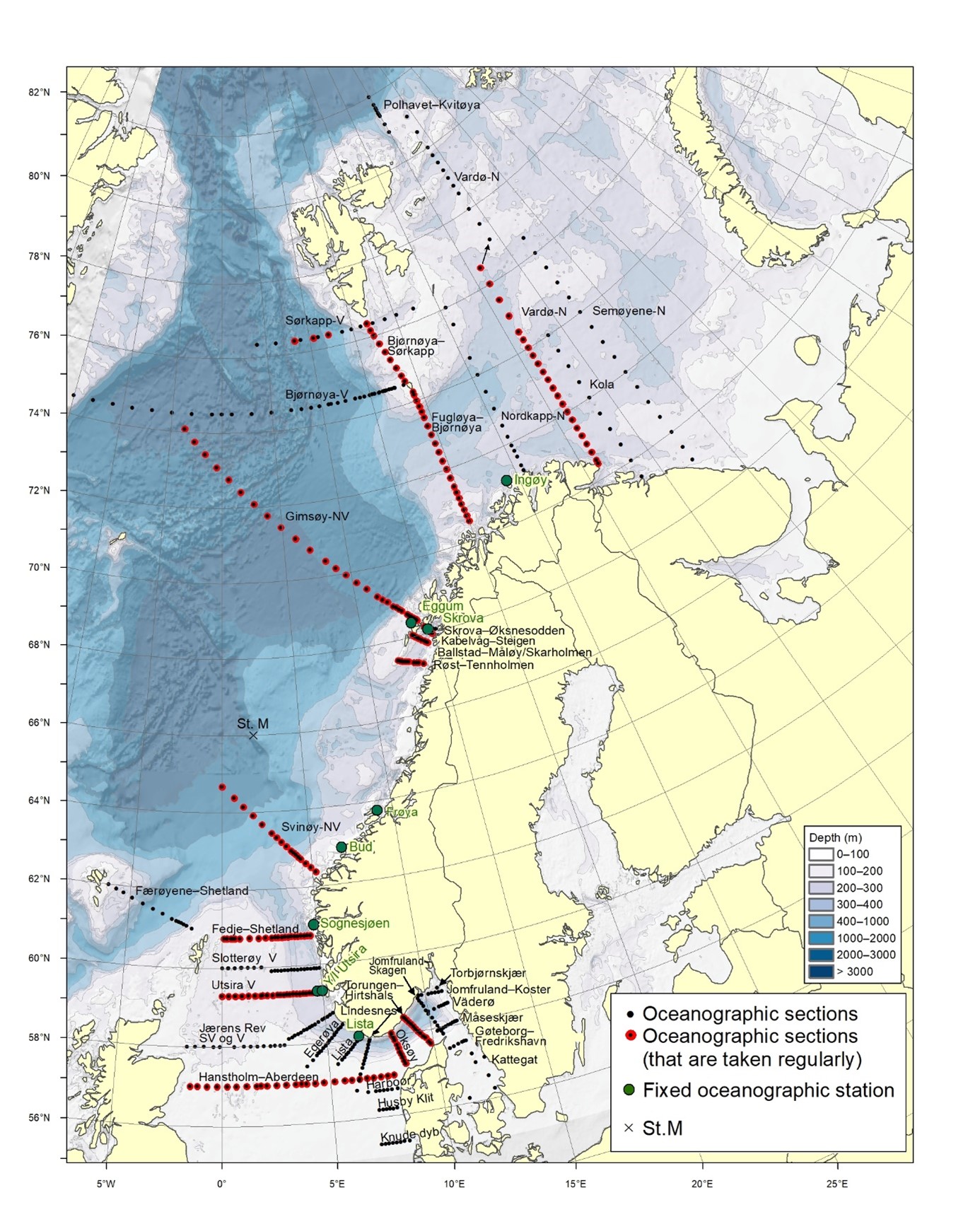
18 - Oceanographic sections and Fixed oceanographic stations map
19 - Tables – Observations in 2021. Oceanographic sections and fixed oceanographic stations
|
Oceanogr. sec |
Jan |
Feb |
Mar |
Apr |
May |
Jun |
Jul |
Aug |
Sep |
Oct |
Nov |
Dec |
|
North Sea |
||||||||||||
|
Fedje– Shetland |
|
|
|
|
|
|
|
|
|
|
|
|
|
Slotterøy- West |
|
|
|
|
|
|
|
|
|
|
|
|
|
Utsira- West |
2021201 |
|
|
|
|
|
2021207 |
2021617 |
|
|
|
|
|
Jærens Rev- SW and W |
|
|
|
|
|
|
|
|
|
|
|
|
|
Egerøya- SW |
2021201 |
|
|
|
|
|
|
|
|
|
|
|
|
Lista- SW |
|
|
|
|
|
|
|
|
|
|
|
|
|
Lindesnes- SSW |
|
|
|
|
|
|
|
|
|
|
|
|
|
Hanstholm– Aberdeen |
2021201 |
|
|
|
|
|
|
2021617 |
|
|
|
|
|
Harboør |
|
|
|
|
|
|
|
|
|
|
|
|
|
Hysby Klit |
|
|
|
|
|
|
|
|
|
|
|
|
|
Knude-Dyb |
|
|
|
|
|
|
|
|
|
|
|
|
|
Oceanogr. sec |
Jan |
Feb |
Mar |
Apr |
May |
Jun |
Jul |
Aug |
Sep |
Oct |
Nov |
Dec |
|
Skagerrak and Kattegat |
||||||||||||
|
Torungen– Hirtshals |
2021301 |
2021302 |
2021303 |
2021305 |
2021306 |
2021307 |
2021308 |
2021309 |
2021317 |
2021313 |
2021314 |
2021316 |
|
Oksøy– Hanstholm |
|
|
|
|
|
|
|
|
|
|
|
|
|
Jomfruland– Skagen |
|
|
|
|
|
|
|
|
|
|
|
|
|
Jomfruland– Koster |
|
|
|
|
|
|
|
|
|
|
|
|
|
Torbjørnskjær |
|
|
|
|
|
|
|
|
|
|
|
|
|
Väderø |
|
|
|
|
|
|
|
|
|
|
|
|
|
Måseskjær |
|
|
|
|
|
|
|
|
|
|
|
|
|
Gøteborg– Fredrikshavn |
|
|
|
|
|
|
|
|
|
|
|
|
|
Kattegat |
|
|
|
|
|
|
|
|
|
|
|
|
|
Oceanogr. sec |
Jan |
Feb |
Mar |
Apr |
May |
Jun |
Jul |
Aug |
Sep |
Oct |
Nov |
Dec |
|
The Norwegian Sea and Vestfjorden |
||||||||||||
|
Svinøy- North/West |
2021202 |
|
2021606 |
|
2021205 |
|
2021106 /208 |
|
|
|
2021212 |
|
|
Gimsøy- North/West |
|
|
2021606 |
2021205 |
|
|
2021106 |
2021208 |
|
|
2021212 |
|
|
Bjørnøya- West |
|
|
2021606 |
2021205 |
|
|
|
2021208 |
|
|
|
2021212 |
|
Sørkapp- West |
|
|
|
|
|
|
|
|
|
|
|
|
|
Færøyene– Shetland |
|
|
|
|
|
|
|
|
|
|
|
|
|
Skrova– Øksnesodden |
|
|
|
|
|
|
|
|
|
|
|
|
|
Kabelvåg– Steigen |
|
|
|
|
|
|
|
|
|
|
|
|
|
Ballstad– Måløy /Skarholmen |
|
|
|
|
|
|
|
|
|
|
|
|
|
Røst– Tennholmen |
|
|
|
|
|
|
|
|
|
|
|
|
|
Oceanogr. sec |
Jan |
Feb |
Mar |
Apr |
May |
Jun |
Jul |
Aug |
Sep |
Oct |
Nov |
Dec |
|
The Barents Sea |
||||||||||||
|
Fugløya– Bjørnøya |
2021202 |
|
2021606 |
2021205 |
|
|
|
2021208 |
|
|
|
|
|
Vardø- North |
|
|
2021203 |
|
|
|
|
|
2021209 |
|
|
|
|
Semøyene- North |
|
|
|
|
|
|
|
|
|
|
|
|
|
Bjørnøya– Sørkapp |
|
|
|
|
|
|
|
|
|
|
|
|
|
Nordkapp- North |
|
|
|
|
|
|
|
|
|
|
|
|
|
Polhavet– Kvitøya |
|
|
|
|
|
|
|
|
|
|
|
|
|
Kola |
|
|
|
|
|
|
|
|
|
|
|
|
|
Fair Isle -Pentland
|
|
|
|
|
|
|
|
|
|
|
|
|
| Fixed stations | Jan | Feb | Mar | Apr | May | Jun | Jul | Aug | Sep | Oct | Nov | Dec | Total |
| LISTA N58º 05,1' E06º 32,5' | 3 | 3 | 3 | 3 | 3 | 3 | 3 | 3 | 3 | 3 | 3 | 3 | 36 |
| UTSIRA Y N59º 19' E04º 44' | 4 | 3 | 3 | 2 | 0 | 2 | 5 | 3 | 3 | 3 | 4 | 4 | 36 |
| UTSIRA I N59º 19'E04º 59' | 4 | 3 | 3 | 2 | 0 | 2 | 5 | 3 | 3 | 3 | 4 | 4 | 36 |
| SOGNESJØEN N61º 01' E04º 50' | 1 | 2 | 1 | 2 | 3 | 2 | 2 | 2 | 3 | 0 | 2 | 1 | 21 |
| BUD N62º 56' E06º 47' | 2 | 3 | 2 | 2 | 2 | 2 | 3 | 3 | 3 | 4 | 3 | 3 | 32 |
| SKROVA N68º 07' E14º 39' | 3 | 3 | 4 | 2 | 1 | 4 | 3 | 1 | 4 | 3 | 4 | 3 | 35 |
| EGGUM N68º 23' E13º 38' | 4 | 3 | 4 | 3 | 5 | 4 | 2 | 4 | 4 | 5 | 4 | 2 | 44 |
| INGØY N71º 08' E24º 01' | 1 | 2 | 1 | 2 | 2 | 2 | 2 | 2 | 2 | 0 | 2 | 2 | 20 |