The report gives an overview of cruises in 2018, by the Institute of Marine Research and University of Bergen, on board our research vessels and hired commercial vessels. Each cruise is described by a short description and a track chart mainly showing CTD, plankton and trawl stations. The coverage of the oceanographic sections is listed in a table. Another table shows the number of observations per month for the fixed stations. Meta data about the cruises are reported to the International Council for the Exploration of the Sea (ICES) using the form “Cruise Summary Report”: http://www.seadatanet.org/Metadata/CSR. Research data are available from the Norwegian Marine Data Centre at Institute of Marine Research. The charts can internally at IMR be downloaded from the Institute Intranet/Archive. Charts are made by Karen E. Gjertsen. Sebastian Bosgraaf made charts for “G.M.Dannevig”.
Report on cruises and data stations 2018
Rapportserie:
Fisken og havet 2019-1
ISSN: 1894-5031
Publisert: 30.04.2019
Oppdatert: 03.05.2019
Prosjektnr: 14417
Forskningsgruppe(r):
Norsk marint datasenter (NMD)
Program:
Kystøkosystemer,
Nordsjøen,
Norskehavet,
Barentshavet og Polhavet
Forskningsgruppeleder(e):
Helge Sagen (Norsk marint datasenter (NMD))
Godkjent av:
Forskningsdirektør(er):
Geir Huse
Programleder(e):
English summary
Sammendrag
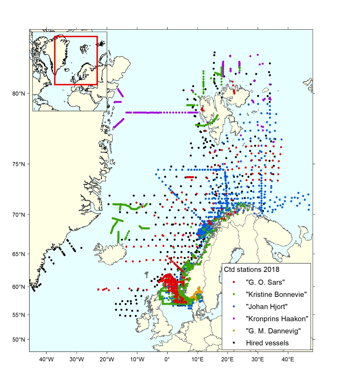
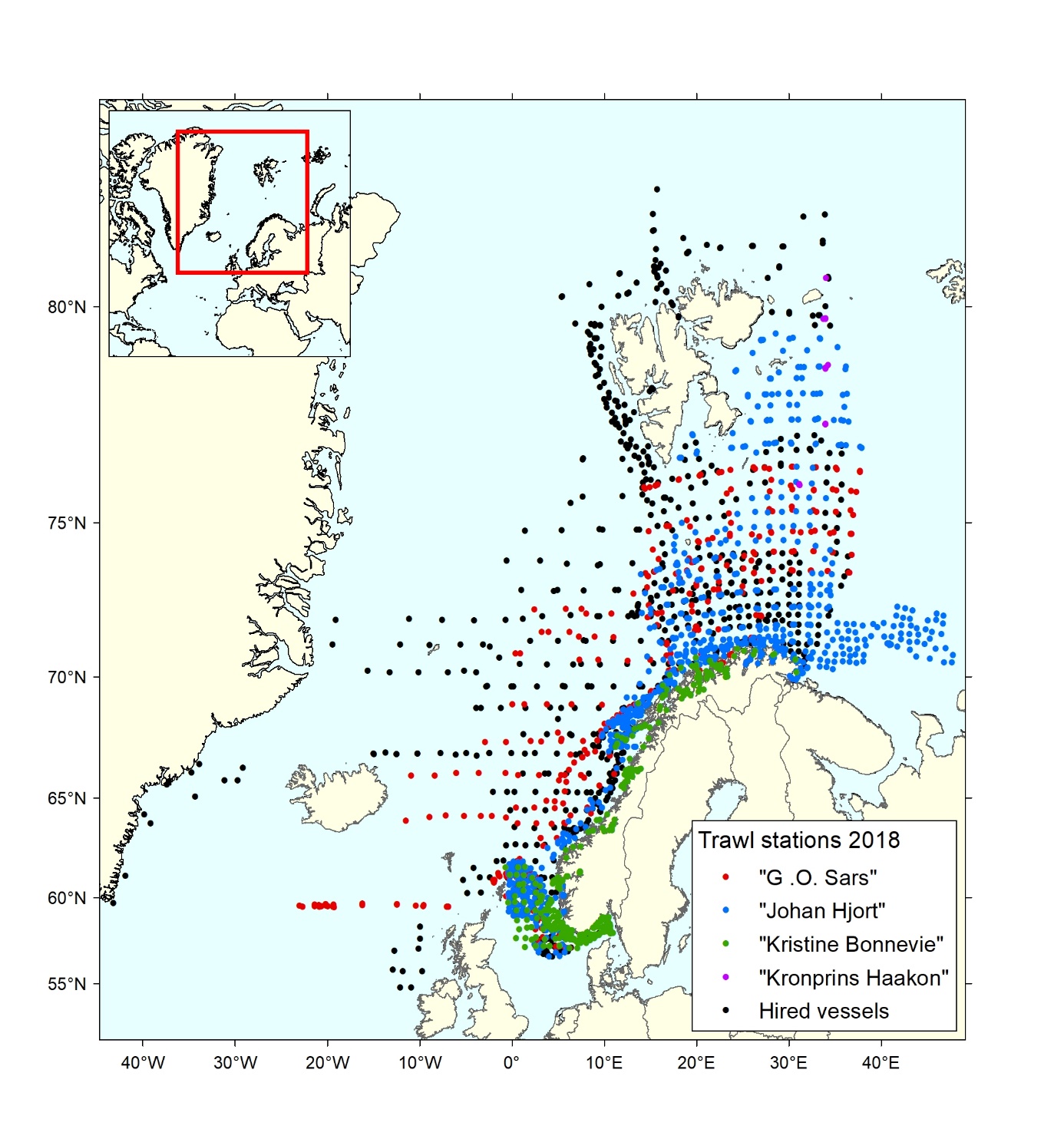
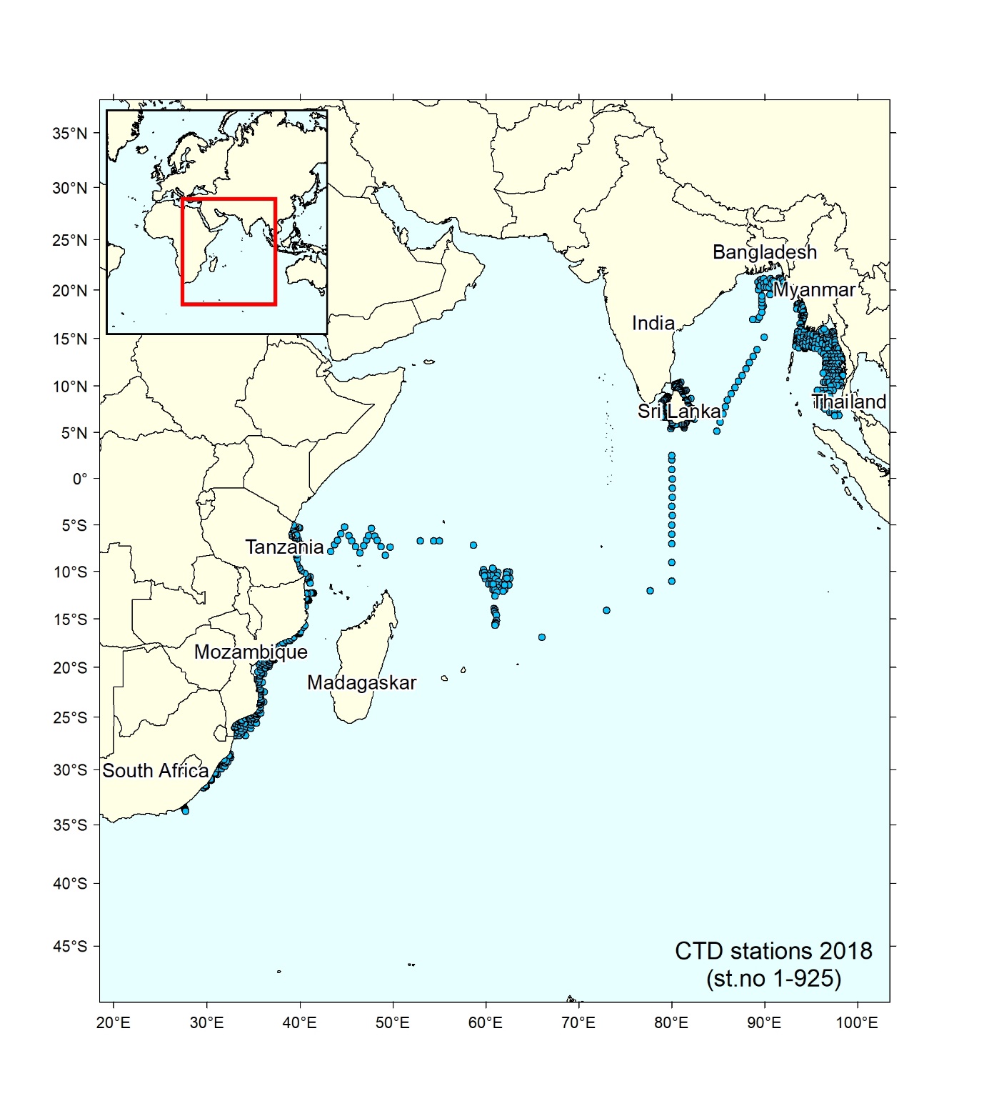
1 - Charts overview 2018 – CTD and trawl stations.
CTD and trawl stations 2018
Ctd stations 2018 “Dr. Fridtjof Nansen”
2 - "G. O. Sars" - (Ship code no 10). Cruises 2018.
| Cruise no | Period | Purpose | Area | CTD st.no | Trawl st.no | Fig. no |
| 2018101 | 1.1.-3.1. | The marine geological survey is a training course for students within marine geology and marine geophysics. | Norwegian fjords | 1-2 | - | 1 |
| 2018102 | 4.2.-2.3. | IBTS Q1 bottom trawl survey. | North Sea | 3-164 | 1-88 | 2-3 |
| 2018103 | 4.3.-19.3. | Spawning saithe acoustic survey. Objectives were to cover the northern North Sea shelf edge and West of Shetland during a joint acoustic survey with Germany. Collected standard acoustic data + broadband from transects, and collect biological information on target identification and species compositions. Tested use of GOV + rockhopper (14ʺ bobbins). | North Sea | 165-197 | 89-145 | 4-5 |
| 2018104 | 20.3.-14.4. | Combined acoustic and bottom trawl survey along the continental shelf from 62°N to 74°N. Main target fish species are Greenland halibut, redfish and silver smelt. | Continental shelf from 62˚ north to 74˚ north. | 198-203 | 265-342 | 6-7 |
| 2018105 | 30.4.-2.5. | Provide acoustic estimates of abundance and distribution of pelagic species in the Norwegian Sea. | Norwegian Sea | 205-273 | 343-400 | 8-9 |
| 2018106 | 6.5.-24.6 | Biomass and diversity of the mesopelagic ecosystem. | North Atlantic Ocean | 274-286 | 401-436 | 10 |
| 2018107 | 28.6.-26.6. | C-DEEPSEA 2018. | Norwegian Sea | 287-294 | - | 11 |
| 2018108 | 28.7.-14.8. | SponGES - Deep-sea Sponge Grounds Ecosystems of the North Atlantic. | Norwegian Sea Barents Sea | 295-318 | - | 12 |
| 2018109 | 18.8.-5.9. | Sea bottom mapping with video-filming and sampling of benthic fauna and sediments at selected stations in the Kongsfjord and Rijpfjord, Svalbard. The main aim is mapping of benthic fauna, bio-diversity, habitat types, geological terrain-parameters and chemical pollution. The mapping was performed using visual seabed observation and sampling of sediments and organisms using a variety of sampling gears (video-rig, grab, box corer, multicorer, beam trawl and hyperbenthic sledge). | Barents Sea Svalbard area | 319-332 | - | 13 |
| 2018110 | 7.9.-30.9. | Annual ecosystem survey to monitor the status and changes of the Barents Sea ecosystem to support scientific research and management advice. | Barents Sea | 333-382 | 437-537 | 14-15 |
| 2018111 | 6.10.-20.10. | A) Training cruise in BIO 325 – Ocean Science: Applying Demersal Campelen 1800 trawl, Harstad-Pelagic trawl with Multisampler, MIK juvenile fish trawl,Maxi Multinet. B) Hydro acoustic surveying for biomass estimation of pelagic and demersal fish. C) Demonstration of VAMS (ROV and video) D) Custom light measurements | North Sea | 383-428 | - | 16 |
| 2018112 | 24.10.-6.11. | The principal objective of this cruise was testing and development of gear for responsible fish harvesting. | Barents Sea | - | 576-613 | 17 |
| 2018113 | 8.11.-22.11. | 1:Target strength measurements of herring in lateral aspect, wideband. 2: Collect sonar data on herring schools for biomass estimation with SU90 sonar and MS70 sonar for measuring acoustic extinction. 3: Trial of new instruments, Kajakdrone, WBAT, Tuna buoy with EK80. 4: Wideband calibration. | Norwegian Sea | 429-433 | 614-616 | 18-19 |
| 2018114 | 23.11.-6.12. | Investigations of sampling trawls. | Barents Sea | - | 617-654 | 20 |
| 2018115 | 11.12.-18.12. | International course in Acoustic Broadband Methods with 20 students, where 10 is from IMR/UIB. | Norwegian fjord | 434-435 | 655-657 | 21 |
3 - “G. O. Sars” – Charts for cruises 2018.
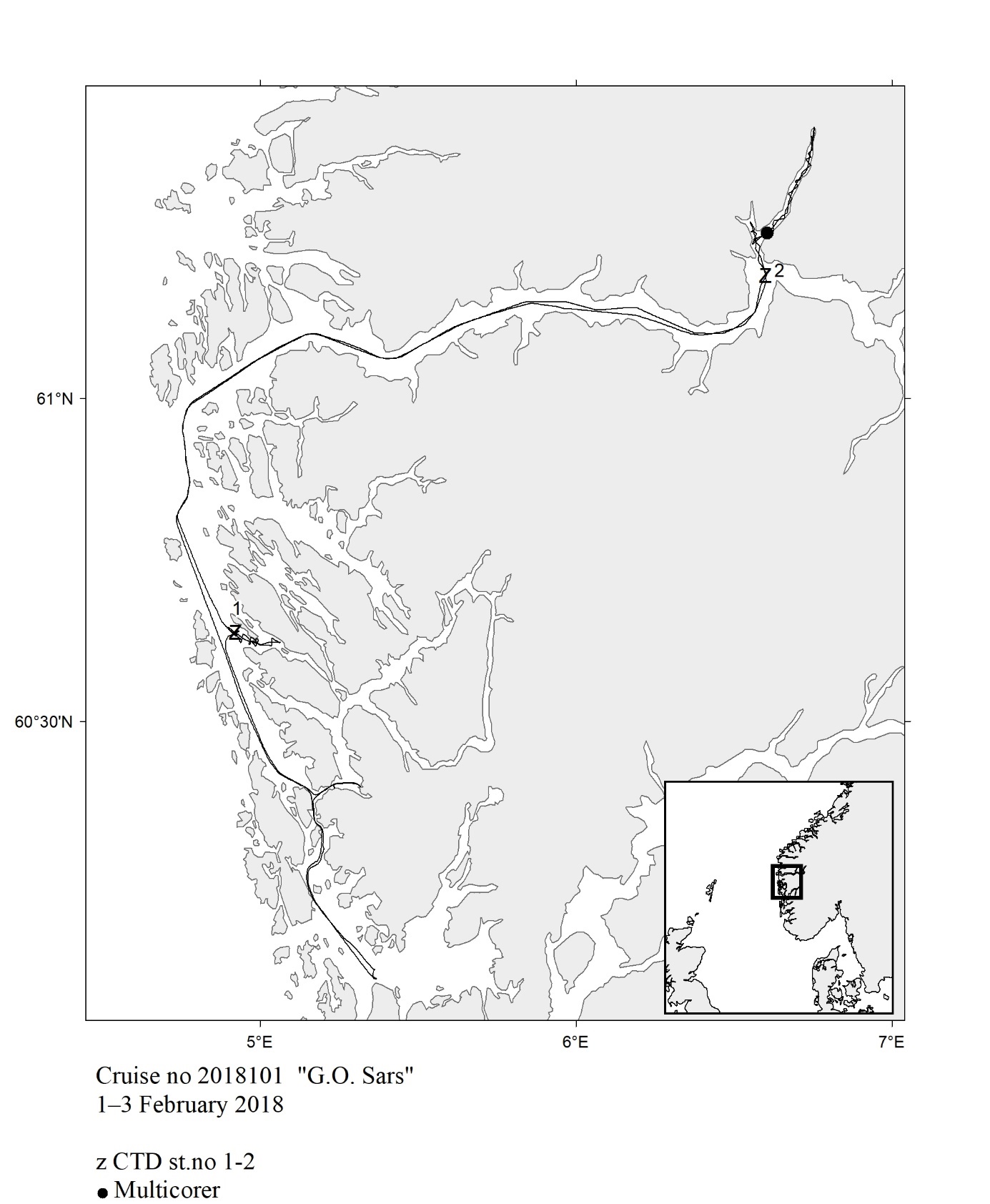
Fig. 1
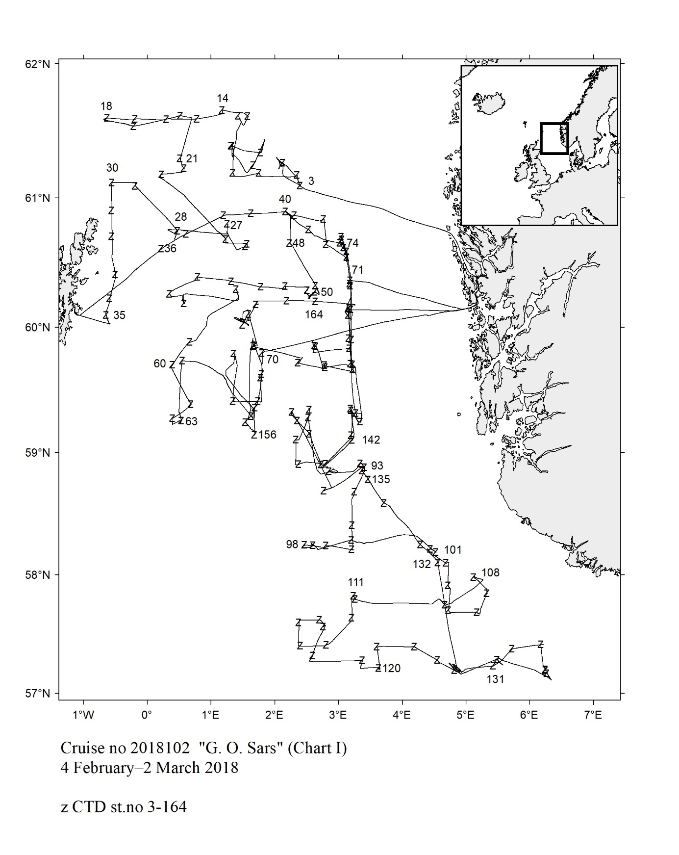 Fig. 2
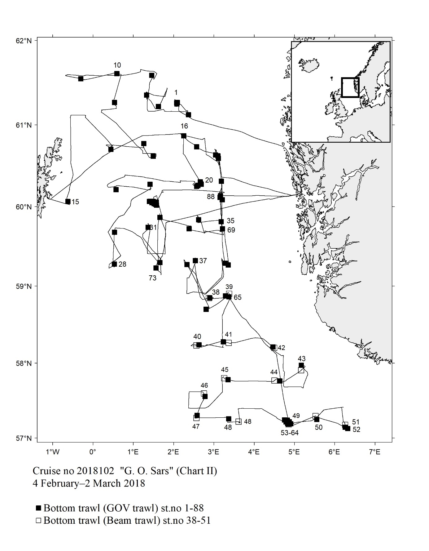 Fig. 3
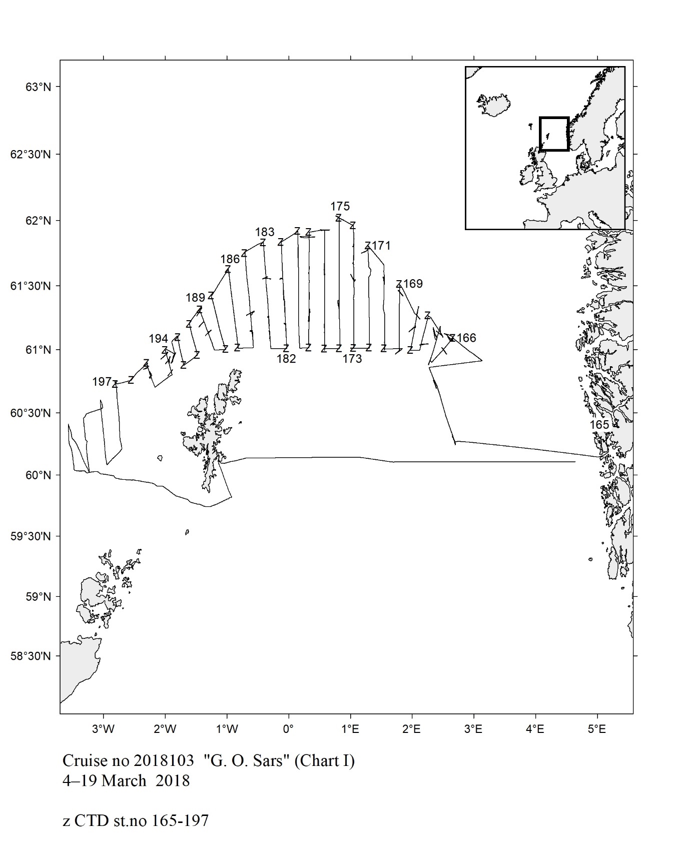 Fig. 4
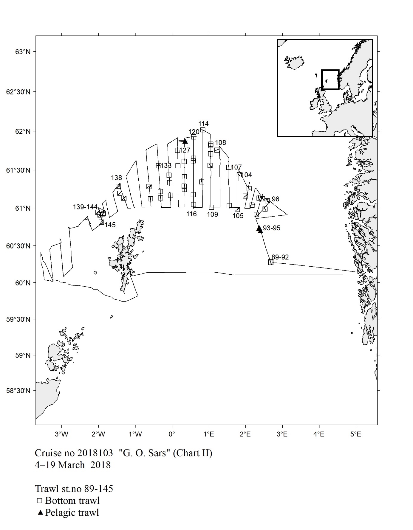 Fig. 5
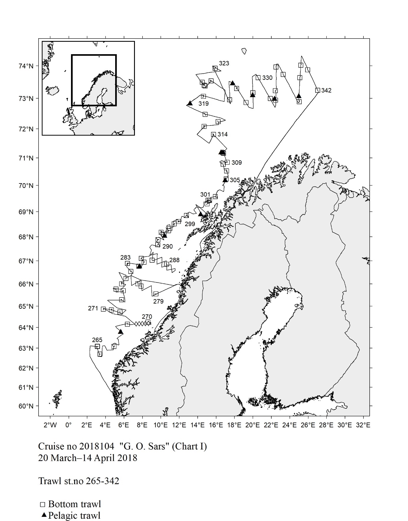 Fig. 6
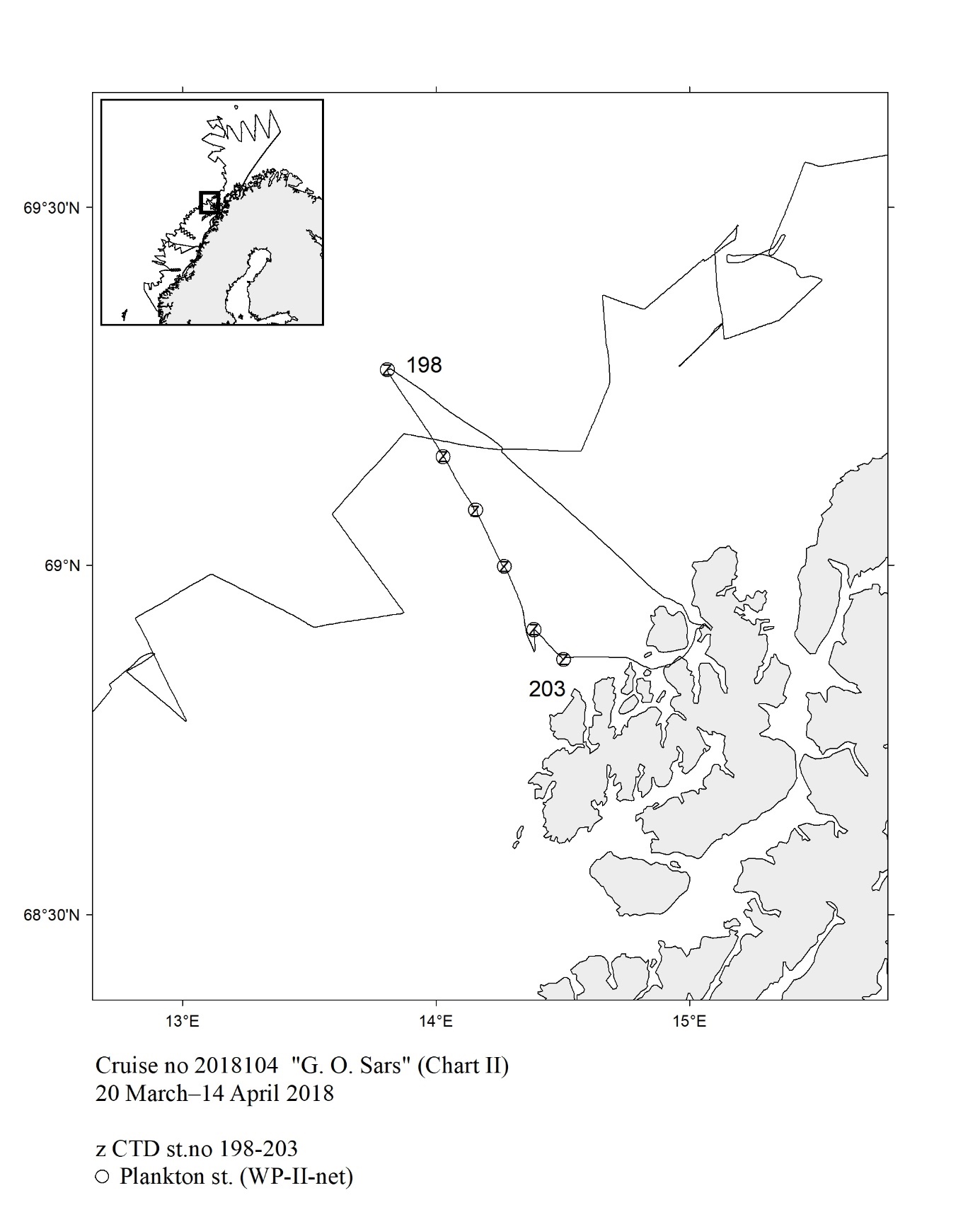 Fig. 7
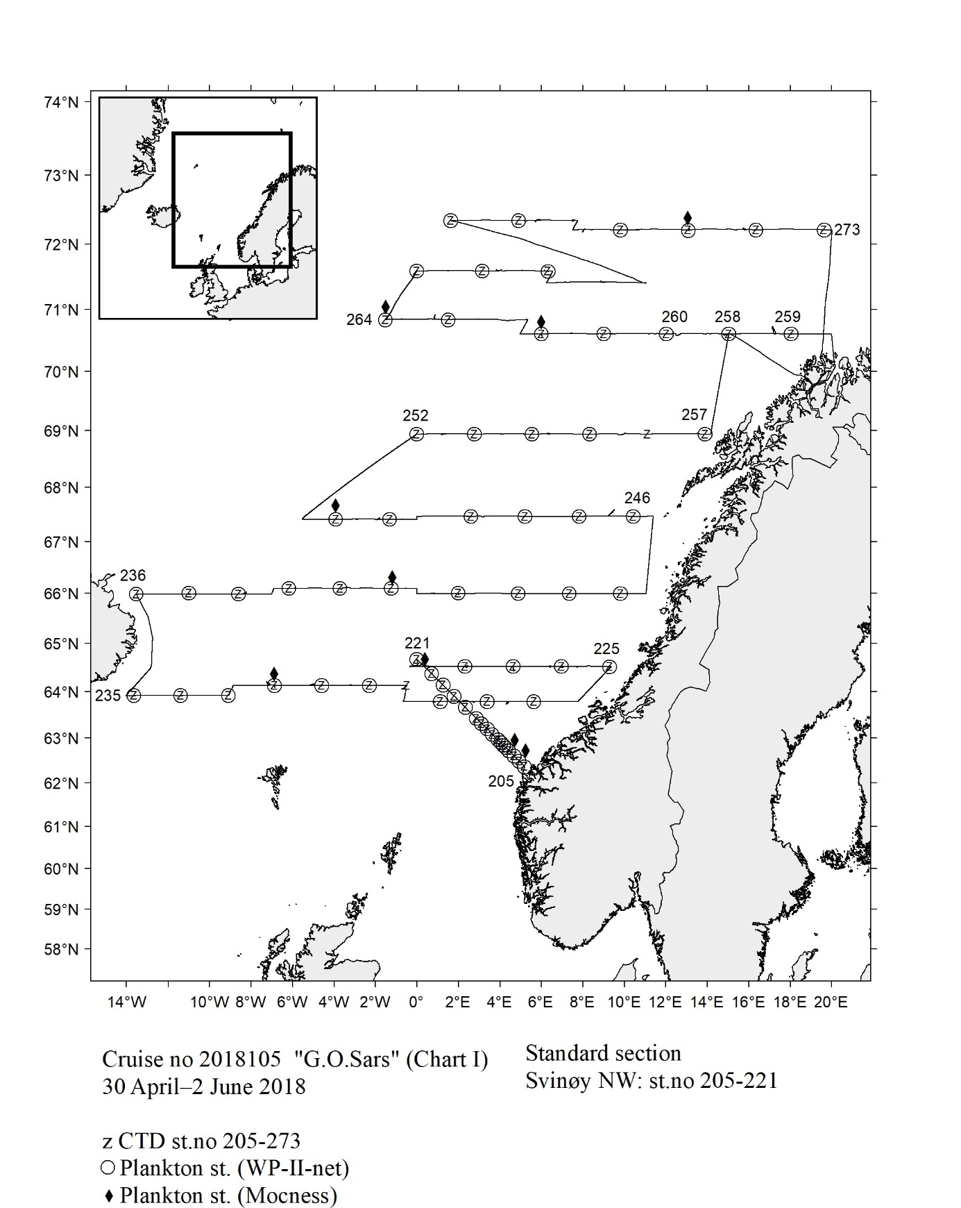 Fig. 8
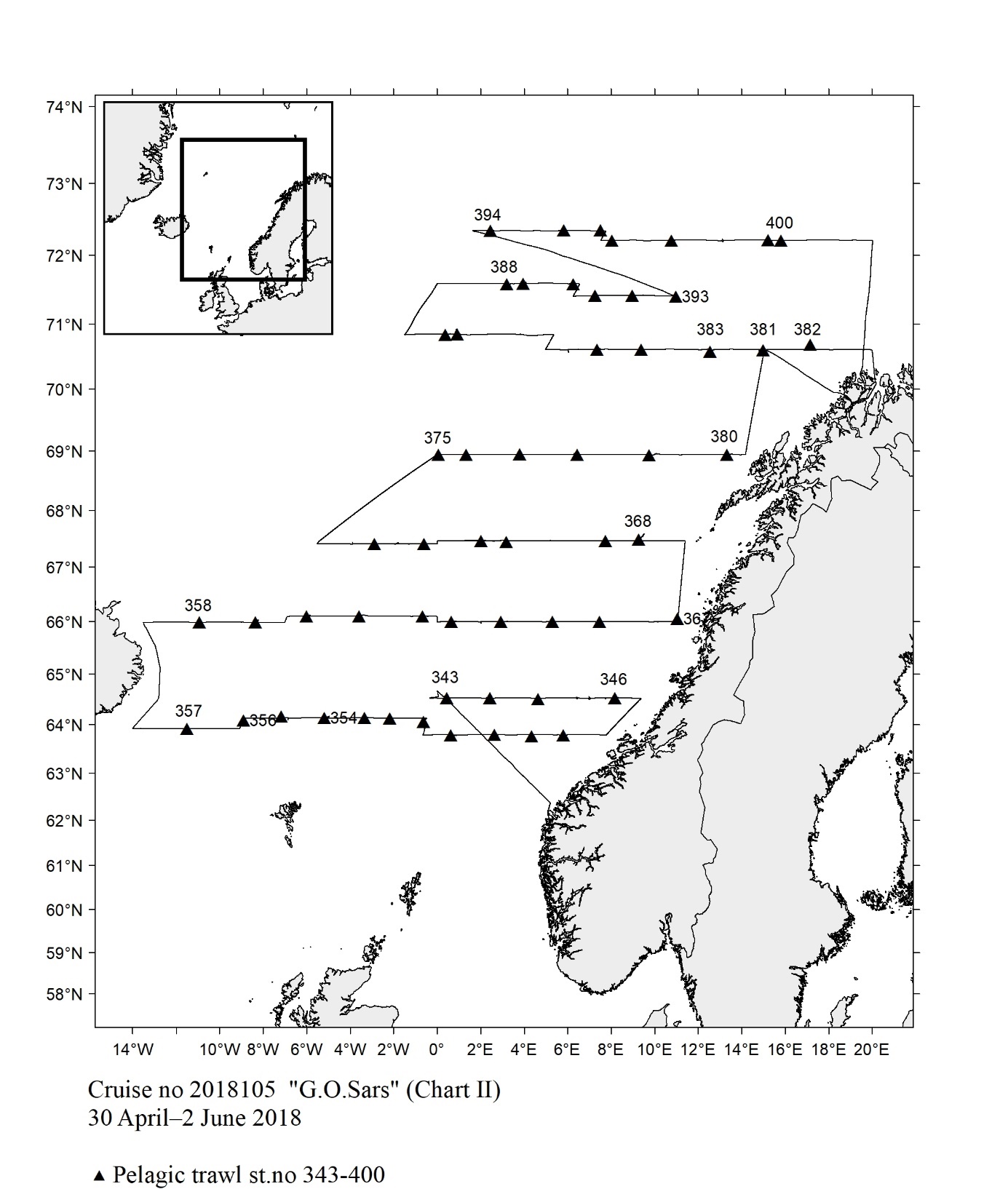 Fig. 9
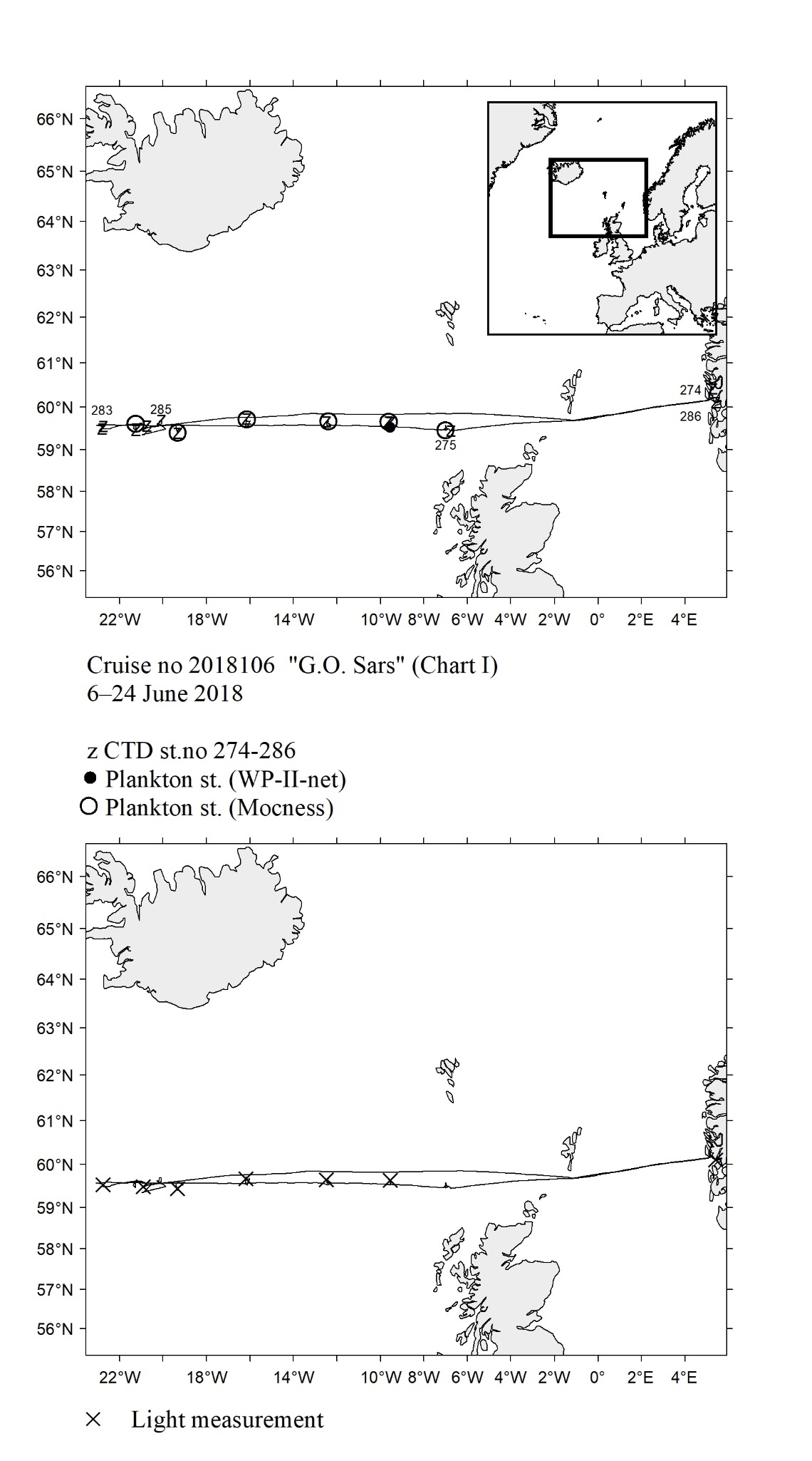
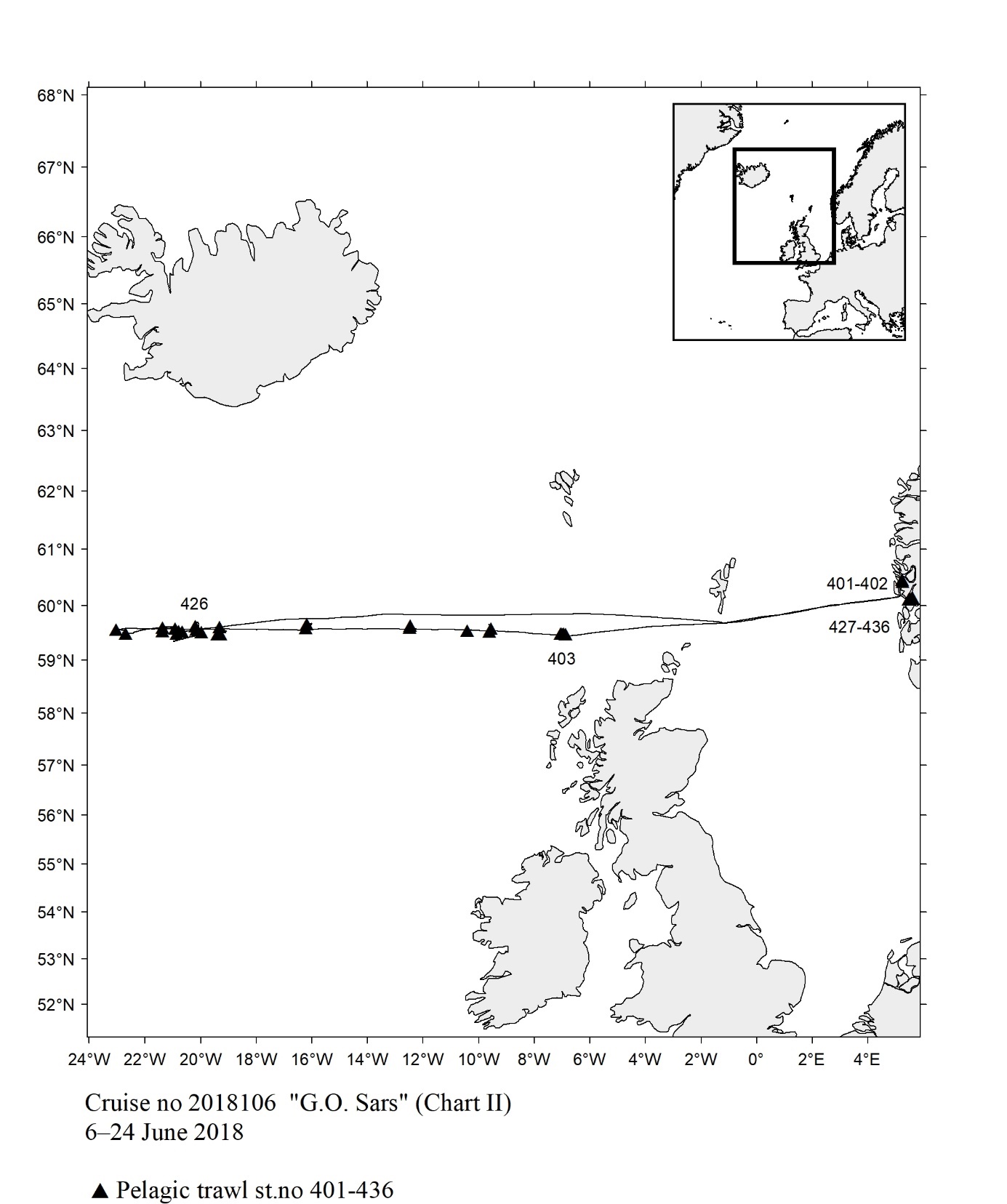 Fig. 10
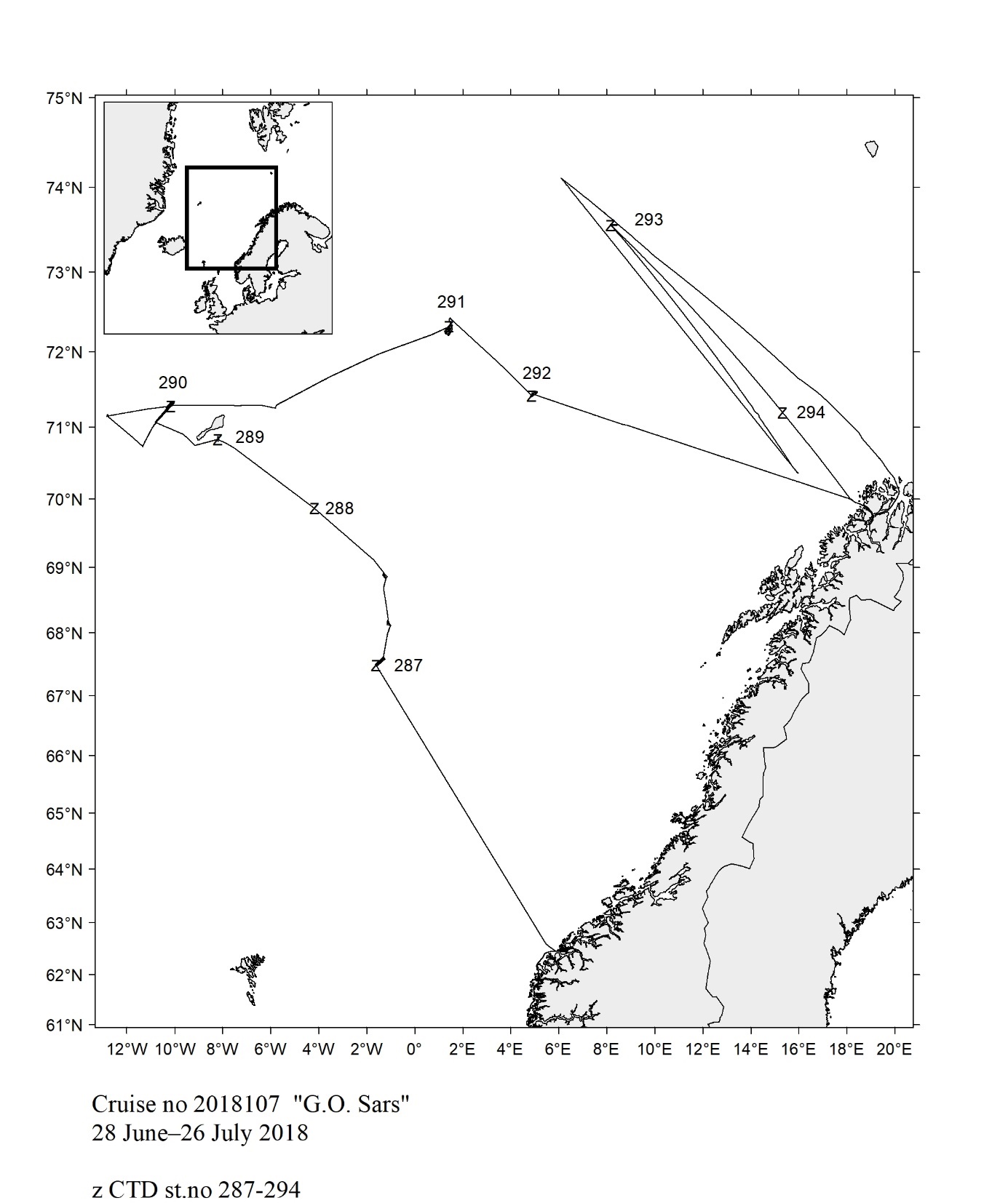 Fig. 11
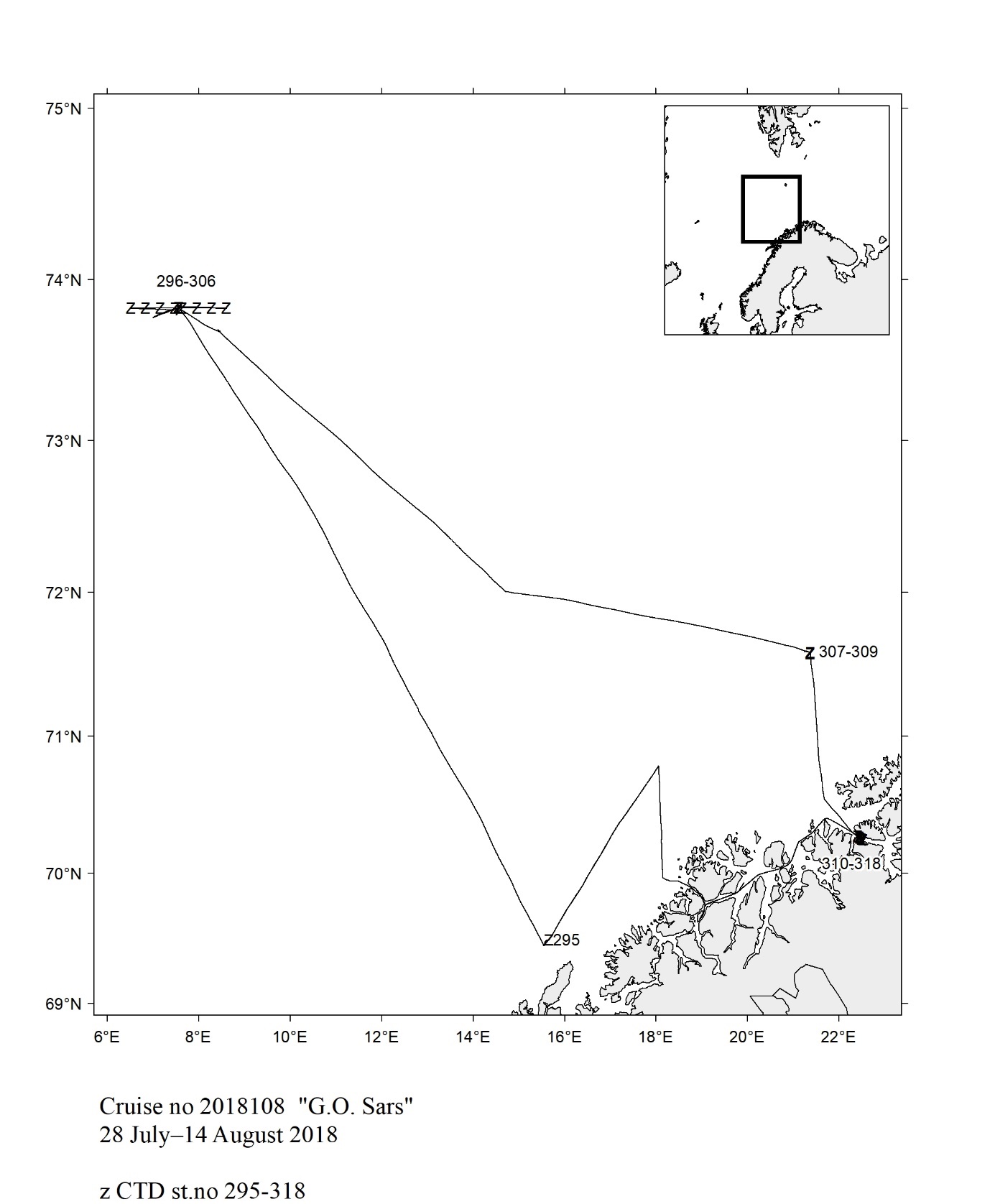 Fig. 12
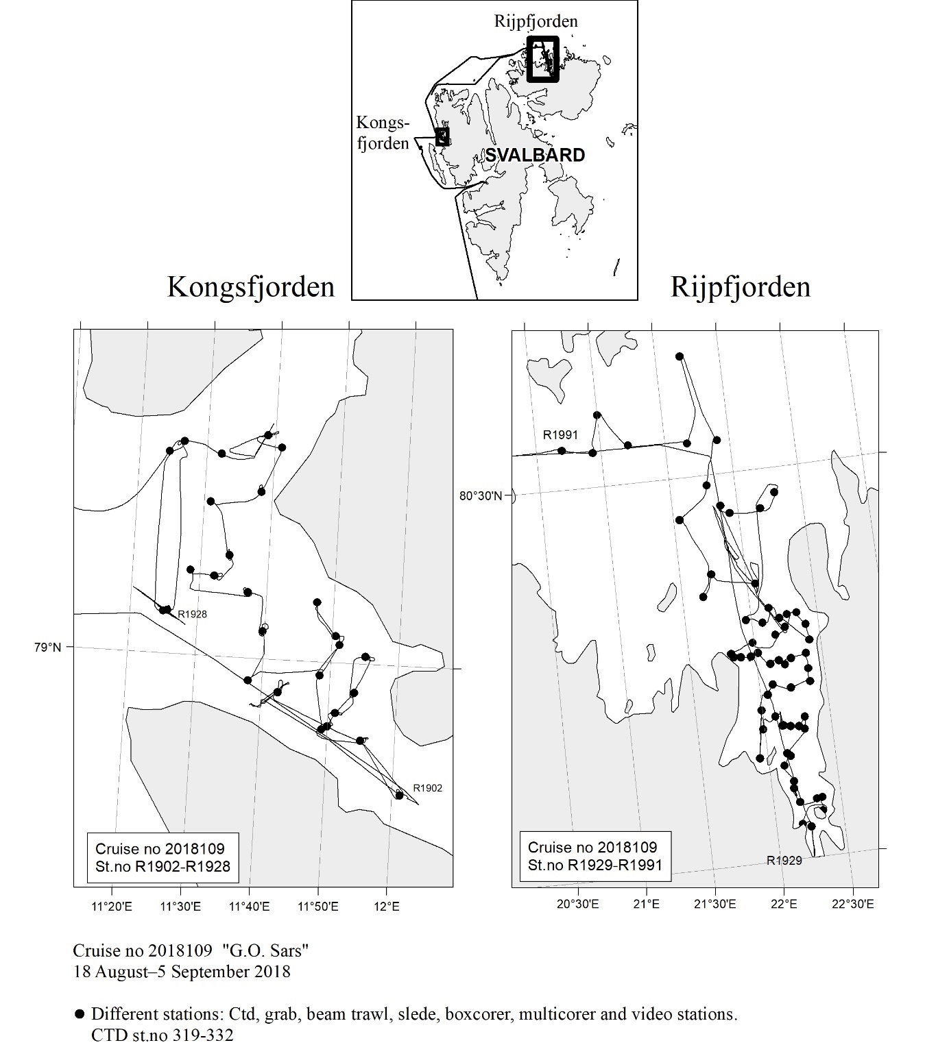
Fig. 13
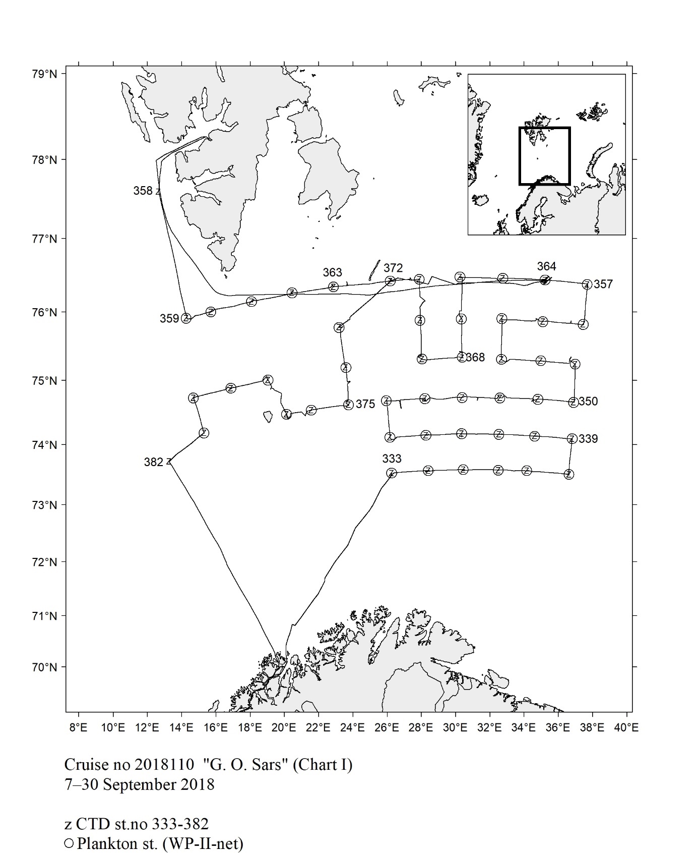 Fig. 14
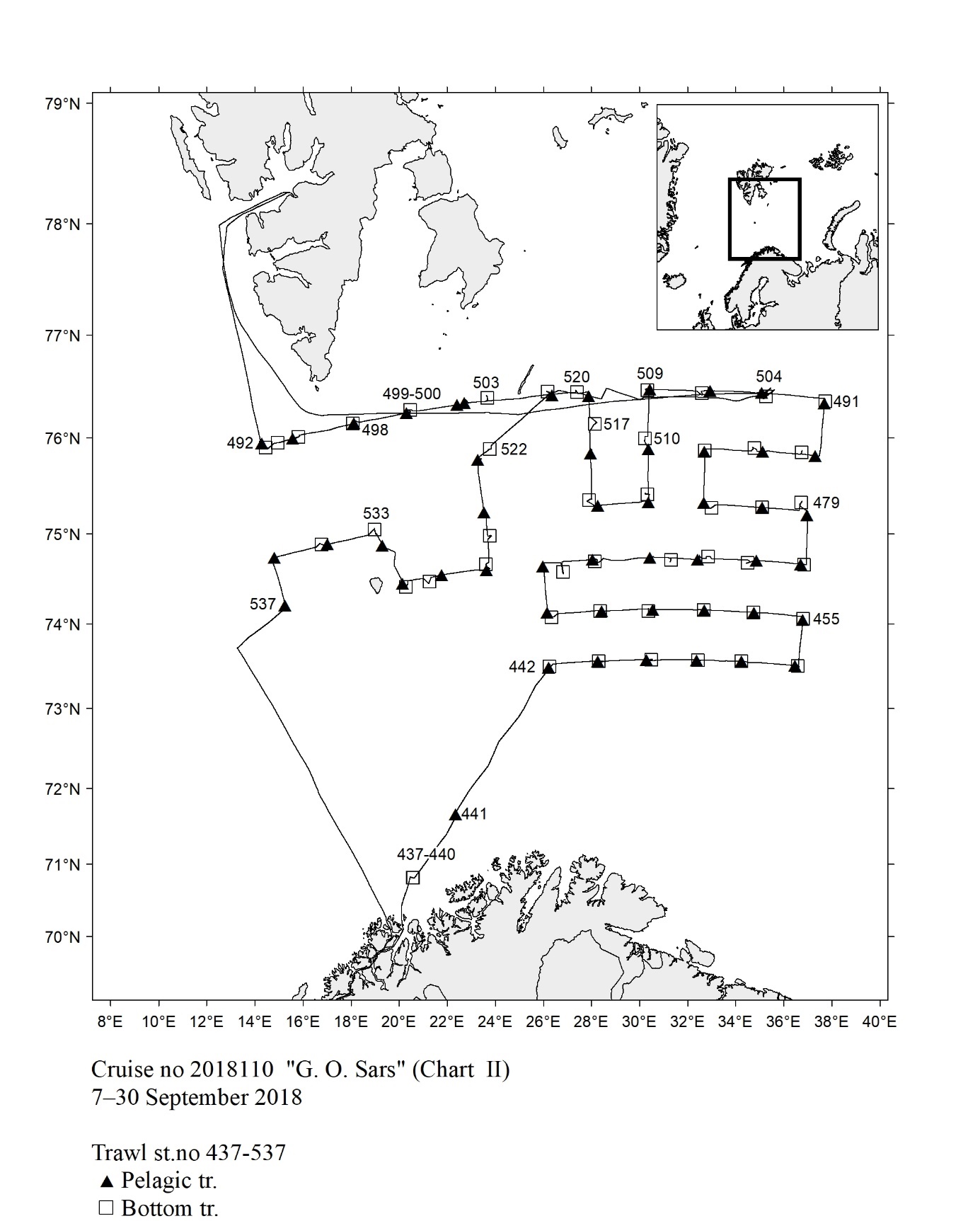 Fig. 15
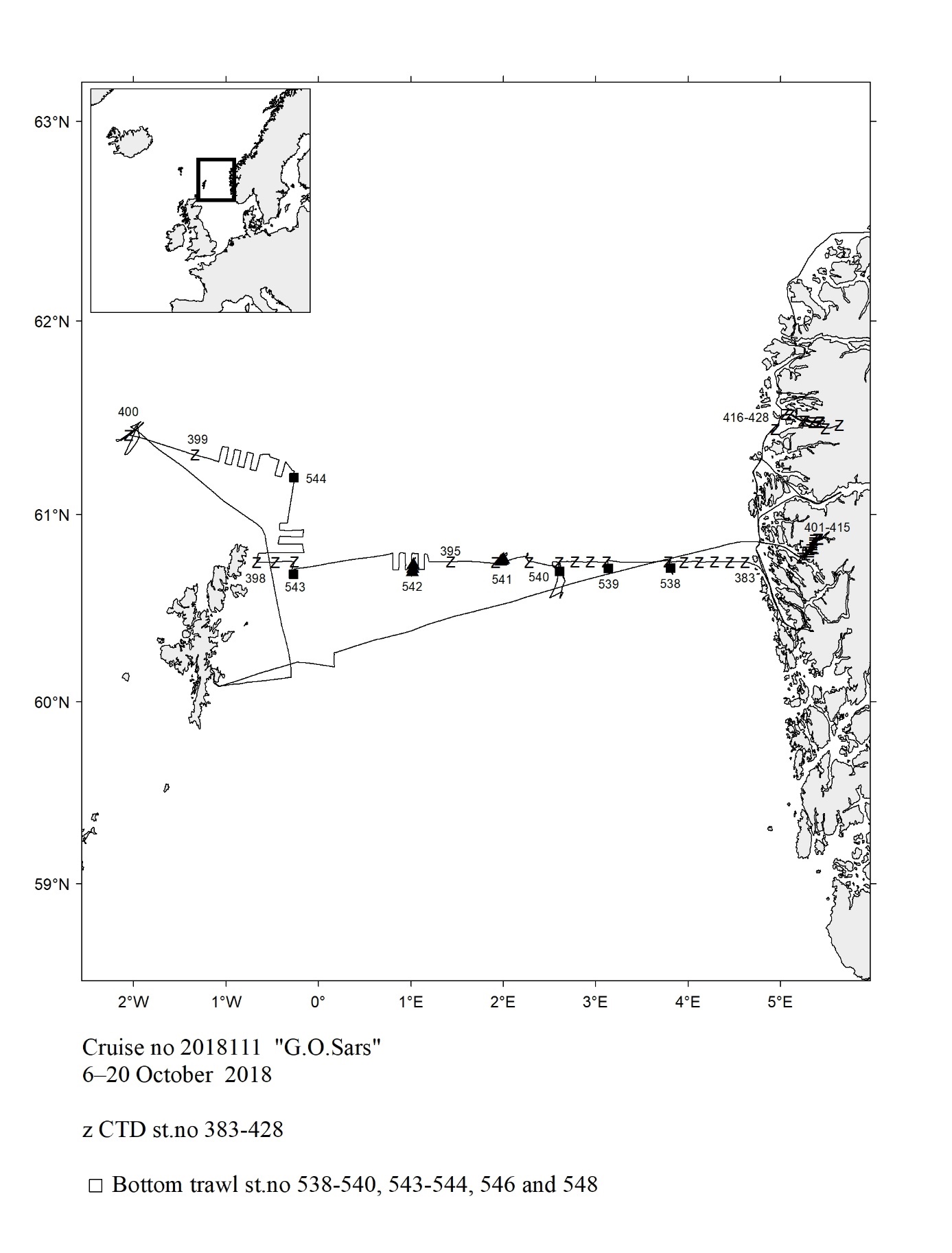 Fig. 16
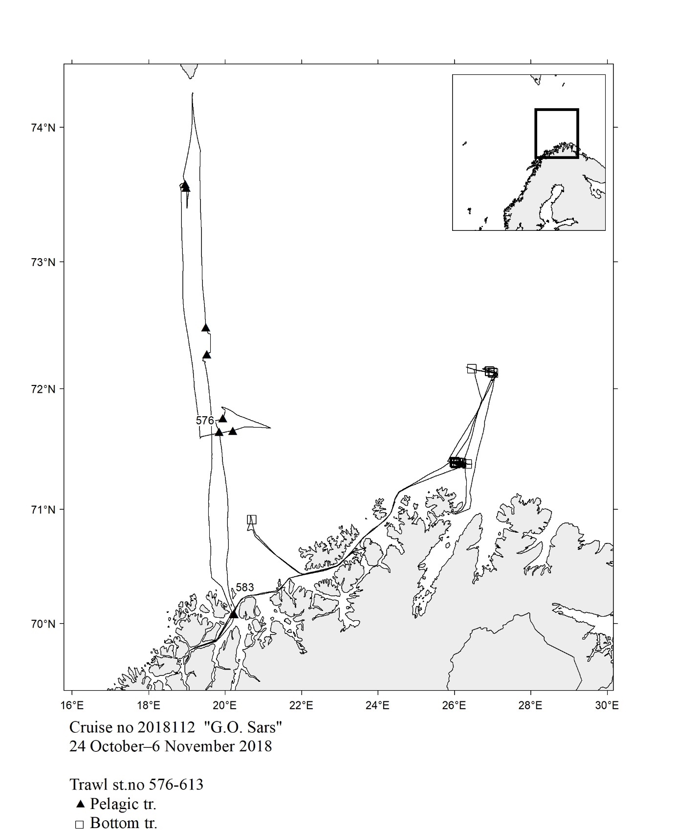 Fig. 17
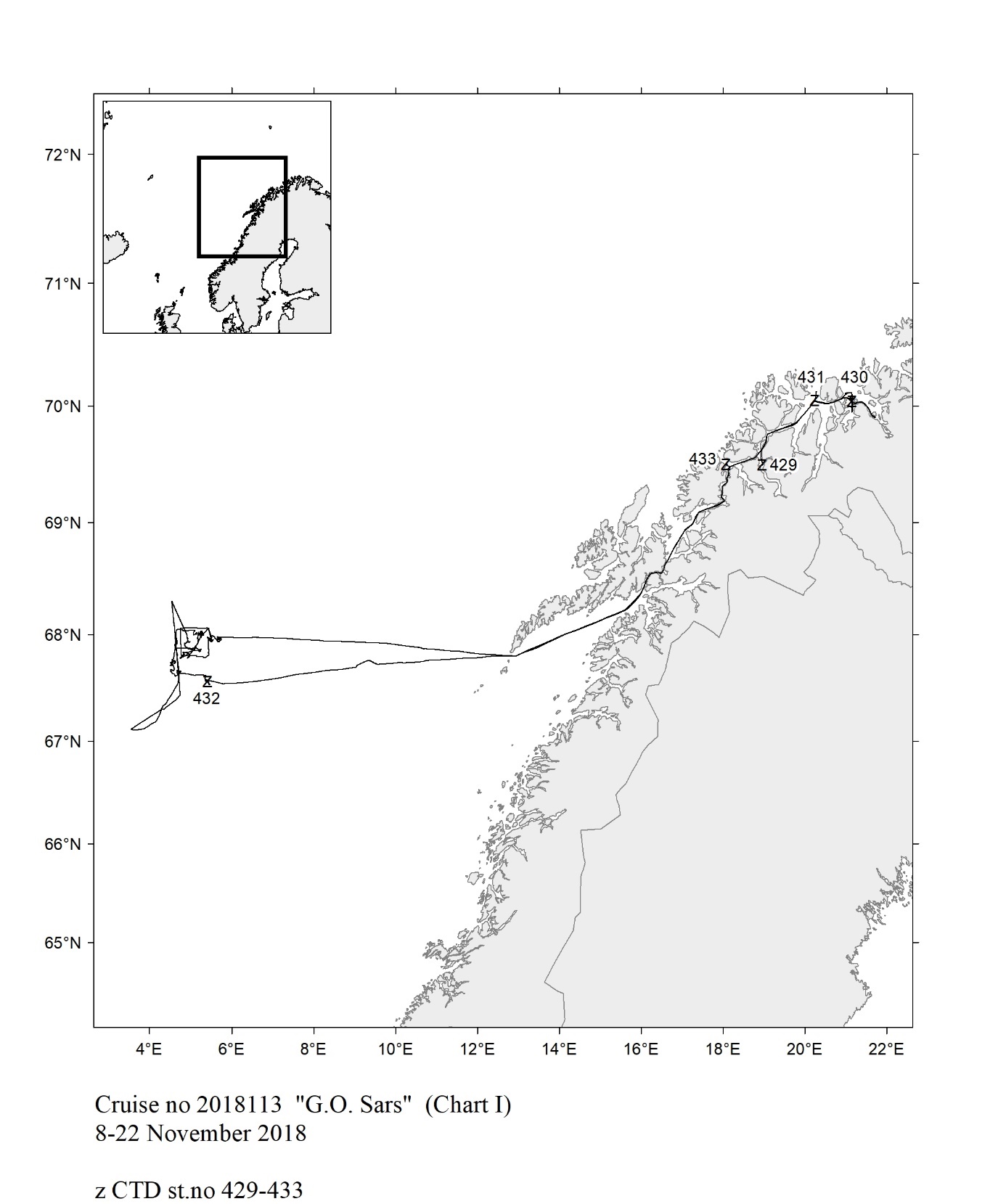 Fig. 18
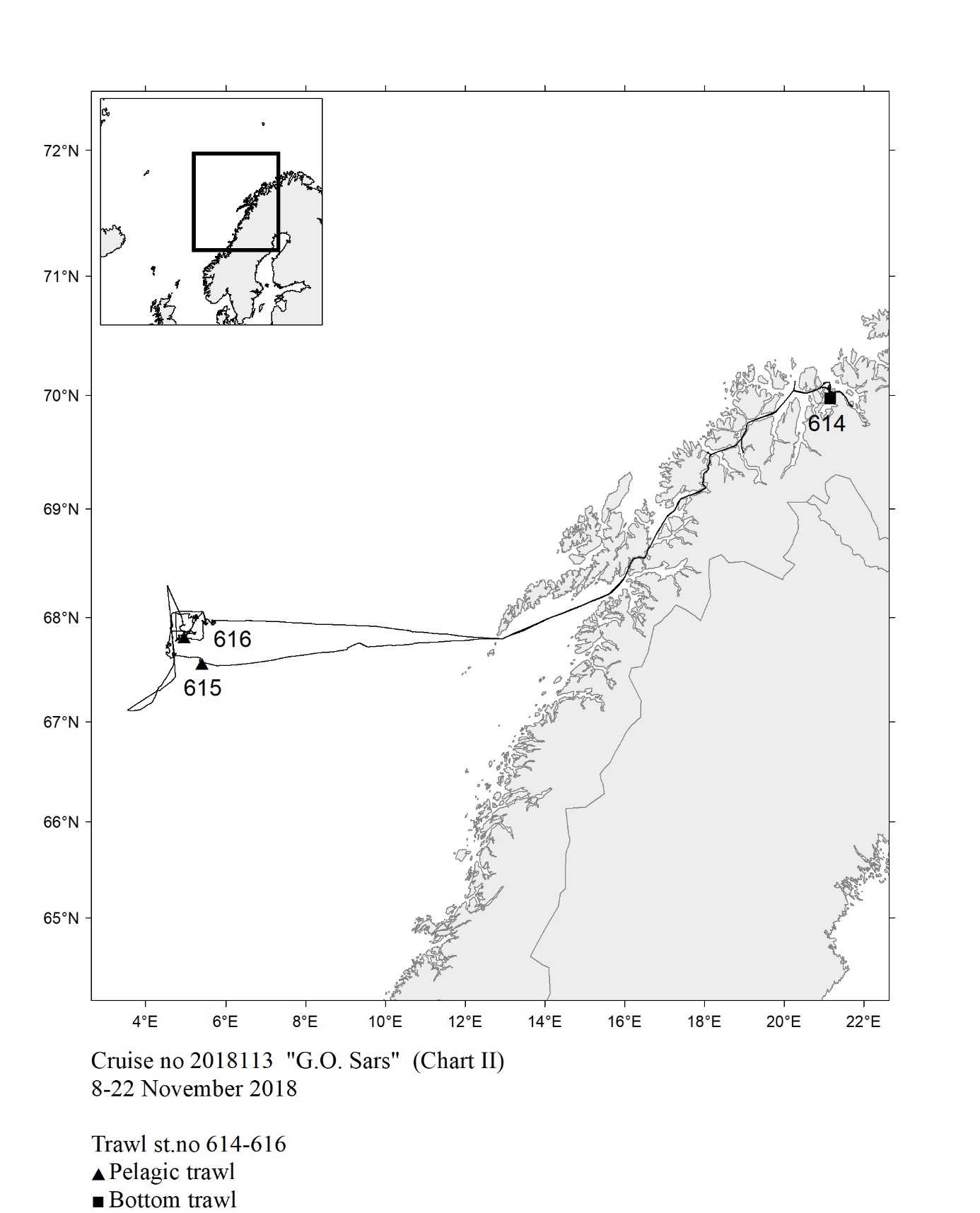 Fig. 19
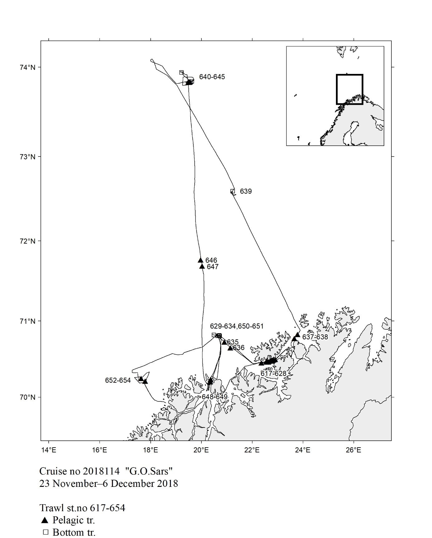 Fig. 20
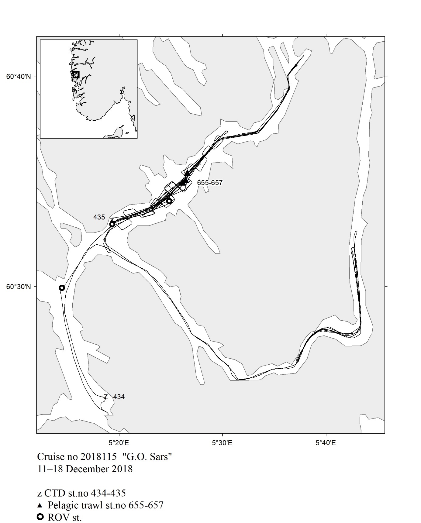 Fig. 21
4 - "Johan Hjort" - (Ship code no 12). Cruises 2018.
| Cruise no | Period | Purpose | Area | CTD st.no | Trawl st.no | Fig. no |
| 2018201 | 16.1.-25.1. | Objectives: To collect data and samples on pre-selected stations. To sample standard sections for physical oceanographic parameters (CTD casts, nutrients and chlorophyll) and zooplankton. | Barents Sea Norwegian Sea | 2-45 | - | 22 |
| 2018202 | 28.1.-11.3. | Annual combined acoustic and bottom trawl survey. | Barents Sea | 46-121 | 1-220 | 23-24 |
| 2018212 | 14.3.-20.3. | 1. Collect diversed fauna for relocation study. 2. Deployment of fauna landers on a transect from an aquaculture farm. 3. CTD profiles of fjords. | Norwegian coast | 122-130 | - | 25 |
| 2018203 | 22.3.-9.4. | The main survey objective is to estimate abundance indices at age of the spawning stock of North East Arctic cod using the trawl acoustic method. The survey area is the shelf area from Malangsgrunnen south to Røsttunga and the shelf are of Vestfjorden connected to the Lofoten islands. Additional observations included the use of CTD and T80 net for sampling density and stage distribution of spawned eggs. The survey is a part of a time series. | Norwegian Sea | 131-265 | 221-260 | 26-27 |
| 2018204 | 12.4.-10.5. | The North Sea Ecosystem spring cruise has been run since 2010 by the Institute of Marine Research (IMR) as a multi-purpose survey. The cruise covers hydrography, chemistry, phytoplankton and zooplankton (IMR project “Monitoring of climate and plankton in the North Sea Skagerrak”) as well as fish eggs and fish larvae (IMR project “Early life history dynamics of North Sea Fishes”). The cruise also includes monitoring of radioactive contamination (IMR project “Monitoring of radioactivity in Norwegian waters” IMR 14379-01). | Kattegat North Sea Skagerrak | 266-518 | - | 28-29 |
| 2018205 | 21.5.-4.6. | The cruise objectives were to occupy the standard sections Fugløya-Bjørnøya, extended Bjørnøya west and extended Gimsøy section. ADCP moorings and bottom mounted ADCPs e recovered and -redeployed. Argo floats deployed. | Barents Sea Norwegian Sea | 519-597 | - | 30-31 |
| 2018206 | 5.6.-25.6. | Studies on the post larval dynamics of NSS herring with the intention of understanding the mechanisms that determine year class strength. | Norwegian Sea Barents Sea | 598-692 | 261-330 | 32-33 |
| 2018207 | 2.7.-29.7. | This survey combined the HERAS and NORACU surveys, which were acoustic surveys for North Sea herring and saithe. The survey took target and blind bottom and pelagic trawl tows for target registration and biological samples. Also included were CTD stations and profiles (CTD mounted on trawl) for temperature and salinity. | North Sea | 693-742 | 331-476 | 34-35 |
| 2018208 | 10.8.-22.8. | The objective of the cruise was to collect data and samples on pre-selected stations as part of the IMR monitoring of physical and biological parametres. Sampling were made on the following standard sections: Svinøy–NW, Gimsøy NW, Bjørnøya W and Fugløya-Bjørnøya, and station M. | Norwegian Sea Barents Sea | 743-814 | - | 36 |
| 2018209 | 22.8.-4.10. | The ecosystem survey in the Barents Sea has been conducted yearly in August/September since 2004. The aim of the ecosystem survey is to monitor the status and changes of the Barents Sea ecosystem to support scientific research and management advice. The task of the ecosystem survey: Sampling of physical oceanography, phytoplankton, zooplankton, fish, benthos, sea mammals, sea birds, and litter throughout the entire Barents Sea and around Svalbard. In addition, selected special scientific sampling and methodology research is conducted. The whole survey is a cooperation between Norwegian and Russian scientists. It is conducted with three Norwegian vessels in Norwegian waters and around Svalbard, and one Russian vessel in Russian waters. | Barents Sea | 815-924 | 477-681 | 37-38 |
| 2018210 | 5.10.-13.11. | Annual combined acoustic and bottom trawl survey along the Norwegian coast north of 62˚ N. | Norwegian coast | 925-986 | 595-723 | 39-40 |
| 2018211 | 14.11-27.11. | The objective of the cruise was to collect data and samples on standard sections: Svinøy-NW, Gimsøy-NW, Bjørnøya-W and Fugløya-Bjørnøya and "Station M" and standard LoVe transect. Deployment Polar Buoy and Argo Buoy. | Norwegian Sea Barents Sea | 987-1054 | - | 41 |
| 2018213 | 2.12.-11.12 | Main objective was to test a newly developed macro zooplankton trawl and how this performed compared to the standard macro zooplankton trawl used by IMR for quantitative sampling of mesopelagic macro zooplankton and micronekton. | Norwegian coast | 1055-1057 | 724-768 | 42 |
5 - “Johan Hjort” – Charts for cruises 2018
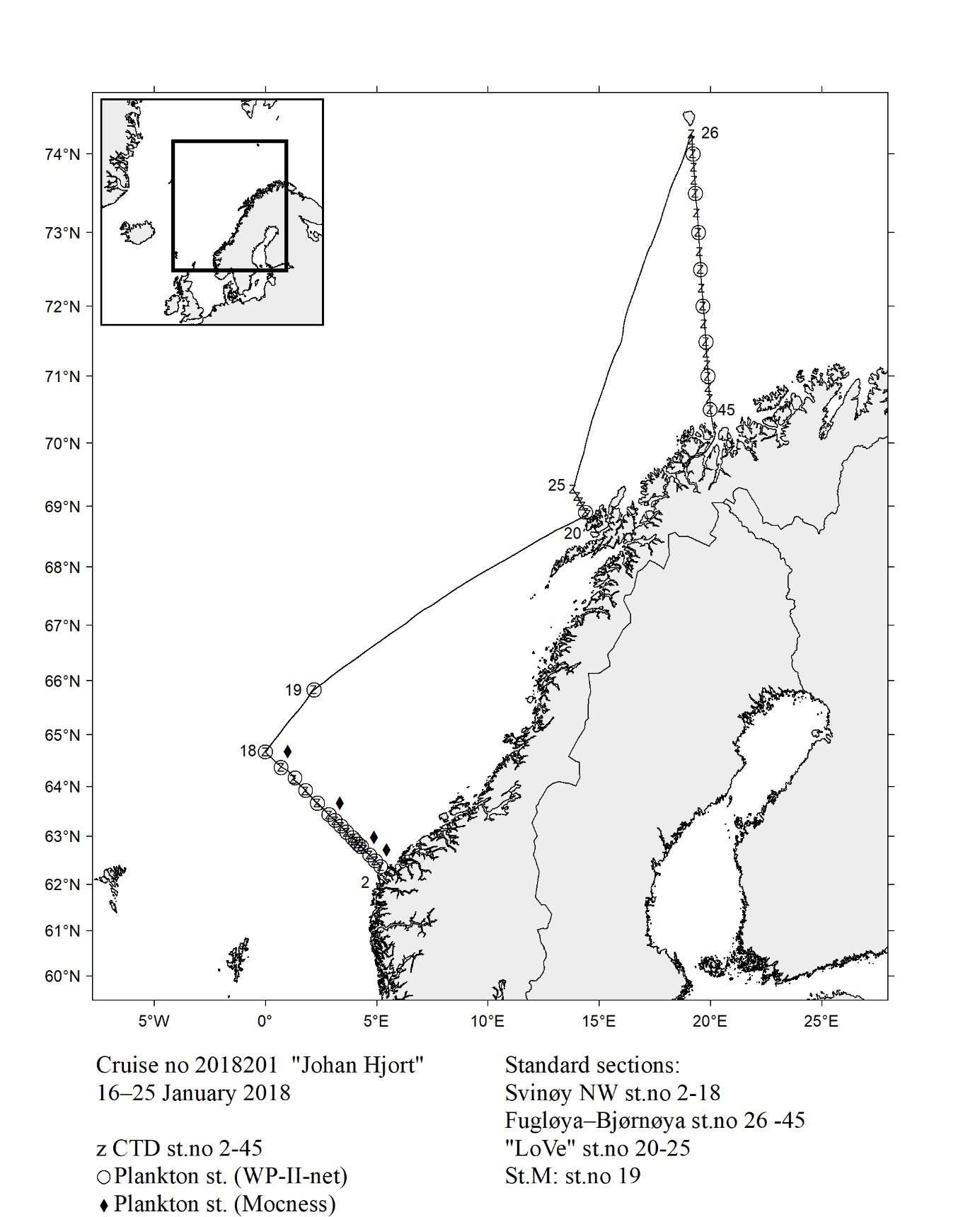 Fig. 22
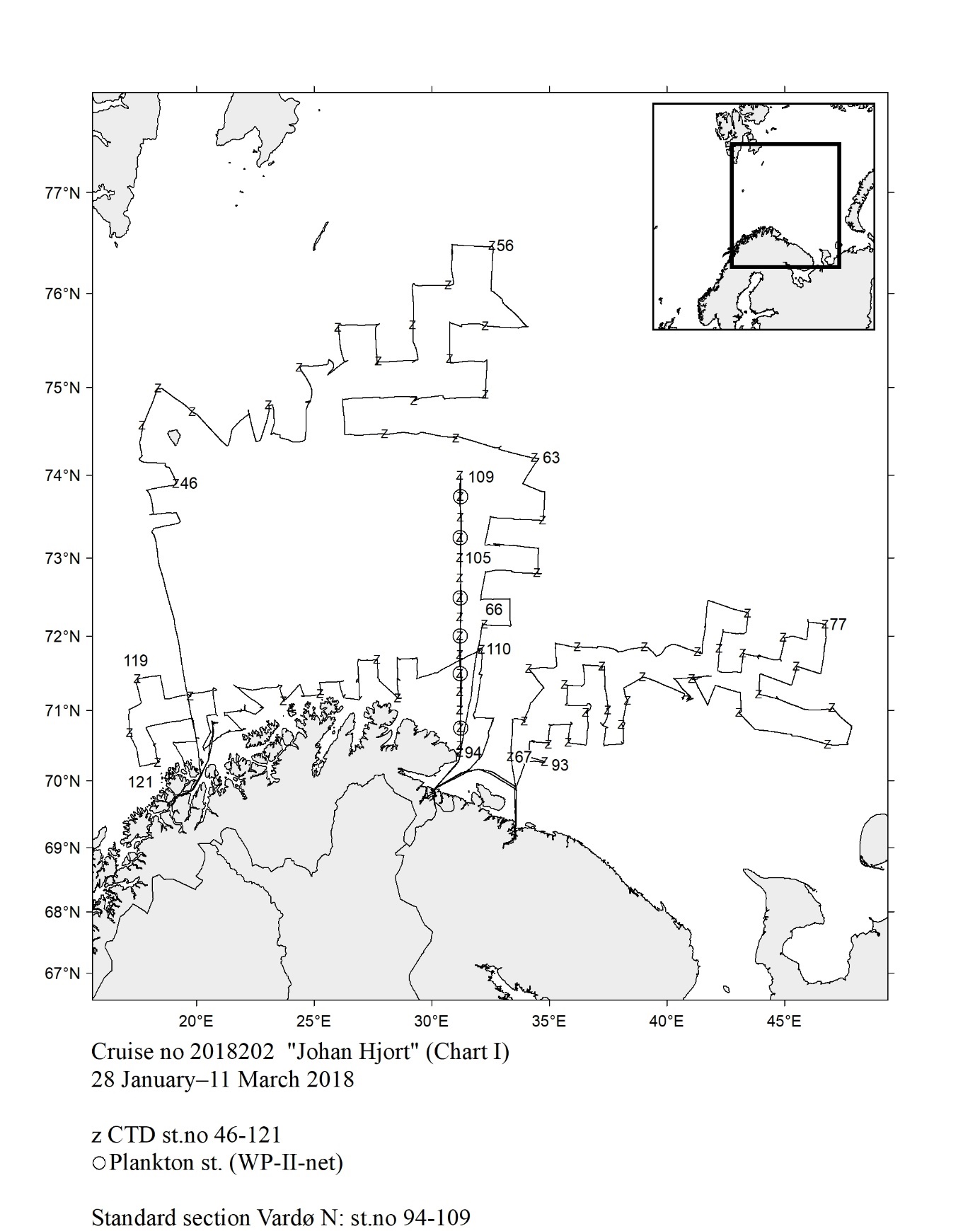 Fig. 23
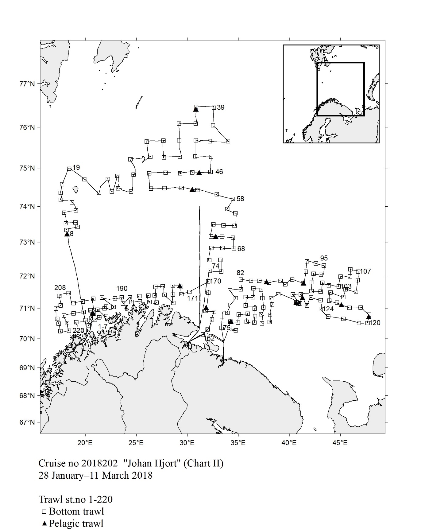 Fig. 24
 Fig. 25
 Fig. 26
 Fig. 27
 Fig. 28
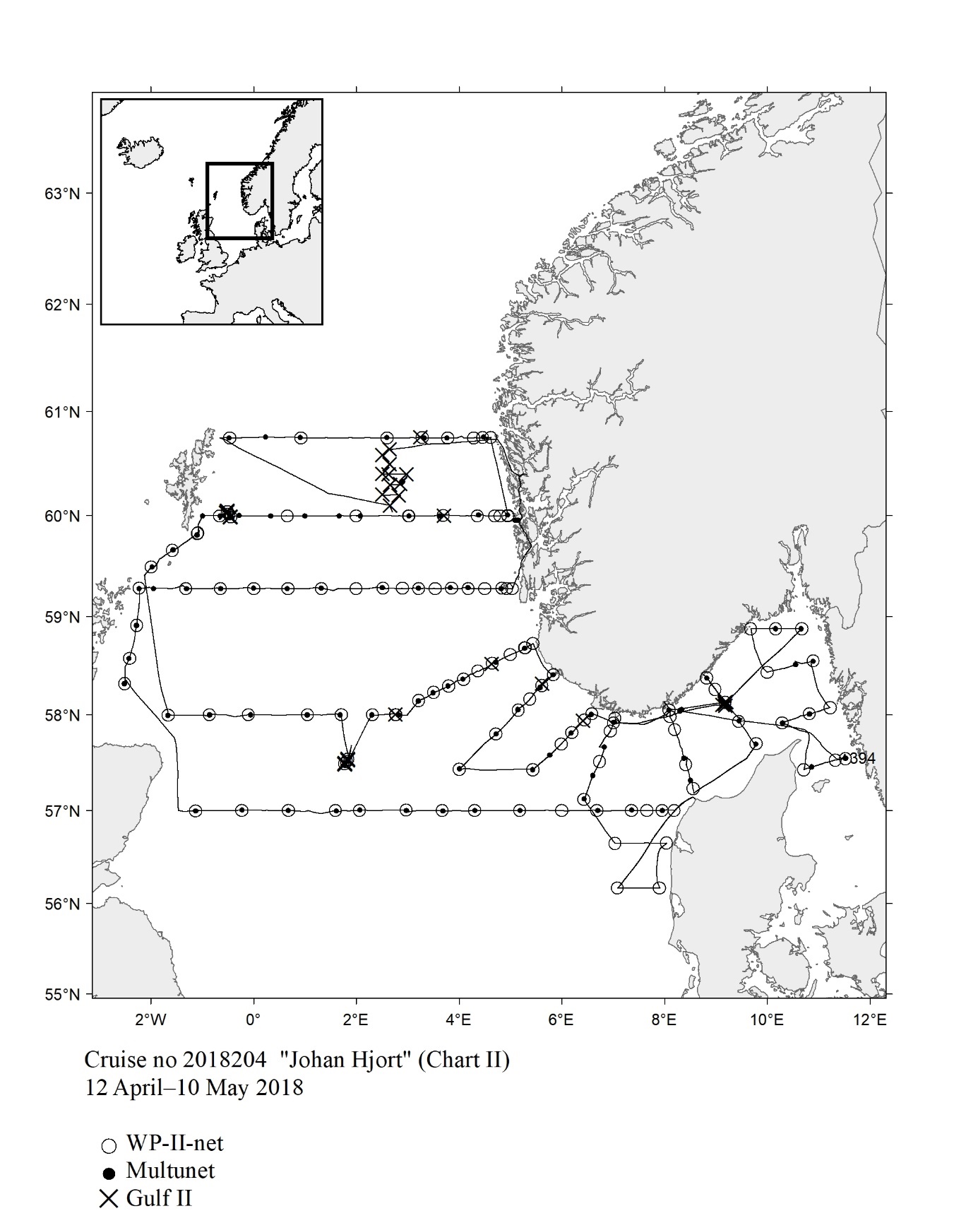 Fig. 29
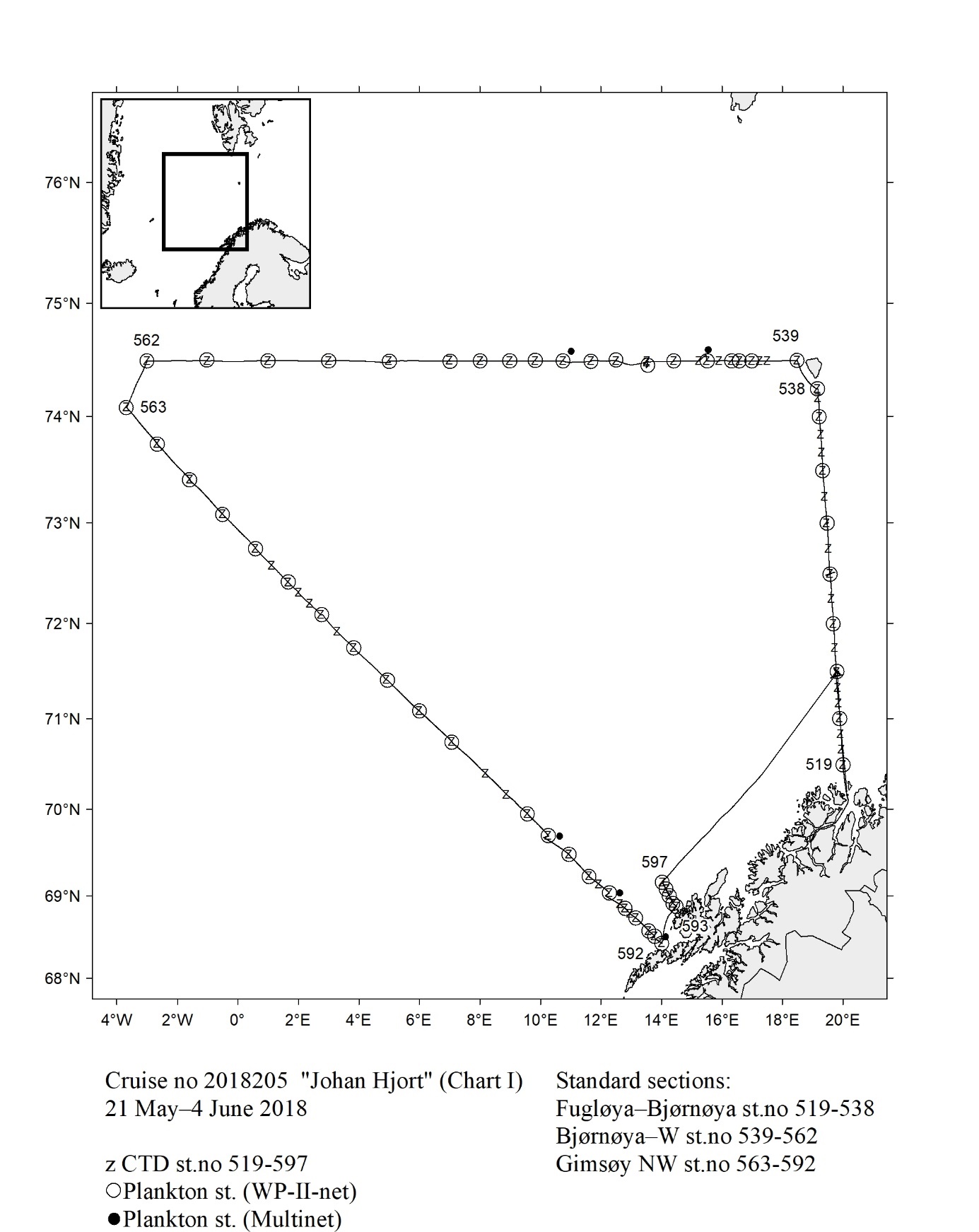 Fig. 30
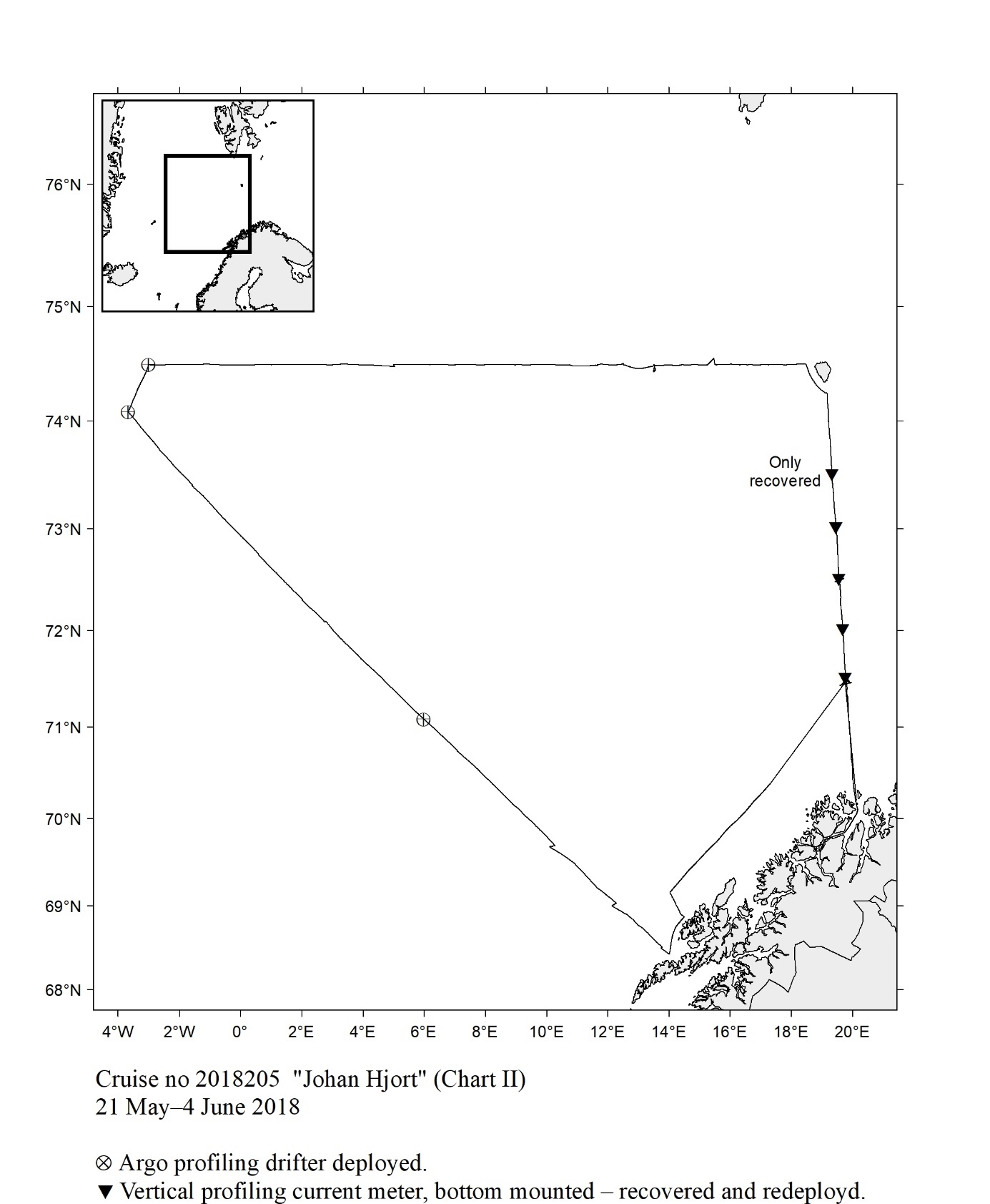 Fig. 31
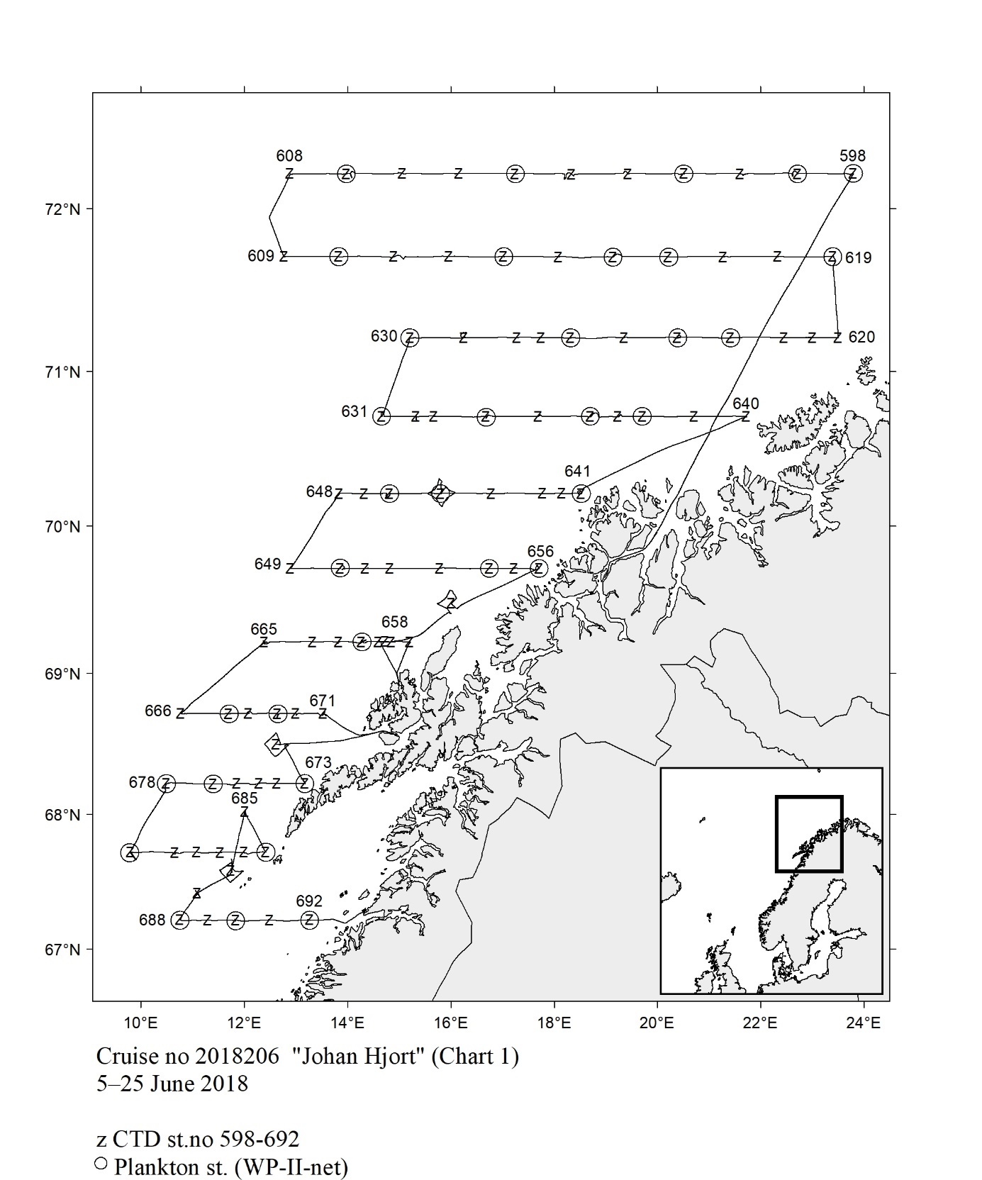 Fig. 32
 Fig. 33
 Fig. 34
 Fig. 35
 Fig. 36
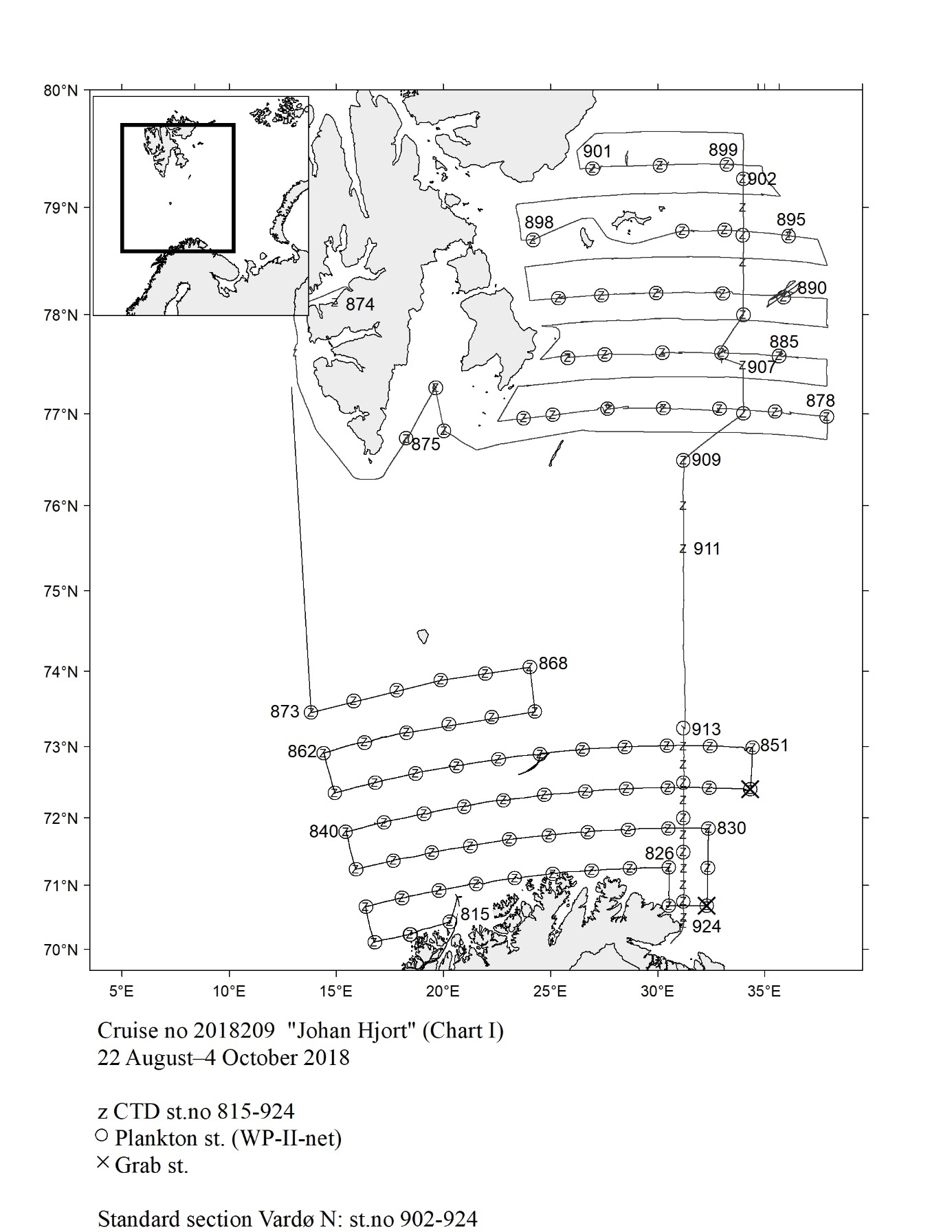 Fig. 37
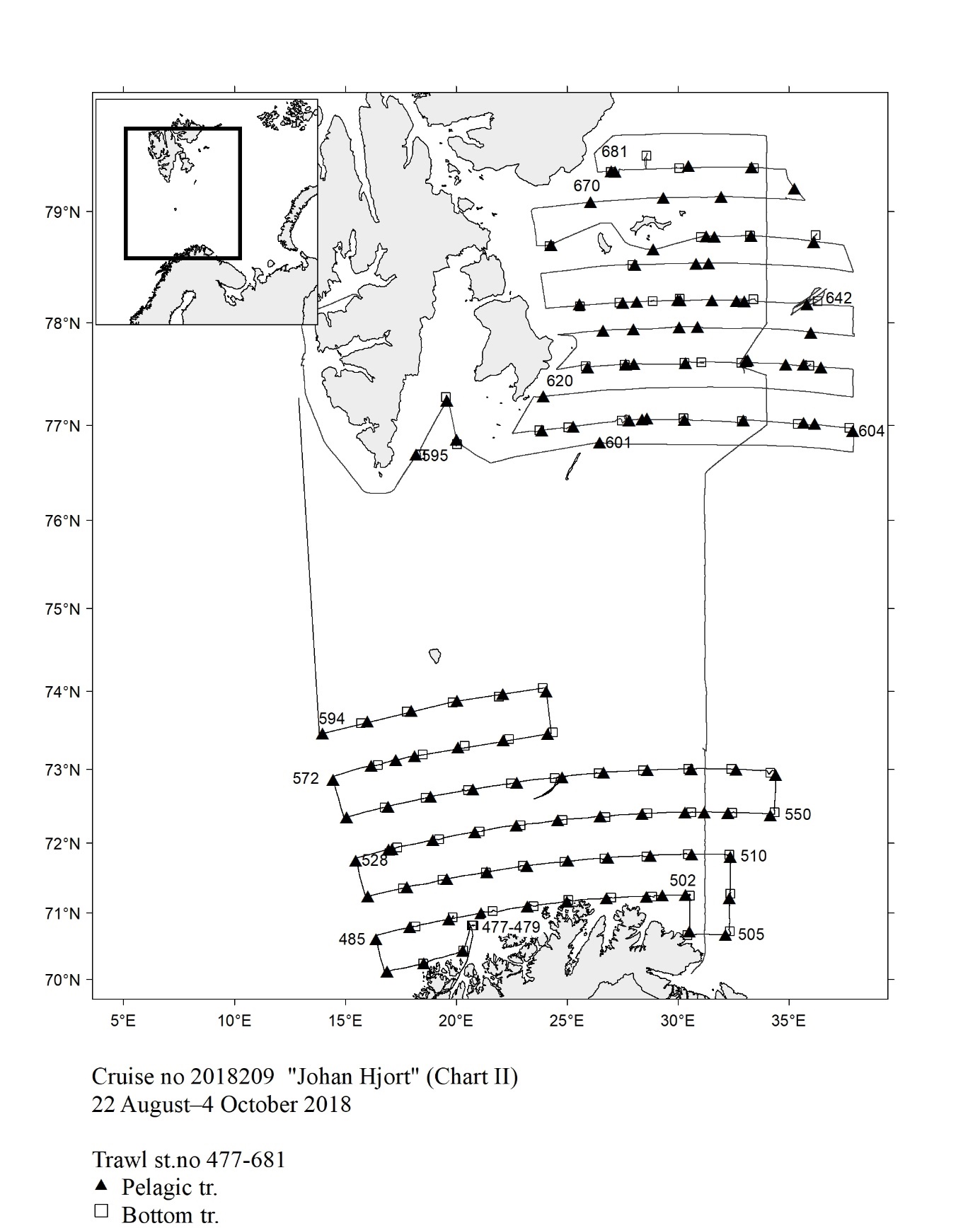 Fig. 38
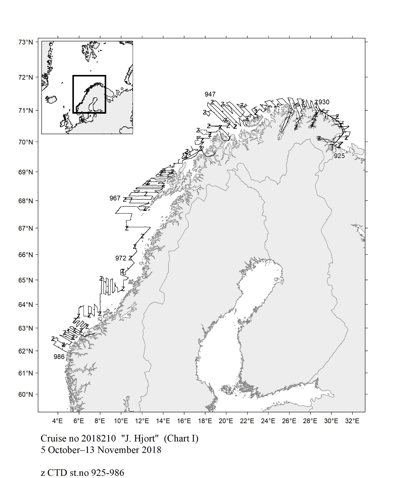
Fig. 39
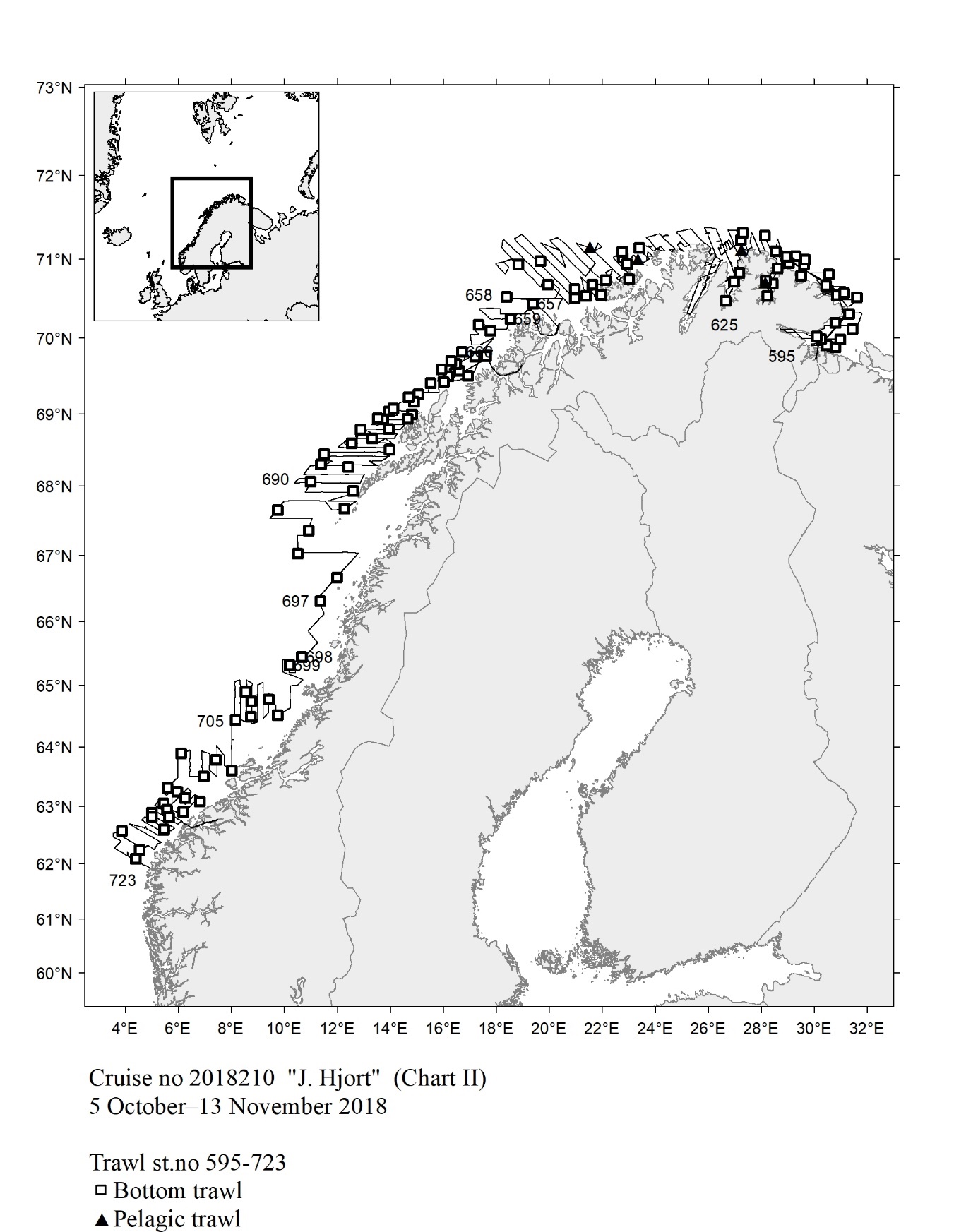 Fig. 40
 Fig. 41
 Fig. 42
6 - "Kristine Bonnevie" - (Ship code no 03). Cruises 2018.
| Cruise no | Period | Purpose | Area | CTD st.no | Trawl st.no | Fig. no |
| 2018601 | 6.1-30.1. | Annual shrimp survey. | North Sea,Skagerrak | 1-93 | 1-126 | 43-44 |
| 2018602 | 4.2.-9.2. | This is an educational cruise which is part of the course GEOF337 (Fjord oceanography) given at GFI, UiB. The students are to be trained in the use of oceanographic equipment (CTD, moorings, turbulence measurements) and they will analyze and work with the data for a report related to the curriculum of the course. Moorings will be recovered in the period 1-4/3 2018. | Norwegian fjords | 94-269 | - | 45 |
| 2018603 | 10.2-19.2. | The objective of the cruise was to collect data and samples on pre-selected stations as part of the IMR monitoring of physical and biological parametres in the North Sea. | North Sea | 270-306 | - | 46-47 |
| 2018604 | - | Cancelled | - | - | - | - |
| 2018605 | 18.3-21.3. | The cruise is part of the bachelor course GEOF 232 given at University of Bergen. The students are trained in the use of standard oceanographic equipment and in the planning of a scientific cruise. Moorings were deployed during cruise 2018602 2-9/2 2018 and recovered during this cruise. | West coast of Norway Bjørnafjorden | 307-406 | - | 48 |
| 208606 | - | Cancelled | - | - | - | - |
| 2018607 | - | Cancelled | - | - | - | - |
| 2018608 | 24.3-4.4. | Genetic sampling of spawning Northeast Atlantic saithe. | Northeast Atlantic Ocean | 407-419 | 127-139 | 49-50 |
| 2018609 | 5.4.-18.4. | To obtain information on: 1. Diel vertical distribution of herring larvae. 2. Vertical distributions relative to physical structures. 3. Vertical distributions relative to potential prey sources. 4. Vertical distributions relative to potential predators. 5. Collect recently hatched larvae from spawning. | Norwegian Sea | 420-526 | 515-517 | 51-53 |
| 2018610 | 19.4.-21.4. | Deploy current meter moorings in the Norwegian Coastal Current. Perform ship ADCP and hydrographic surveys. | Norwegian Sea | 527-547 | - | 54 |
| 2018611 | - | Cancelled | - | - | - | - |
| 2018612 | 9.5.-19.5. | The purpose of the cruise was to collect fauna, construct and deploy benthic fauna landers in a gradient away from one fish farm in Møre to assess the long-term effects of effluents from salmon farming i open net-pens on long-lived and sensitive species, such as cold-water corals. Landers will be deployed for 1 year and will be retreived after 1,5 years. Coral samples were also collected to assess the genetics of Lophelia pertusa at Aktivneset and to assess the importance of larvae recruitment from UK for the viability of the population of corals on the Norwegian shelf. | Norwegian Sea | 548-866 | - | 55-56 |
| 2018613 | 20.5.-23.5. | The purpose of the cruise was to collect fauna, construct and deploy benthic fauna landers in a gradient away from one fish farm in Hordaland to assess the long-term effects of effluents from salmon farming in open net-pens on long-lived and sensitive species, such as cold-water corals. Landers will be deployed for 1year and will be retreived after 1,5 years. | Norwegian Fjords | 567-571 | - | 57 |
| 2018614 | 25.5.-15.6. | he cruise is a part of a research project with the objective to investigate water masses and ocean currents in the Greenland and Iceland Seas and the exchange between these basins. In order to reach this goal we use current meter and surface meteorological moorings, glider measurements, and detailed hydrographic and velocity surveys. On this cruise we recovered 6 current meter moorings and 2 meteorological buoys. | Greenland Sea Iceland Sea Norwegian Sea | 572-761 | - | 58-59 |
| 2018615 | - | Cancelled | - | - | - | - |
| 2018626 | 16.6.-19.6. | BURSE - Burial of kelp carbon in soft sediments. | Norwegian fjords | - | - | 60 |
| 2018616 | 27.6.-10.7. | The cruise is the first research cruise of the project the Nansen LEGACY. LEGACY is the Norwegian Arctic research community’s joint effort to establish a holistic understanding of a changing marine Arctic climate and ecosystem. KB 2018616 is a physical oceanography cruise with objectives to conduct ocean mixing and water transformation process studies in the region west and north of Svalbard, with particular focus on the warm Atlantic boundary current. | Arctic Ocean | 762-881 | - | 61 |
| 2018617 | 16.7.-15.8. | International Bottom Trawl Survey (IBTS) of the North Sea where the whole area is covered by a number of participating nations (Norway, England, Scotland, Germany, Sweden and Denmark). The survey provides biological data on fish and bentos. The cruise is coordinated by the ICES IBTSWG. The first part of the cruise includes sampling the hydrography, chemistry, zoo- and ichthyoplankton along the hydrographic transects, Utsira-W, Hantholm-Aberdeen and Fair Isle-Pentland plus a number of additional stations on the western and eastern side of the northern North Sea. The cruise also entails registering marine litter. | North Sea | 882-1037 | 518-587 | 62-64 |
| 2018618 | - | Cancelled | - | - | - | - |
| 2018620 | 17.8.-20.8. | Training cruise for students | Norwegian fjord | 1038-1051 | 588-600 | 65-66 |
| 2018619 | 21.8.-23.8. | Training cruise in BIO 102 – Organismal Biology. | Norwegian Sea | 1052-1056 | 601-605 | 67 |
| 2018627 | 24.8.-27.8 | Mandatory Field course for International IMBERSEA masters students. | Norwegian Sea | 1057-1068 | 606-621 | 68-69 |
| 2018621 | 28.8.-30.8. | Training cruise in BIO 102 part 2 – Organismal Biology. | Norwegian Sea | 1069-1071 | 622-626 | 70 |
| 2018622 | 26.9.-30.9. | Recovery of current meter moorings and CTD/ADCP survey in the Norwegian Coastal Current off the coast of Møre. Recovery of sound source mooring in the Norwegian Sea. | Norwegian Sea | 1072-1084 | - | 71 |
| 2018623 | 1.10.-8.11. | Annual survey for monitoring coastal fish stocks. | Barents Sea North Sea Norwegian Sea | 1085-1153 | 627-731 | 72-74 |
| 2018624 | 10.11.-19.11. | The objective of the cruise was to collect data and samples on pre-selected stations as part of the IMR monitoring of physical and biological parametres in the North Sea. Sampling was undertaken on the eastern end of following standard sections: Utsira-W, and Aberdeen-Hanstholm. In addition, samples were taken along the Lindesnes section and the eastern ends of the Jærens and Feie-Shetland section. All sections were terminated at the border between the UK and Norway. A series of samplings were also undertaken along the deep part of the Norwegian trench from opposite Hirtshals (Denmark) in the south east to Fedje (Norway) in the north. | North Sea | 1154-1227 | - | 75-76 |
| 2018625 | 24.11.-8.12. | Survey and map the distribution of herring, sprat and other fish acoustically in the fjords south of 62°N – Oslofjorden, Hardangerfjorden, Sognefjorden and Nordfjord were prioritized. Also survey the amount of zooplankton (food for sprat and herring) in the surveyed areas by plankton nets and take CTD and water samples. | Norwegian Coast | 1233-1272 | 732-764 | 77-78 |
7 - “Kristine Bonnevie” – Charts for cruises 2018
 Fig. 43
 Fig. 44
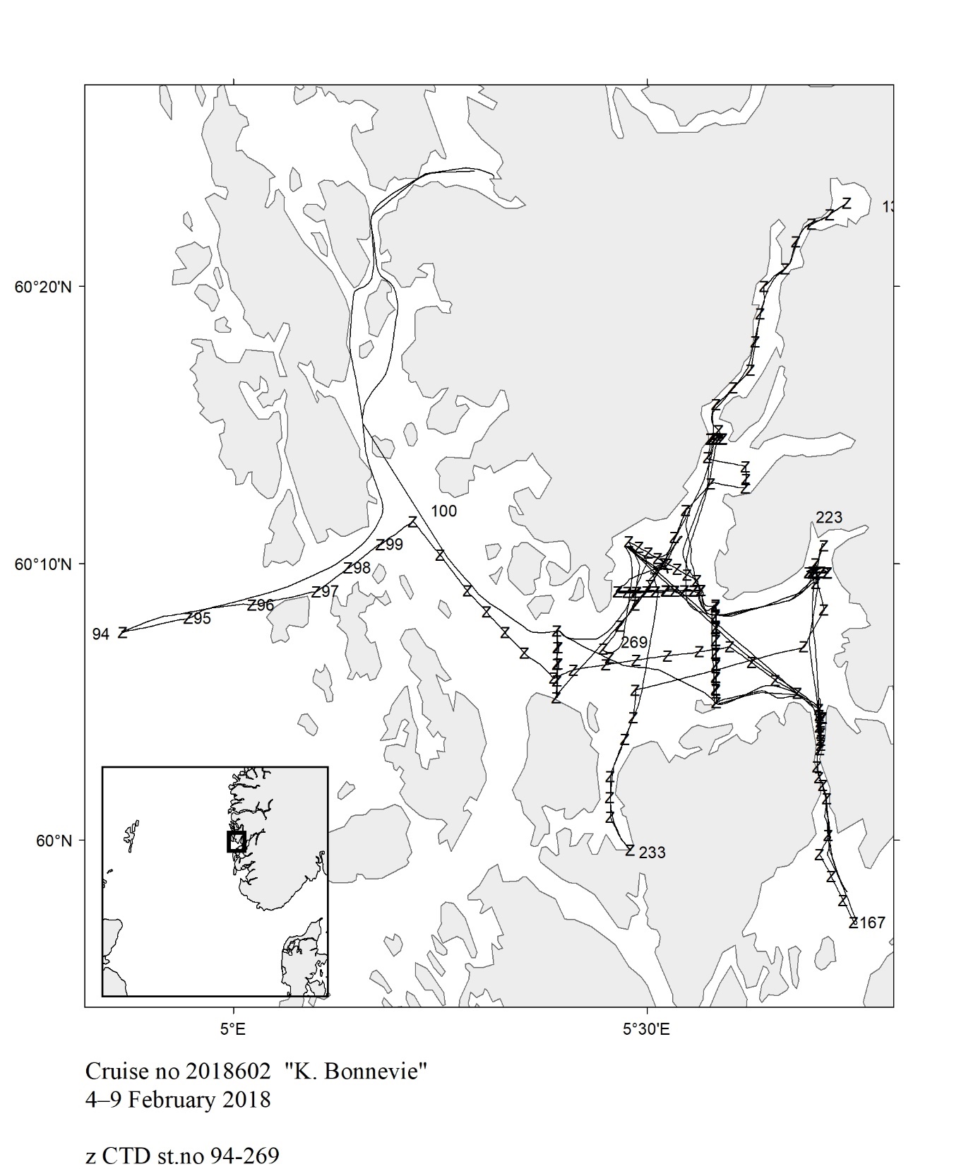 Fig. 45
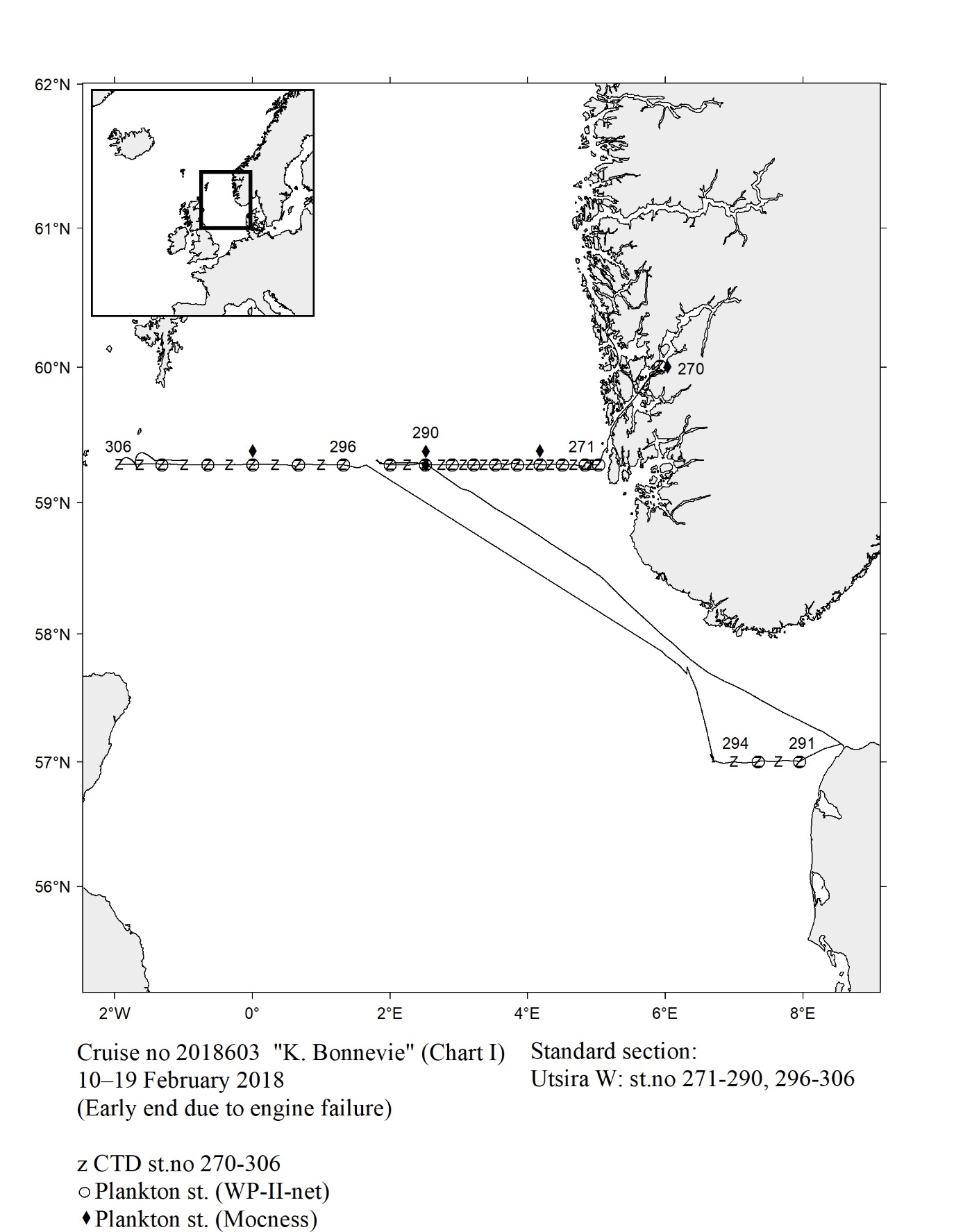 Fig. 46
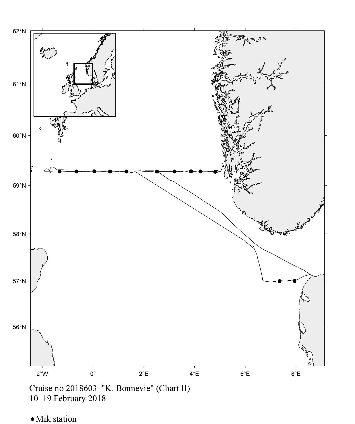 Fig. 47
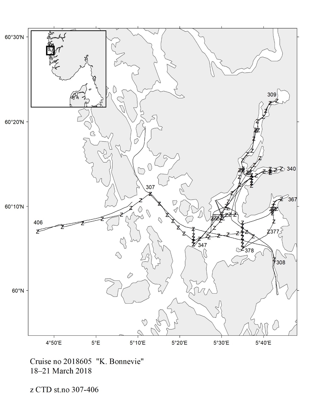 Fig. 48
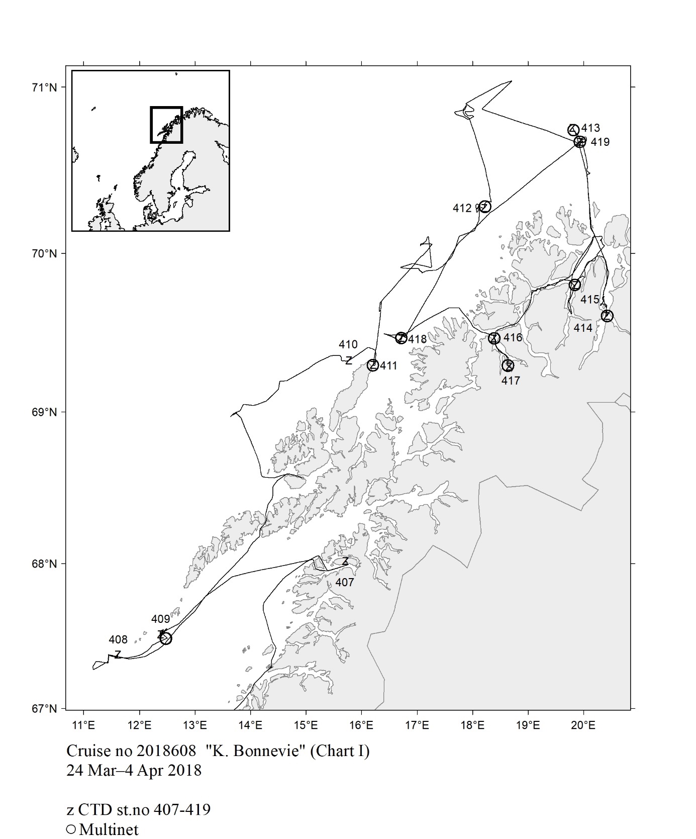 Fig. 49
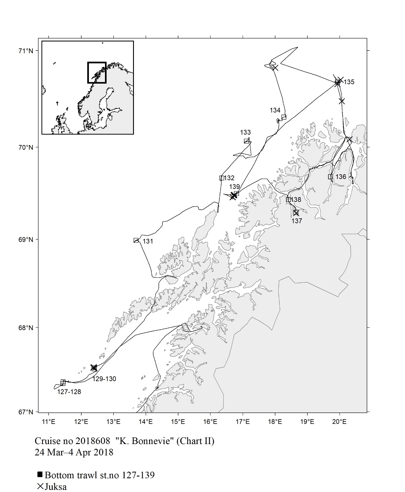 Fig. 50
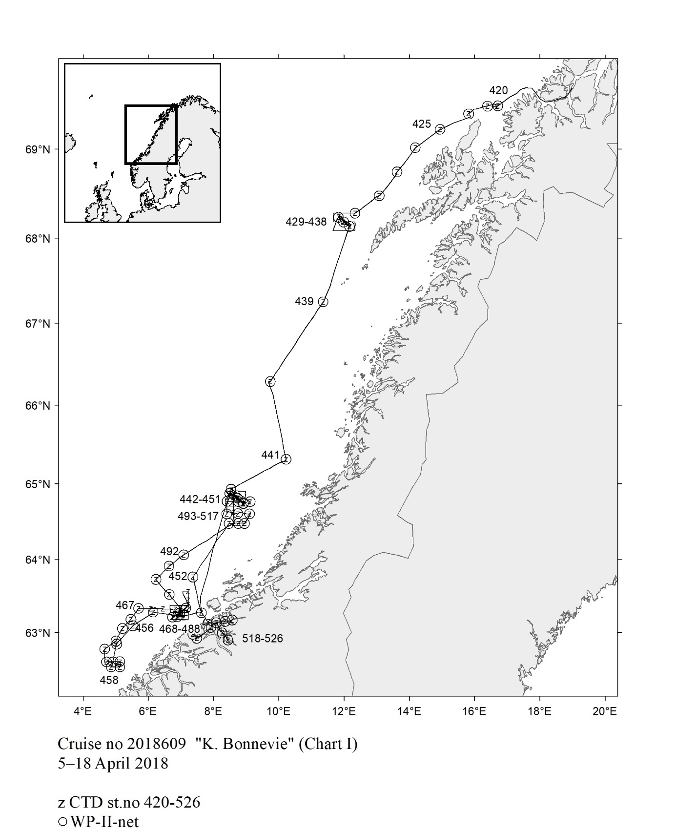 Fig. 51
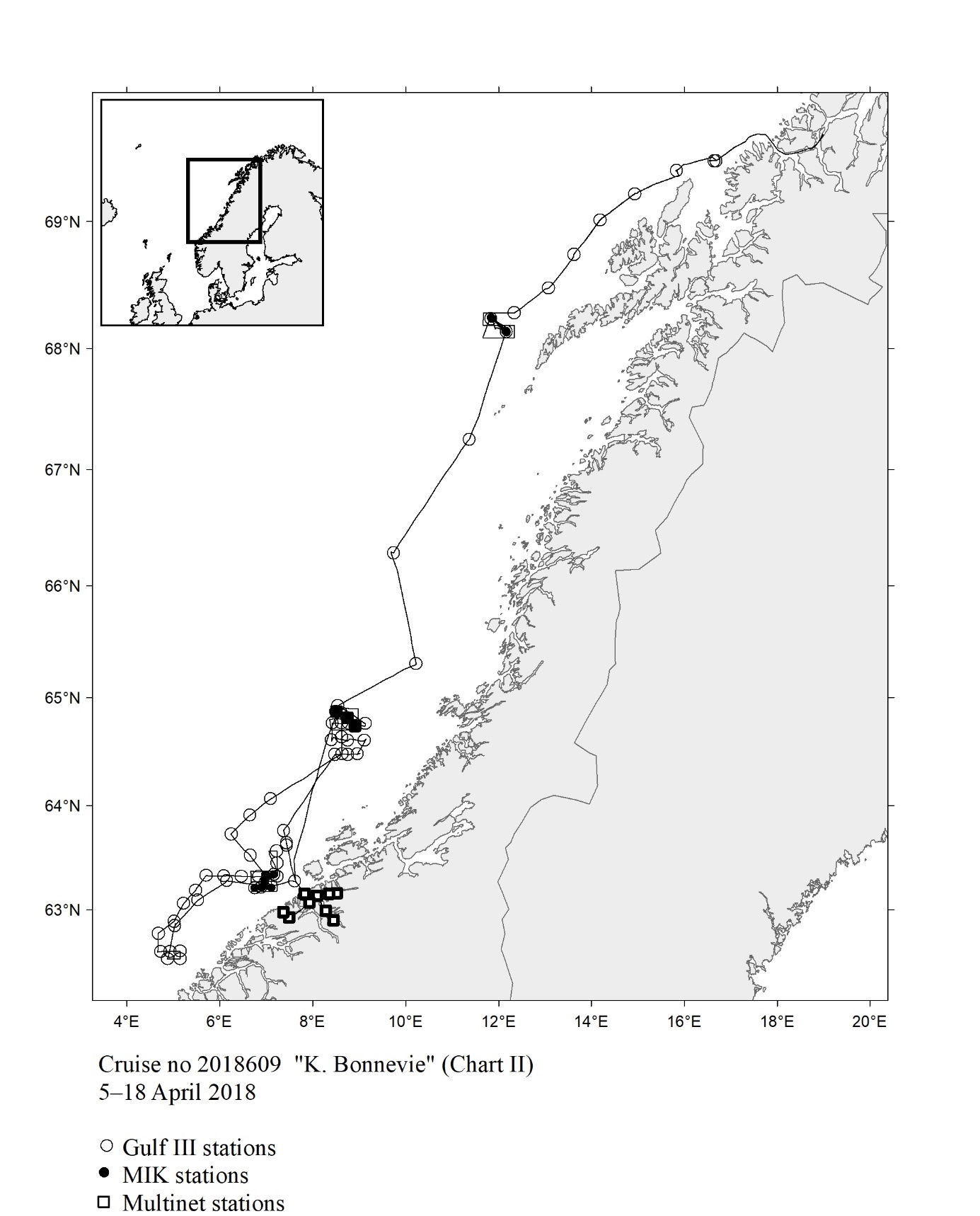 Fig. 52
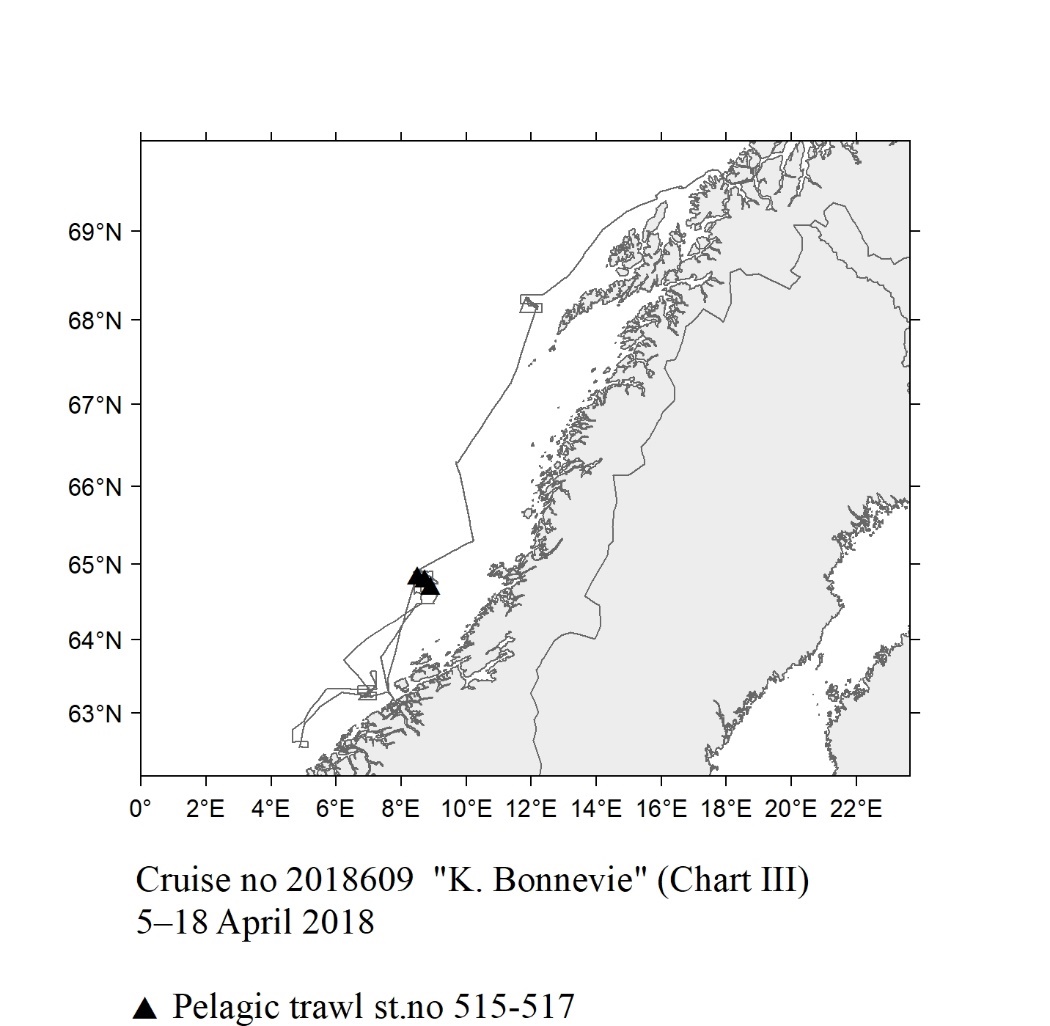 Fig. 53
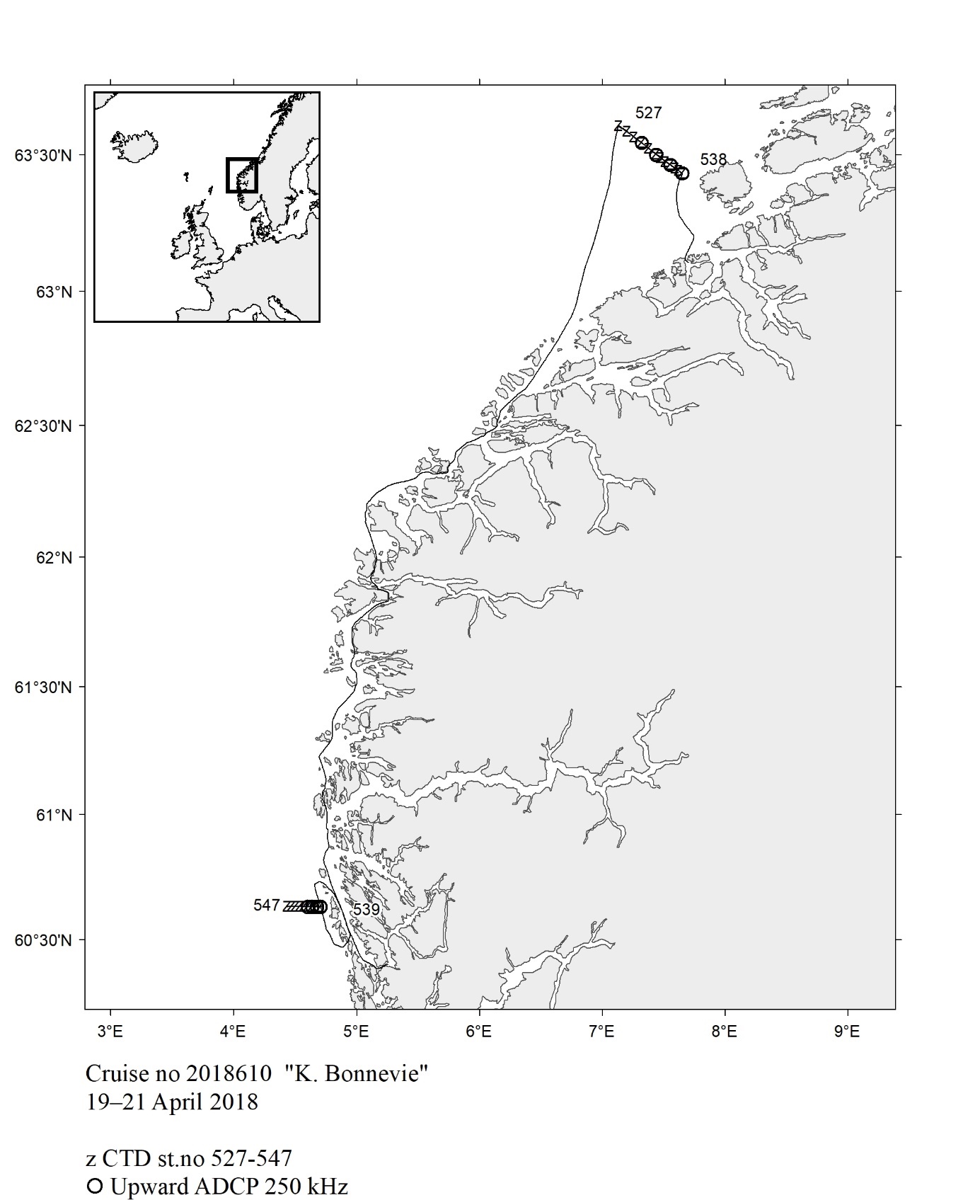 Fig. 54
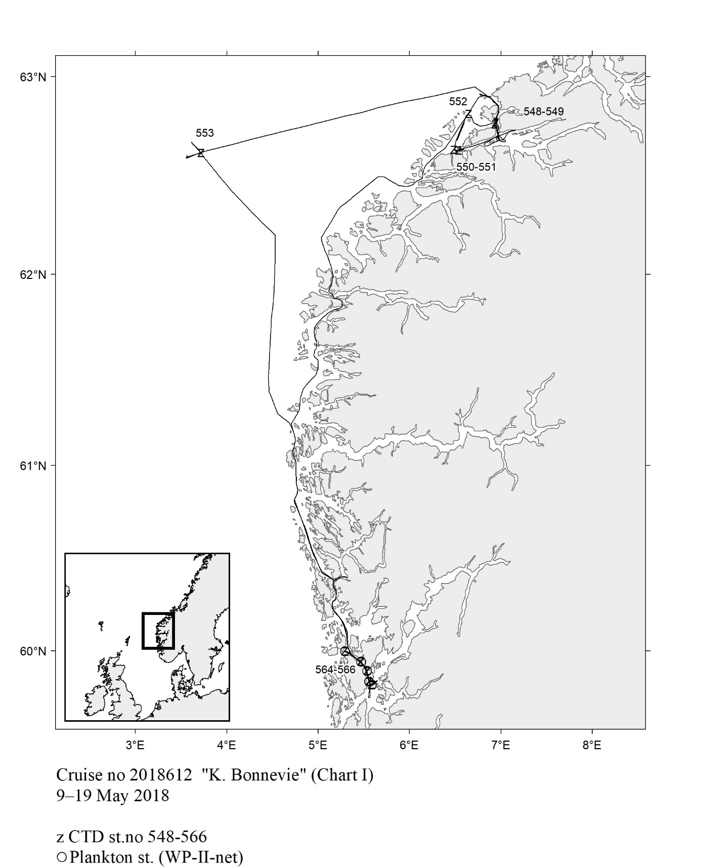 Fig. 55
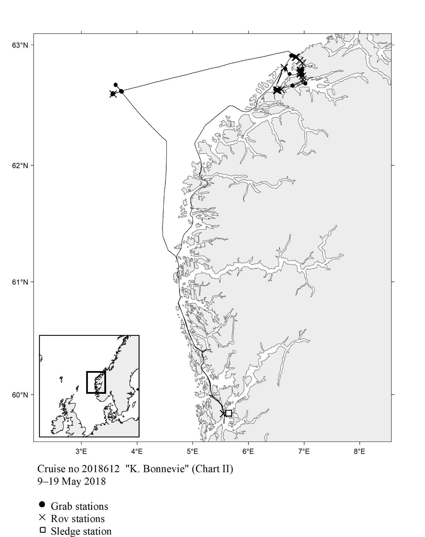 Fig. 56
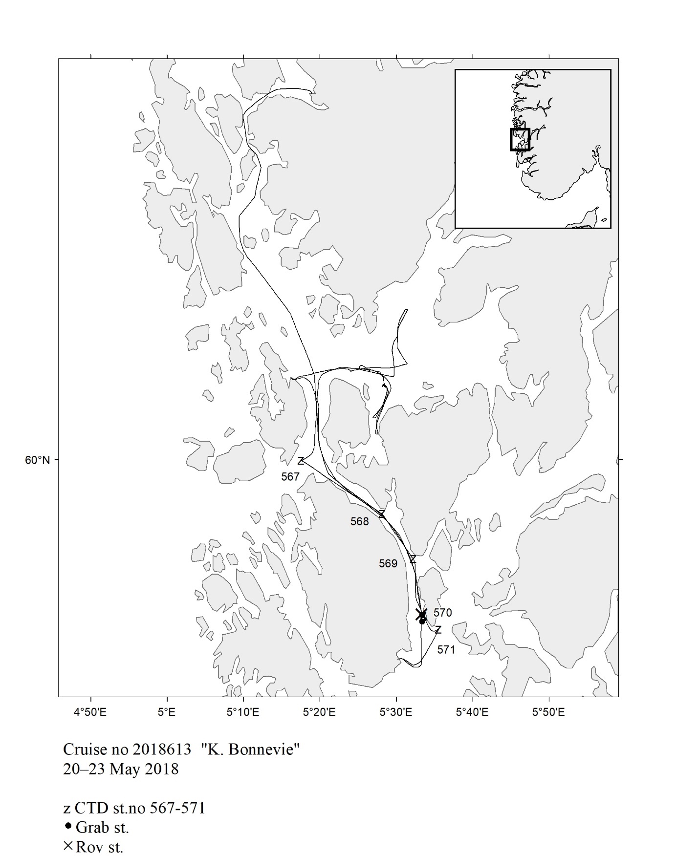 Fig. 57
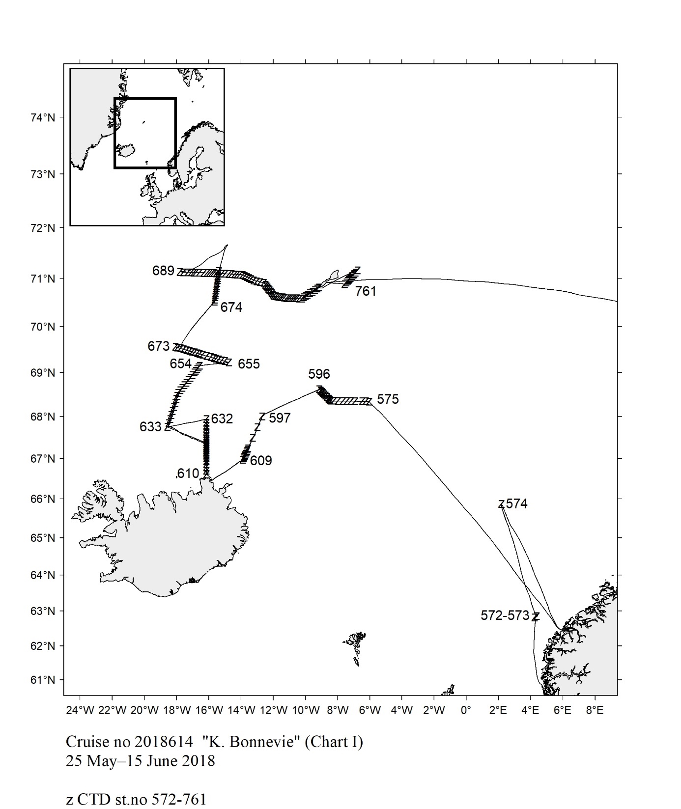 Fig. 58
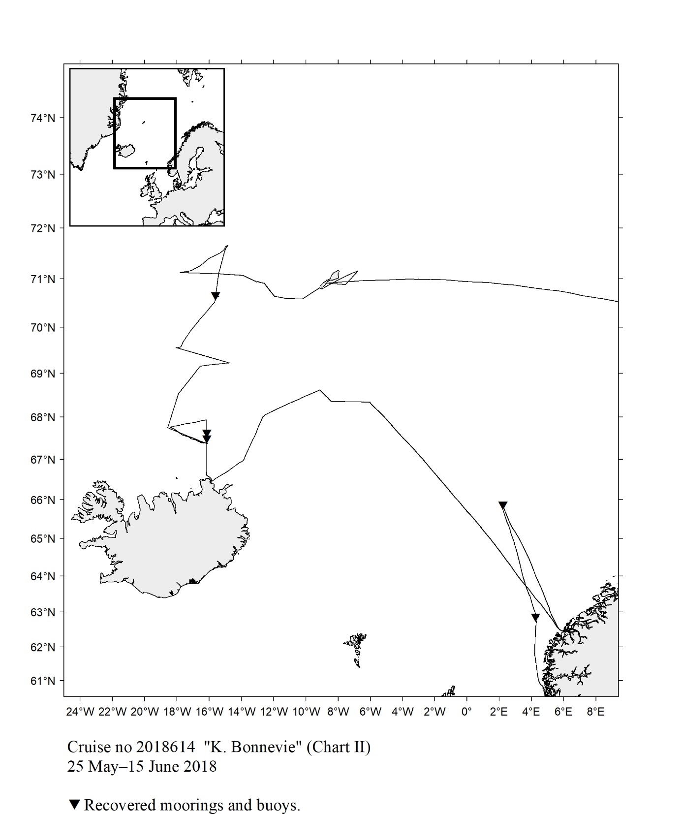 Fig. 59
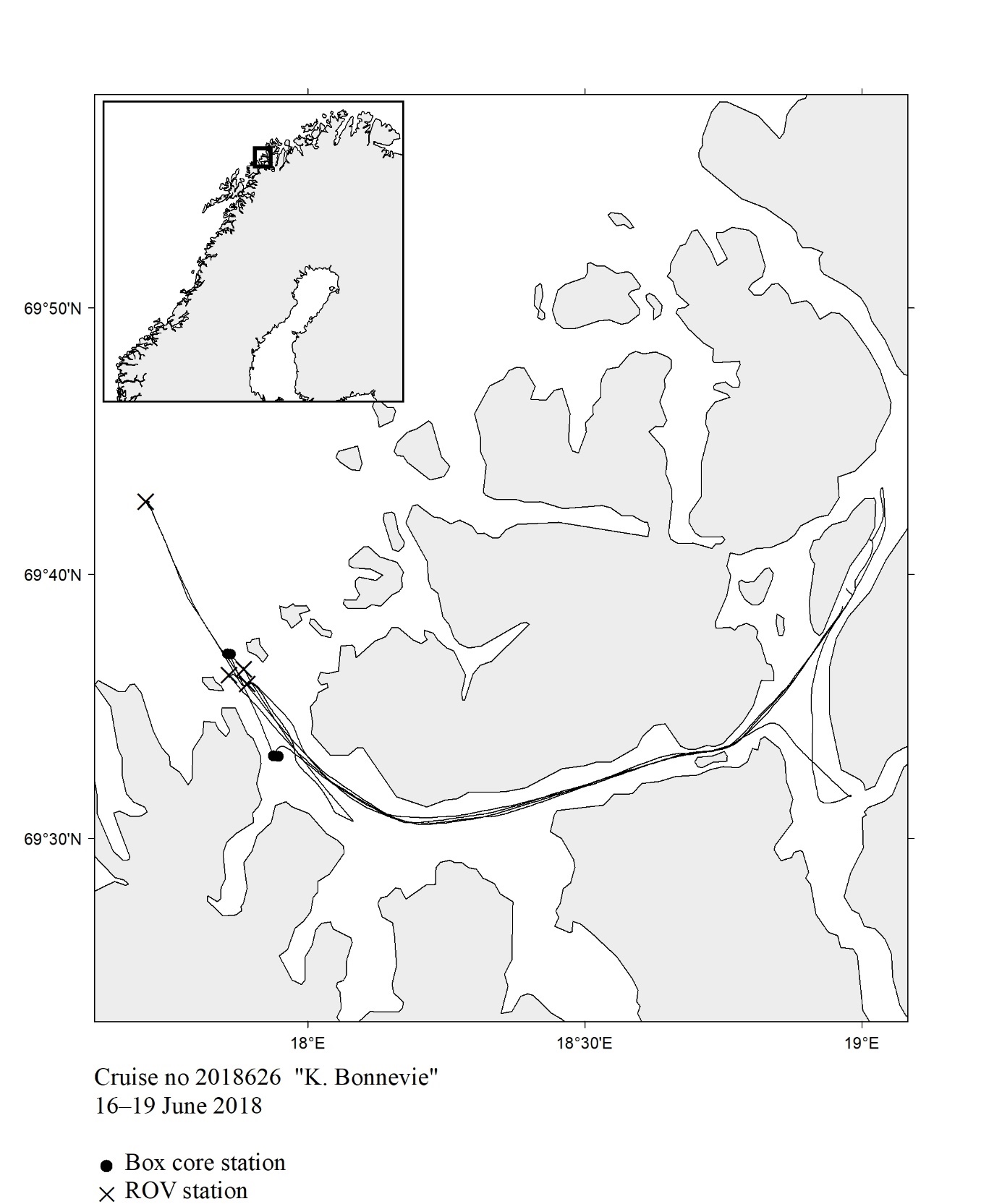 Fig. 60
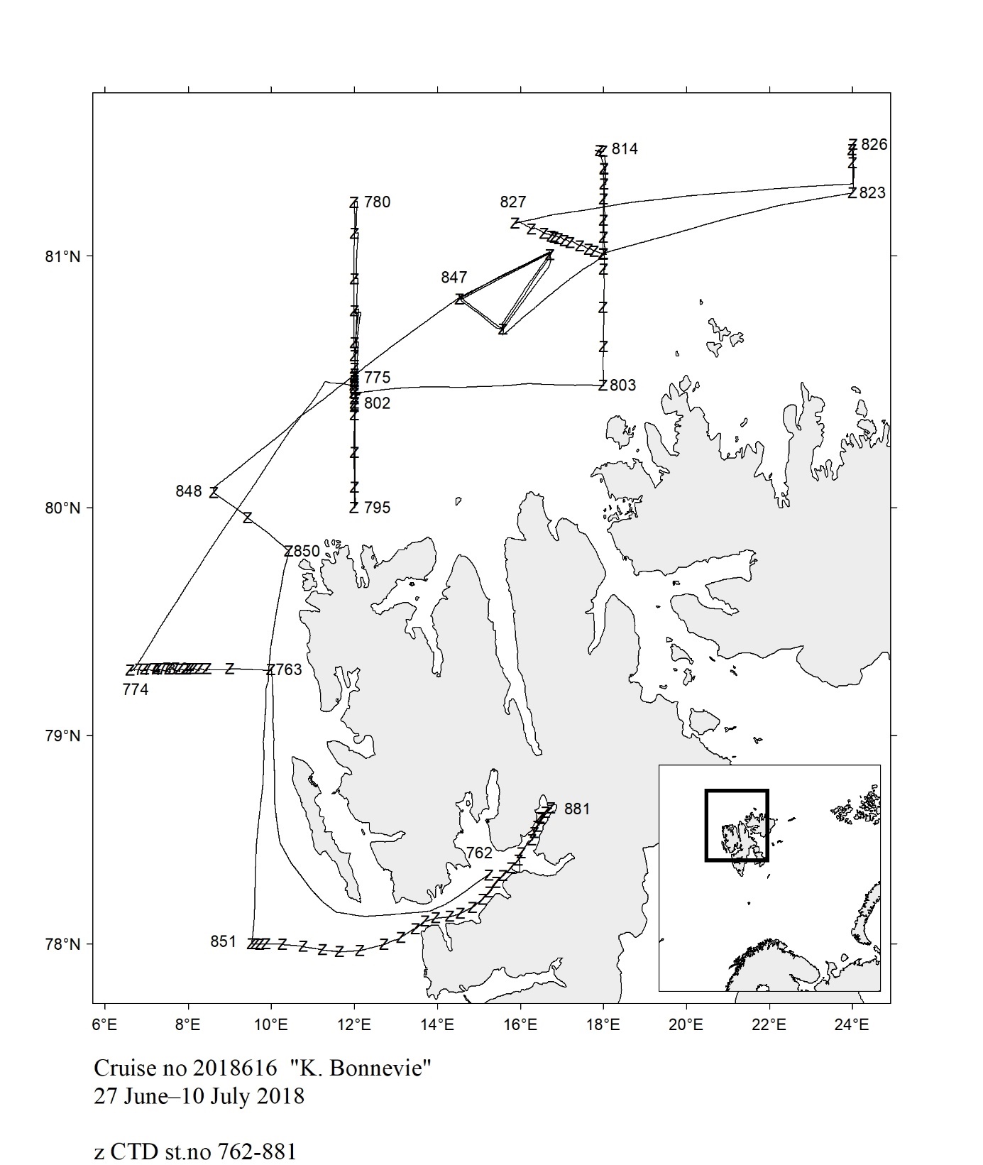 Fig. 61
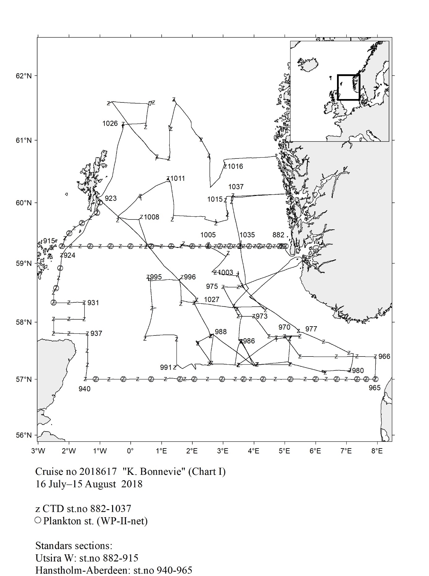 Fig. 62
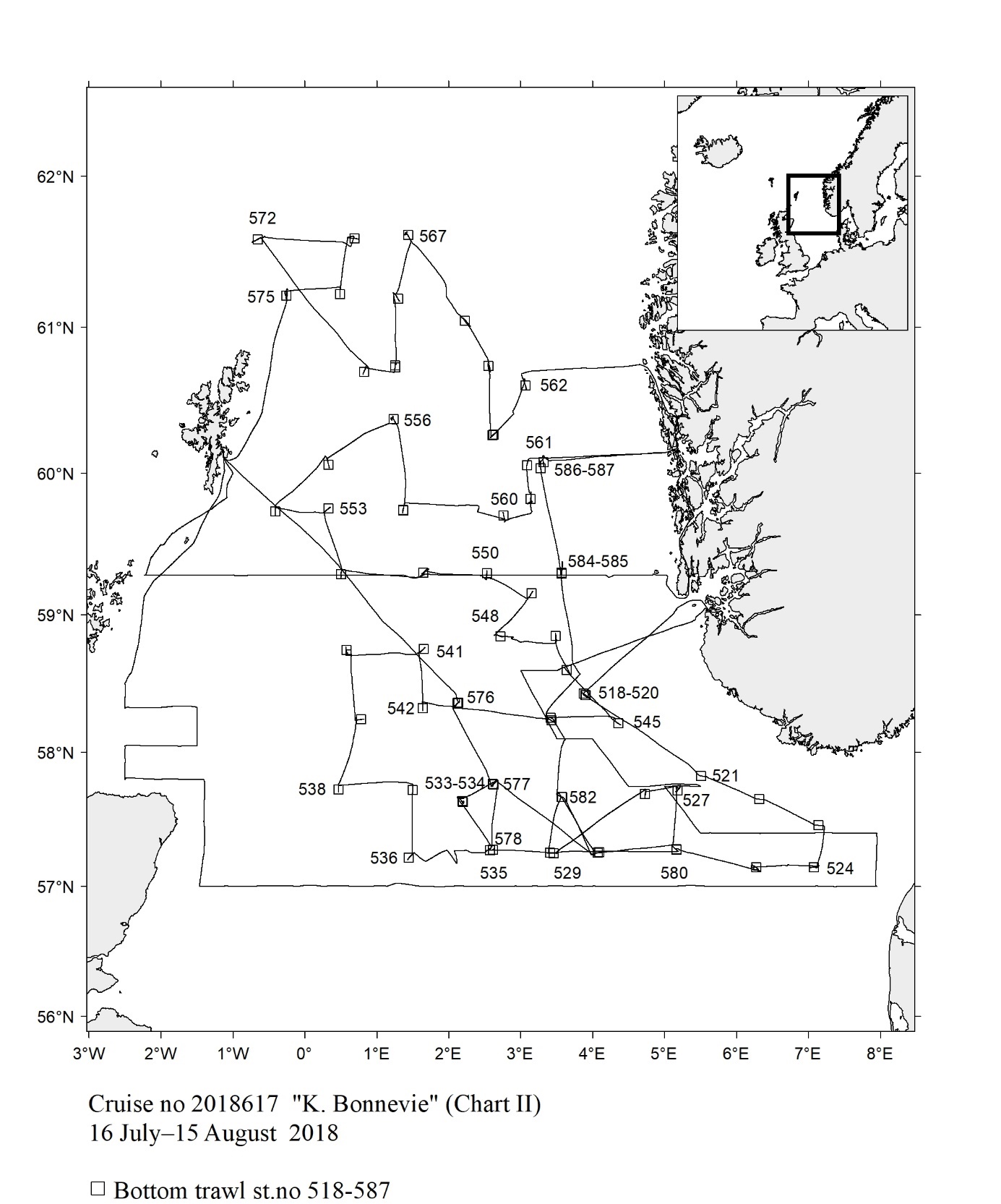 Fig. 63
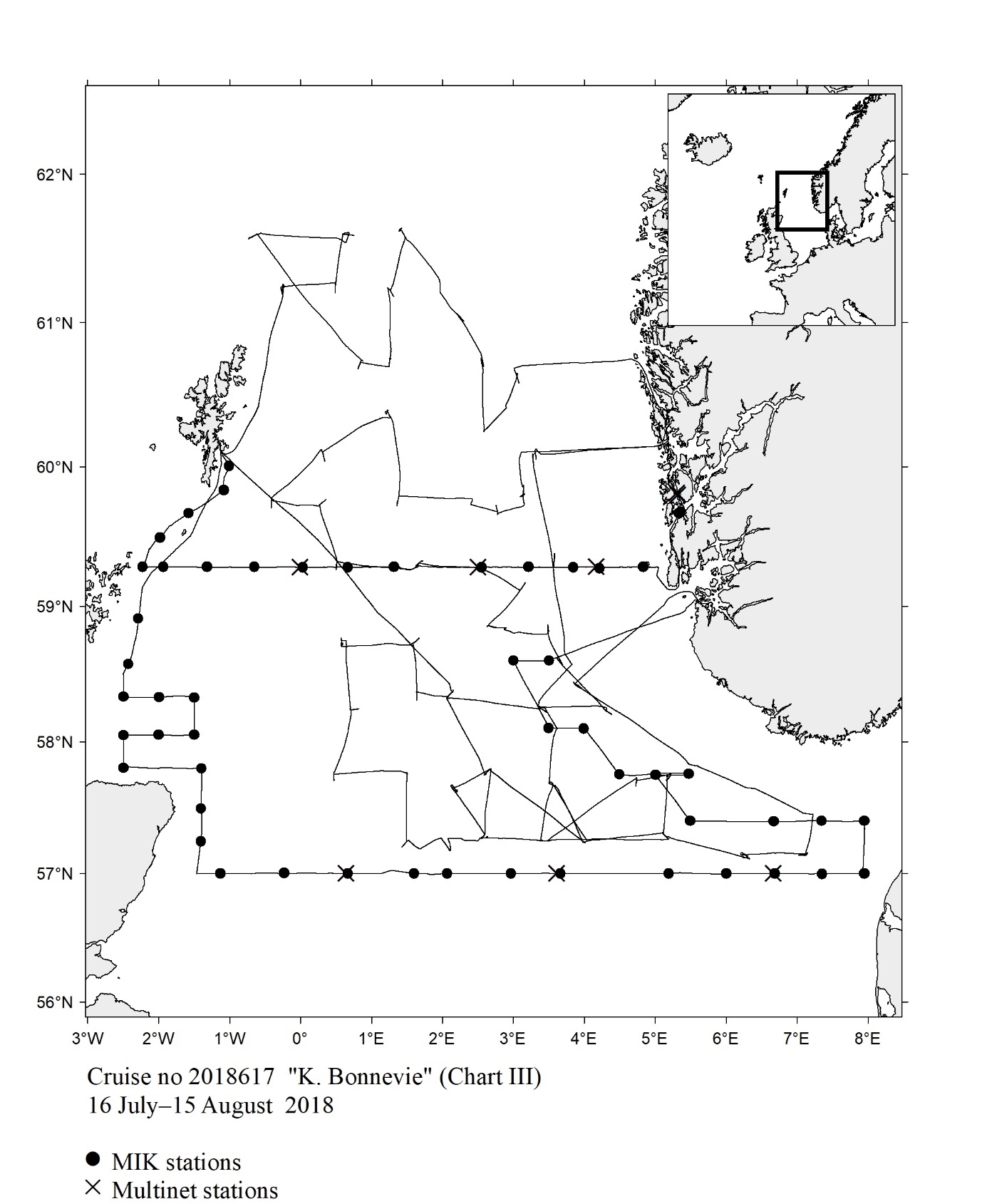 Fig. 64
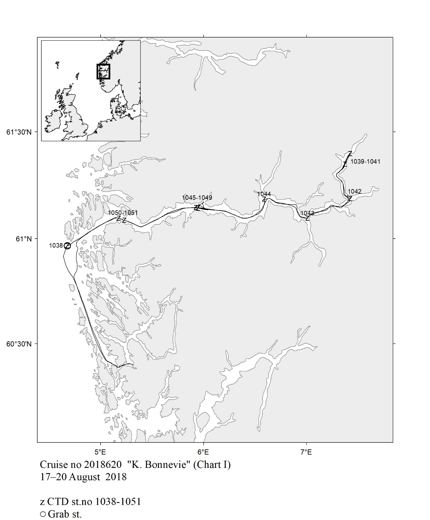 Fig. 65
 Fig. 66
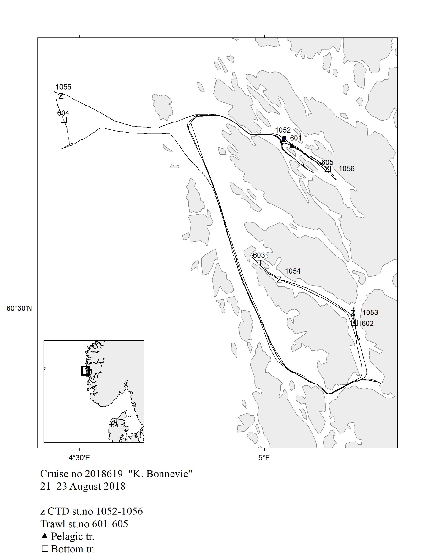 Fig. 67
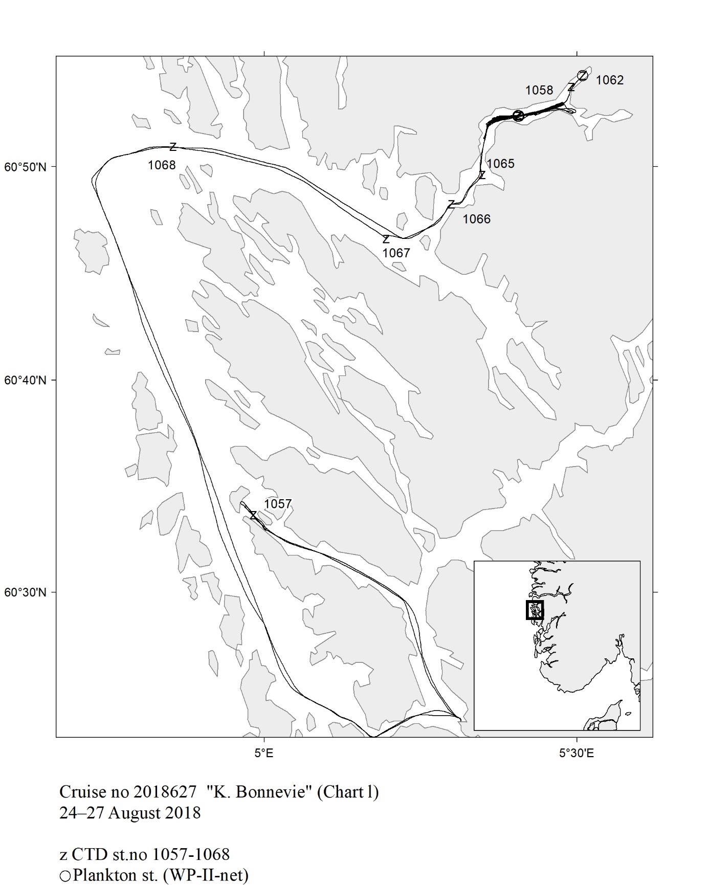 Fig. 68
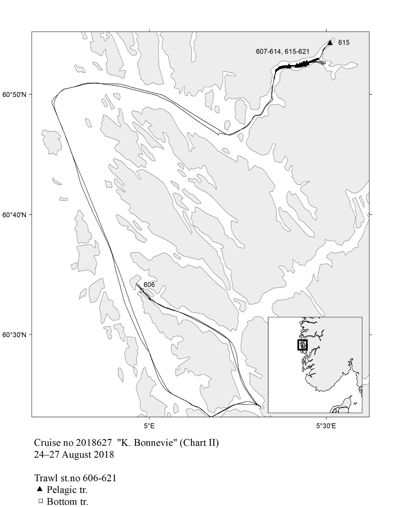 Fig. 69
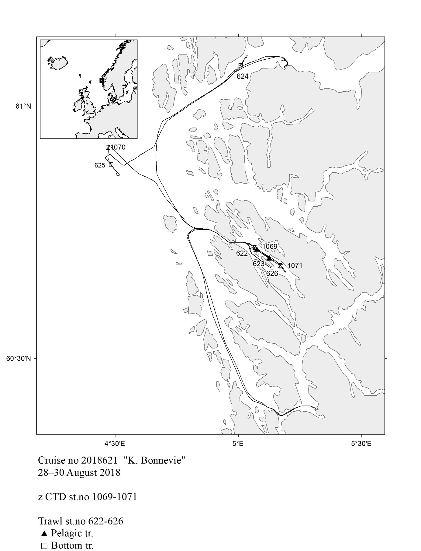 Fig. 70
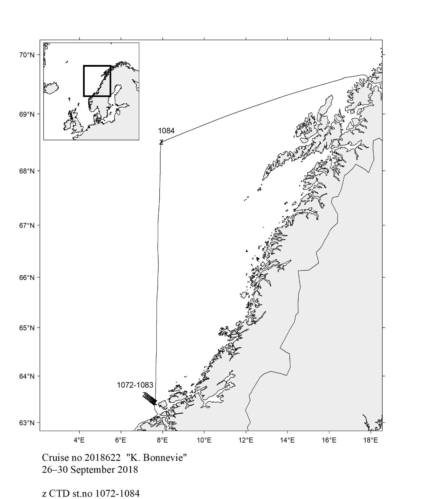 Fig. 71
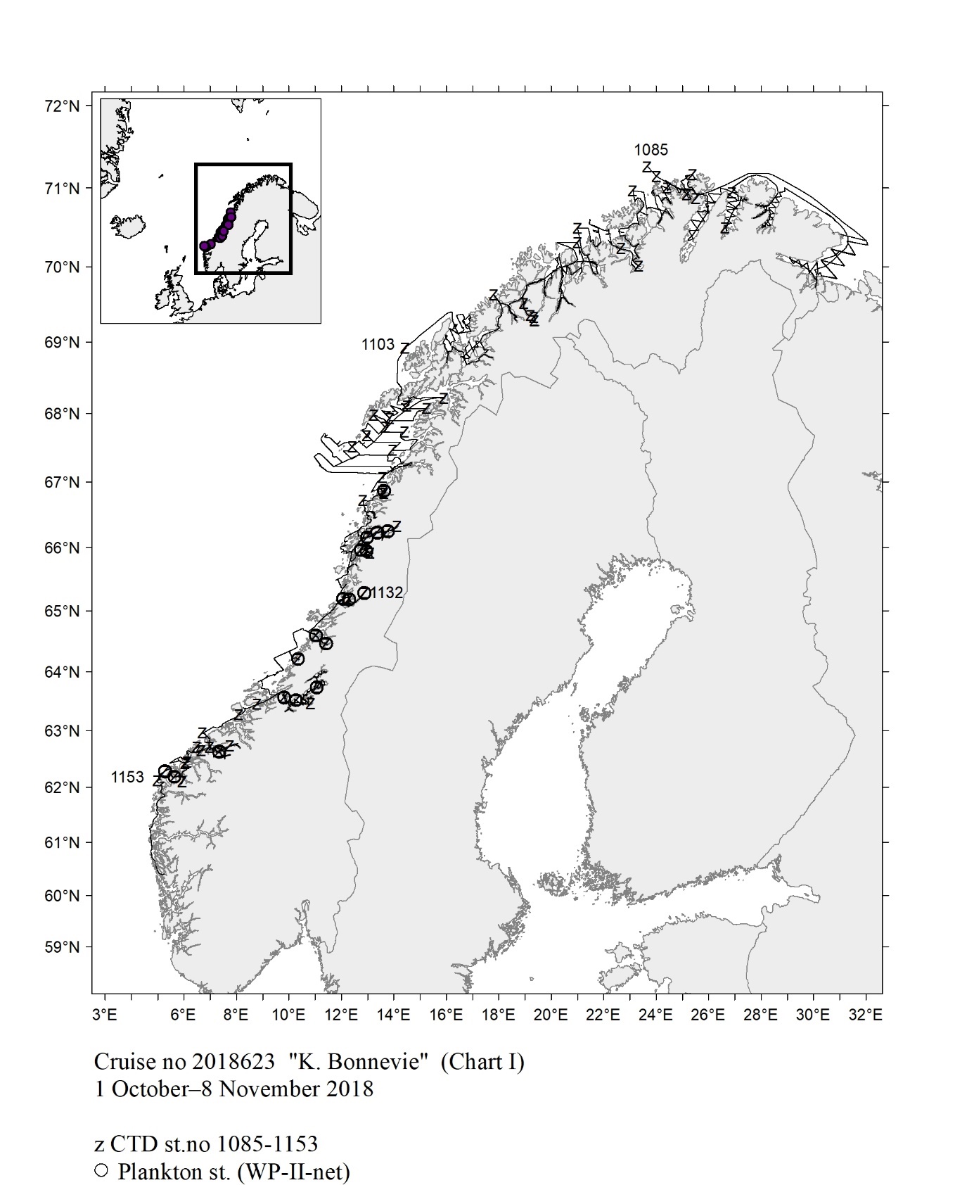 Fig. 72
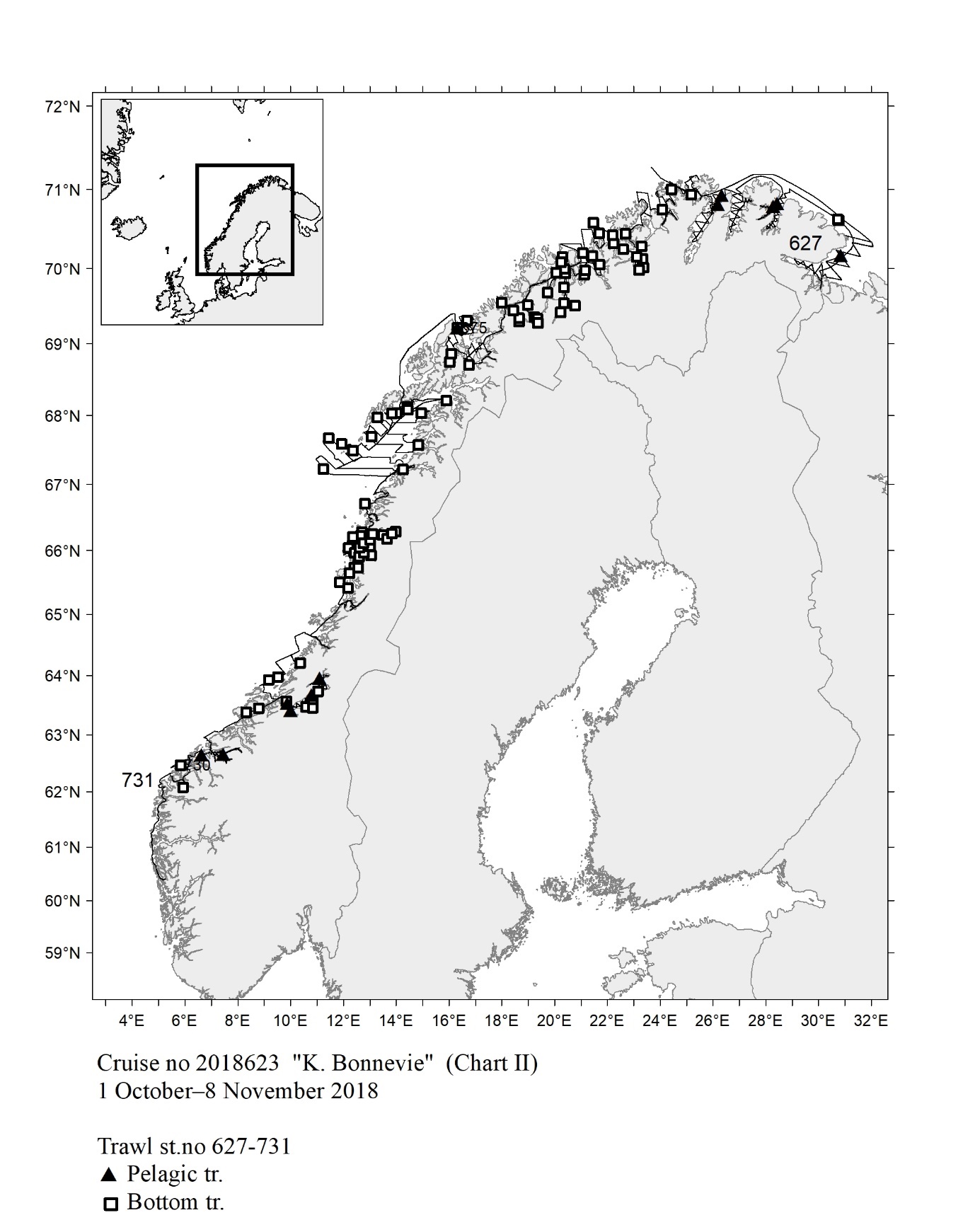 Fig. 73
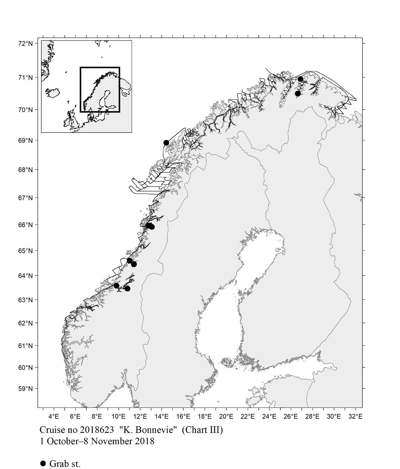 Fig. 74
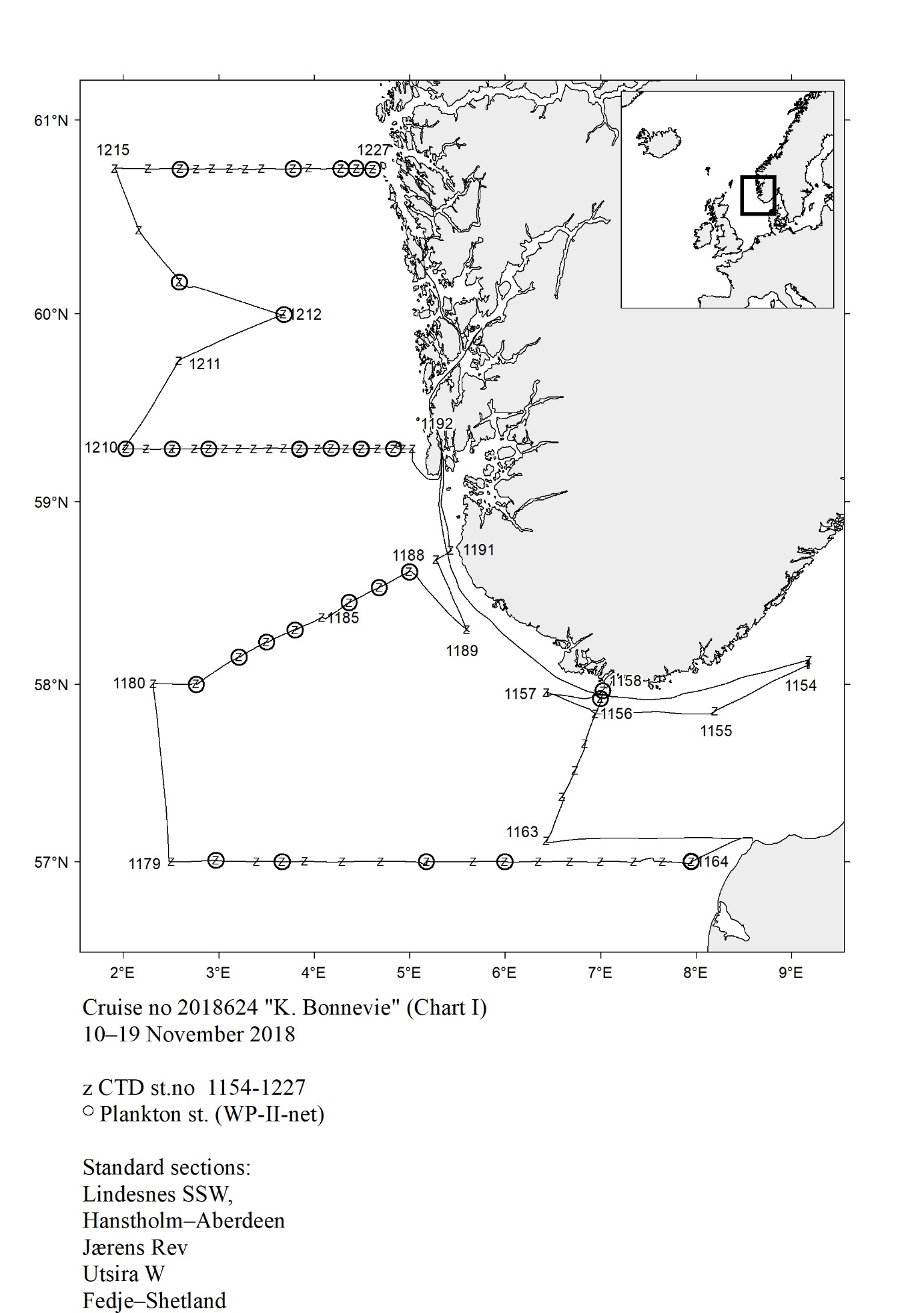 Fig. 75
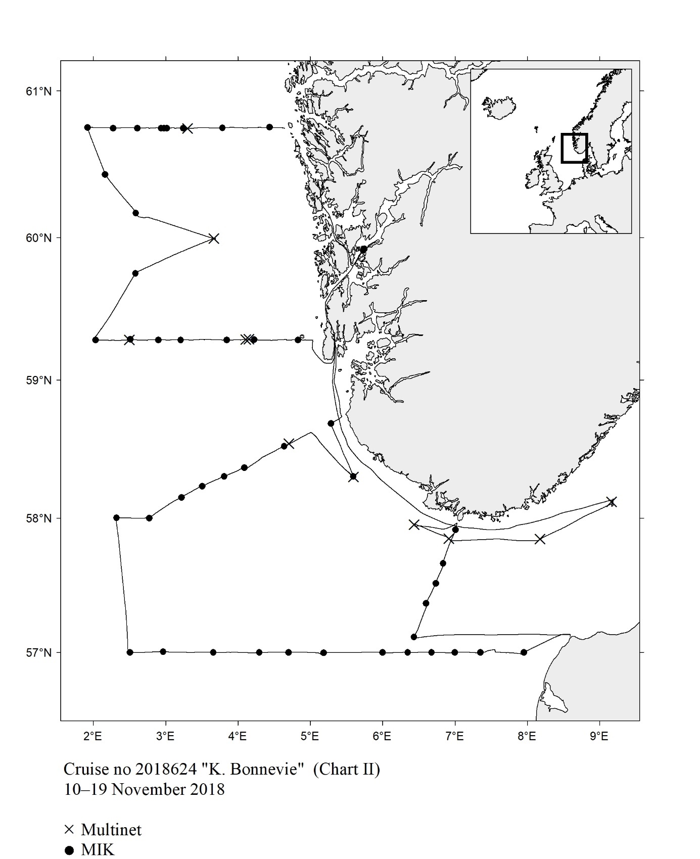 Fig. 76
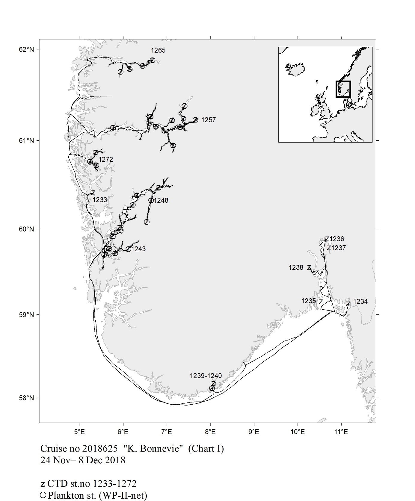 Fig. 77
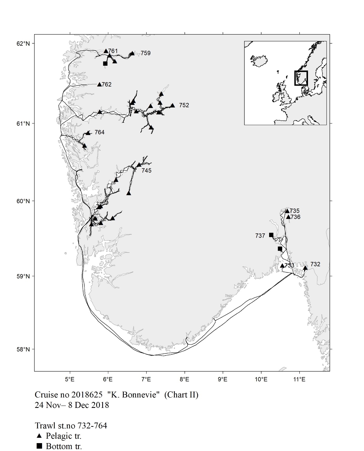
Fig. 78
8 - "Kronprins Haakon" - (Ship code no 59). Cruises 2018.
| Cruise no | Period | Purpose | Area | CTD st.no | Trawl st.no | Fig. no |
| 20186701 | - | Cancelled | - | - | - | - |
| 20186702 | - | Cancelled | - | - | - | - |
| 2018704 | - | Cancelled | - | - | - | - |
| 2018715 | 16.7.-19.7. | Calibration of 6 EK80 in drop keel and 6 EK80 in arctic tanks, two fisheries sonars, the SU90 and SH90 systems, including the ME70 multibeam echo sounder and MS70 multibeam sonar. Noise measurements under different vessel speeds on all systems. | Norwegian coast | - | - | - |
| 2018706 | - | - | - | - | - | - |
| 2018713 | 23.7.-26.7. | Test. Plankton, oceanography, benthos. | Norwegian coast | - | - | - |
| 2018707 | 6.8.-23.8. | AeN Joint Cruise 1_2 is the first joint cruise in the Nansen LEGACY project. Main focus was on comparing the state of the physical, chemical and biological conditions in the southern and northern parts of the Barents Sea and the adjacent Nansen Basin. Given this is the first research cruise on the vessel, the cruise also focuses on testing gear and equipment, and establishing routines for gear deployments, collaboration, data management and storing. | Arctic Ocean Barents Sea | 1-21 | 1-18 | 79-80 |
| 208708 | 25.8.-11.9 | Annual Fram Strait cruise August-September 2018. | Fram Strait between the Nordic Seas and the Arctic Ocean | 22-93 | - | 81 |
| 2018709 | 12.9.-24.9. | The objective was to identify and quantify the processes that are important for the heat budget of a control volume north of Svalbard. The cruise will also contribute to a PhD study (UIB) that aims to further develop, and test advanced technology. | Shelf and slope north of Spitsbergen. | 94-161 | - | 82-83 |
| 20186710 | 26.9.-20.10. | This cruise is part of the Nansen Legacy project and the research focus 1 (RF1) “Natural drivers”, subtask T1-3.1. RF1 aims to improve our understanding of the physical climate system in the Barents Sea and adjacent Arctic Basin. Subtask T1-3.1 will investigate the natural variability and ranges of sea ice cover and Atlantic Water through flow in the Barents Sea. The Barents Sea and Arctic climates in general comprise a strong component of natural variability. For any attempt to project and predict future changes in this environment, it is important to understand the range of this variability, its evolution over time, and its responsiveness to external drivers. The paleoclimate records provide this strongly needed insight and will enable assessment of the changes associated with prior intervals where sea ice cover was less and temperatures were higher than those experienced in the recent past were when instrumental and observational records were obtained. | Barents Sea | 162-180 | - | 84-86 |
| 2018711 | 22..10.-2.11 | Collection of geodata for studies of geological development and gas emissions. | Barents Sea Svalbard area | 181-198 | - | 87 |
| 2018712 | - | Cancelled | - | - | - | - |
9 - “Kronprins Haakon” – Charts for cruises 2018
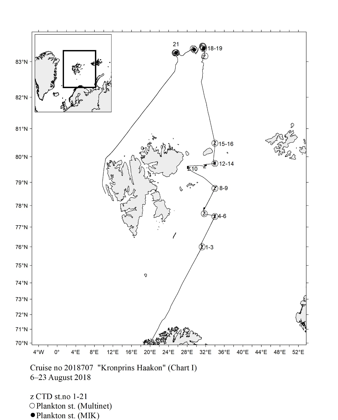
Fig. 79
Fig. 80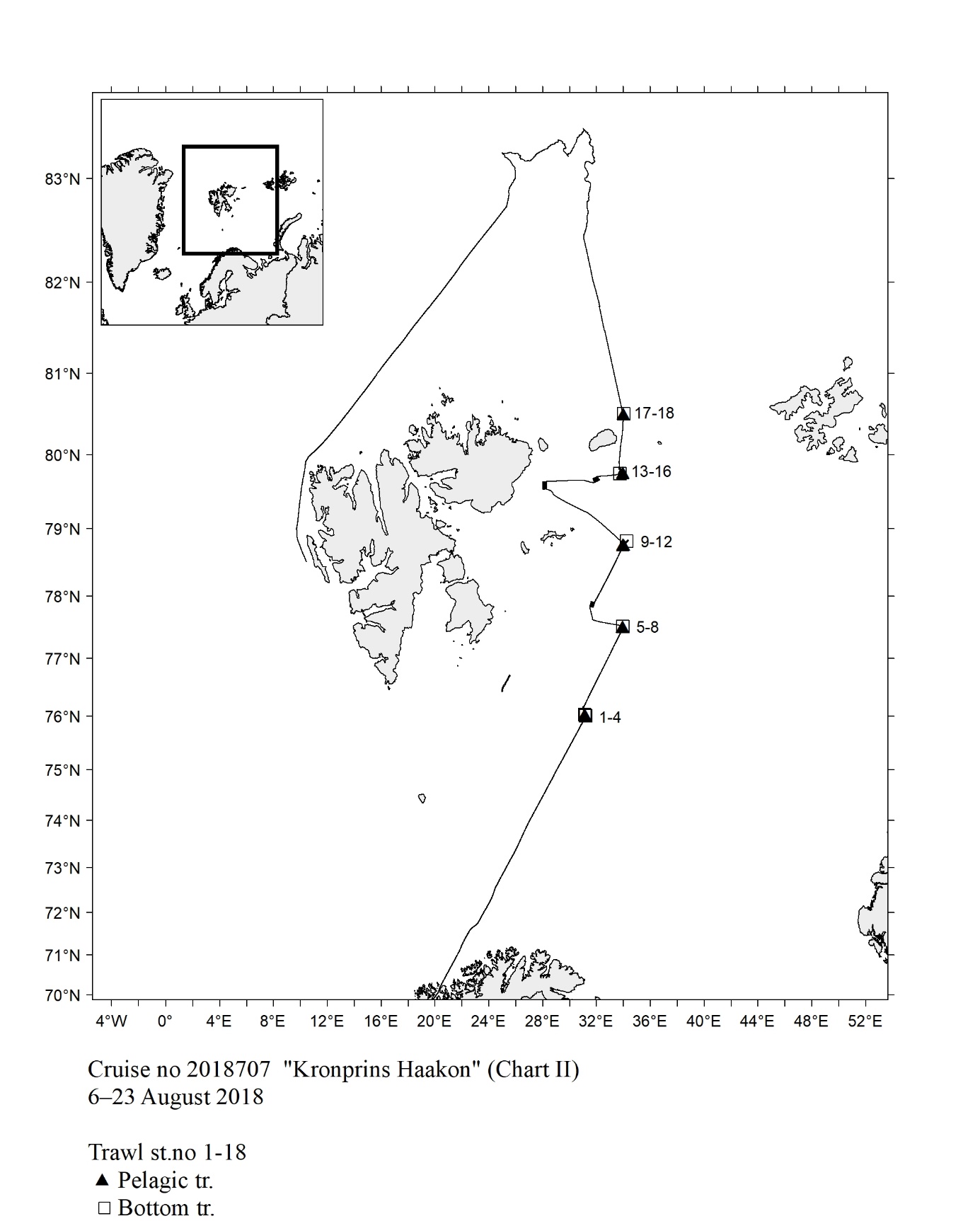
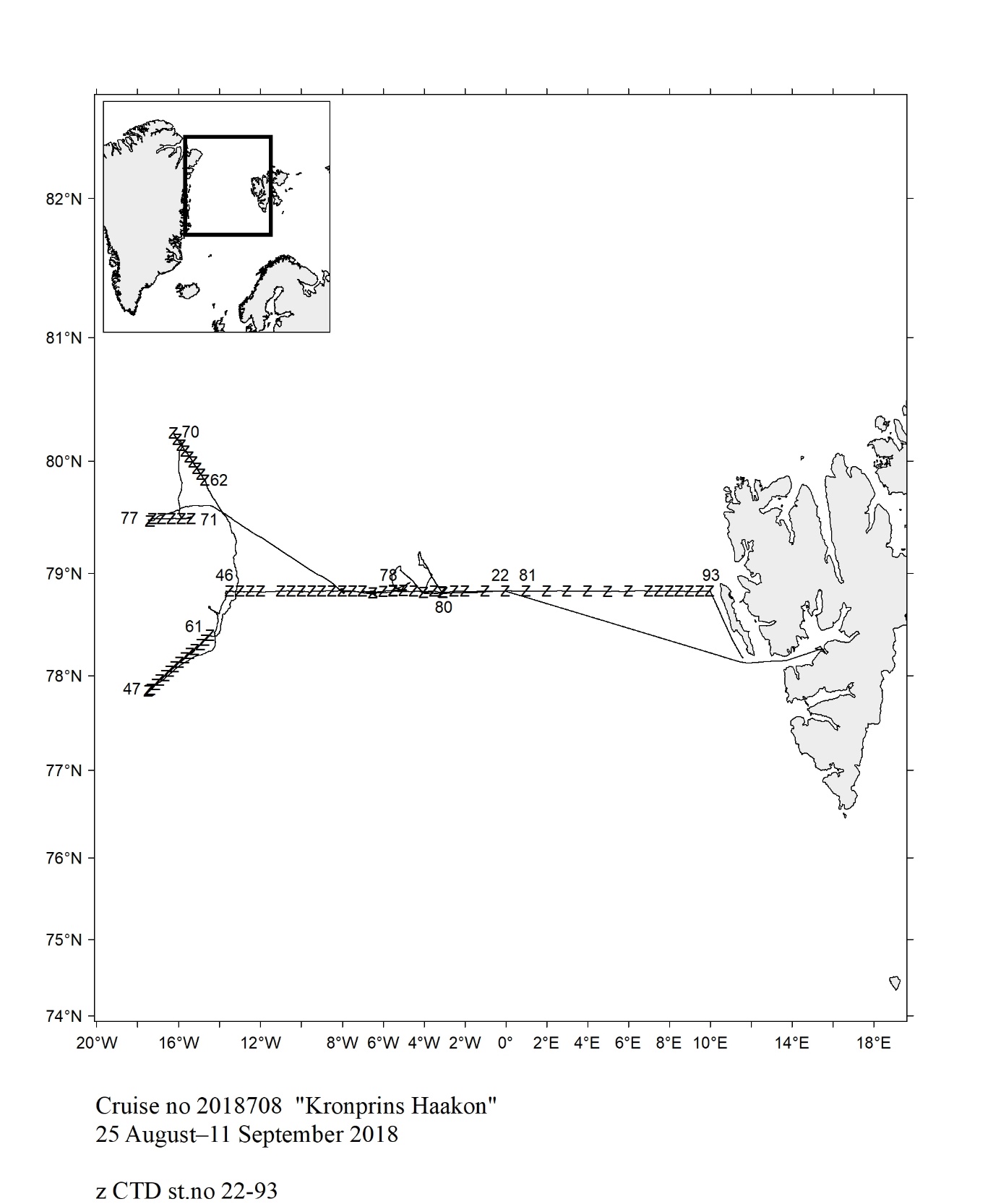 Fig. 81
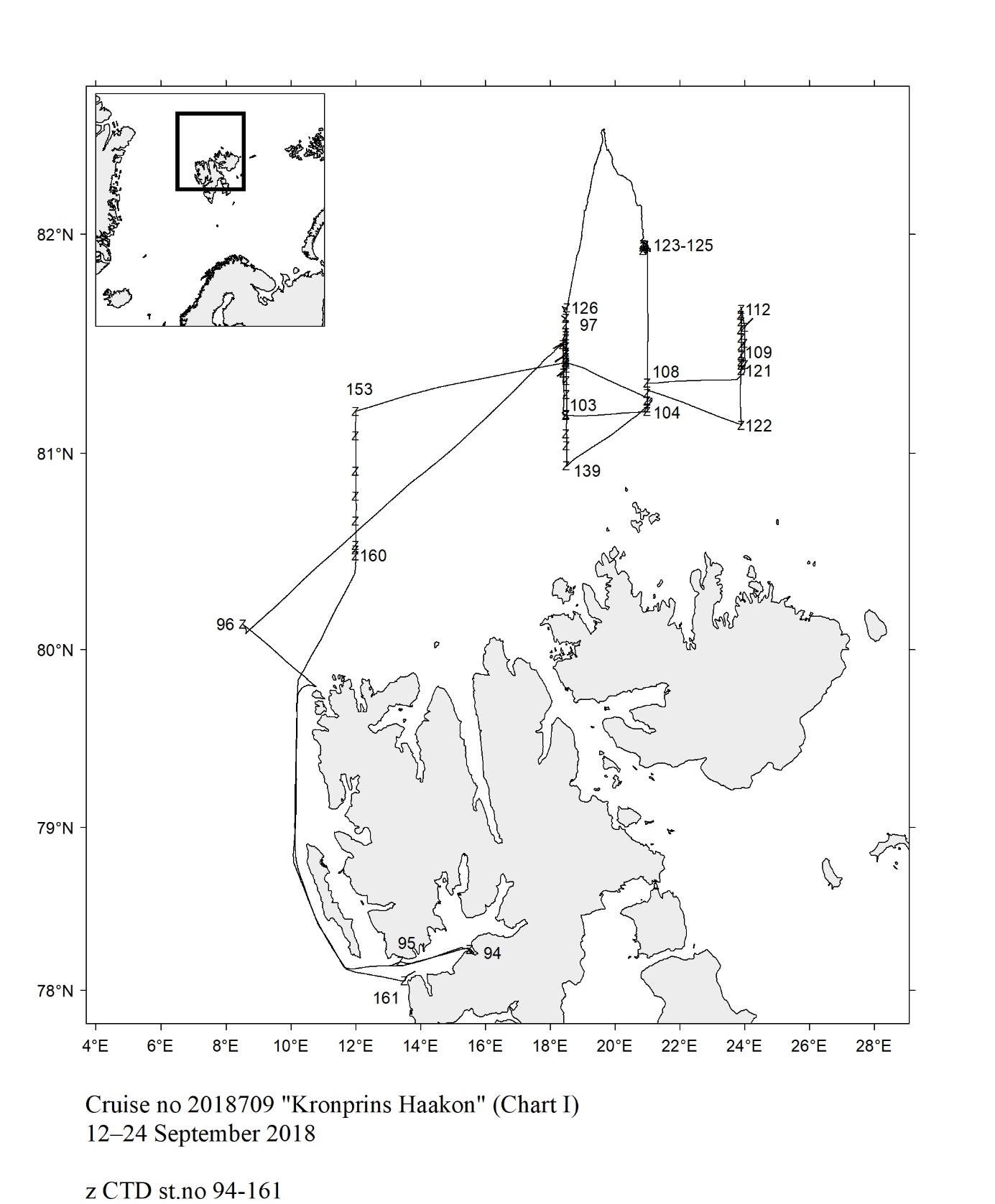
Fig. 82
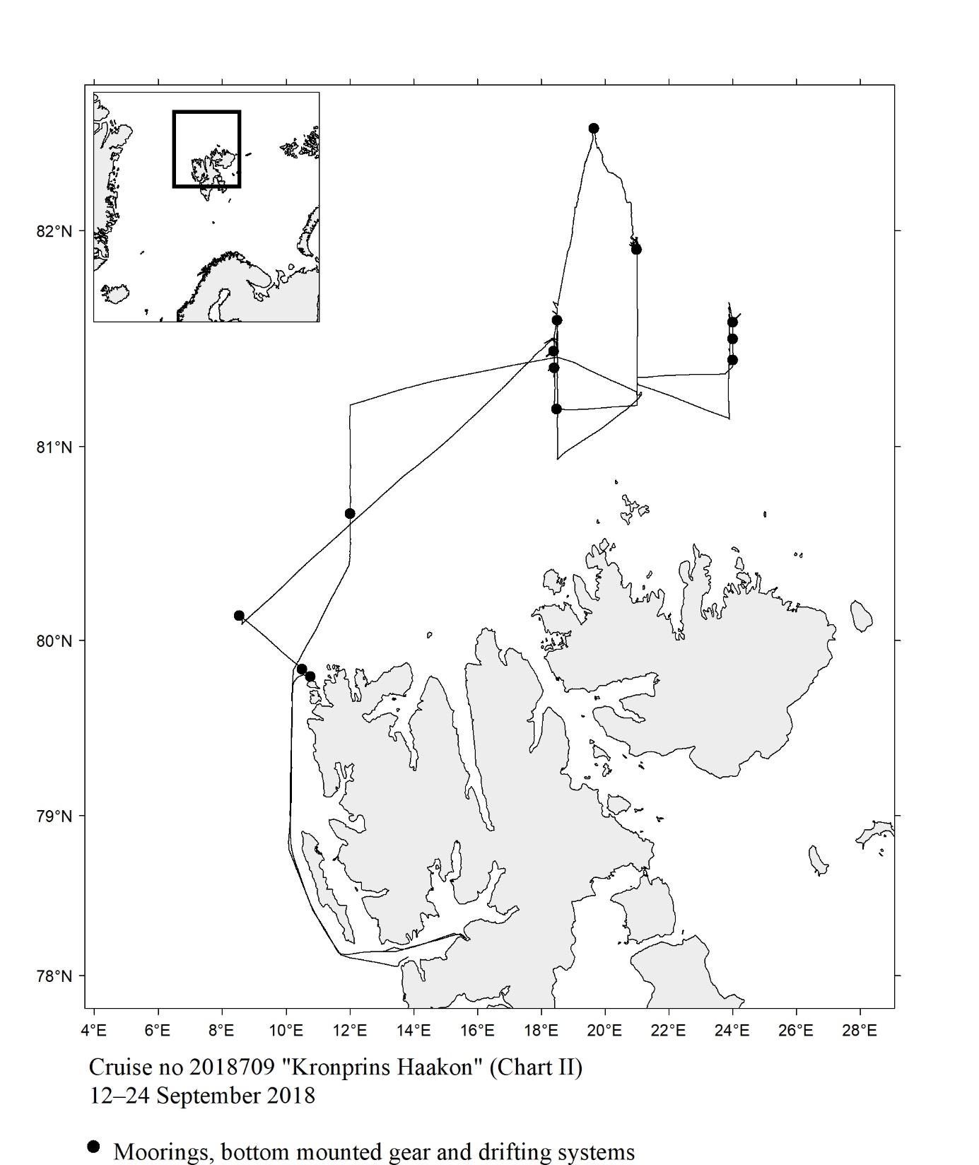 Fig. 83
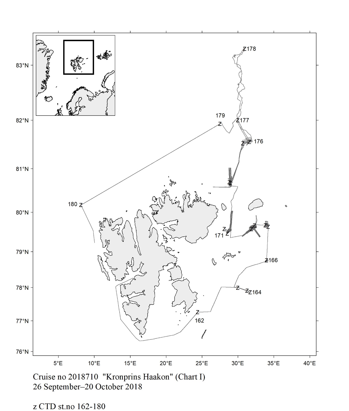
Fig. 84
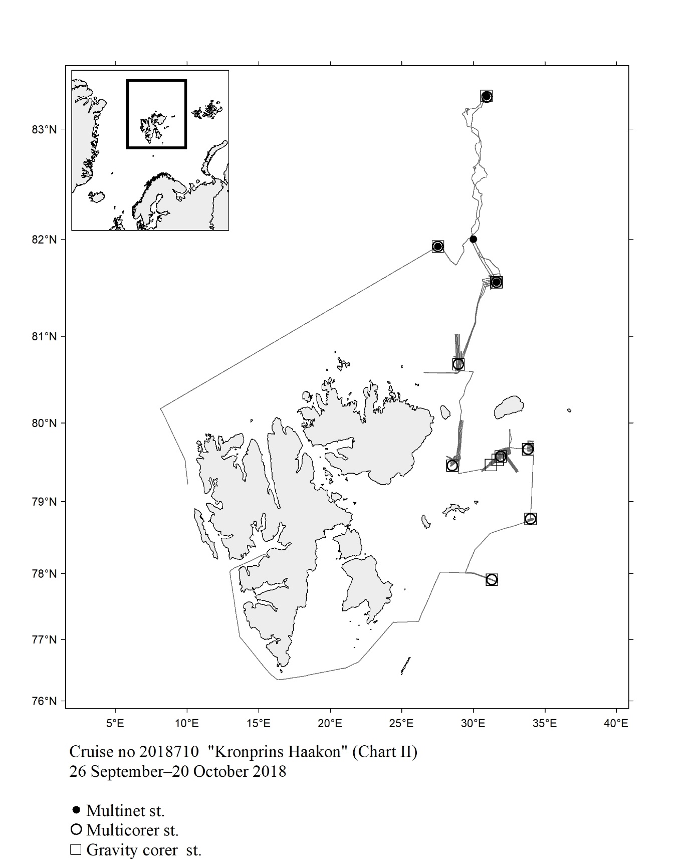 Fig. 85
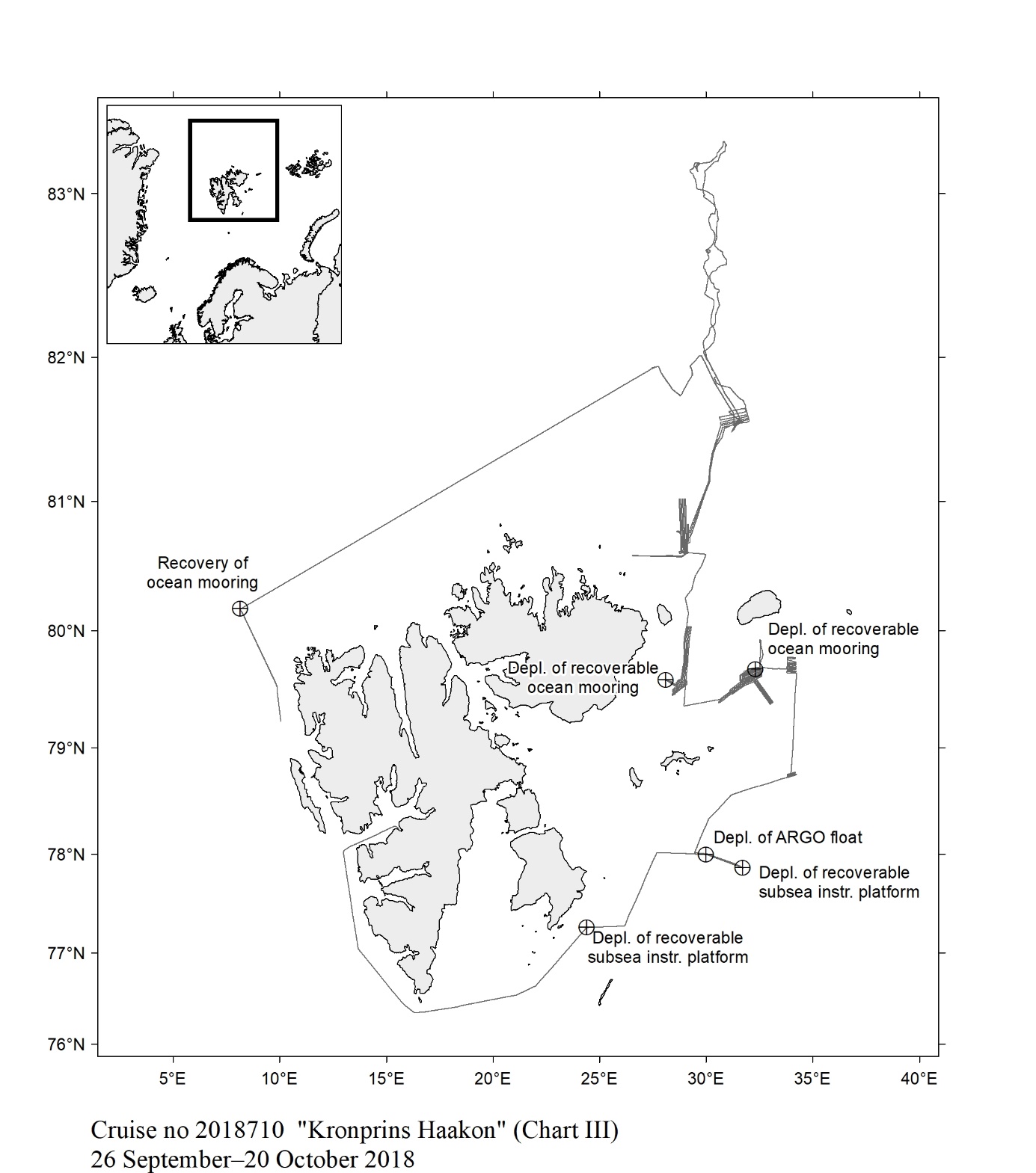 Fig. 86
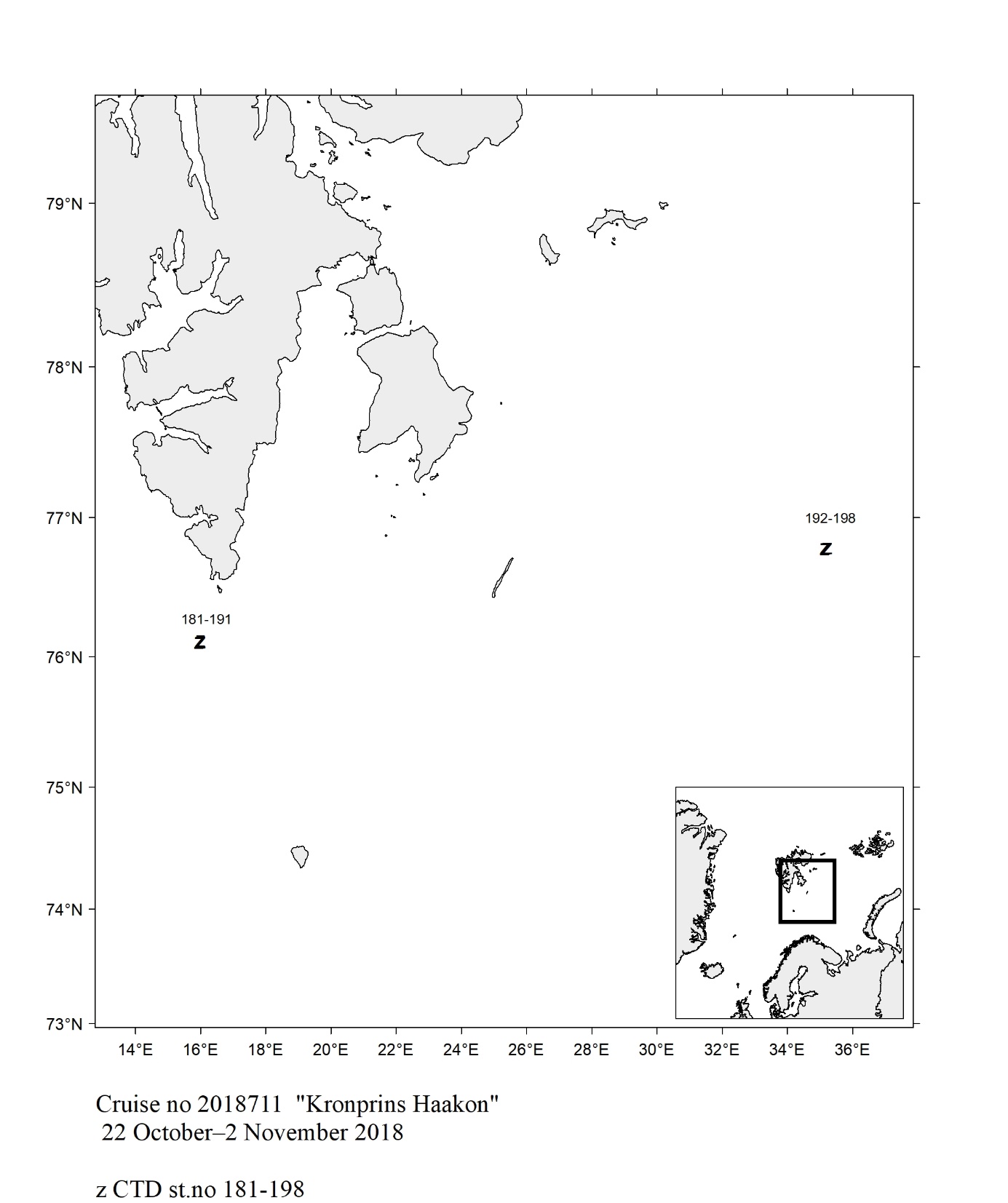 Fig. 87
10 - "G. M. Dannevig" - (Ship code no 16). Cruises 2018.
| Cruise no | Period | Purpose | Area | CTD st.no | Fig. no |
| 2018301 | 15.1.-21.1. | Hydrographic standard section “Torungen-Hirtshals” environmental investigation. Long-term environmental monitoring on a near-shore station outside Arendal and in the fjords along the Norwegian Skagerrak coast. | Skagerrak | 1-36 | 88 |
| 2018302 | 1.2.-7.2. | Hydrographic standard section “Torungen-Hirtshals” environmental investigation. Long-term environmental monitoring on a near-shore station outside Arendal and in the fjords along the Norwegian Skagerrak coast. | Skagerrak | 37-73 | 89 |
| 2018303 | 2.3.-5.3. | Long-term environmental monitoring on a near-shore station outside Arendal and in the fjords along the Norwegian Skagerrak coast. | Skagerrak | 74-84 | 90 |
| 2018304 | 6.3.-14.3. | Cruise to map eggs from other species than costal cod. | Skagerrak | 85 | 91 |
| 2018306 | 21.4.-26.4. | Hydrographic standard section “Torungen-Hirtshals” environmental investigation. Long-term environmental monitoring on a near-shore station outside Arendal and in the fjords along the Norwegian Skagerrak coast. | Skagerrak | 86-108 | 92 |
| 2018307 | 19.5.-22.5. | Hydrographic standard section “Torungen-Hirtshals” environmental investigation. Long-term environmental monitoring on a near-shore station outside Arendal and in the fjords along the Norwegian Skagerrak coast. | Skagerrak | 109-130 | 93 |
| 2018309 | 14.6.-22.6. | Hydrographic standard section “Torungen-Hirtshals” environmental investigation. Long-term environmental monitoring on a near-shore station outside Arendal and in the fjords along the Norwegian Skagerrak coast. | Skagerrak | 131-169 | 94 |
| 2018310 | 7.7.-12.7. | Hydrographic standard section “Torungen-Hirtshals” environmental investigation. Long-term environmental monitoring on a near-shore station outside Arendal and in the fjords along the Norwegian Skagerrak coast. | Skagerrak | 170-206 | 95 |
| 2018311 | 11.8.-15.8. | Hydrographic standard section “Torungen-Hirtshals” environmental investigation. Long-term environmental monitoring on a near-shore station outside Arendal and in the fjords along the Norwegian Skagerrak coast. | Skagerrak | 207-245 | 96 |
| 2018316 | 15.9.-5.10. | Beach seine studies to measure recruitment of coastal fish-species. Hydrographic standard section “Torungen-Hirtshals” environmental investigation. | Skagerrak | 246-322 | 97 |
| 2018317 | 6.10.-8.10. | Hydrographic standard section “Torungen-Hirtshals” environmental investigation. Long-term environmental monitoring on a near-shore station outside Arendal and in the fjords along the Norwegian Skagerrak coast. | Skagerrak | 323-334 | 98 |
| 2018318 | 13.11.-18.11. | Hydrographic standard section “Torungen-Hirtshals” environmental investigation. Long-term environmental monitoring on a near-shore station outside Arendal and in the fjords along the Norwegian Skagerrak coast. | Skagerrak | 335-373 | 99 |
| 2018320 | 5.12.-10.12. | Hydrographic standard section “Torungen-Hirtshals” environmental investigation. Long-term environmental monitoring on a near-shore station outside Arendal and in the fjords along the Norwegian Skagerrak coast. | Skagerrak | 374-399 | 100 |
11 - “G. M. Dannevig” – Charts for cruises 2018.
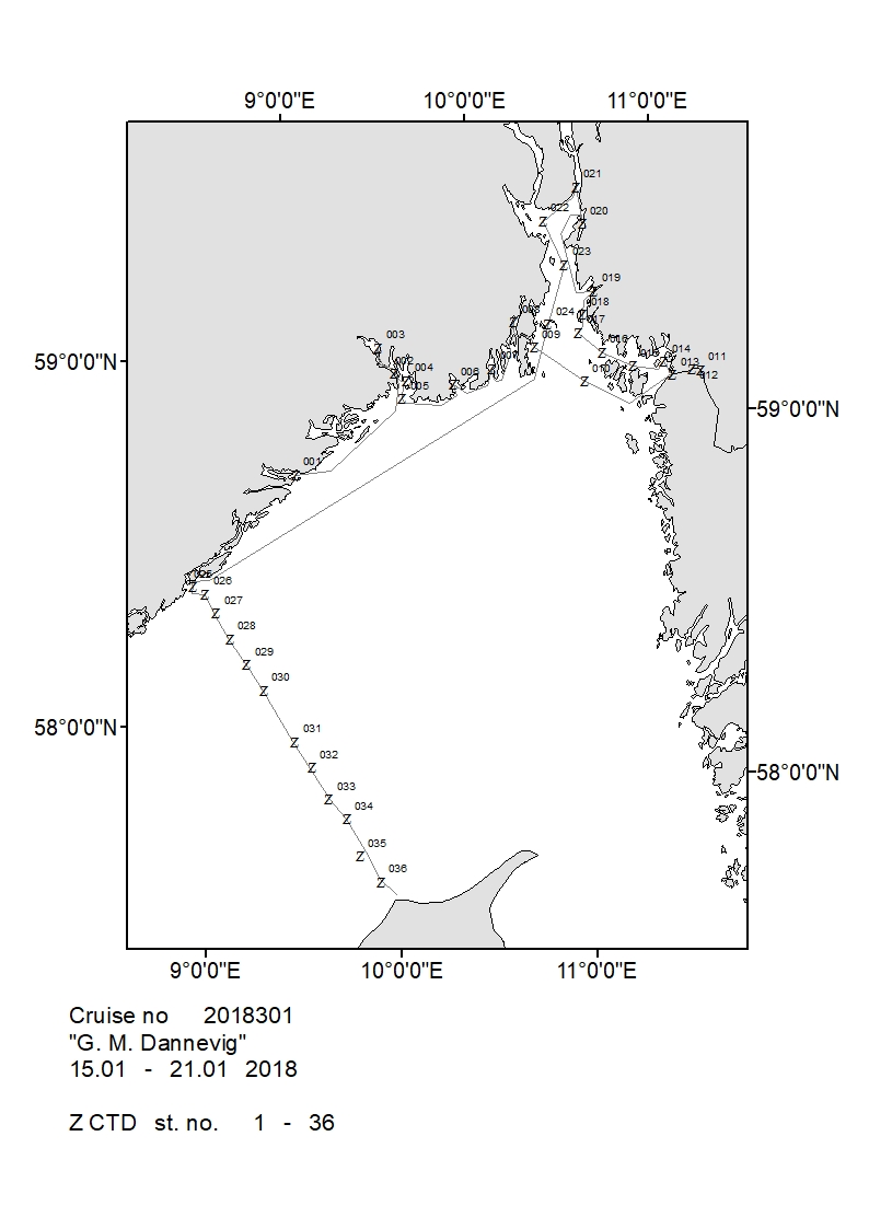 Fig. 88
 Fig. 89
 Fig. 90
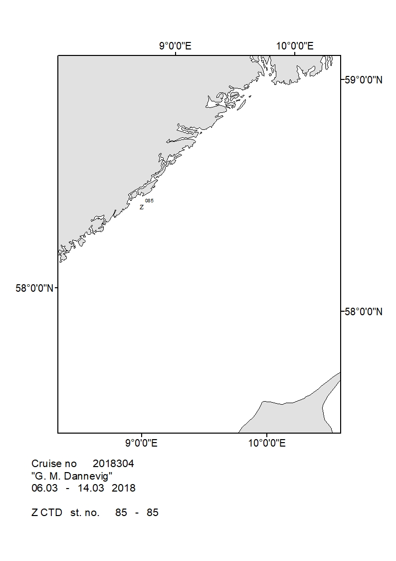 Fig. 91
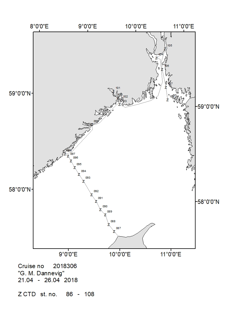 Fig. 92
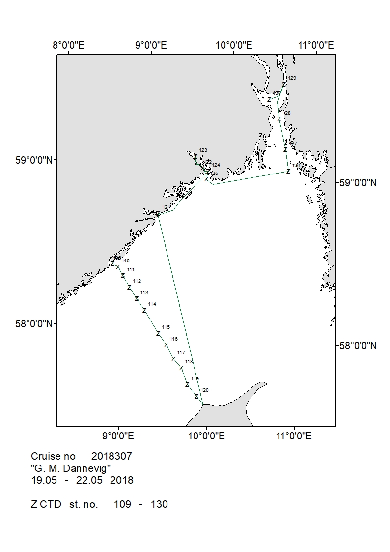 Fig. 93
 Fig. 94
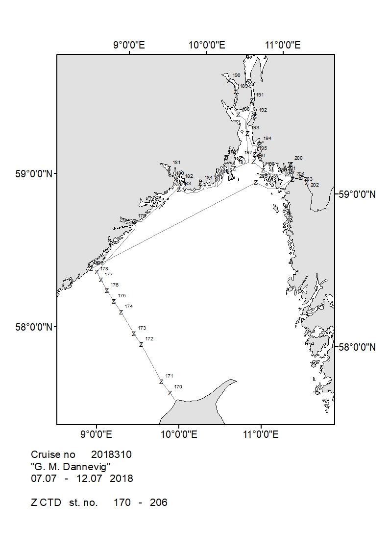 Fig. 95
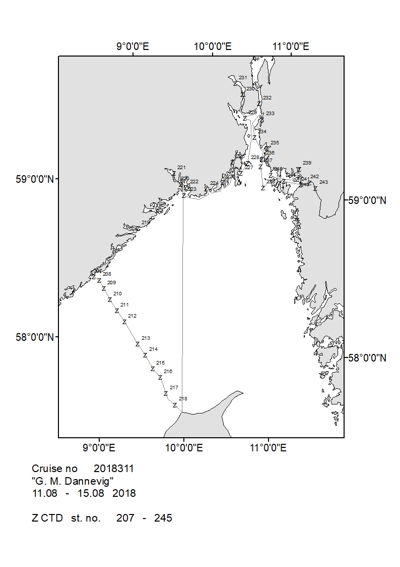 Fig. 96
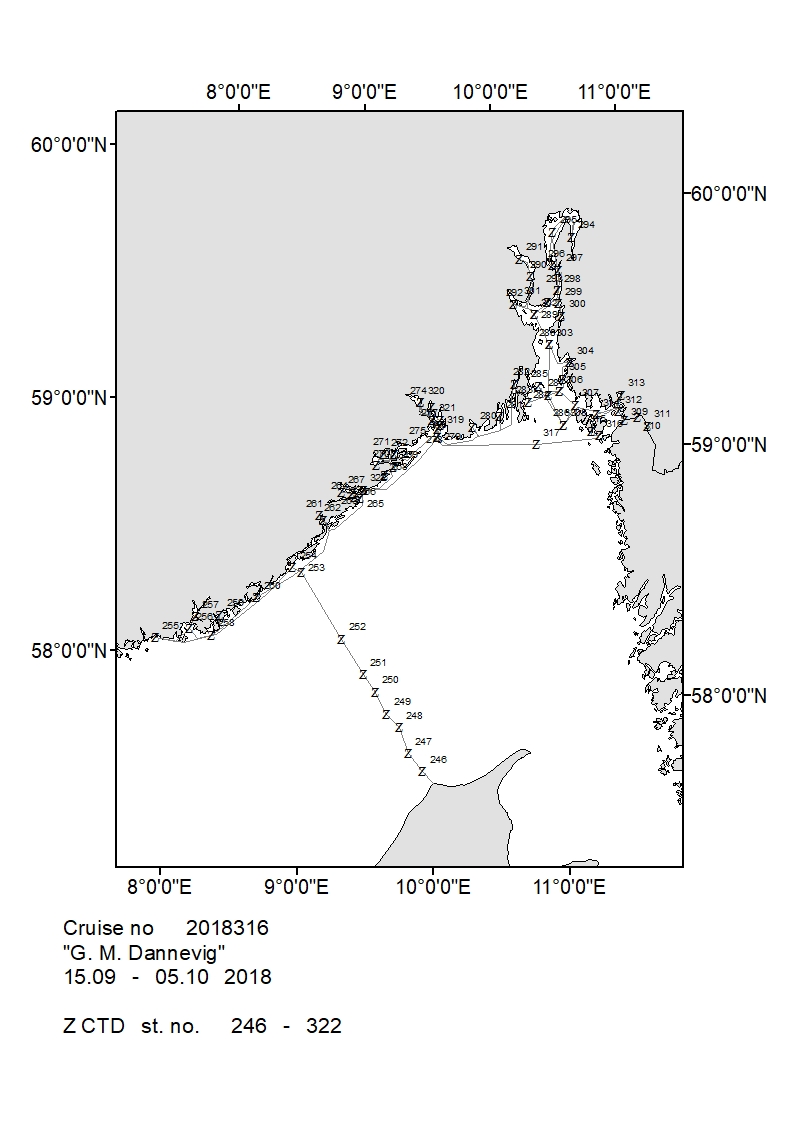 Fig. 97
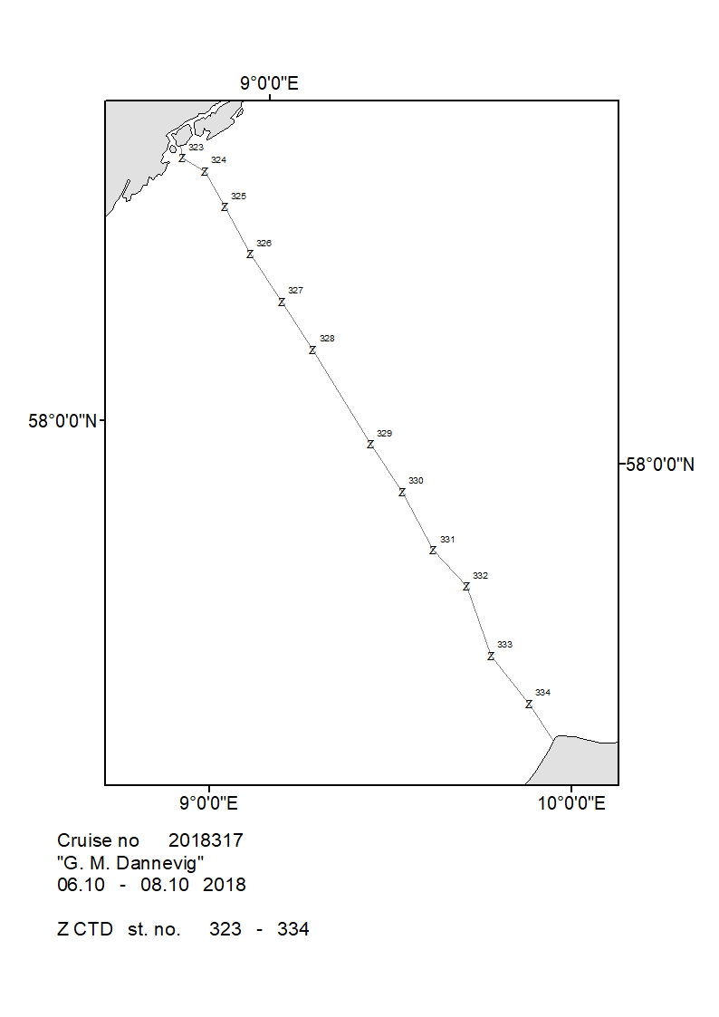 Fig. 98
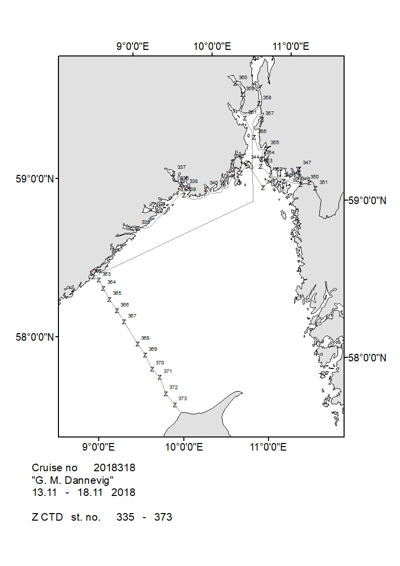 Fig. 99
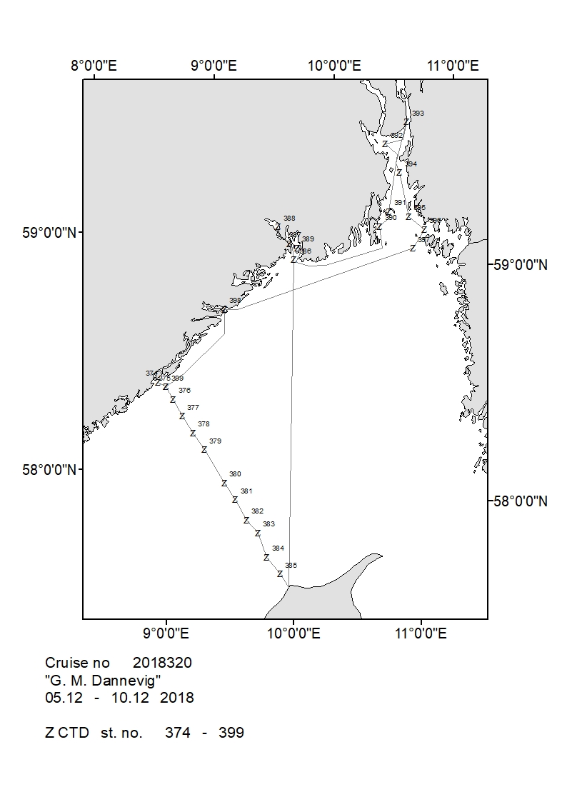 Fig. 100
12 - Hired fishing vessels - Cruises 2018
| Cruise no | Period | Vessel | Purpose | Area | CTD st.no | Trawl st.no | Fig. no |
| 2018836 | 20.1.-27.2. | «Helmer Hanssen» | The survey with Helmer Hanssen forms parts of the joint Norwegian-Russian ground fish survey conducted annually in January-March. It is a combined trawl survey (calculating stock size indices of groundfish using swept-area estimation technique), and acoustic survey, calculating stock size indices using acoustics. Two Norwegian research vessels and one Russian research vessel participate. | Barents Sea, western and central parts. | 1-66 | 1-240 | 101-102 |
| 2018838 | 14.9.-2.10. | «Helmer Hanssen» | The survey is part of the Barents Sea Ecosystem survey. Main goal is monitoring of the ecosystem. Data that were collected included physcial oceanography, plankton, fish, benthos and marine mammal registrations. Several special investigations were also conducted. | Barents Sea. West and north of Svalbard | 67-112 | 241-333 | 103-104 |
| 2018809 | 28.5.-1.6. | “Johan Ruud” | Study the efficiency of the agassiz trawl used in the stock assessment of the red king crab in the quota regulated area in Finnmark. | Barents Sea | - | - | 105 |
| 2018808 | 18.6.-24.6. | “Johan Ruud” | Study the spreading area for red king crab in West Finnmark, Norway. This is the area for a free fishing for red king crab and the further spreading is monitored. | Barents Sea | - | - | 106 |
| 2018810 | 20.8.-31.8. | “Johan Ruud” | Yearly monitoring the red king crab stock in the fjords in the quota regulated area in eastern Finnmark, Norway. The survey covered the fjords Varangerfjorden, Tanafjorden, Laksefjorden and Porsangerfjorden. | Barents Sea | - | - | 107 |
| 2018811 | 10.9.-21.9. | “Johan Ruud” | Stock assessment study for red king crab in East Finnmark, Norway. This is the quota regulated area for red king crab. | Barents Sea | - | - | 108 |
| 2018830 | 13.2.-25.2. | «Eros» | Collection of acoustic data from fisheries sonar for biomass estimation of herring ∀ Collection of acoustic data from echo sounder for biomass estimation of herring ∀ Collection of biological samples for estimation of species and size composition in the acoustic observations ∀ Collection of hydrographic data (CTD) | Norwegian Sea | 1-28 | 1-21 | 109 |
| 2018813 | 5.3.-15.3.3. | «Eros» | Collection of acoustic data from fisheries sonar for biomass estimation of individual capelin schools ∀ Monitoring of school and net during commercial fishing operations ∀ Purse seine catch of individual capelin schools for comparison with sonar estimates ∀ Video and oxygen measurements during purse siening | Norwegian Sea | - | - | 110 |
| 2018823 | 24.4.-14.5. | «Eros» | Measuring the abundance, distribution and age composition of sandeel ∀ Dredge sampling for burrowed sandeels ∀ Bottom trawls ∀ Pelagic trawls ∀ Echo sounder sampling ∀ Zooplankton sampling ∀ Mapping of hydrographical conditions | North Sea | 29-63 | 23-56 | 111-112 |
| 2018821 | 12.6.-19.6. | «Eros» | Develop and test optic and acoustic instruments and methods for monitoring fish behaviour and catch composition during purse seine fishing. | North Sea | - | - | 113 |
| 2018812 | 30.9.-15.10. | “Eros” | Collection of acoustic data from fisheries sonar for biomass estimation of individual mackerel schools. | Norwegian Sea | - | - | 114 |
| 2018807 | 4.9.-27.9. | “Eros” | Capelin. | West of Island | 101-128 | 1-12 | 115 |
| 2018829 | 13.2.-25.2. | “Kings Bay” | Abundance estimation of Norwegian spring spawning herring. This survey was carried out with three vessels, also participating was” Eros” and “Vendla”. | Norwegian Coast | - | 1-25 | 116 |
| 2018819 | 20.3.-5.4. | “Kings Bay” | International blue whiting spawning stock survey. Acoustic survey to monitor the spawning stock of blue whiting on the spawning grounds west of the British Isles. | Northwest of the British Isles | 1-29 | 25-35 | 117-118 |
| 2018843 | 5.4.-12.4. | «Kings Bay» | Survey of potentially human pathogenic and/or quality reducing parasites and microbiota in blue whiting intended for human consumption. | NE Atlantic Greater Rockall Bank | - | - | - |
| 2018847 | 29.5.-2.6. | «Kings Bay» | Survey of potentially human pathogenic and/or quality reducing parasites and microbiota in North Sea herring intended for human consumption. Parasite life-cycle studies by investigating abundance of actual parasites in zooplankton samples. | NE Atlantic Viking Bank | - | - | - |
| 2018826 | 2.6.-6.8. | «Kings Bay» | Primary objectives: Large-scale mapping and abundance estimation of Northeast Atlantic (NEA) mackerel, Norwegian Spring-Spawning (NSS) herring and Atlantic blue whiting. Swept area trawling for mackerel and acoustic recordings and trawling for NSS herring and blue whiting. Secondary objectives: Mapping distribution of Atlantic salmon, lumpfish and other pelagic species. Sampling of zooplankton and water temperature/salinity profiles. Opportunistic marine mammals observations along the transects and survey lines. | Barents Sea, Greenland Sea, Iceland Sea, Norwegian Sea | 30-96 | 36-126 | 119 |
| 2018849 | 26.9.-30.9. | «Kings Bay» | Survey of potentially human pathogenic and/or quality reducing parasites and microbiota in Atlantic mackerel intended for human consumption. Additionally, fish were examined for the presence of certain ectoparasites on the gills which may serve as biological tag to track the actual mackerel’s migration route. | NE Atlantic | - | - | - |
| 2018850 | 14.10.-17.10. | «Kings Bay» | Survey of parasites in Atlantic mackerel with special emphasis on the occurrence and development of the so-called soft flesh-condition in mackerel induced by the myxozoan parasite Kudoa thyrsites. | NW North Sea | - | - | - |
| 2018851 | 9.11.-14.11. | «Kings Bay» | Survey of parasites in Norwegian Spring Spawning Herring with special emphasis on the epidemiology of anisakid nematodes. | Norwegian Sea | - | - | - |
| 2018852 | 14.11.-17.11. | «Kings Bay» | Survey of parasites in Norwegian Spring Spawning Herring with special emphasis on the epidemiology of anisakid nematodes. | Norwegian Sea | - | - | - |
| 2018831 | 13.2.-24.2. | “Vendla” | Acoustic survey to monitor the spawning stock of Norwegian spring spawning herring on its spawning migration. | Norwegian Sea | 1-7 | 1-20 | 120 |
| 2018837 | 25.6.-1.7. | “Vendla” | Improving the quality of the pelagic trawl survey for Northeast Atlantic mackerel | Norwegian Sea | - | - | - |
| 2018827 | 4.7.-6.8. | “Vendla” | Part of the International Ecosystem Summer Survey of the Nordic Seas (IESSNS) where the objectives are (1) to measure the abundance of Northeast Atlantic mackerel using swept-area method (2) measure the abundance of Norwegian spring-spawning herring and blue whiting using acoustics, (2) collect data on zooplankton, (3) measure the hydrographical conditions (4) Marine mammal observations. | Norwegian Sea | 9-82 | 41-150 | 121-122 |
| 2018816 | 14.3.-27.3. | “Svalbard” | The main purpose of the cruise was to obtain data necessary for estimation of the abundance of harp seals and hooded seals, of the Greenland Sea stocks. The methodological approach implied conduction of aerial surveys of harp and hooded seal pups in the Greenland Sea pack-ice during the whelping period in 2018. One fixed-wing twin-engined aircraft (stationed in Akureyri, Iceland) was used for reconnaissance flights and photographic surveys along transects over the whelping patches once they have been located and identified. A helicopter, stationed on and operated from the vessel (KV “Svalbard”), assisted in the reconnaissance flights, and subsequently flew visual transect surveys over the whelping patches. The helicopter was also used for other purposes (stageing of pups, monitoring of ice drift). In addition to serve as base for the helicopter surveys, the vessel was also used to transport personell into the whelpimg patches where some ground-truthing of the aerial surveys and collection of biological samples were performed. | Greenland Sea North Atlantic Ocean | - | - | 123 |
| 2018842 | 3.4.-15.4. | «Lance» | The objectives of this cruise were to investigate the physical environment, abundance zooplankton and phytoplankton as well as collecting water samples for chemical analyses using a CTD probe, on our standard sections in the Norwegian Sea and Barents Sea. | Barents Sea Norwegian Sea | 1-48 | - | 124 |
| 2018814 | 3.4.-15.4. | "Kågtind II" | CRISP – trawl testing. | Barents Sea | - | 1-30 | 125 |
| 2018817 | 11.4.-16.5. | «Ottar» | It is established a long-term data set of reproductive data for the Harp Seal population in the Barents Sea. The main purpose of the cruise was to obtain data to continue this work and to collect samples to get updated data for the population’s condition. The methodological approach was to collect jaws, ovaries and body measurements of female harp seals. The sampled seals were animals that were part of the commercial catch of the sealing vessel MS “Ottar”. | Barents Sea | - | - | 126 |
| 2018822 | 29.4.-16.5. | «Tempo» | Experiments to reduce bycatches of juvenile fish and small fish in the shrimp fisheries, by using artificial light. A 6 meter netting section was installed in front of a conventional Nordmøre grid, illuminated with dive lights of various wavelengths to stimulate escape behaviour of fish. Two trawls were towed simultaneously, one with a conventional grid, the other with the experimental grid. | Skagerrak | - | 1-26 | 127 |
| 2018828 | 9.5.-10.6. | «Fiskebas» | Tagging with RFID technology and biological sampling of mackerel in the spawning areas west of Ireland and Scotland. | Northeast Atlantic Ocean | - | - | 128 |
| 2018805 | 15.6.-6.7. | «Prowess» | The aim of the cruise was to study the spreading of the snow crab in the Svalbard Fishery Protection Zone by using a hired fishery vessel and snow crab traps. | Barents Sea | - | - | 129 |
| 2018846 | 23.6.-6.7. | “Silje Kristina | To improve size selectivity in the shrimp fisheries, a regular shrimp trawl of conventional length, was compared to a trawl with a shorter trawl belly towing both trawls simultaneously. For comparing size-related size selection, samples of shrimp and small fish were measured for size distribution and total catch weight recorded., | Skagerrak | - | 1-17 | 130 |
| 018833 | 26.6.-20.8. | “Acc Mosby” | The objective of the cruise is to collect sightings information for estimating abundance of whales, especially minke whales, as part of a long-term survey program to cover the Northeast Atlantic over the years 2014-2019. | North Sea Norwegian Sea | - | - | 131 |
| 2018834 | 31.8.-13.9. | “Acc Mosby” | The objectives of this cruise is to instrument whales with satellite tags which can map their habitat use, collect biopsy samples of whales to study their population structure and photo identification pictures of whales to study their long-term movement patterns and biology. The focus has been on the humpback whales. | Barents Sea | - | - | 132 |
| 2018820 | 17.9.-12.10 | “Cristina E” | - Develop and test optical and acoustic instruments and methods for monitoring fish behaviour and catch composition during purse seine fishing. - Investigate the effect of catch handling on fish welfare and thereby. i) survival/vitality potential of unwanted catches released from the seine, and ii) the vitality and quality of retained catches. | Norwegian Sea and North Sea | - | - | 133 |
| 2018006 | 30.9.-30.10. | “Katla” | Compare the unfished shrimp stocks in the two fjords Porsanger and Tana in North-Norway. Collect data on all demersal fish stocks | North Norwegian fjords | - | - | - |
13 - Hired fishing vessels – Charts for cruises 2018.
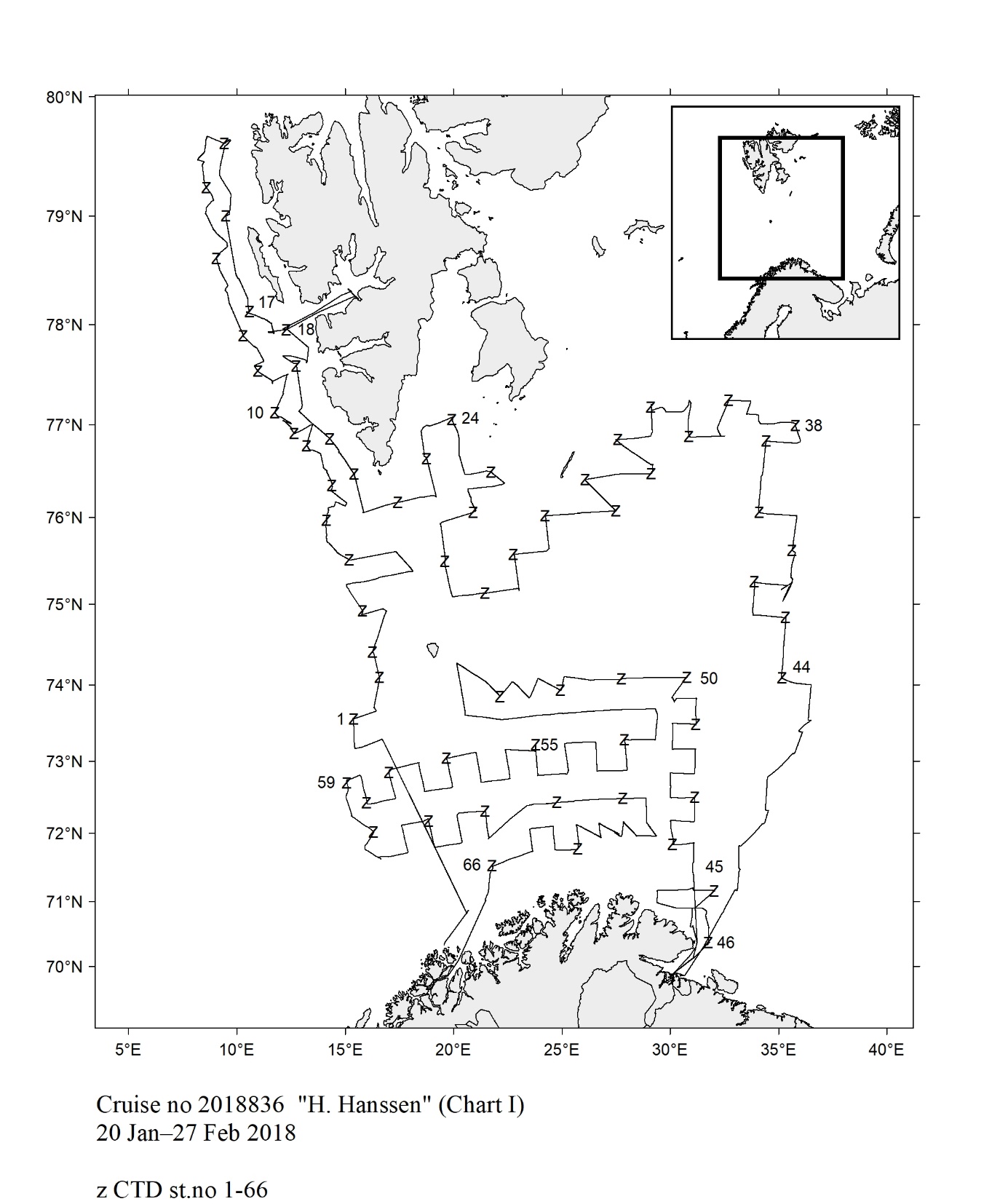 Fig. 101
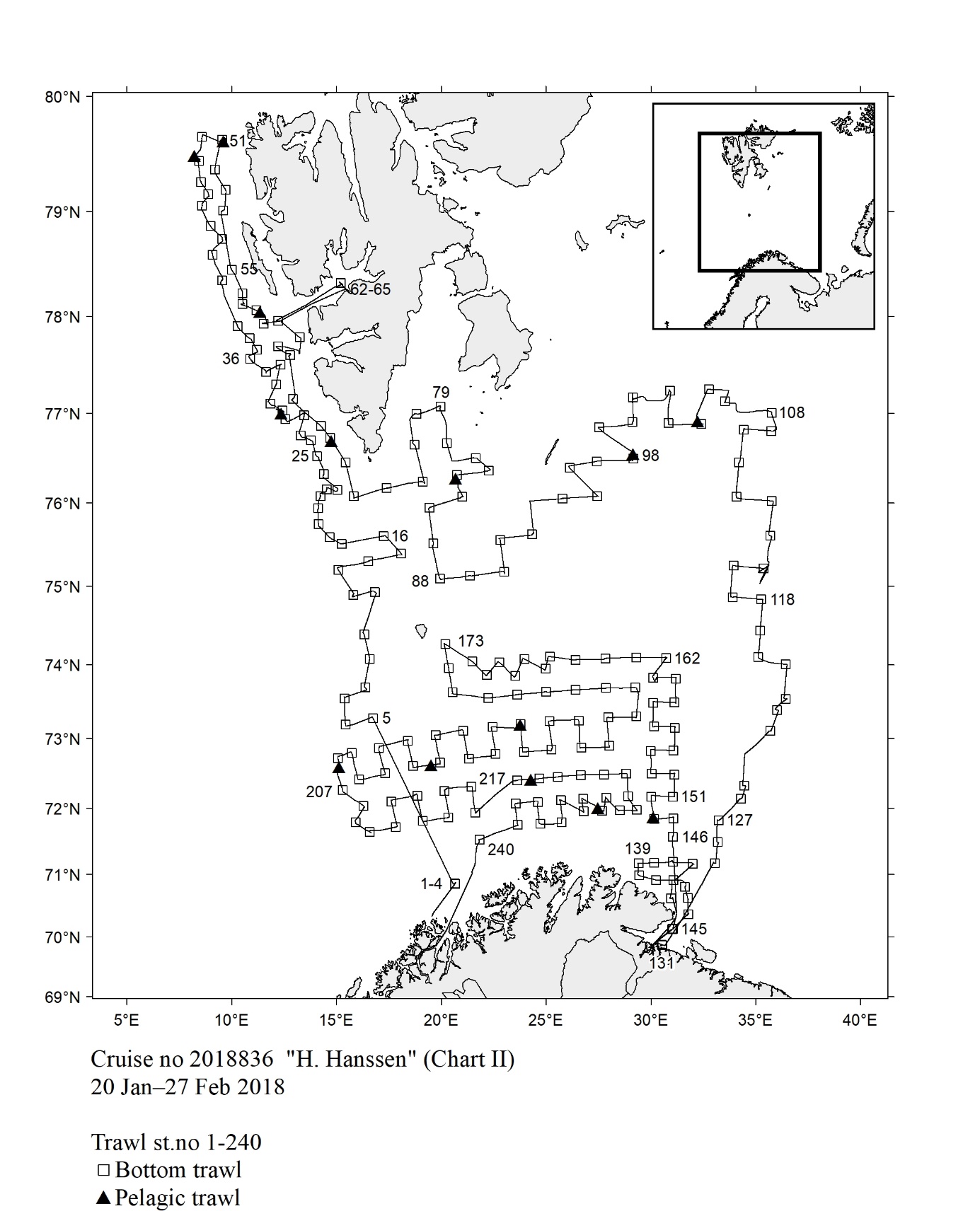 Fig. 102
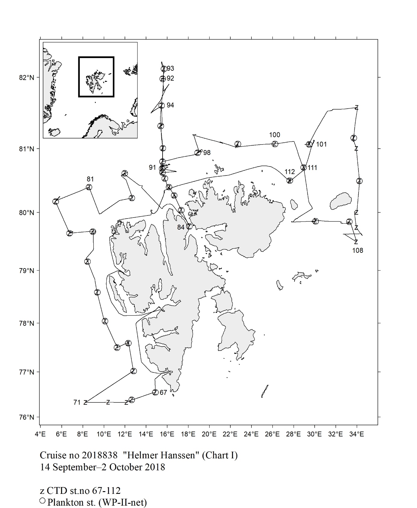 Fig. 103
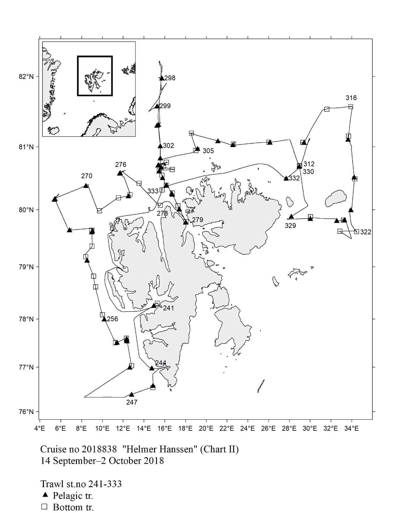 Fig. 104
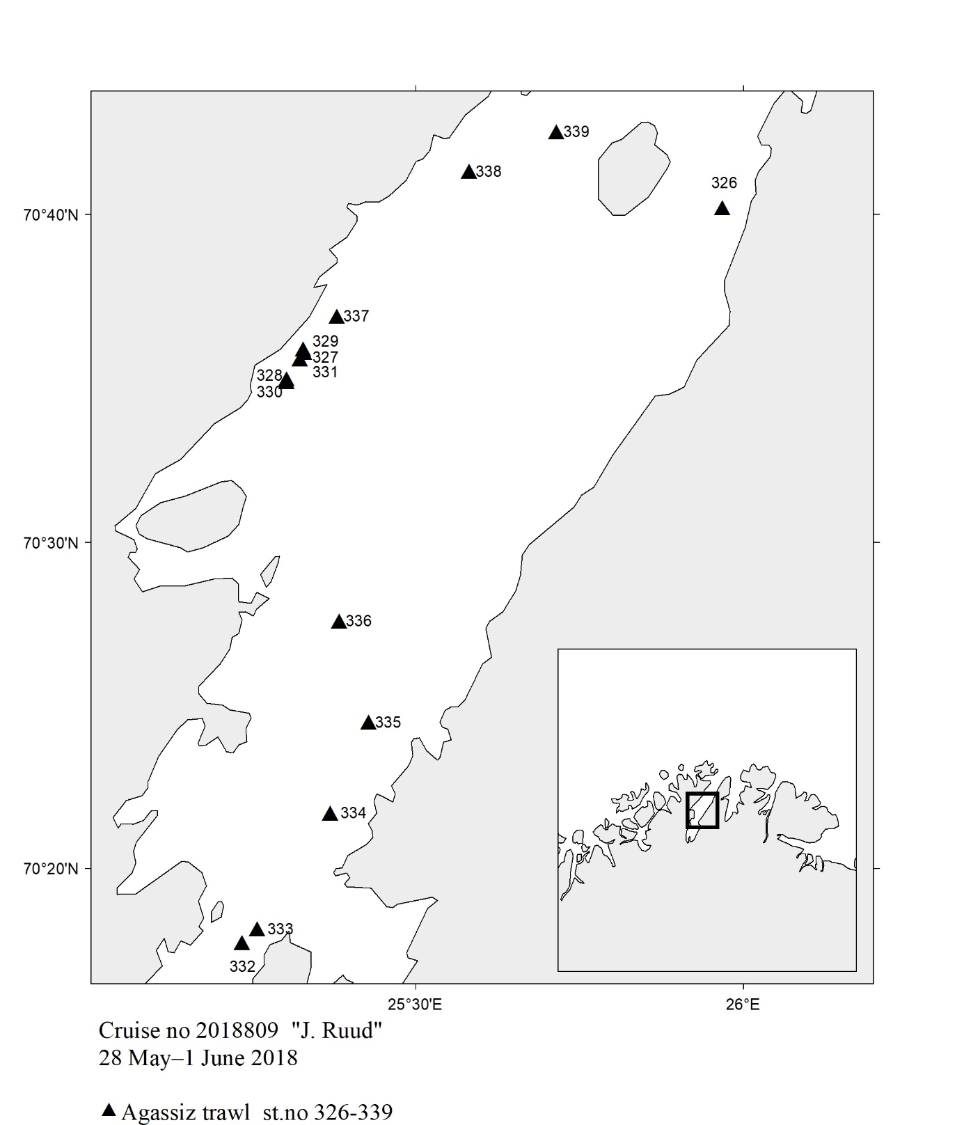 Fig. 105
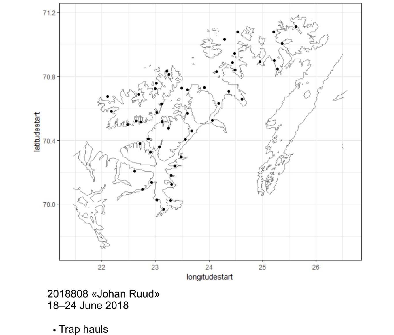 Fig. 106
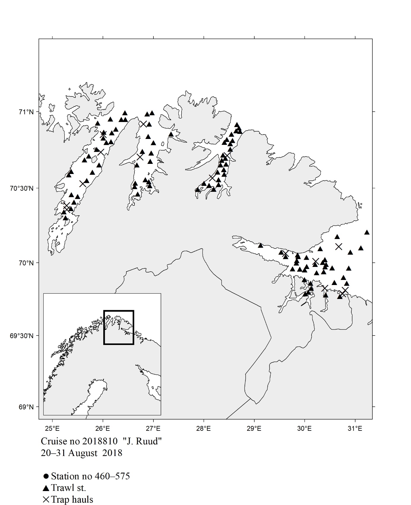 Fig. 107
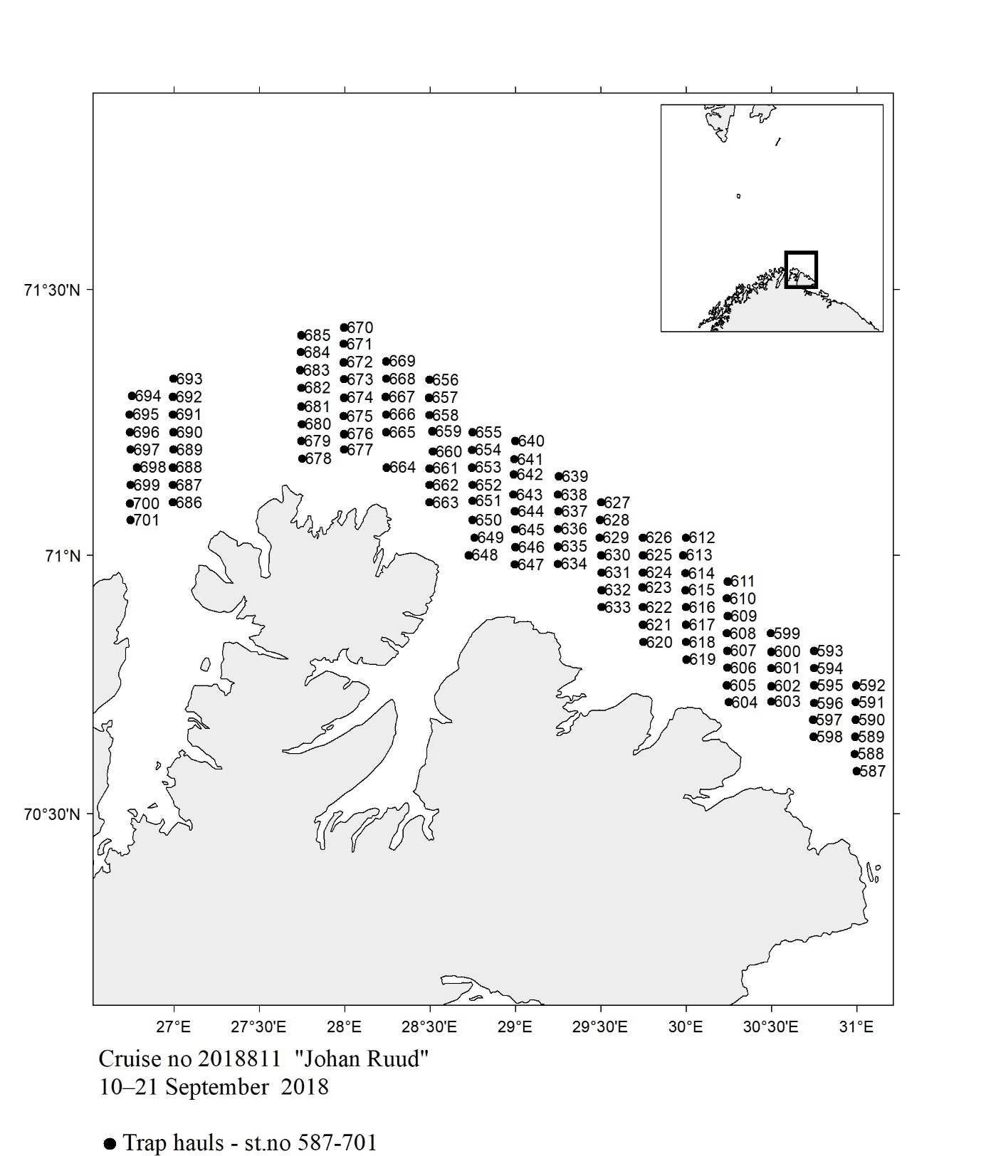 Fig. 108
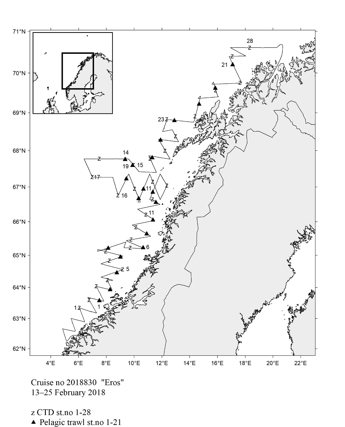 Fig. 109
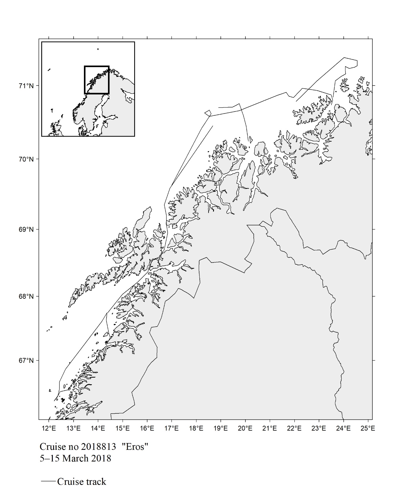 Fig. 110
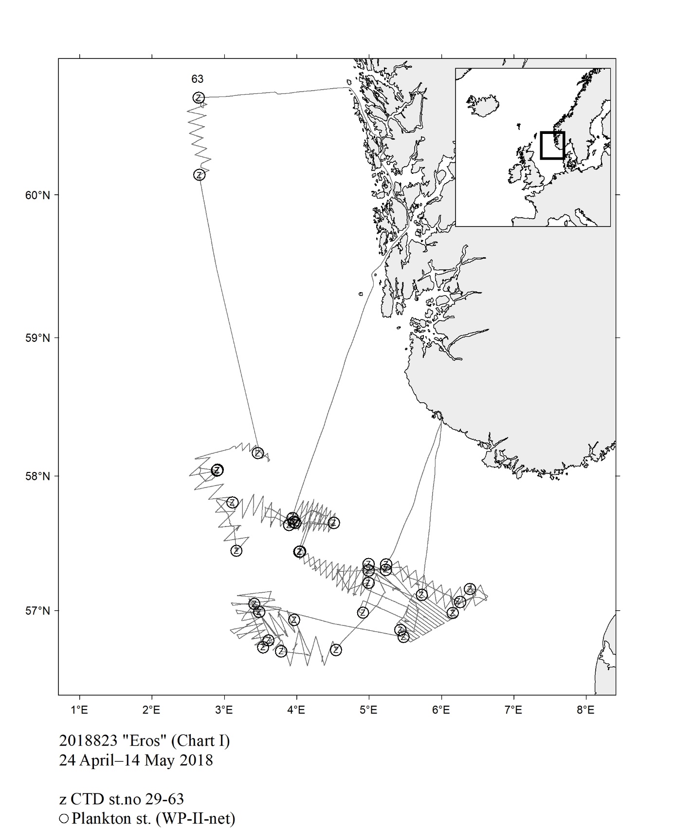 Fig. 111
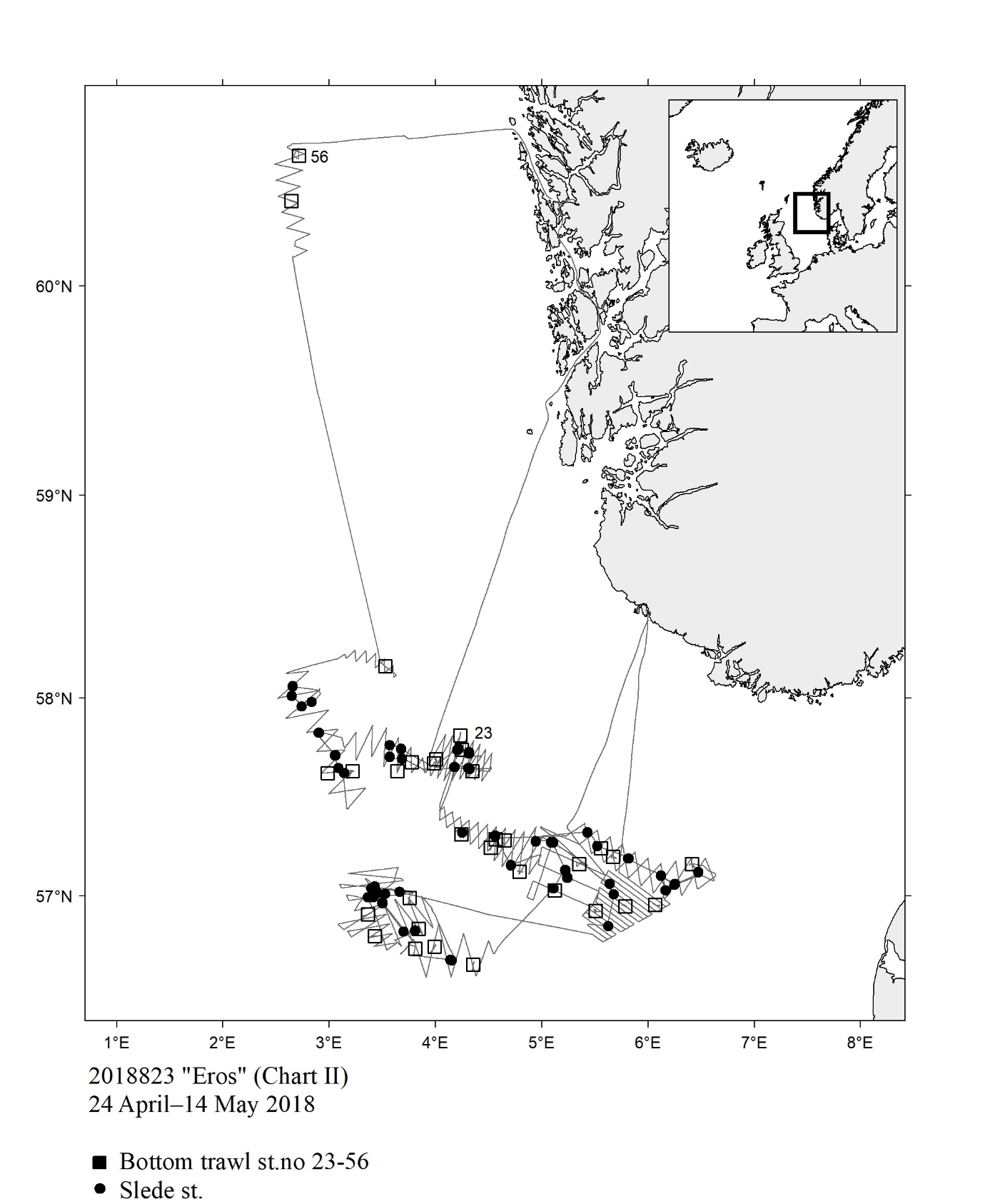 Fig. 112
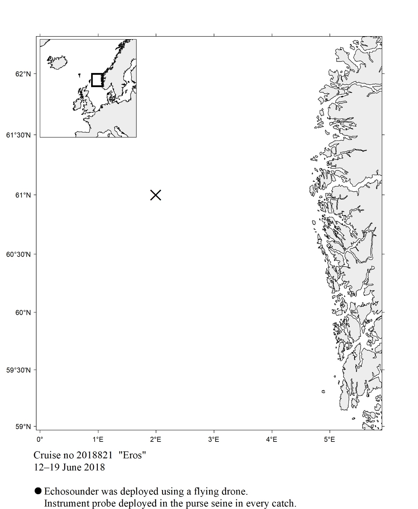 Fig. 113
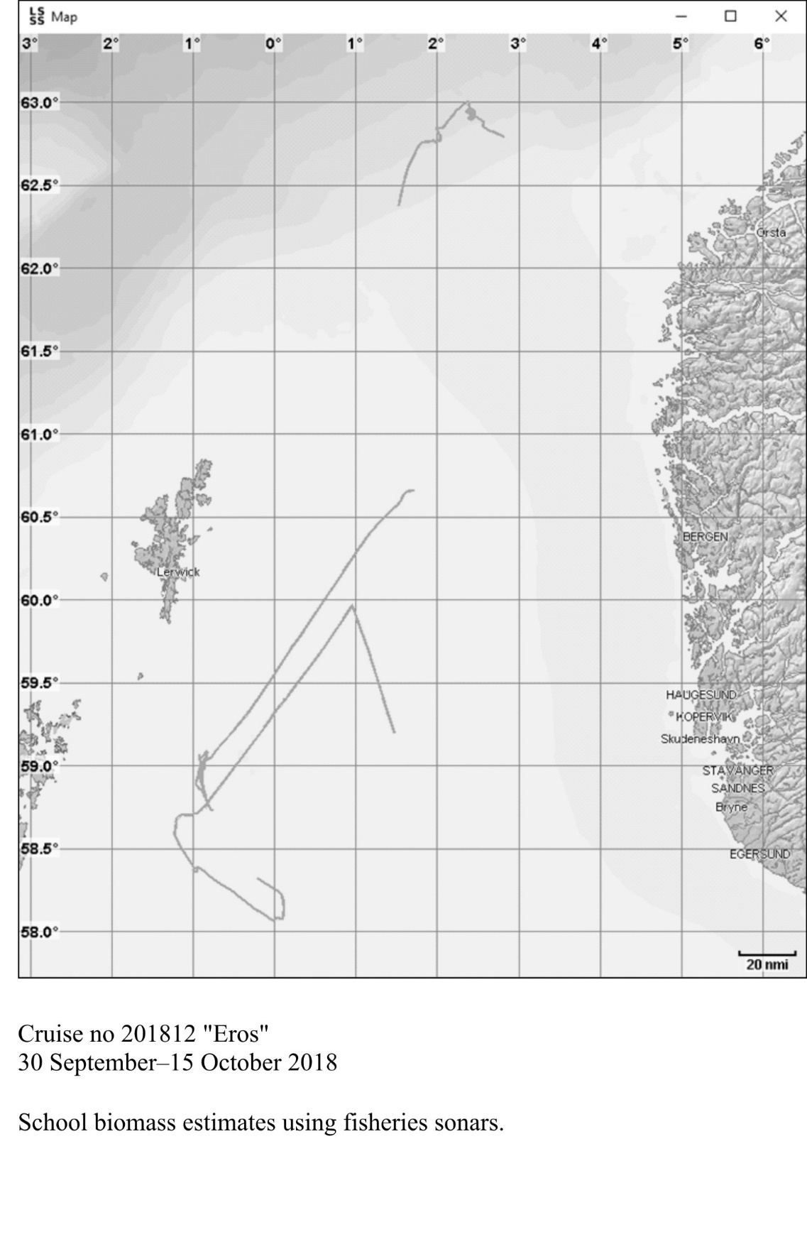 Fig. 114
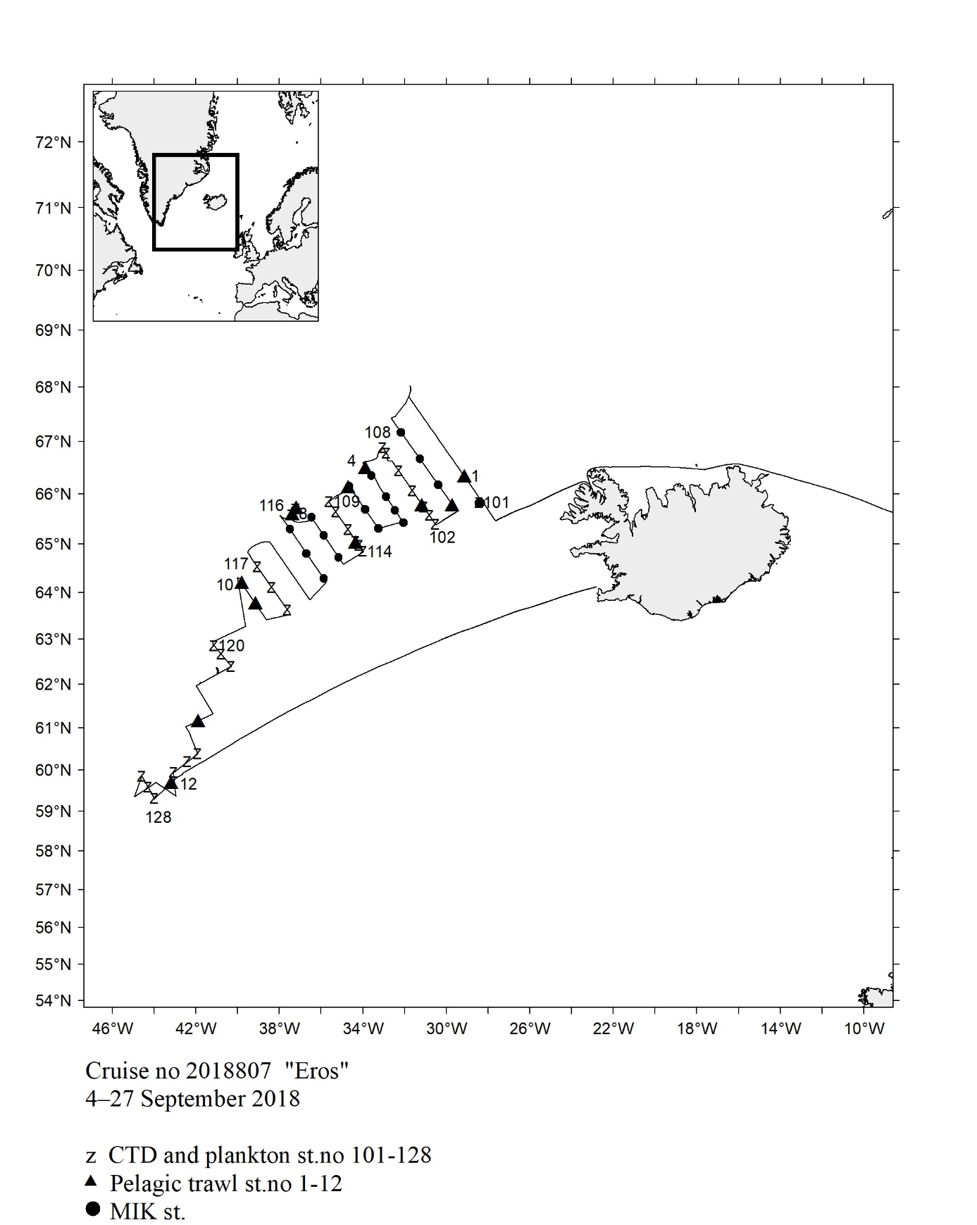 Fig. 115
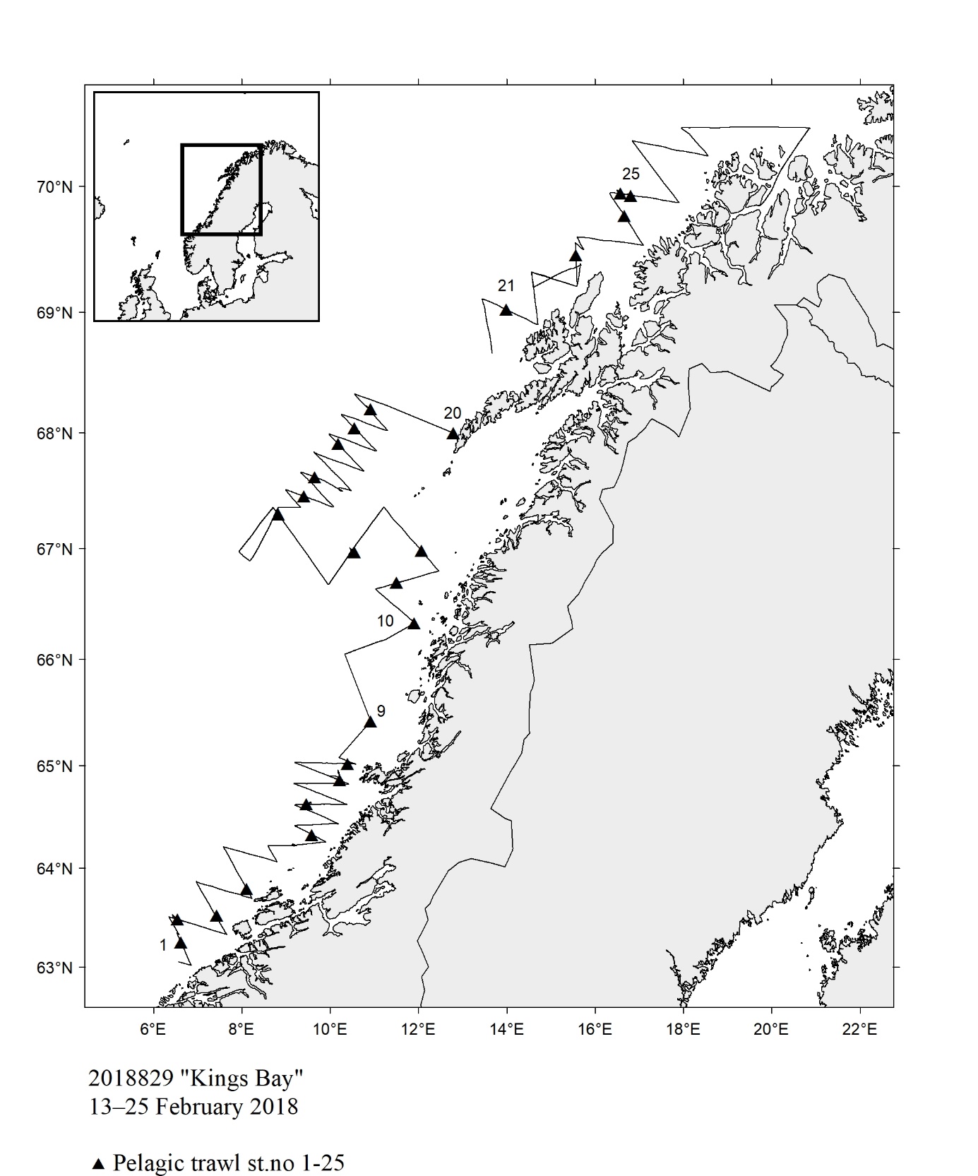 Fig. 116
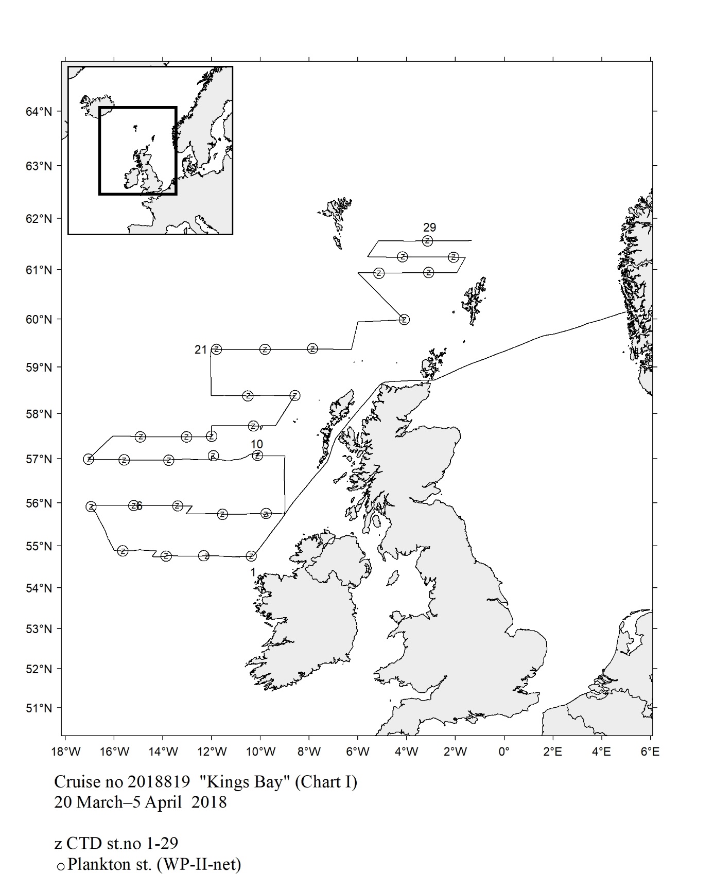 Fig. 117
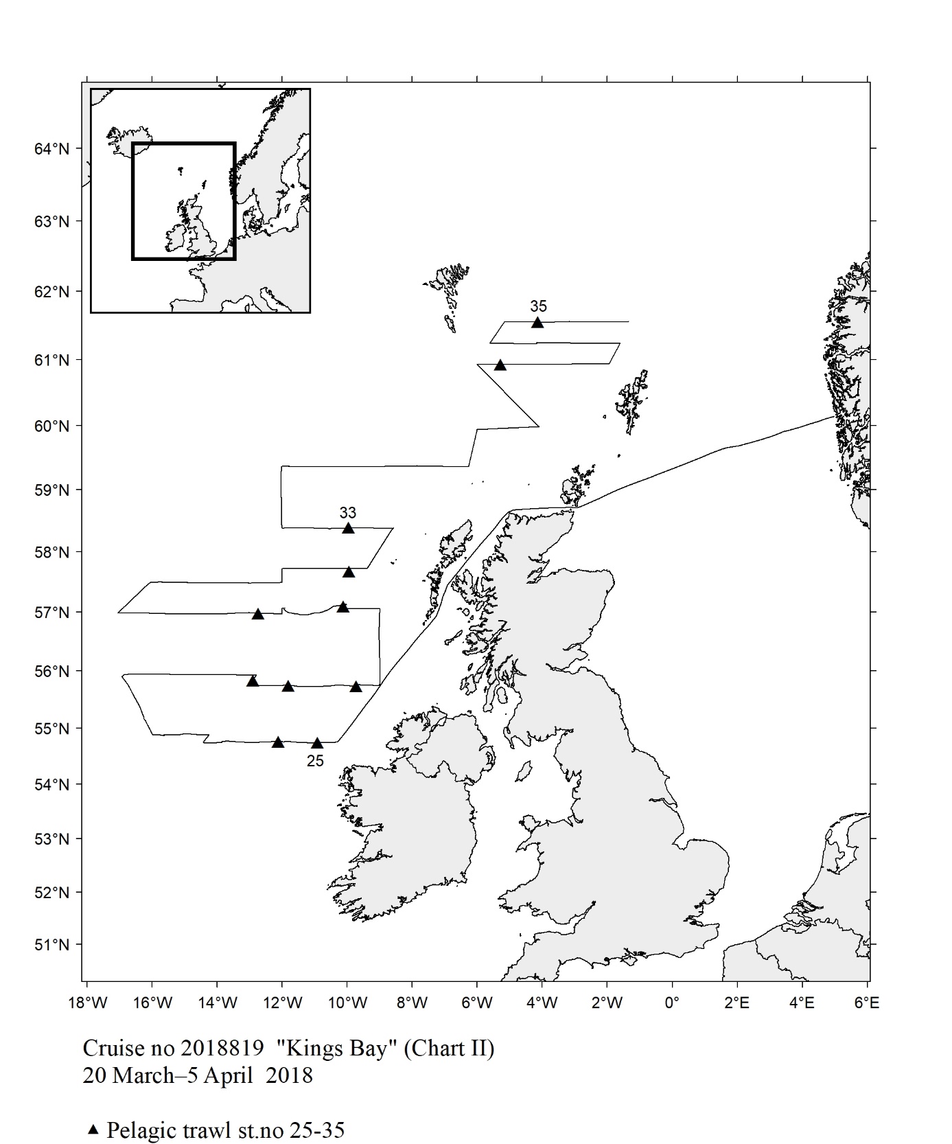 Fig. 118
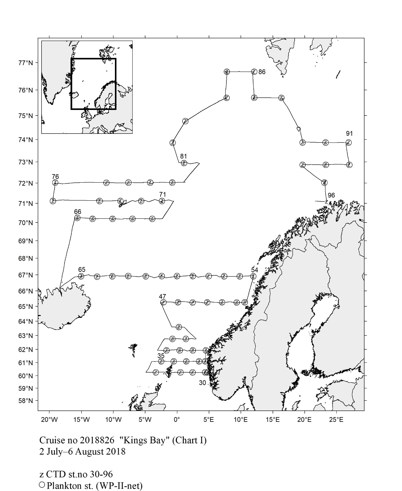 Fig. 119
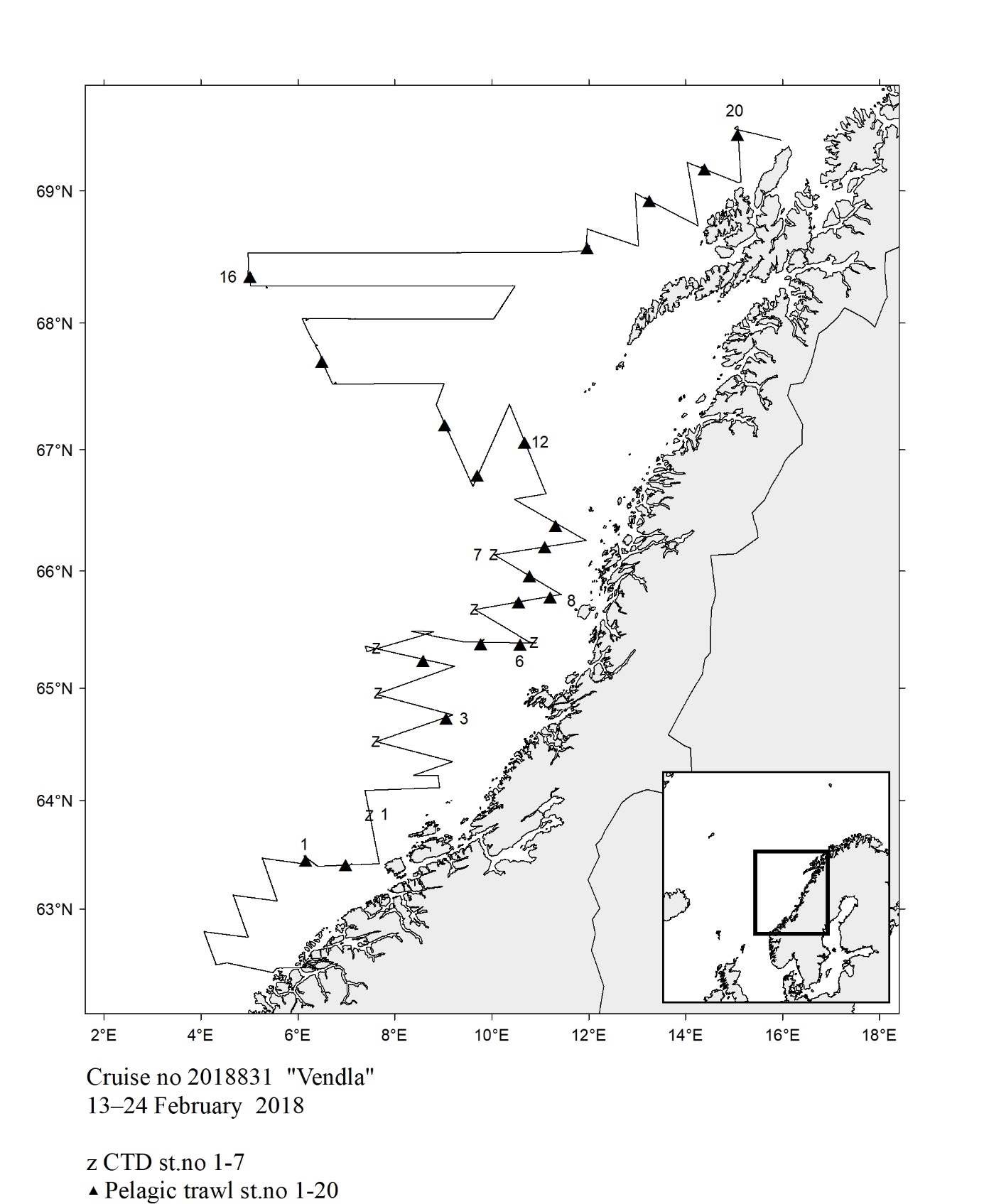 Fig. 120
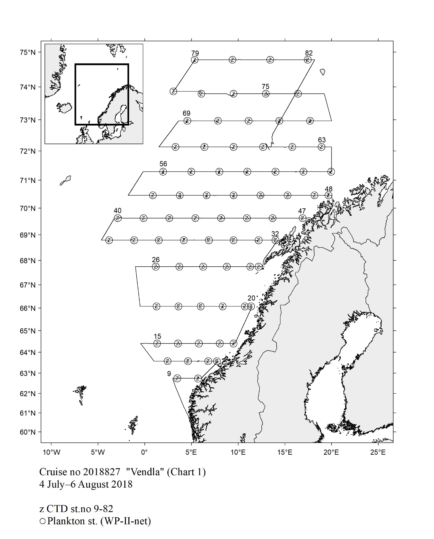 Fig. 121
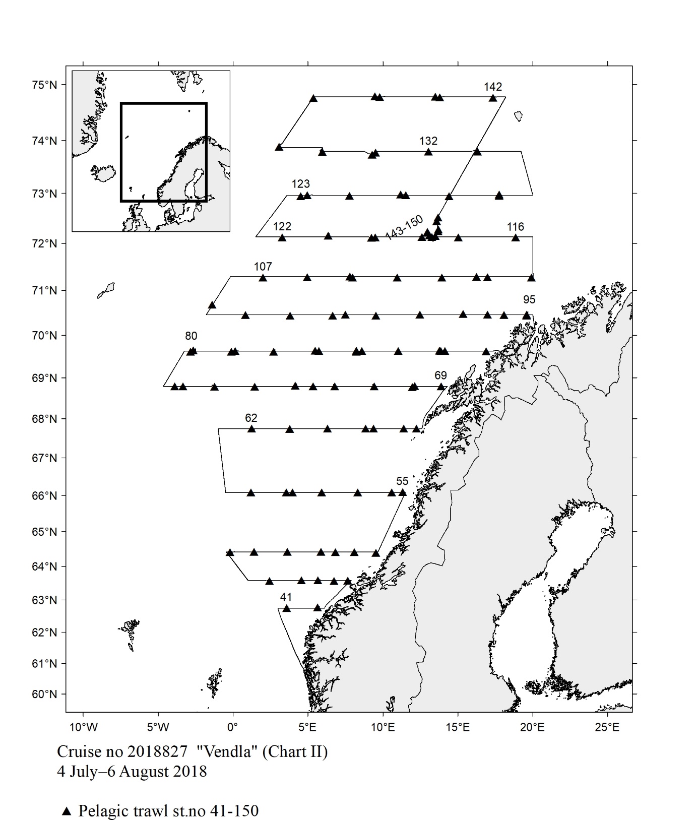 Fig. 122
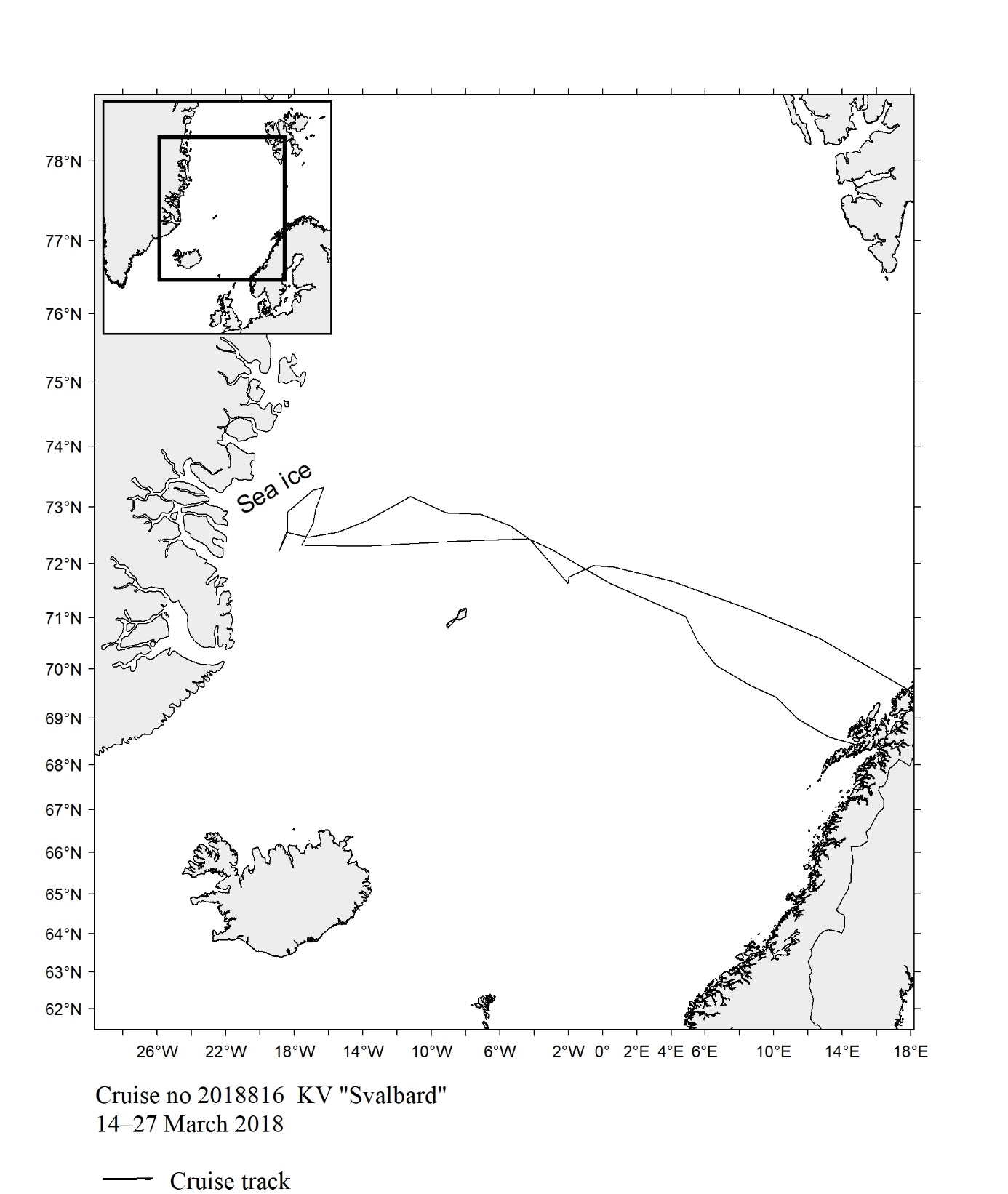 Fig. 123
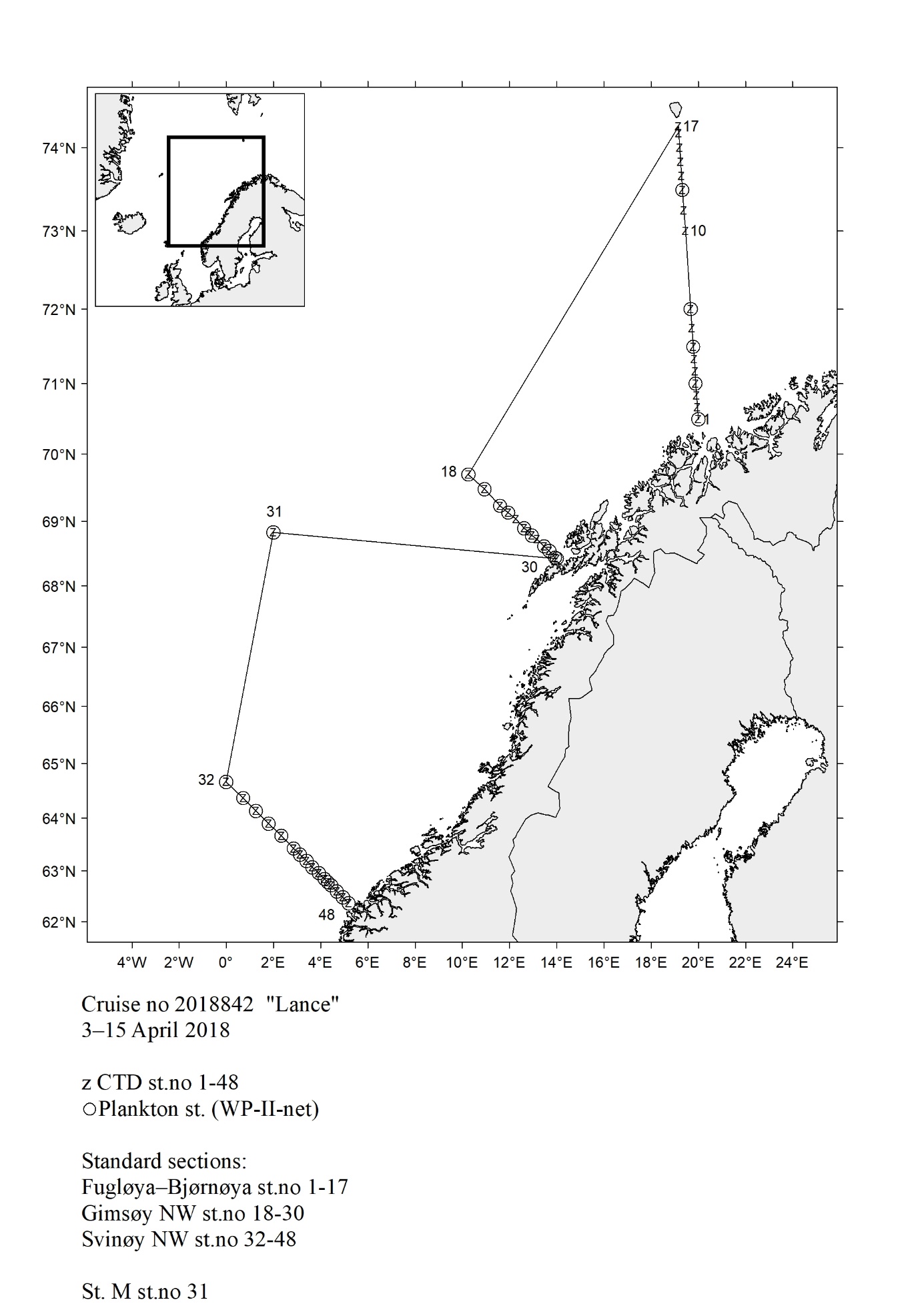 Fig. 124
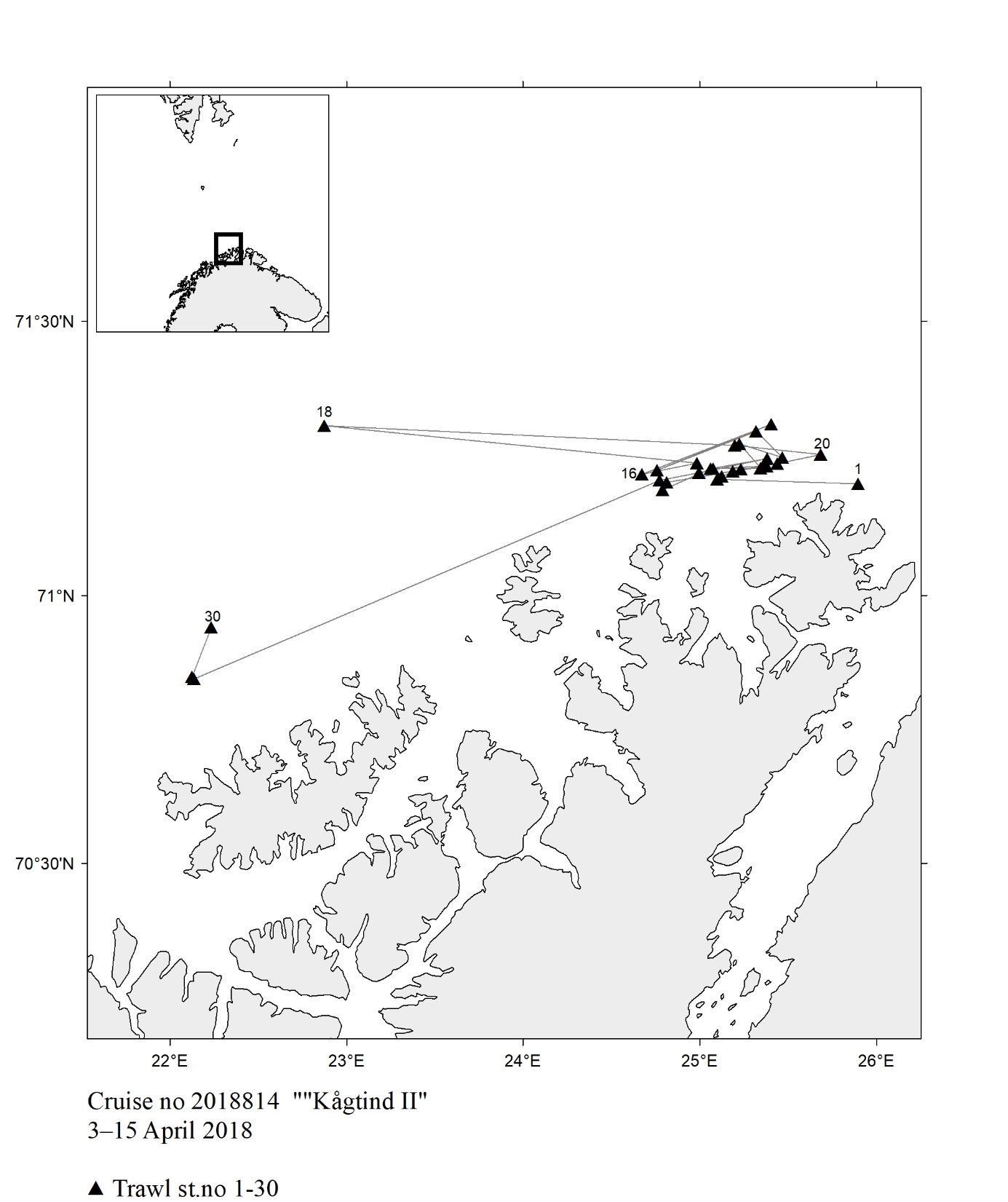 Fig. 125
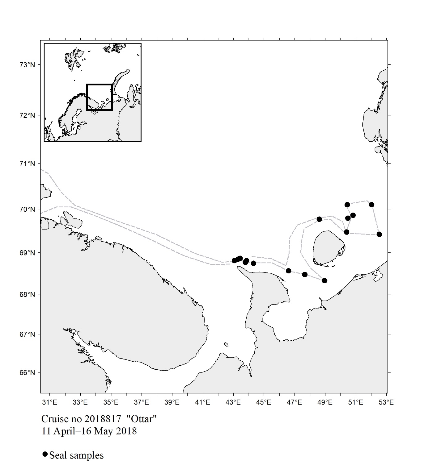 Fig. 126
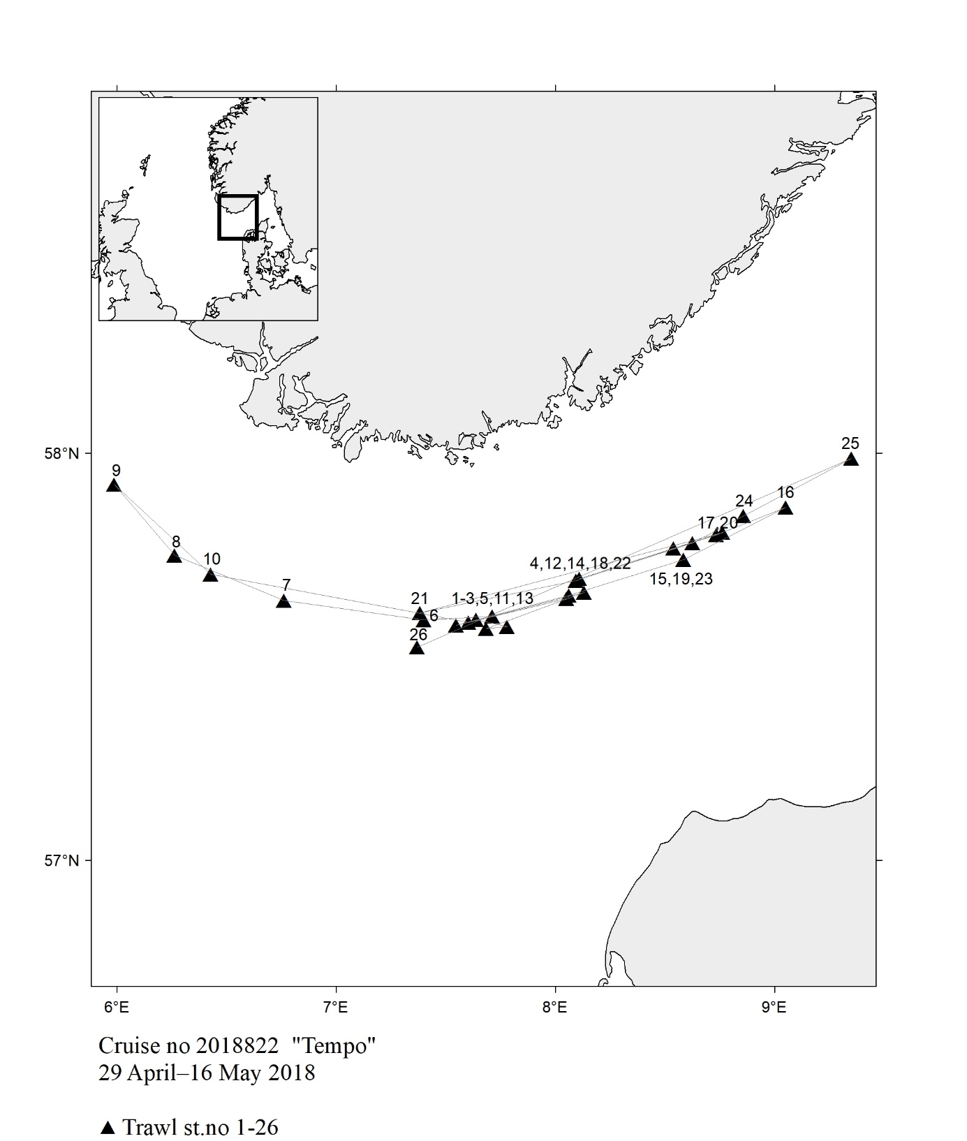 Fig. 127
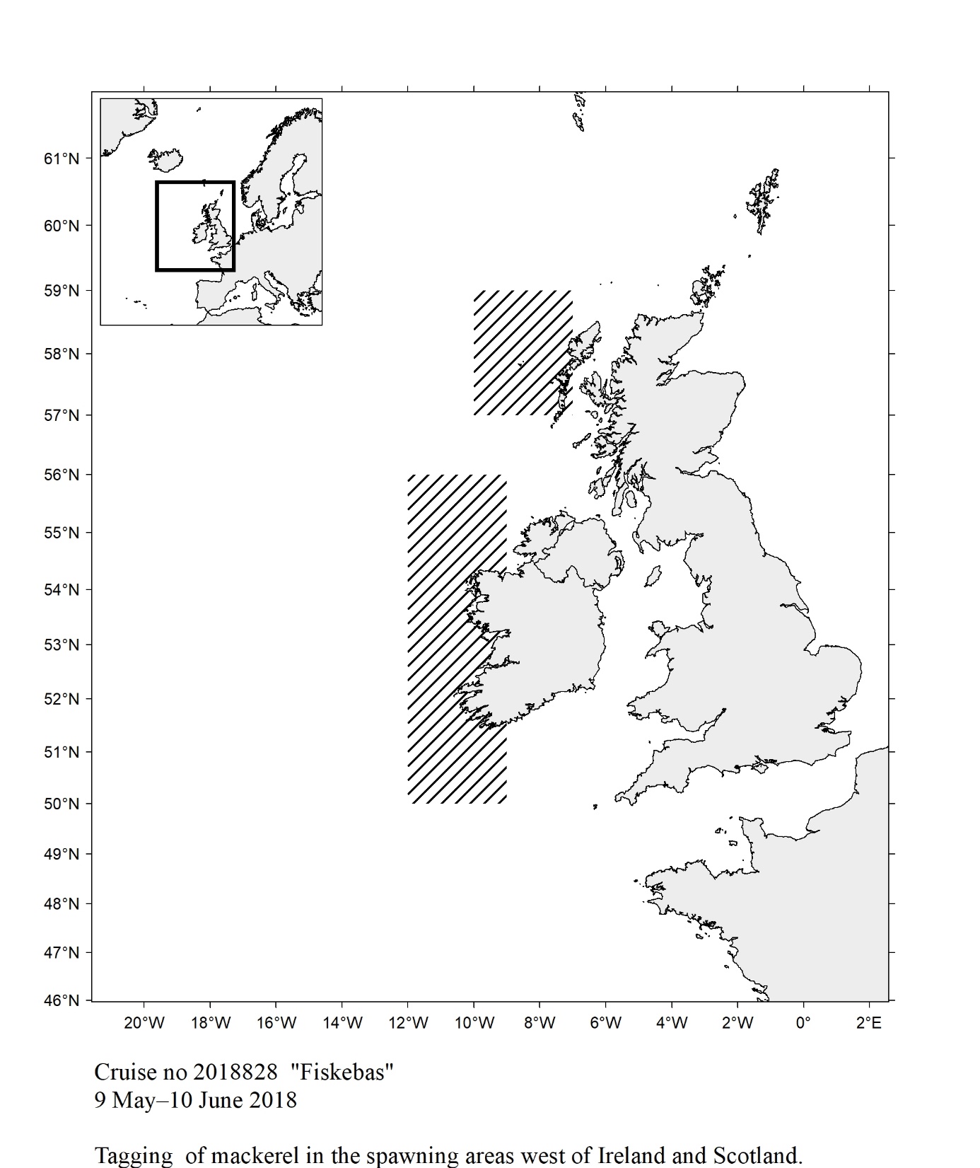 Fig. 128
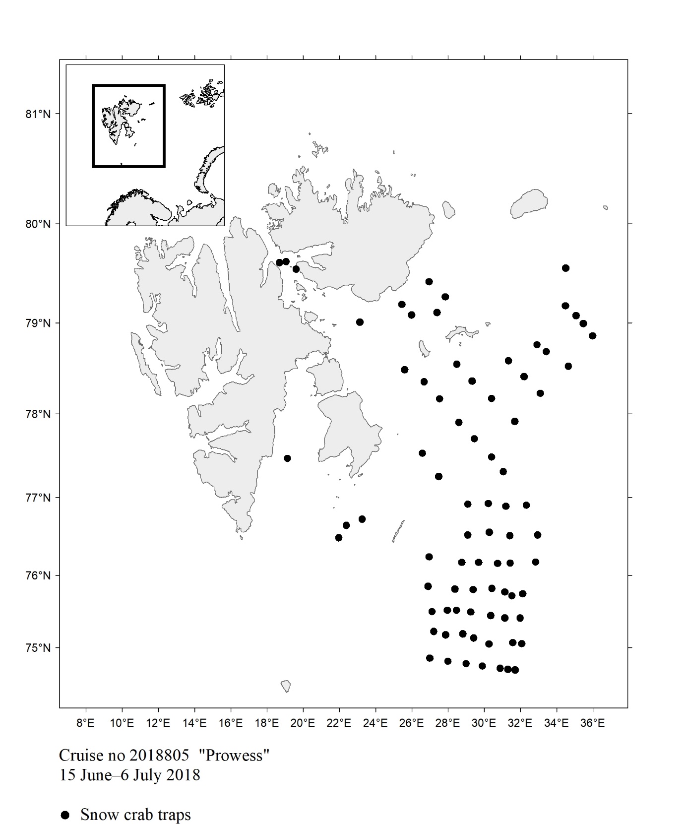 Fig. 129
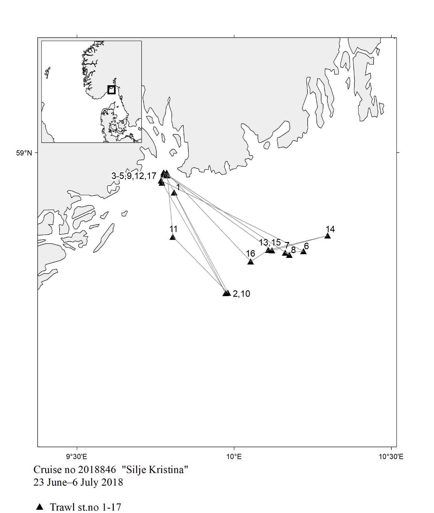 Fig. 130
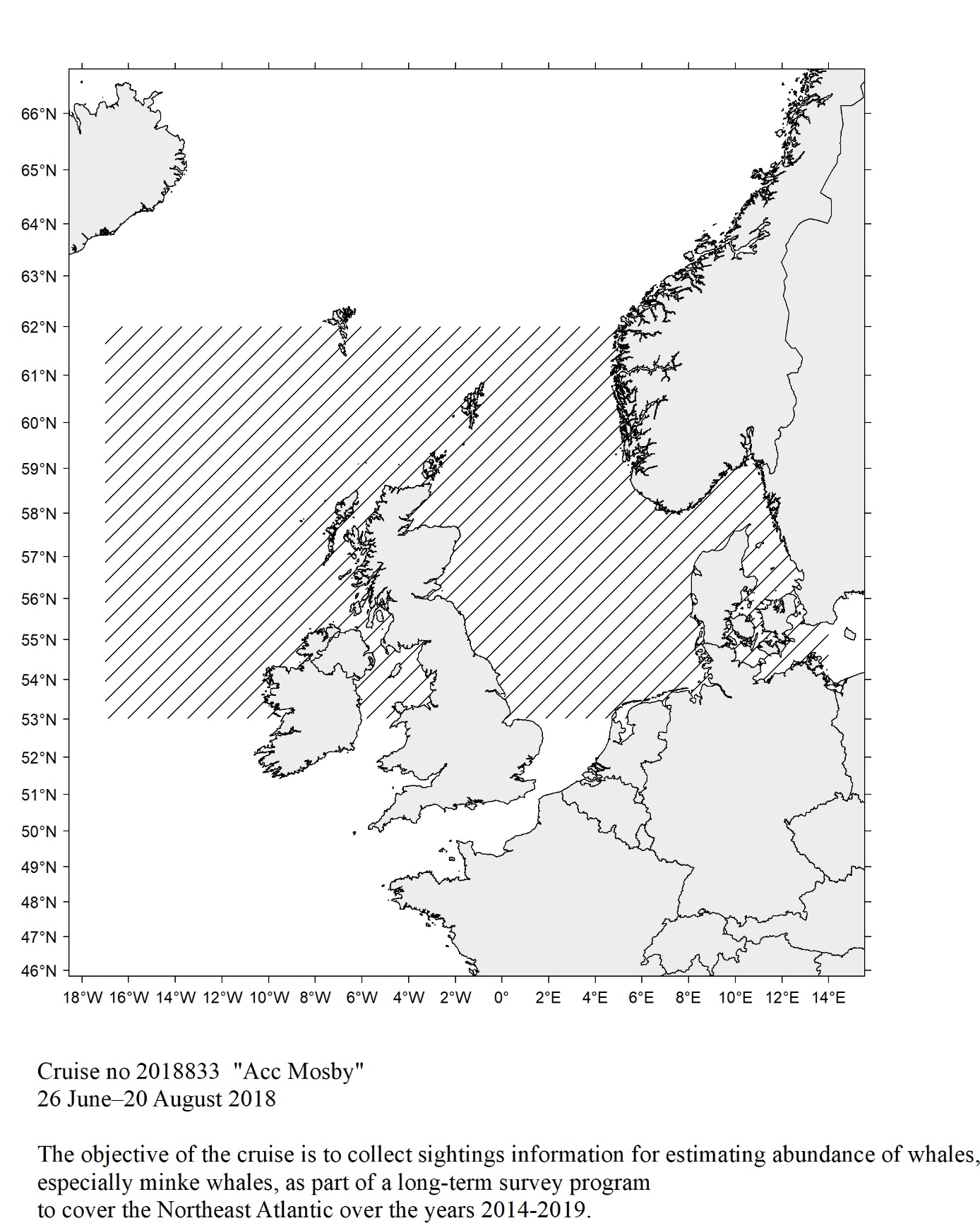 Fig. 131
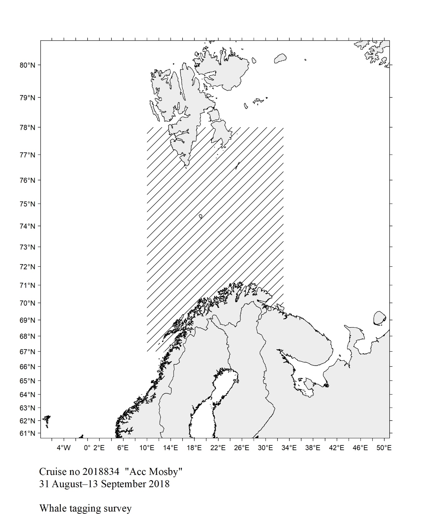 Fig. 132
Fig. 133
14 - "Dr. Fridtjof Nansen" - (Ship code no 14). Cruises 2018.
| Cruise no | Period | Purpose | Area | CTD st.no | Trawl st.no | Fig. no |
| 2018401 | 20.1.-21.2. | Collect data that can provide information about the marine ecosystem (fish, plankton, water chemistry, currents, nutrients, whales and epibenthos). | North Atlantic Ocean | 1-71 | 1-22 | 134-135 |
| 2018402 | 12.2.-19.3. | Collect data that can provide information about the marine ecosystem (fish, plankton, water chemistry, currents, nutrients, whales and epibenthos). | Indian Ocean | 72-263 | 1-143 | 136-137 |
| 2018403 | 20.3.-4.4. | The cruise aimed to collect samples and information about the biodiversity and benthic habitats in 4 areas on the Northern coast of Mozambique. Samples for analysis of the levels of pollution in the sediments were collected. The samples will be analysed according to the OSPAR guidelines for monitoring the petroleum industry. Multi beam Eco-sounders will be used to fill gaps in our available bathymetric maps of this area. Hydrographic measurements and water sampling took place along the sailing route. Plankton, fish larvae and micro plastics were collected along the sailing tracks by use of a ship mounted Cufes pump that delivers 1,7 m2 from 2 meters depth. The chemical and biological baseline studies will be the basis for future environmental monitoring of the petroleum industry in this area. | Northern coast of Mozambique. From Pemba up to the border of Tanzania. | 264-300 | 144-153 | 138-139 |
| 2018404 | 6.4.-18.4. | Collect data that can provide information about the marine ecosystem (fish, plankton, water chemistry, currents, nutrients, whales and epibenthos). | Indian Ocean | 301-366 | 1-37 | 140-141 |
| 2018405 | 20.4.-2.5. | Collect data that can provide information about the marine ecosystem (fish, plankton, water chemistry, currents, nutrients, whales and epibenthos). | Indian Ocean | 367-389 | 1-16 | 142-143 |
| 2018406 | 4.5.-2.6. | Habitat studies of the Mascarene bank. Investigation of geomorphology, physical and chemical oceanography and the ecosystems of the Saya de Malha and Nazareth Banks in the Western Indian Ocean. The cruise started in Victoria and ended in Port Loius, with detailed studies in the two bank areas. | Indian Ocean | 390-444 | 1-18 | 144-145 |
| 2018407 | 7.6.-21.6. | Investigation of mesopelagic fish distribution, water chemistry, currents, plankton and microplastic along two transects between Mauritius and Sri Lanka in International waters. First transect eastwards from Port Louis to 11°S, 80°E, and second transect from 11°S, 80°E northwards to Colombo. | Indian Ocean | 445-460 | 1-8 | 146-147 |
| 2018408 | 24.6.-15.7. | Establish a baseline survey of the marine ecosystem of the coast of Sri Lanka. | Indian Ocean Bay of Bengal | 461-597 | 1-85 | 148-149 |
| 2018409 | 19.7.-31.7 | Map the concentration of mesopelagic fish and environmental conditions in the Bay of Bengal. | Indian Ocean Bay of Bengal | 598-615 | 150 | |
| 2018410 | 2.8.-17.8. | Map the concentration of mesopelagic fish and environmental conditions in the Bay of Bengal. | Indian Ocean Bay of Bengal | 616-653 | 1-42 | 151-152 |
| 2018411 | 24.8.-29.9. | Study the egg and larvae concentration and distribution along the coast of Myanmar. | Indian Ocean Bay of Bengal | 655-871 | 1-55 | 153-154 |
| 2018412 | 1.10.-15.10. | Map the deepsea resources in the Andaman sea. | Andaman Sea | 872-925 | 1-55 | 155-156 |
| 2018413 | 18.10.-8.11. | Underway survey. | Indian Ocean | - | - | - |
15 - “Dr. Fridtjof Nansen” charts for cruises 2018
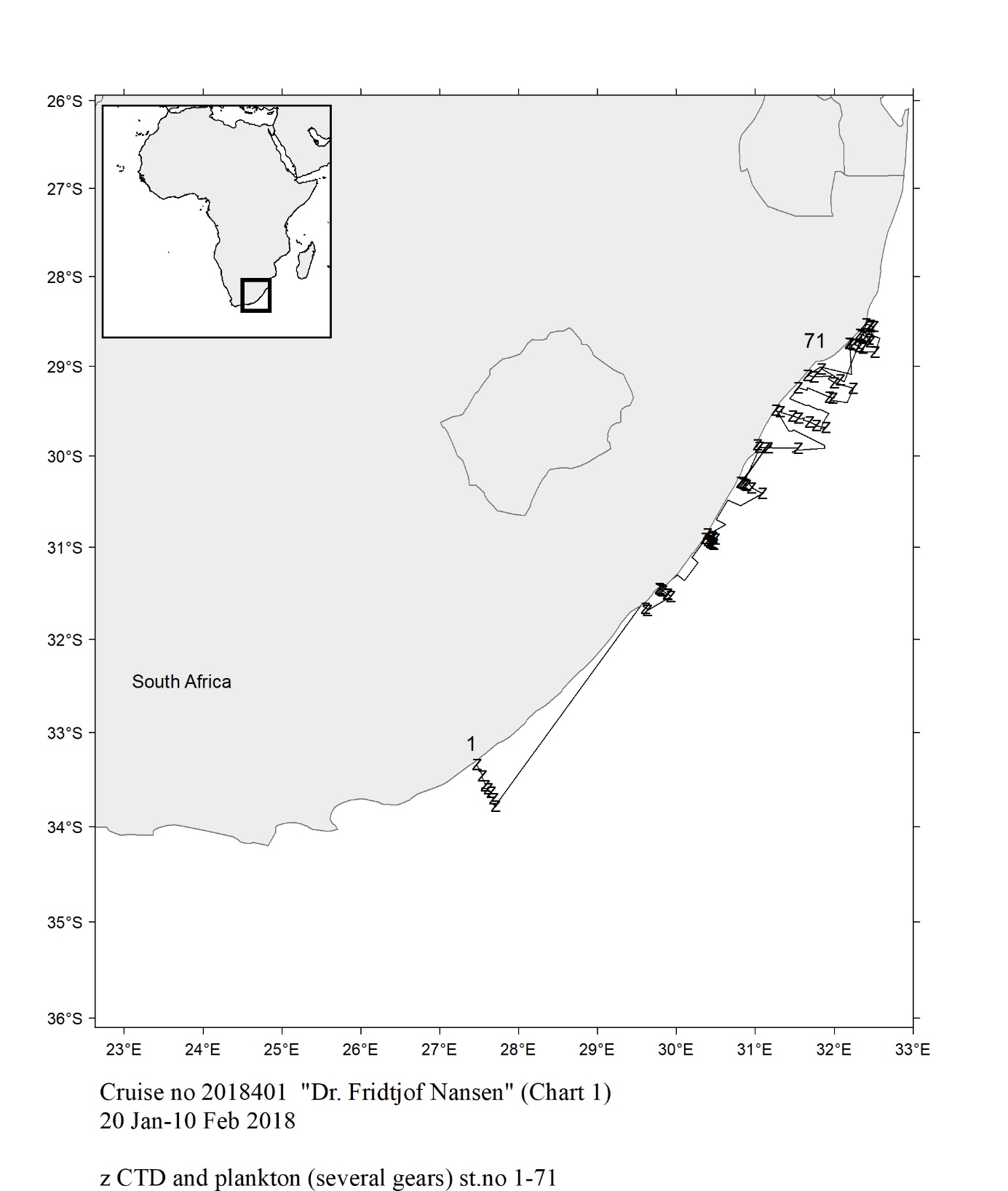 Fig. 134
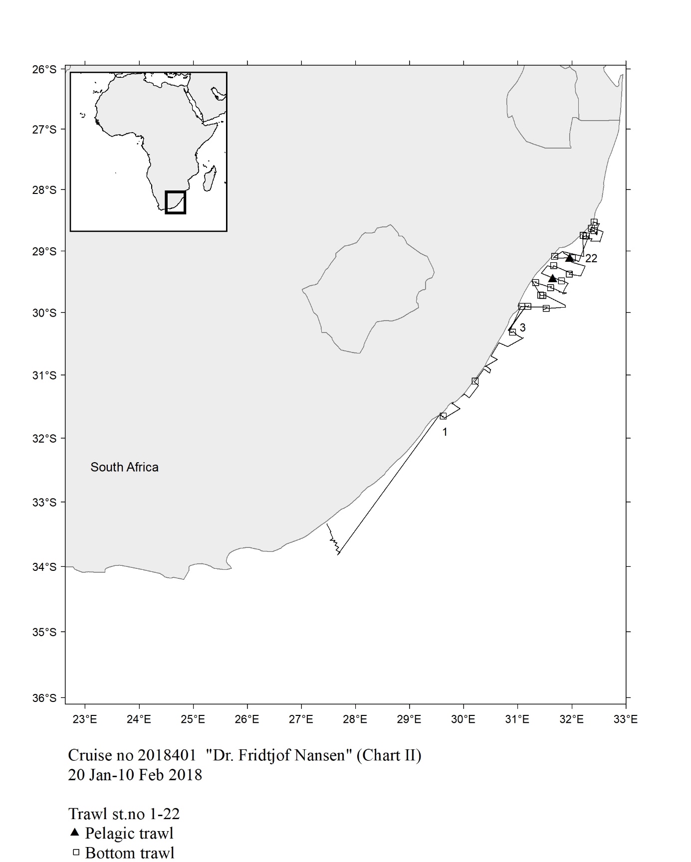 Fig. 135
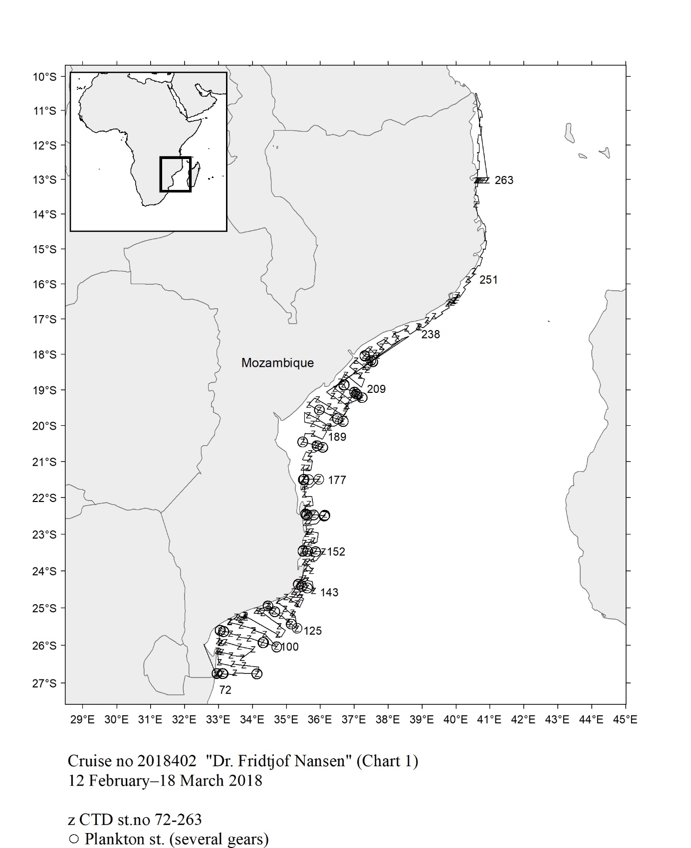 Fig. 136
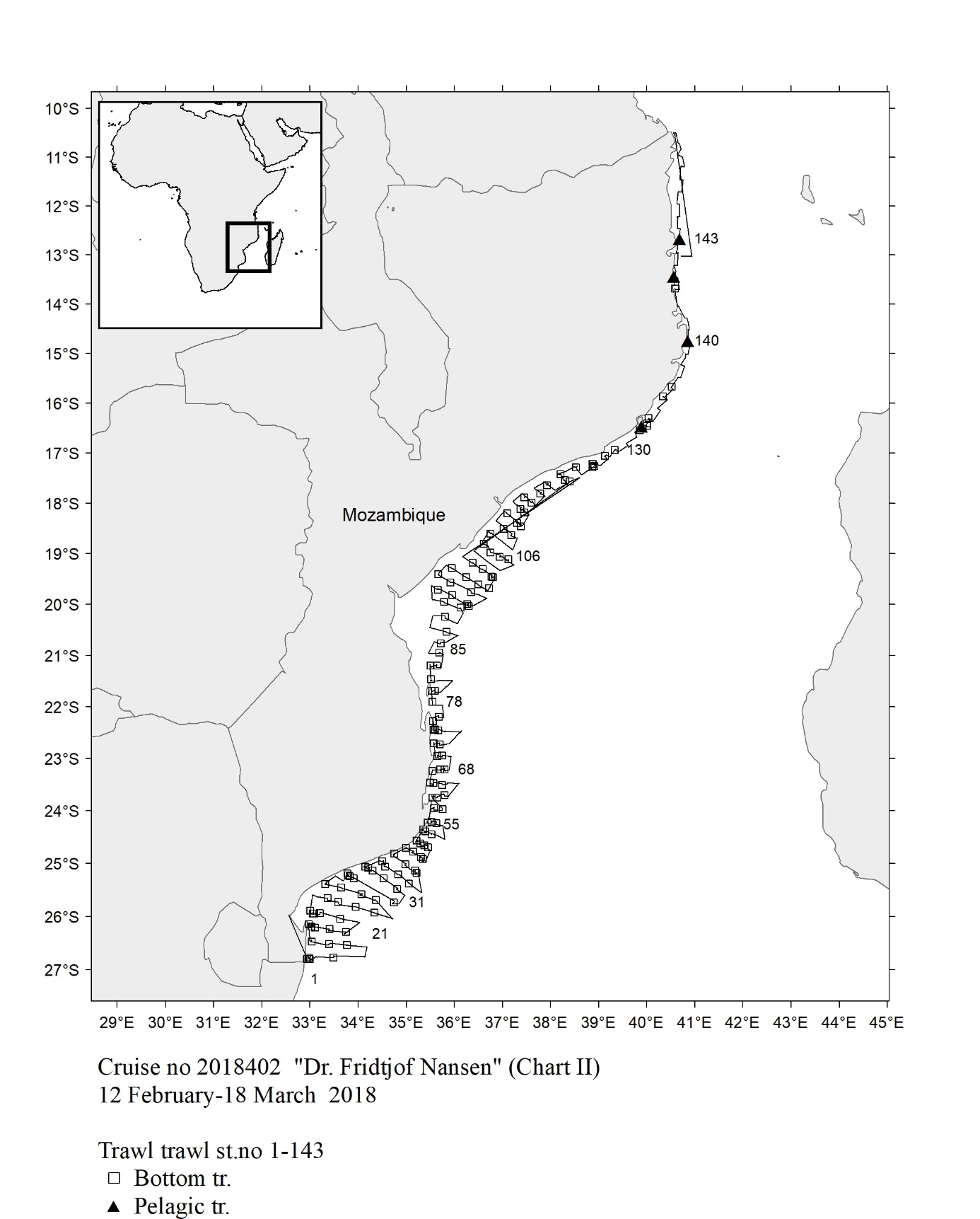 Fig. 137
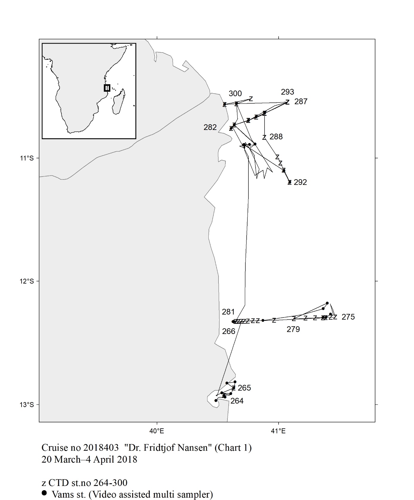 Fig. 138
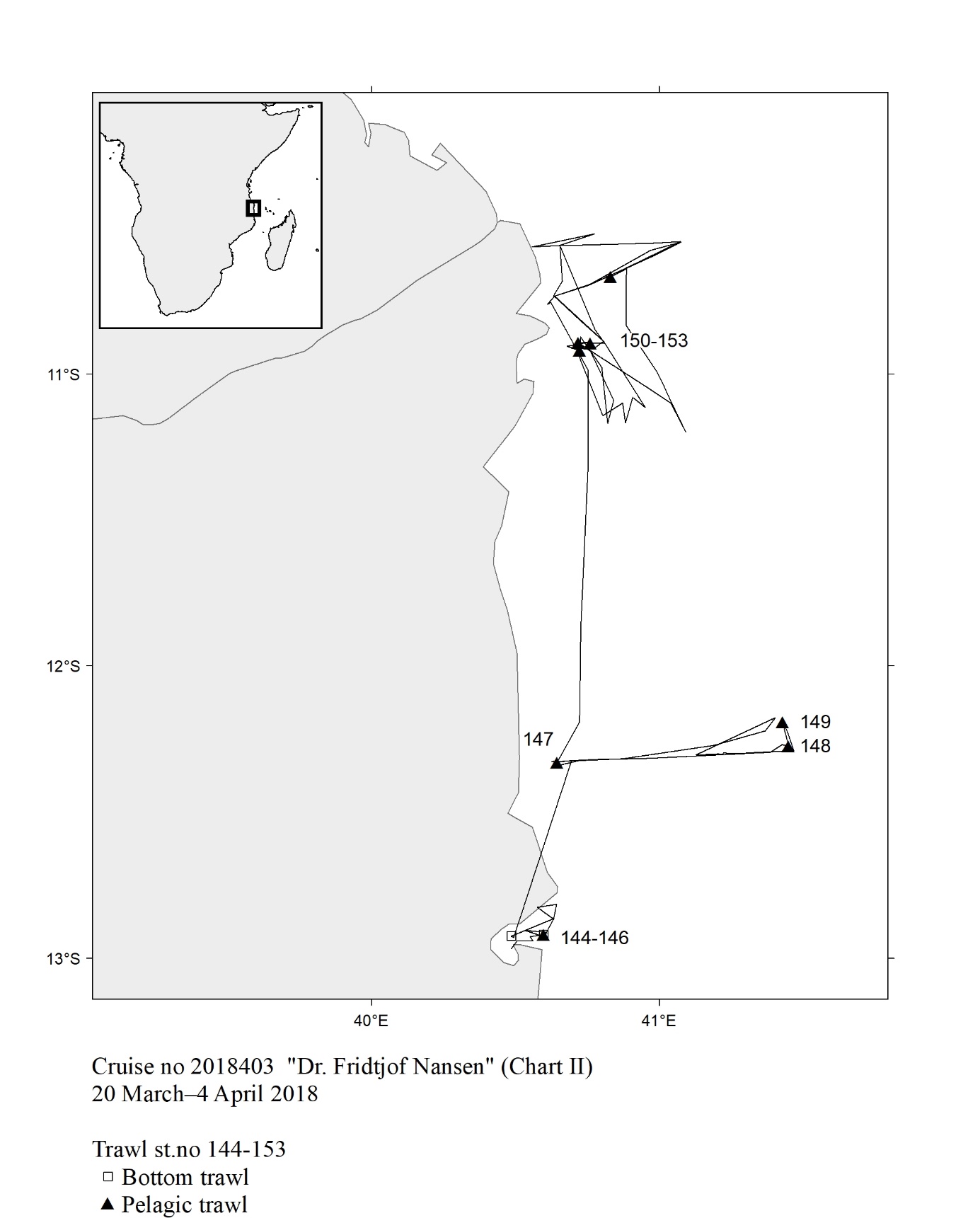 Fig. 139
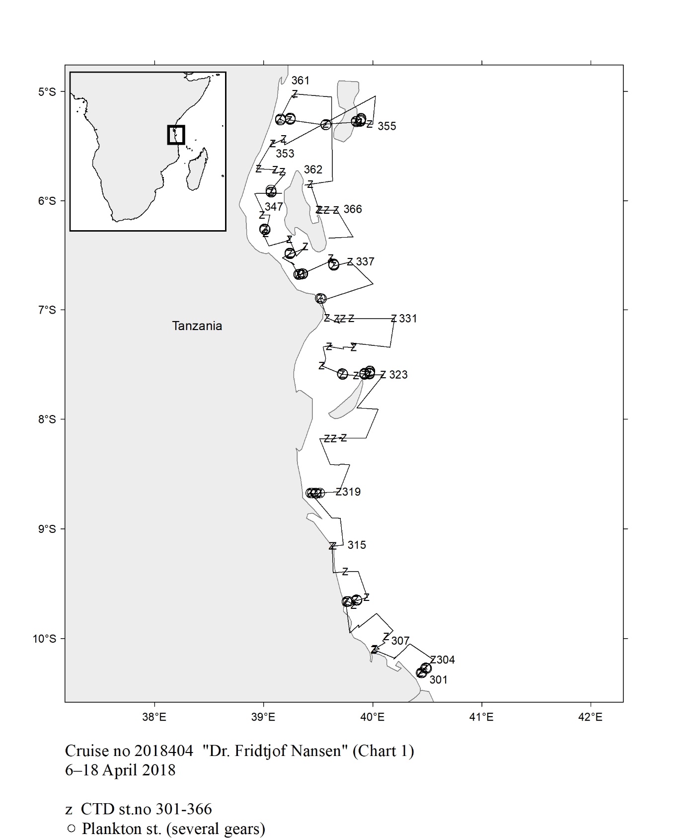 Fig. 140
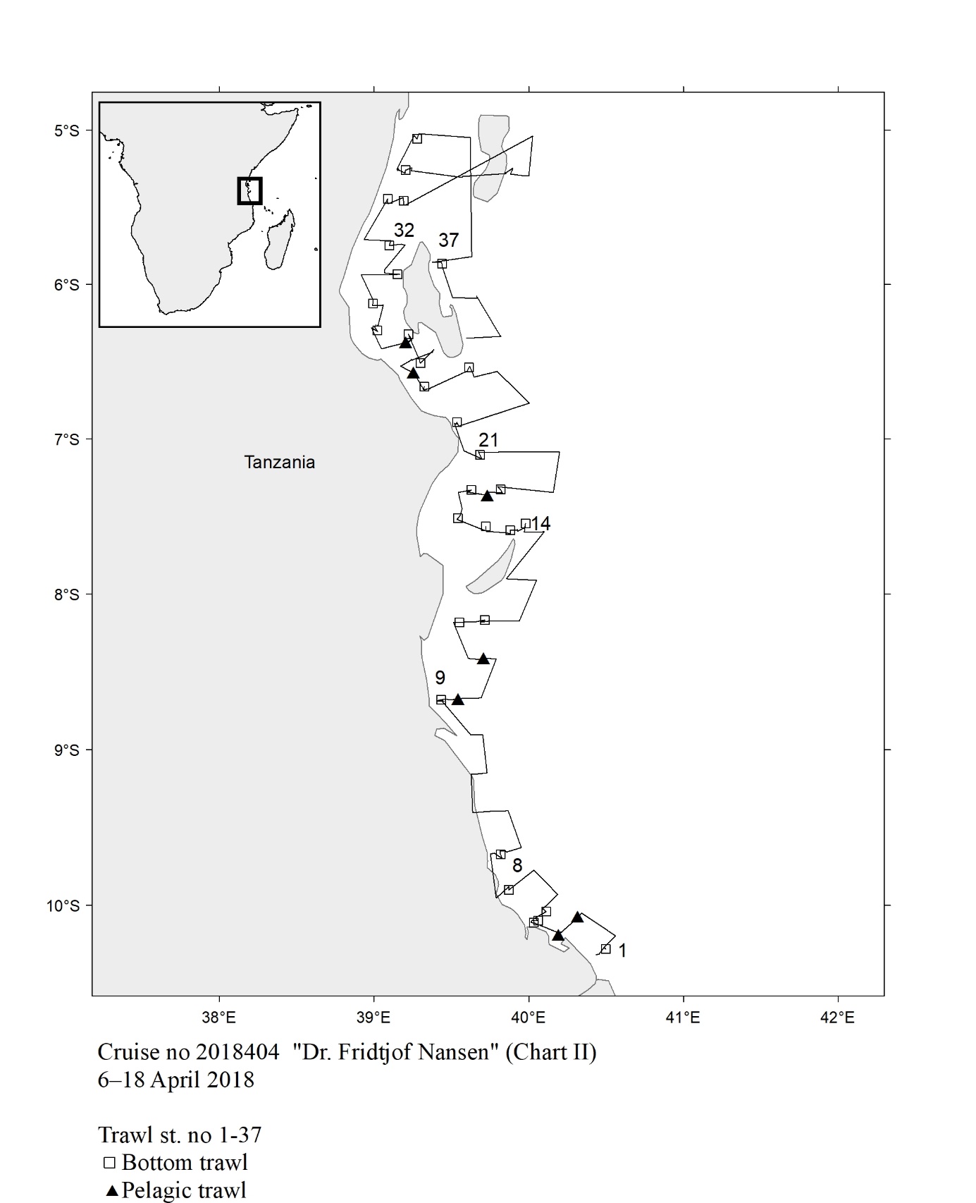 Fig. 141
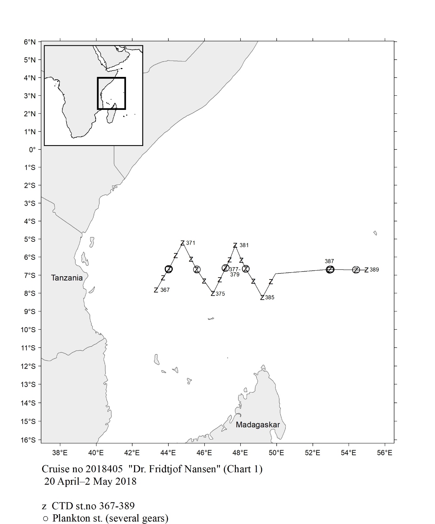 Fig. 142
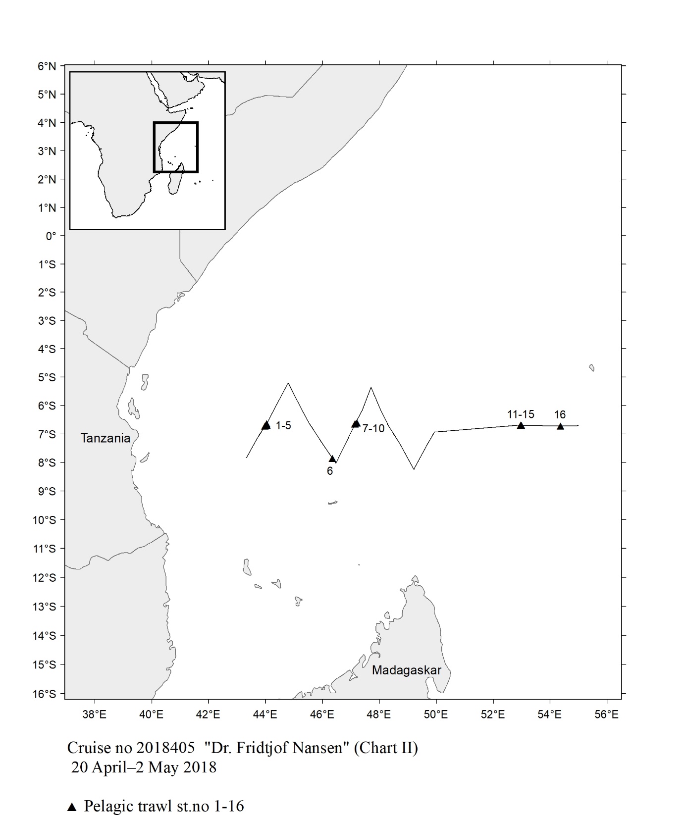 Fig. 143
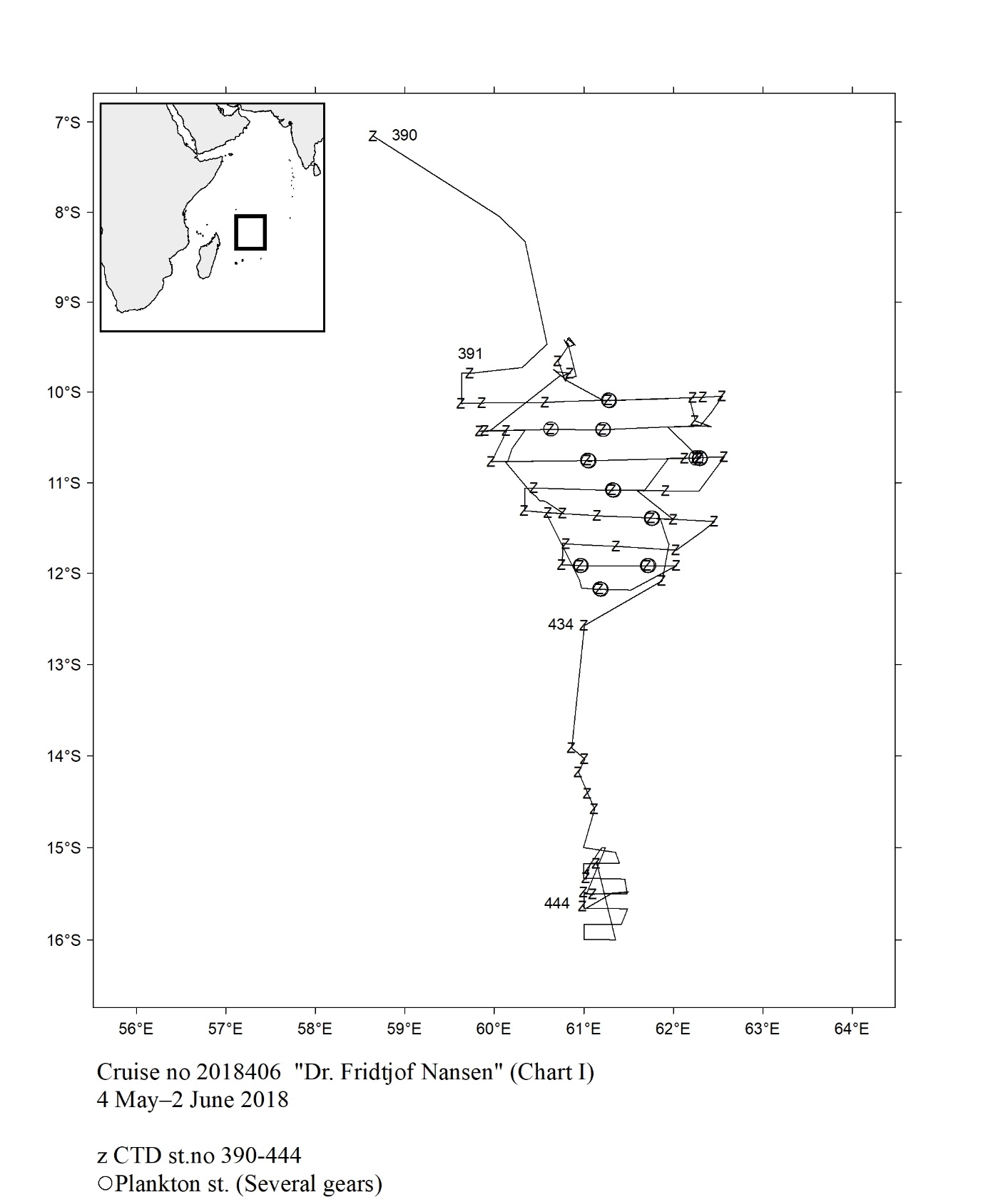 Fig. 144
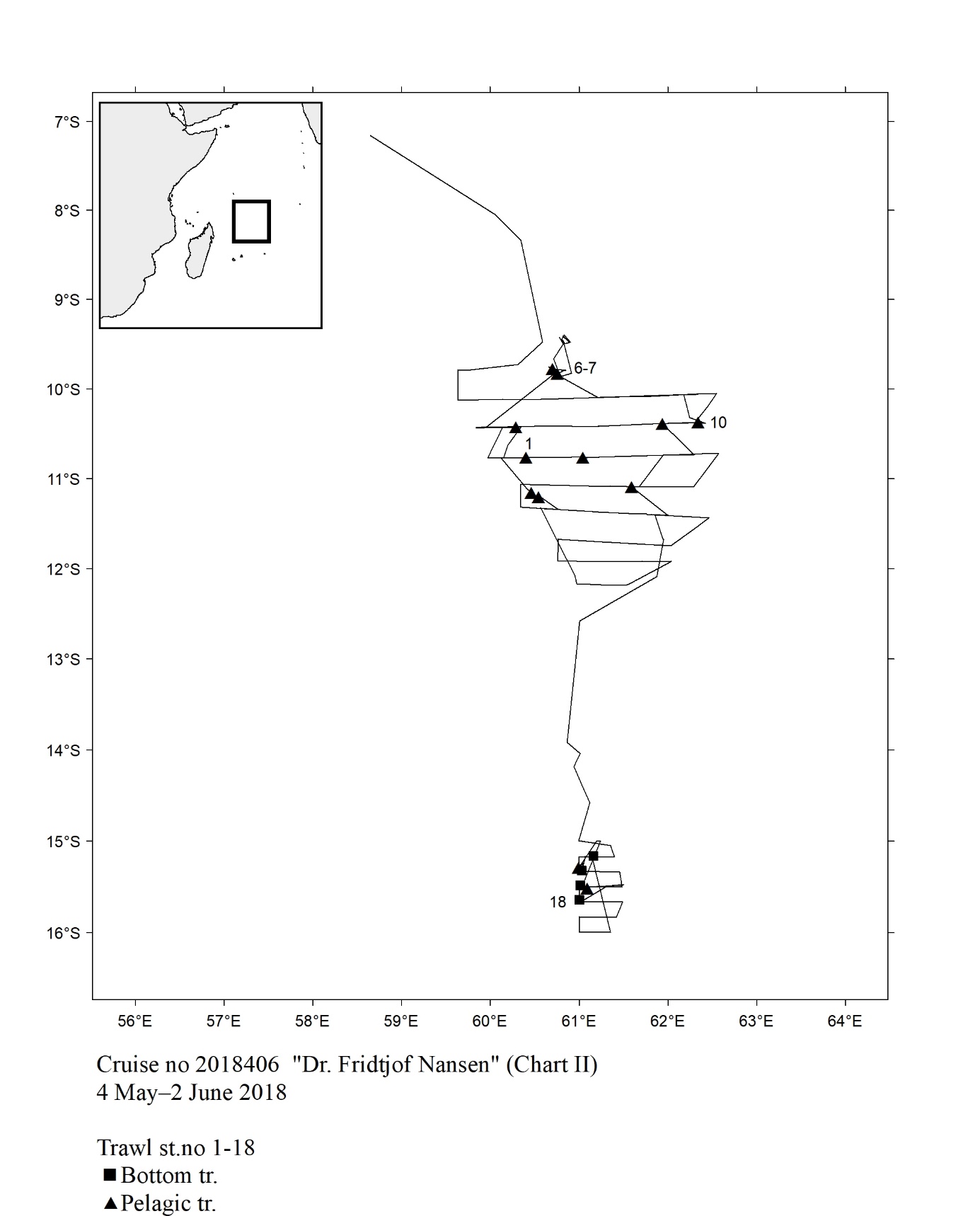 Fig. 145
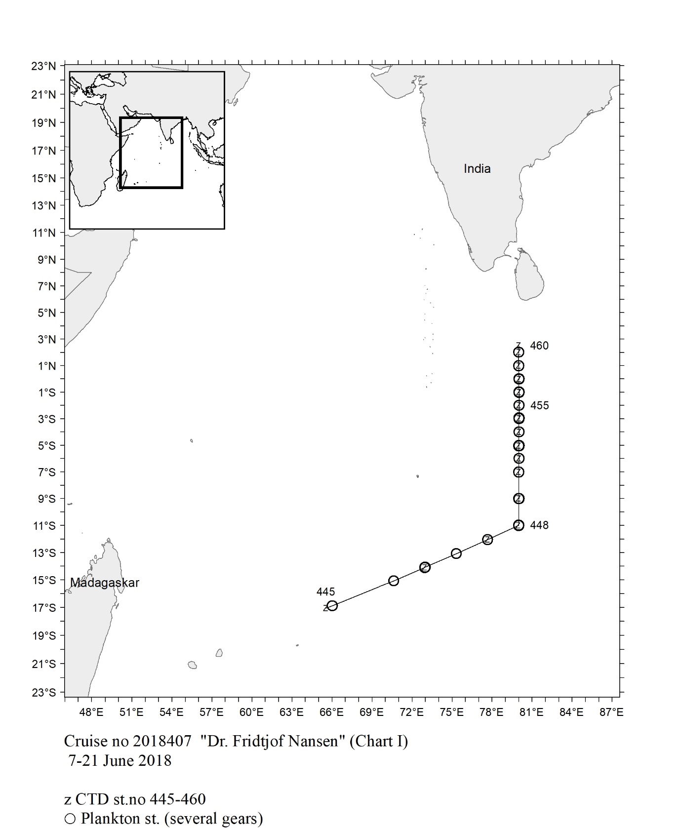 Fig. 146
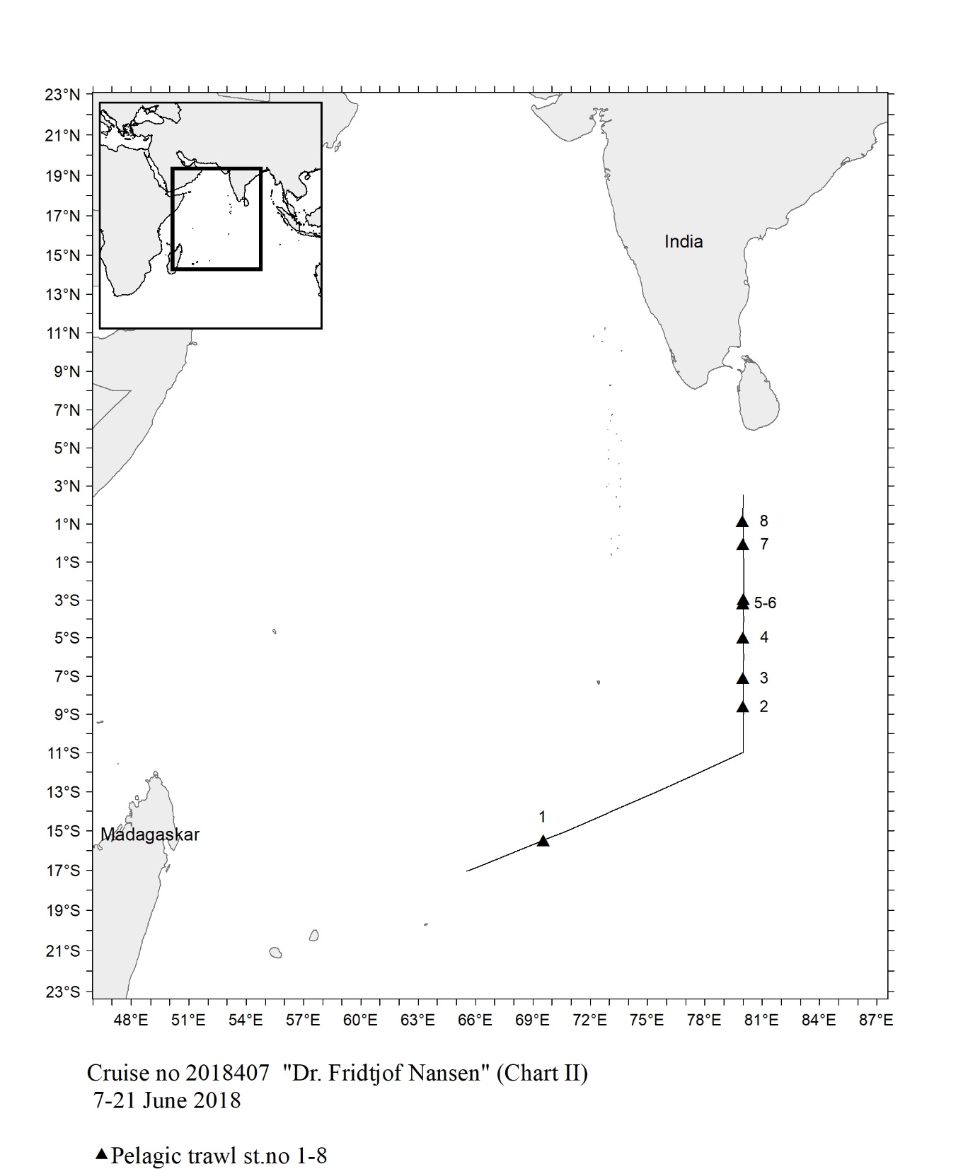 Fig. 147
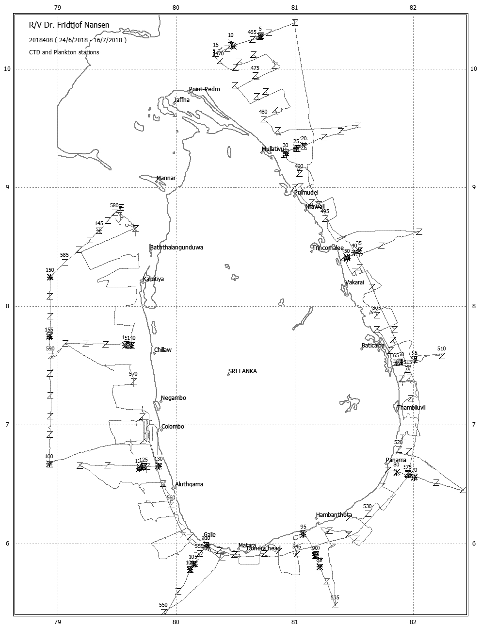 Fig. 148
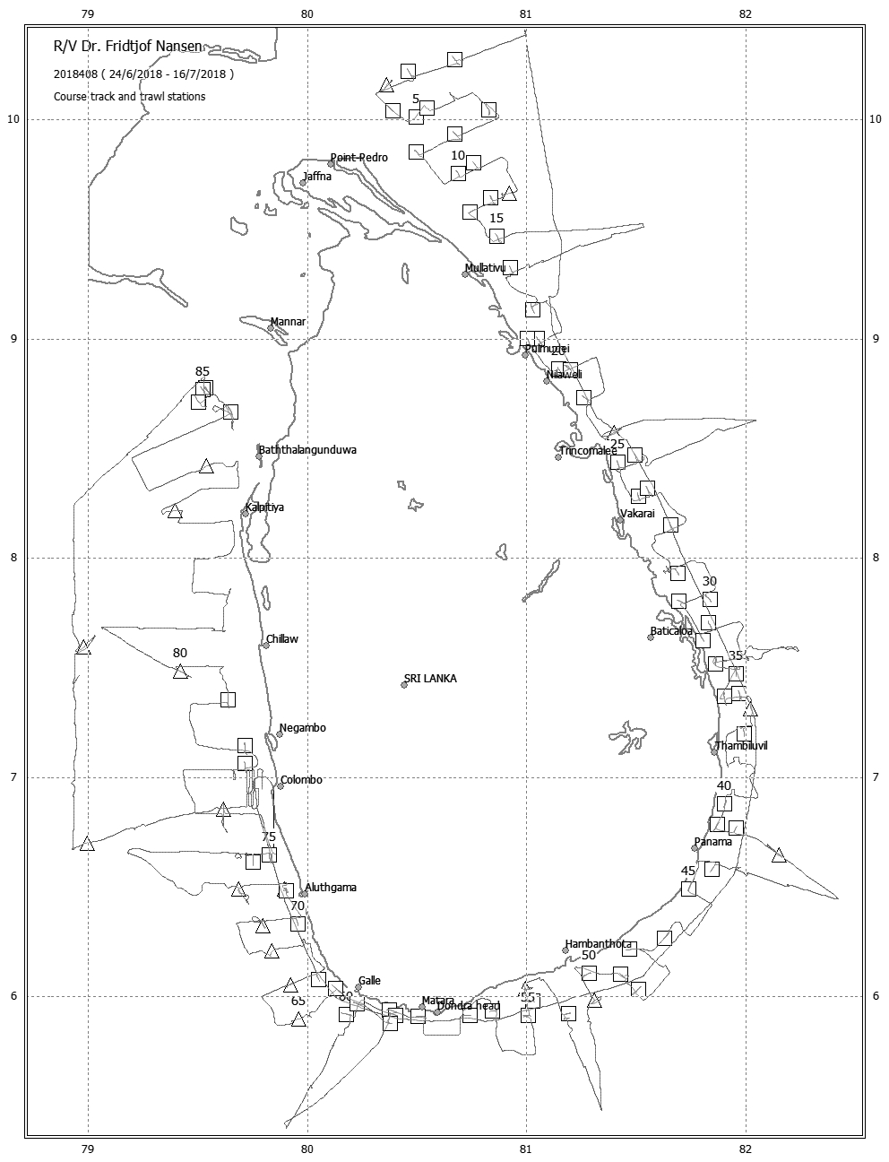 Fig. 149
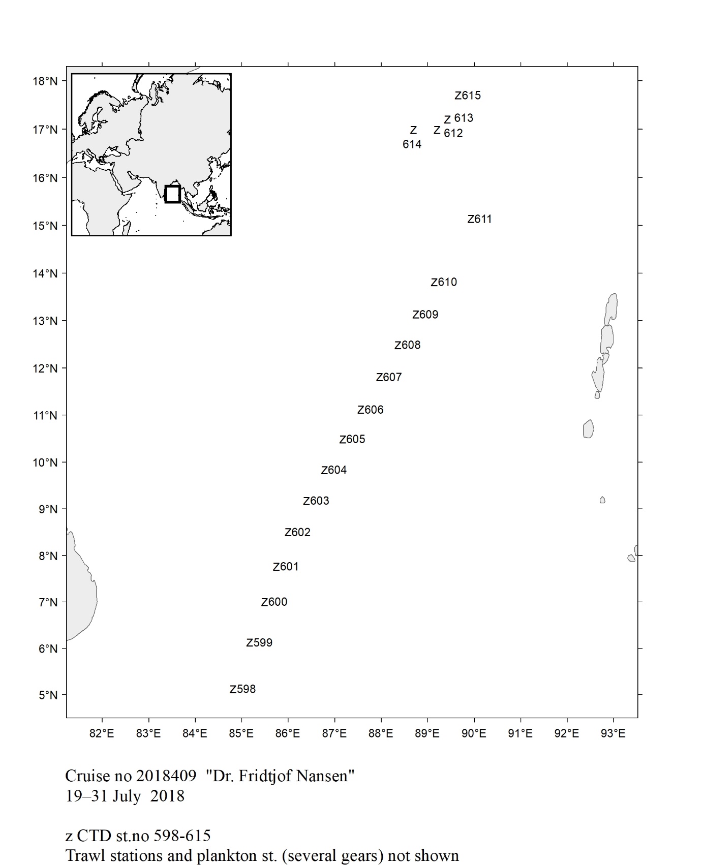 Fig. 150
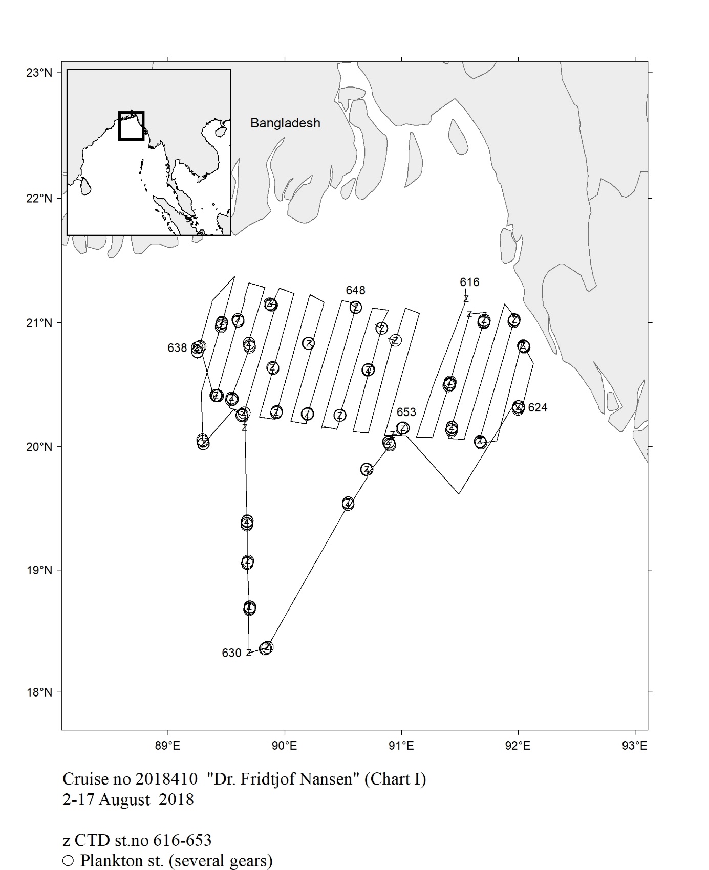 Fig. 151
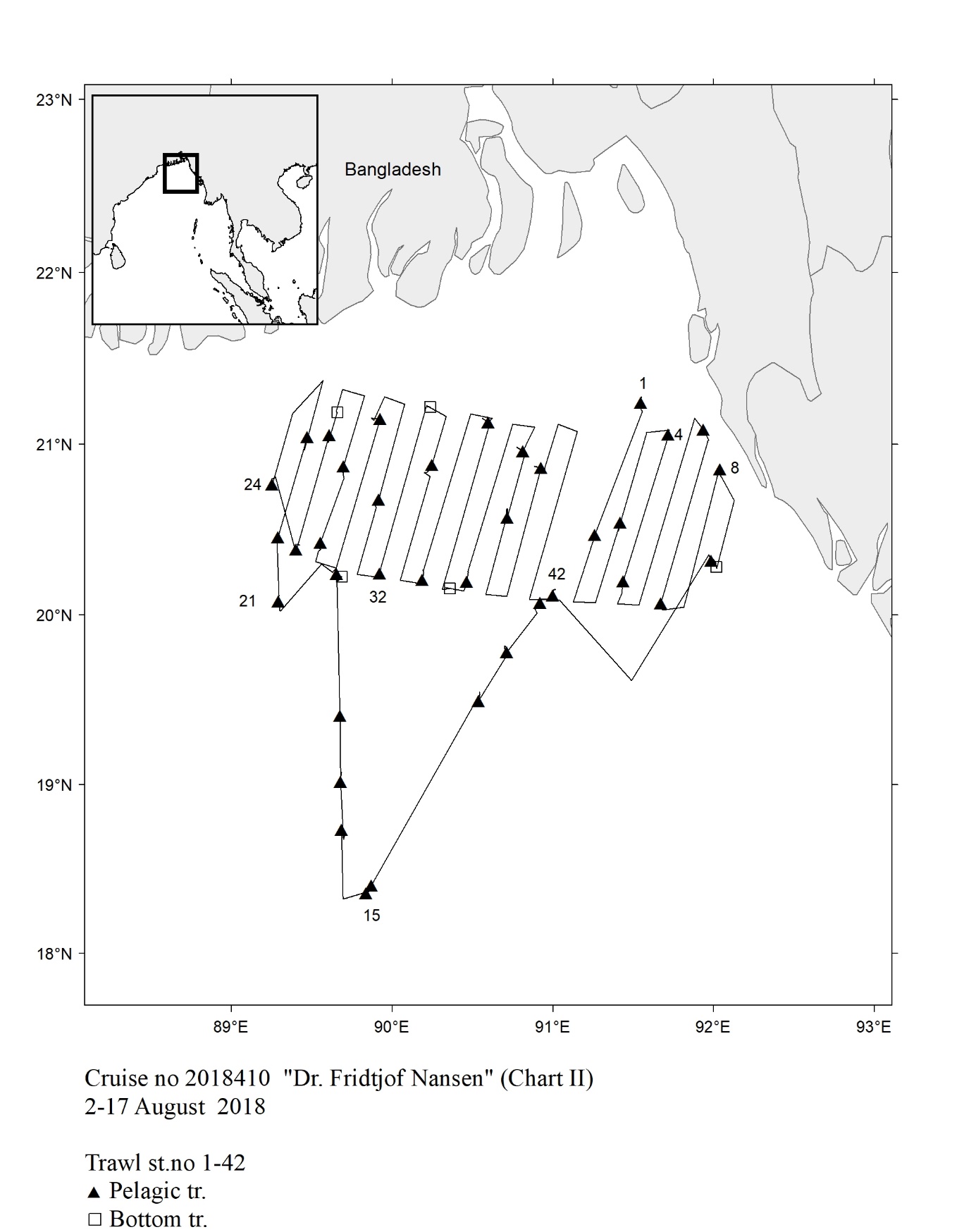 Fig. 152
 Fig. 153
 Fig. 154
 Fig. 155
 Fig. 156
16 - Map showing Oceanographic sections and Fixed oceanographic stations.
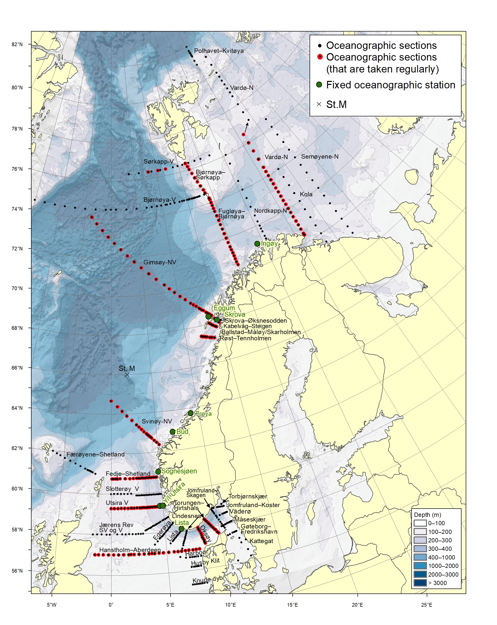
17 - Oceanographic sections and fixed oceanographic stations – Observations in 2018.
Oceanographic sections 2018 (Cruise no)
| Area | Oceanogr. sec. | Jan | Feb | Mar | Apr | May | Jun | Jul | Aug | Sep | Oct | Nov | Dec |
| North Sea | Fedje–Shetland | 2018204 | 2018624 | ||||||||||
| Slotterøy-West | 2018204 | ||||||||||||
| Utsira-West | 2018603 | 2018204 | 2018617 | 2018624 | |||||||||
| Jærens Rev-SW and W | 2018204 | 2018624 | |||||||||||
| Egerøya-SW | 2018204 | ||||||||||||
| Lista-SW | 2018204 | ||||||||||||
| Lindesnes-SSW | 2018204 | 2018624 | |||||||||||
| Hanstholm–Aberdeen | 2018204 | 2018617 | 2018624 | ||||||||||
| Harboør | |||||||||||||
| Hysby Klit | 2018204 | ||||||||||||
| Knude-Dyb | 2018204 | ||||||||||||
| Skagerrak and Kattegat | Torungen–Hirtshals | 2018301 | 2018302 | 2018303 | 2018204 2018306 | 2018307 | 2018309 | 2018310 | 2018311 | 2018315 | 2018317 | 2018318 | 2018320 |
| Oksøy–Hanstholm | 2018204 | ||||||||||||
| Jomfruland–Skagen | |||||||||||||
| Jomfruland–Koster | 2018204 | ||||||||||||
| Torbjørnskjær | |||||||||||||
| Väderø | 2018204 | ||||||||||||
| Måseskjær | 2018204 | ||||||||||||
| Gøteborg–Fredrikshavn | 2018204 | ||||||||||||
| Kattegat | |||||||||||||
| The Norwegian Sea and Vestfjorden | Svinøy-North/West | 2018201 | 2018105 2018842 | 2018208 | 2018211 | ||||||||
| Gimsøy-North/West | 2018842 | 2018205 | 2018208 | 2018211 | |||||||||
| Bjørnøya-West | 2018205 | 2018208 | 2018211 | ||||||||||
| Sørkapp-West | |||||||||||||
| Færøyene–Shetland | |||||||||||||
| Skrova–Øksnesodden | |||||||||||||
| Kabelvåg–Steigen | 2018203 | ||||||||||||
| Ballstad– Måløy/Skarholmen | 2018203 | ||||||||||||
| Røst–Tennholmen | |||||||||||||
| The Barents Sea | Fugløya–Bjørnøya | 2018201 | 2018842 | 2018205 | 2018208 | 2018211 | |||||||
| Vardø-North | 2018202 | 2018209 | |||||||||||
| Semøyene-North | |||||||||||||
| Bjørnøya–Sørkapp | |||||||||||||
| Nordkapp-North | |||||||||||||
| Polhavet–Kvitøya | |||||||||||||
| Kola |
Fixed oceanographic stations 2018
| Fixed stations | Jan | Feb | Mar | Apr | May | Jun | Jul | Aug | Sep | Oct | Nov | Dec | Total |
| LISTA N58° 05,1' E06° 32,5' | - | 2 | 3 | 3 | 3 | 3 | 3 | 3 | 3 | 3 | 3 | 1 | 30 |
| UTSIRA Y N59° 19' E04° 44' | 1 | - | 3 | 2 | 3 | 3 | 3 | 4 | 1 | 2 | 1 | - | 23 |
| UTSIRA I N59° 19' E04° 59' | 1 | - | 3 | 2 | 3 | 3 | 3 | 4 | 1 | 2 | 1 | - | 23 |
| SOGNESJØEN N61° 01' E04° 50' | 1 | 1 | 3 | 2 | 2 | 3 | 2 | 3 | 1 | 3 | 2 | - | 23 |
| BUD N62° 56' E06° 47' | - | - | - | - | - | - | - | - | - | - | - | - | 0 |
| SKROVA N68° 07' E14° 39' | 3 | 3 | 2 | 4 | 4 | 2 | 2 | 2 | 2 | 1 | 2 | - | 27 |
| EGGUM N68° 23' E13° 38' | 2 | 3 | 3 | 4 | 3 | 4 | 4 | 3 | - | 1 | 3 | - | 30 |
| INGØY N71° 08' E24° 01' | 2 | 1 | - | 3 | 3 | 3 | 3 | - | 2 | 3 | - | - | 20 |
| Frøya N63° 44,6' E09° 05,1' | - | 1 | 1 | 1 | 1 | - | - | - | - | - | - | - | 4 |